 Catalogue PIGMA
repository
Type of resources
Available actions
Topics
Keywords
Contact for the resource
Provided by
Years
Formats
Representation types
status
-

Built and developed by researchers, to ensure that everyone can join in Open Science. The OpenAIRE project, in the vanguard of the open access and open data movements in Europe was commissioned by the EC to support their nascent Open Data policy by providing a catch-all repository for EC funded research. CERN, an OpenAIRE partner and pioneer in open source, open access and open data, provided this capability and Zenodo was launched in May 2013. In support of its research programme CERN has developed tools for Big Data management and extended Digital Library capabilities for Open Data. Through Zenodo these Big Science tools could be effectively shared with the long-tail of research. Zenodo helps researchers receive credit by making the research results citable and through OpenAIRE integrates them into existing reporting lines to funding agencies like the European Commission. Citation information is also passed to DataCite and onto the scholarly aggregators.
-

NCAR was established by the National Science Foundation in 1960 to provide the university community with world-class facilities and services that were beyond the reach of any individual institution. More than a half-century later, we are still delivering on that mission. NCAR provides the atmospheric and related Earth system science community with state-of-the-art resources, including supercomputers, research aircraft, sophisticated computer models, and extensive data sets. From its founding, NCAR was meant to provide the atmospheric research community with the shared resources necessary to work on the most important scientific problems of the day. Not much has changed. The hundreds of scientists who work here research all things atmospheric — which includes everything from the microphysics of cloud formation and the chemistry of air pollution to large-scale planetary waves and the impact of increased greenhouse gases on our climate. Since the atmosphere interacts with everything it touches, its crucial to investigate those interactions, too.
-
Accredited through the MEDIN partnership, and core-funded by the Department for the Environment, Food and Rural Affairs (Defra) and the Scottish Government, DASSH provides tools and services for the long-term curation, management and publication of marine species and habitats data, within the UK and internationally. Below are a selection of projects, outputs and deliverables that DASSH and the MBA Data Team have been involved in recently. - NE Data Management: DASSH have been contracted by the Marine team at Natural England (NE) to support NE data dissemination. We have been digitising datasets used in Article 17 reporting and helping them input data to Marine Recorder and MEDIN guidelines. In addition, DASSH is running a 2-day workshop with the marine data team in October 2014 on data management and standards. The aims of the workshop are to present MEDIN data guidelines and standards and to run practicals on quality assurance (QA) issues with data, creating MEDIN formatted data, and creation of MEDIN metadata. - MCZ Data Archiving: DASSH staff have been working with Defra, JNCC, Natural England, Cefas and the other MEDIN DAC's in the development and implementation of a strategy for the archiving and dissemination of MCZ survey data. This involves the archives of many terrabytes of data from the survey work undertaken at 127 sites. DASSH is currently working with the other DACs archiving the data from several MCZ sites before taking delivery of the complete survey catalogue. - Non-Natives Data Management: DASSH staff work with other members of the KE team to help deliver the MBA contribution to the GB Non-native Species Information Portal. The data team ensure the validation of records submitted and raise alerts when records of Invasive Non-Native Species of concern and in disseminating information about species distribution via DASSH and the NBN. DASSH staff continue to liaise with organisations to ensure the prompt flow of marine non-native species distribution data to the public domain. The KE team facilitated the identification of two new marine invasive non-native species in 2014 and have subsequently created the identification sheet for these species. Hemigrapsus sanguineus (from volunteer records sent in for identification) and Hemigrapsus takanoi (first recorded by the John Bishop Group survey team). - EMODNet Biology: The Data Team are part of a consortium led by the Flanders Marine Institute (VLIZ) for the biological data component of EMODNet (European Marine Observation and Data Network). The Data Team will lead a work package relating to biological traits and indicator species as identified for Marine Strategy Framework Directive (MSFD) reporting, bringing an additional €130k of funding. - VALMER: The Data Team led a key work package in a £3.7 million (ca. €260k for the MBA) INTERREG project to "Develop, trial and refine methodologies that will be used to quantify and communicate the value (economical, social and environmental) of marine and coastal ecosystem services". The research identified an operational framework to value marine ecosystem services, and which could be used to enhance marine planning and policy decisions.
-

The ODIS "Catalogue of Sources" aims to be an online browsable and searchable catalogue of existing ocean related web-based sources/systems of data and information as well as products and services. It will also provide information on products and visualize the landscape (entities and their connections) of ocean data and information sources. It will contribute to the objectives of the Agenda 2030, and in particular the UN Decade for Ocean Science for Sustainable Development. The Catalogue is not an ocean database or metadata repository. The catalogue includes descriptive information such as the URL, title, description, language, point of contact, geographic scope, available technologies for machine-to-machine interaction, keywords, etc. and can be searched on many of these fields. The IODE network of NODCs has been collecting, managing and serving data for decades. This effort has yielded an extensive, but distributed and heterogeneous collection of data and information sources. Additionally, the low threshold for technical capabilities required to offer data and information over the Internet means that many of the hosted resources are not readily discoverable through NODCs, regional or international data and information systems ODIS will provide an online catalogue of (ideally) all online data/information sources (and, where possible, metadata on off-line sources as well). Many regional and international programmes and projects have developed online data/information services but there is currently no "one-stop shop" where users are offered an overview and/or common data/information discovery interface. There are currently 3090 sources (2172 are searchable) catalogued in the system.
-

The Marine Environmental Data and Information Network (MEDIN) is a partnership of UK organisations committed to improving access to UK marine data. MEDIN is open to all with an interest in marine data and information. We are sponsored by a consortium of 15 sponsors and partnered with over 50 organisations. MEDIN Sponsors include a range of UK marine organisations who support MEDIN’s principles and lead the UK in marine data management. To officially join the network and become a MEDIN Sponsor, please email MEDIN stating your interest at enquiries@medin.org.uk. Our partners represent government departments and agencies, research organisations and private companies and have committed to practise good data management to help future-proof and secure UK’s valuable marine data. MEDIN reports to the Marine Science Coordination Committee. The MEDIN portal contains information about 15,000 marine datasets. The United Kingdom Directory of Marine Observing Systems (UKDMOS), is a unique internet-based searchable database of marine monitoring conducted by UK organisations. Aiming to fulfil the basic requirement to know where, when and what is being monitored in the marine environment around the UK and provide information to help coordinate monitoring across different organisations, UKDMOS is a tool for searching monitoring programmes and series based on information such as the parameters measured or the frequency of measurements taken. UKDMOS is managed and updated by the Marine Environmental Data and Information Network (MEDIN).
-
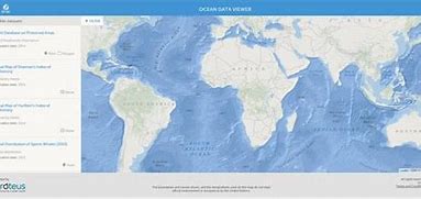
The Ocean Data Viewer offers users the opportunity to view and download a range of spatial datasets that are useful for informing decisions regarding the conservation of marine and coastal biodiversity. These decisions ultimately affect the ocean's health and productivity, which provide the ecosystem services that are necessary for our well-being, livelihoods, and survival. To date, the users of this tool have included government agencies, scientists, researchers, the corporate sector, and non-governmental organisations. These data come from internationally respected scientific institutions and other organisations that have agreed to make their data available to the global community, with the hope that these data will support and encourage informed decision-making that sustains global biodiversity and ecosystem services. The Ocean Data Viewer is primarily a mechanism to view and download data, and is not intended to be used for analysis or to query data.
-
Seabed Habitats was one of seven themes of the European Marine Observation and Data Network (EMODnet) initiative, funded by the European Maritime and Fisheries Fund. Since its inception in 2009, EMODnet Seabed Habitats developed, improved and gradually increased the coverage of a broad-scale seabed habitat map for Europe's seabed, also known as EUSeaMap. In addition, EMODnet Seabed Habitats continued the work started by MESH and MESH Atlantic projects in collating and making available seabed habitat maps from surveys, through the EMODnet Seabed Habitats map viewer. In it's third Phase (2017-2019), EMODnet Seabed Habitats collated and provided habitat point data and the outputs of habitat distribution modelling, and the third phase has now been extended to 2021. The extended third phase of the project will: - Continue to grow Europe's only comprehensive library of habitat maps from surveys and collection of survey sample points - Create new composite data products to add to those for the Essential Ocean Variable habitats and OSPAR threatened and/or declining habitats - Update the EMODnet broad-scale seabed habitat map for Europe (EUSeaMap) using the next seabed substrate update from EMODnet Geology - Update web content with extra resources for habitat mapping, including a catalogue highlighting all the most useful data products
-
Marine data sharing and preservation, managed & operated by the National Oceanography Centre. Part of the UK's National Oceanography Centre, BODC provide instant access to over 130,000 unique data sets. BODC data helps provide answers to both local questions such as the likelihood of coastal flooding, or global issues such as the impact of climate change. Data categories include: - Acoustics - Bathymetry and topography - Currents — horizontal and vertical velocity, Lagrangian currents and water transport rates - Meteorology — Radiosonde, Met. stations and data buoys - Optical properties — pigments, turbidity, irradiance - Sea level - Water column temperature and salinity - Water column chemistry — nutrients, carbons, oxygen - Waves — statistics and spectra
-
The Copernicus Marine Service (or Copernicus Marine Environment Monitoring Service) is the marine component of the Copernicus Programme of the European Union. It provides free, regular and systematic authoritative information on the state of the Blue (physical), White (sea ice) and Green (biogeochemical) ocean, on a global and regional scale. It is funded by the European Commission (EC) and implemented by Mercator Ocean International. It is designed to serve EU policies and International legal Commitments related to Ocean Governance, to cater for the needs of society at large for global ocean knowledge and to boost the Blue Economy across all maritime sectors by providing free-of-charge state-of-the-art ocean data and information. It provides key inputs that support major EU and international policies and initiatives and can contribute to: combating pollution, marine protection, maritime safety and routing, sustainable use of ocean resources, developing marine energy resources, blue growth, climate monitoring, weather forecasting, and more. It also aims to increase awareness amongst the general public by providing European and global citizens with information about ocean-related issues.
-

The World Bank Group works in every major area of development. It provides a wide array of financial products and technical assistance, and it helps countries share and apply innovative knowledge and solutions to the challenges they face.