 Catalogue PIGMA
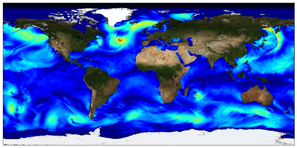
/Ocean Circulation/Ocean Currents
Type of resources
Available actions
Topics
Keywords
Contact for the resource
Provided by
Years
Formats
Representation types
status
Resolution
-
This dataset provides surface Stokes drift as retrieved from the wave energy spectrum computed by the spectral wave model WAVEWATCH-III (r), under NOAA license, discretized in wave numbers and directions and the water depth at each location. It is estimated at the sea surface and expressed in m.s-1. WAVEWATCH-III (r) model solves the random phase spectral action density balance equation for wavenumber-direction spectra. Please refer to the WAVEWATCH-III User Manual for fully detailed description of the wave model equations and numerical approaches. The data are available through HTTP and FTP; access to the data is free and open. In order to be informed about changes and to help us keep track of data usage, we encourage users to register at: https://forms.ifremer.fr/lops-siam/access-to-esa-world-ocean-circulation-project-data/ This dataset was generated by Ifremer / LOPS and is distributed by Ifremer / CERSAT in the frame of the World Ocean Circulation (WOC) project funded by the European Space Agency (ESA).
-

These gridded products are produced from the along-track (or Level-3) SEA LEVEL products (DOI: doi.org/10.48670/moi-00147) delivered by the Copernicus Marine Service (CMEMS, marine.copernicus.eu) for satellites SARAL/AltiKa, Cryosat-2, HaiYang-2B, Jason-3, Copernicus Sentinel-3A/B, Sentinel-6 MF, SWOT nadir, and SWOT Level-3 KaRIn sea level products (DOI: https://doi.org/10.24400/527896/A01-2023.018). Three mapping algorithms are proposed: MIOST, 4DvarNET, 4DvarQG: - the MIOST approach which give the global SSH solutions: the MIOST method is able of accounting for various modes of variability of the ocean surface topography (e.g., geostrophic, barotrope, equatorial waves dynamic …) by constructing several independent components within an assumed covariance model. - the 4DvarNET approach for the regional SSH solutions: the 4DvarNET mapping algorithm is a data-driven approach combining a data assimilation scheme associated with a deep learning framework. - the 4DvarQG approach for the regional SSH solutions: the 4DvarQG mapping technique integrates a 4-Dimensional variational (4DVAR) scheme with a Quasi-Geostrophic (QG) model.
-
This dataset provides Level 4 total current including geostrophy and a data-driven approach for Ekman and near-inertial current, based on a convolution between drifter observation and wind history, to fit empirically a complex and time-lag dependant transfert function between ERA5 wind stress and current The data are available through HTTP and FTP; access to the data is free and open. In order to be informed about changes and to help us keep track of data usage, we encourage users to register at: https://forms.ifremer.fr/lops-siam/access-to-esa-world-ocean-circulation-project-data/ This dataset was generated by Datlas and is distributed by Ifremer / CERSAT in the frame of the World Ocean Circulation (WOC) project funded by the European Space Agency (ESA).
-

This dataset contains the high-frequency total horizontal current at 15m depth on a global grid at 1/4° resolution. It is composed by the addition of two components, the first is the Geostrophic current derived by Altimetry, from the DT-2018 CMEMS database, and the second is the unsteady-Ekman ageostrophic component forced by the wind. All the details about the algorithm and the physical content of this ageostrophy component are given in the ATBD. The data are available through HTTP and FTP; access to the data is free and open. This dataset was generated by Datlas Ocean and is distributed by Ifremer / CERSAT in the frame of the World Ocean Circulation (WOC) project funded by the European Space Agency (ESA).
-

These gridded products are produced from the following upstream data: - for satellites SARAL/AltiKa, Cryosat-2, HaiYang-2B, Jason-3, Copernicus Sentinel-3A/B, Sentinel-6 MF, SWOT Nadir => NRT (Near-Real-Time) Nadir along-track (or Level-3) SEA LEVEL products (DOI: https://doi.org/10.48670/moi-00147) delivered by the Copernicus Marine Service (http://marine.copernicus.eu/ ). The gridded product is based on near-real-time (NRT) Level-3 Nadir datasets for the period from July 7, 2025, to December 31, 2025. => MY (Multi-Year) Nadir along-track (or Level-3) SEA LEVEL products (DOI: https://doi.org/10.48670/moi-00146 ) delivered by the Copernicus Marine Service (CMEMS, http://marine.copernicus.eu/ ). The gridded product is based on MY Level-3 Nadir datasets for the period from March 28, 2023, to July 6, 2025. - for SWOT KaRIn : the L3_LR_SSH Expert v3.0 product distributed by AVISO (DOI: https://doi.org/10.24400/527896/A01-2023.018) from March 28, 2023 to December 31, 2025. One mapping algorithm is proposed: the MIOST approach which provides which provides global Sea Surface Height (SSH) solutions. The MIOST method is capable of accounting for various modes of ocean surface topography variability (e.g., geostrophic, barotropic, equatorial wave dynamics) by constructing multiple independent components within a predefined covariance model.
-

The SWOT L3_LR_SSH product provides ocean topography measurements obtained from the SWOT KaRIn and nadir altimeter instruments, merged into a single variable. The dataset includes measurements from KaRIn swaths on both sides of the image, while the measurements from the nadir altimeter are located in the central columns. In the areas between the nadir track and the two KaRIn swaths, as well as on the outer edges of each swath (restricted to cross-track distances ranging from 10 to 60 km), default values are expected. SWOT L3_LR_SSH is a cross-calibrated product from multiple missions that contains only the ocean topography content necessary for thematic research (e.g., oceanography, geodesy) and related applications. This product is designed to be simple and ready-to-use, and can be combined with other altimetry missions. The SWOT L3_LR_SSH product is a research-orientated extension of the L2_LR_SSH product, distributed by the SWOT project (NASA/JPL and CNES) and managed by the SWOT Science Team project DESMOS. The "Technical" version of SWOT L3_LR_SSH (the "Basic", "Expert" and "Unsmoothed" versions are the subject of separate metadata sheets) includes additional parameters and geophysical fields that may be of interest for certain applications or that provide an alternative solution to those used in the core (Basic/Expert) products.
-

The SWOT L3_LR_SSH product provides ocean topography measurements obtained from the SWOT KaRIn and nadir altimeter instruments, merged into a single variable. The dataset includes measurements from KaRIn swaths on both sides of the image, while the measurements from the nadir altimeter are located in the central columns. In the areas between the nadir track and the two KaRIn swaths, as well as on the outer edges of each swath (restricted to cross-track distances ranging from 10 to 60 km), default values are expected. SWOT L3_LR_SSH is a cross-calibrated product from multiple missions that contains only the ocean topography content necessary for thematic research (e.g., oceanography, geodesy) and related applications. This product is designed to be simple and ready-to-use, and can be combined with other altimetry missions. The SWOT L3_LR_SSH product is a research-orientated extension of the L2_LR_SSH product, distributed by the SWOT project (NASA/JPL and CNES). SWOT L3_LR_SSH is managed by the SWOT Science Team project DESMOS. The "Expert" version of SWOT L3_LR_SSH (the "Basic" version is the subject of a separate metadata sheet) includes each algorithm, correction, or external model incorporated into the SWOT L3_LR_SSH product as a separate layer. In addition to the SSH anomalies, this "Expert" version also includes mean dynamic topography (as in the "Basic" version), backscatter coefficient (sigma0), mean sea surface and geostrophic currents (absolute and anomalies).
-

The SWOT L3_LR_SSH product provides ocean topography measurements obtained from the SWOT KaRIn and nadir altimeter instruments, merged into a single variable. The dataset includes measurements from KaRIn swaths on both sides of the image, while the measurements from the nadir altimeter are located in the central columns. In the areas between the nadir track and the two KaRIn swaths, as well as on the outer edges of each swath (restricted to cross-track distances ranging from 10 to 60 km), default values are expected. SWOT L3_LR_SSH is a cross-calibrated product from multiple missions that contains only the ocean topography content necessary for thematic research (e.g., oceanography, geodesy) and related applications. This product is designed to be simple and ready-to-use, and can be combined with other altimetry missions. The SWOT L3_LR_SSH product is a research-orientated extension of the L2_LR_SSH product, distributed by the SWOT project (NASA/JPL and CNES) and managed by the SWOT Science Team project DESMOS. The "Basic" version of SWOT L3_LR_SSH (the "Expert" version is the subject of a separate metadata sheet) includes only the SSH anomalies and mean dynamic topography.
-
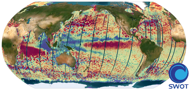
The SWOT L3_LR_SSH product provides ocean topography measurements obtained from the SWOT KaRIn and nadir altimeter instruments, merged into a single variable. The dataset includes measurements from KaRIn swaths on both sides of the image, while the measurements from the nadir altimeter are located in the central columns. In the areas between the nadir track and the two KaRIn swaths, as well as on the outer edges of each swath (restricted to cross-track distances ranging from 10 to 60 km), default values are expected. SWOT L3_LR_SSH is a cross-calibrated product from multiple missions that contains only the ocean topography content necessary for thematic research (e.g., oceanography, geodesy) and related applications. This product is designed to be simple and ready-to-use, and can be combined with other altimetry missions. The SWOT L3_LR_SSH product is a research-orientated extension of the L2_LR_SSH product, distributed by the SWOT project (NASA/JPL and CNES). SWOT L3_LR_SSH is managed by the SWOT Science Team project DESMOS. The ['Unsmoothed'] version of SWOT L3_LR_SSH (the "Basic" and "Expert" versions are the subject of separate metadata sheets) includes each algorithm, correction, or external model incorporated into the SWOT L3_LR_SSH product as a separate layer. This ['Unsmoothed'] version which includes the MSS, MDT and geostrophic currents (absolute and anomalies) in addition to the SSHA and MDT on the 250 m KaRIn native grid. Like the Expert subproduct, it also integrates a quality flag, corrections and external models as separate layers.
-
The SWISCA Level 2S (L2S) product provides along-track colocation of SWIM wave measuring instrument onto SCAT scatterometer grid, over the global ocean. SWIM and SCAT are both instruments onboard CFOSAT. CFOSAT (Chinese French Ocean SATellite) is a french-chinese mission launched in 2018, whose aim is to provide wind (SCAT instrument) and wave (SWIM instrument) measurements over the sea surface. The SWISCA L2S product is broken down into three different subproducts: - L2A containing the sigma0 of both SWIM and SCAT - L2B containing the wave parameters measured by SWIM and wind vectors measured by SCAT - AUX containing additional ancillary fields such as sea ice concentration (from CERSAT/SSMI), ocean currents (from CMEMS/GlobCurrent), SST and Wind (from ECMWF), rain rate (from IMERG), and WaveWatch3 wave spectra. All SWIM and ancillary observations are resampled onto SCAT scatterometer's geometry (wind vector cells, WVC). The SWISCA level 2S product is generated in delayed mode, a few days after acquisition. It is intended to foster cross analysis of SWIM and SCAT observations, and their combination to improve the retrieval of both wind and wave parameters. The SWISCA L2S product is generated and distributed by Ifremer / CERSAT in the frame of the Ifremer Wind and Wave Operation Center (IWWOC) co-funded by Ifremer and CNES and dedicated to the processing of the delayed mode data of CFOSAT mission.