 Catalogue PIGMA
Metadata GDI-Vl-conform
Type of resources
Available actions
Topics
Keywords
Contact for the resource
Provided by
Years
Representation types
Scale
-
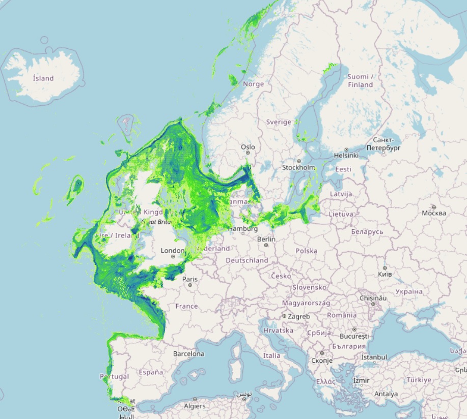
The datasets on fishing intensity in the EU waters by sea basin are created every year by the International Council for the Exploration of the Sea (ICES). In the 2020 Cogea started to collect and harmonize them according to the EMOdnet Human Activities dataset schema. The EMODnet dataset is updated yearly, as soon as new data from ICES Fishing Overviews are released, and is available for viewing and download on the EMODnet web portal (Human Activities, https://emodnet.ec.europa.eu/en/human-activities). Where and when available, the fisheries overview fishing intensity data concern: i) the spatial distribution of average annual fishing effort (mW fishing hours) by ecoregion (Azores, Bay of Biscay and the Iberian Coast, Baltic Sea, Barents Sea, Celtic Seas, Faroes, Greater North Sea, Icelandic Waters, Norwegian Sea and Oceanic Northeast Atlantic) and by gear type (Beam trawls, Bottom otter trawls, Bottom seines, Dredges, Pelagic trawls and seines, Static gears). Fishing effort data are only shown for vessels >12 m having vessel monitoring systems (VMS); ii) the average annual subsurface (top) and surface (bottom) mobile bottom contacting fishing gear (i.e. bottom otter trawls, bottom seines, dredges, beam trawls) disturbance by ecoregion in the Bay of Biscay and the Iberian Coast, Baltic Sea, Barents Sea, Celtic Seas, Faroes, Greater North Sea, Icelandic Waters, Norwegian Sea and Oceanic Northeast Atlantic, expressed as average swept-area ratios (SAR). Due to data confidentiality issues, VMS/logbook data are anonymized and aggregated in a 0.05×0.05 degree grid prior to submission to ICES, using the C-squares geocode system (polygons). The last data loaded into the database, from the ICES 2024 Fishing Overview update or revision (where available), report the 2019-2022 averages. Historical data area also included in the database, starting from the 2020 fishing overview, and reporting the 2015-2018, 2017-2020, 2018-2021, and 2019-2020 averages.
-
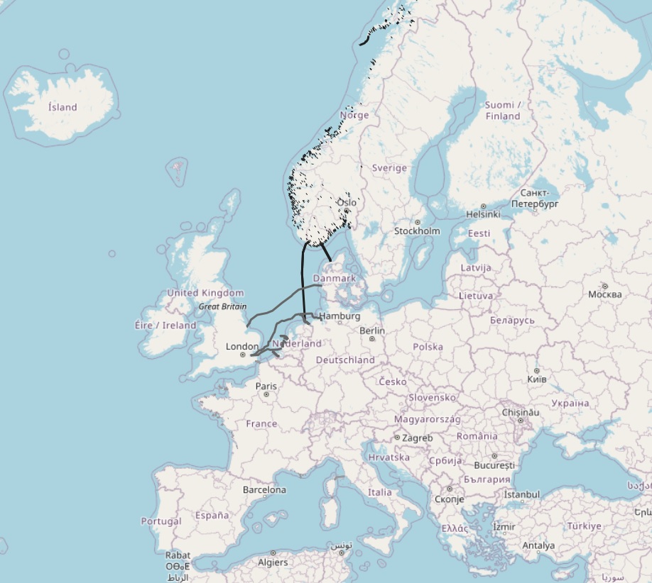
The dataset on subsea power cables in the European waters was created in 2014 by Cogea for the European Marine Observation and Data Network (EMODnet). It is the result of the aggregation of datasets provided by several EU and non-EU sources. It is updated every year, and is available for viewing and download on the EMODnet web portal (Human Activities, https://emodnet.ec.europa.eu/en/human-activities). The dataset contain lines representing actual cable routes locations. Compared with the previous version, this version now includes the German high voltage cables.
-
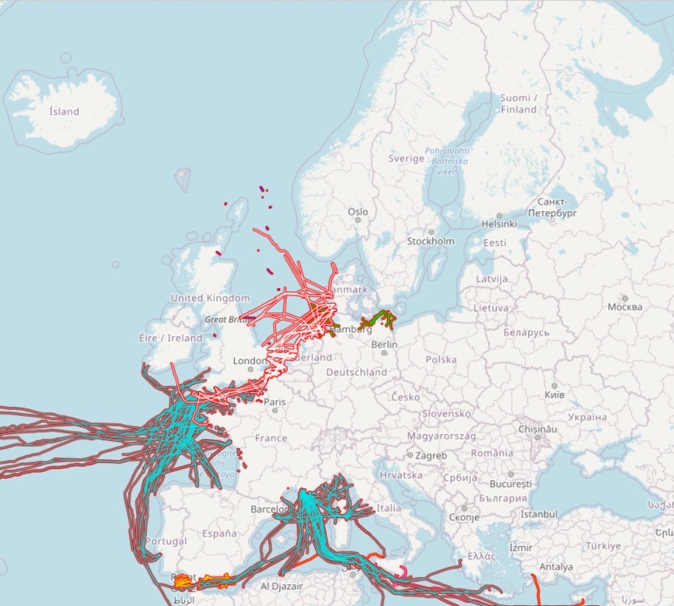
The dataset on subsea telecommunication cables in the European waters was created in 2014 by Cogea for the European Marine Observation and Data Network (EMODnet). It is the result of the aggregation of datasets provided by several EU and non-EU sources. It is updated every year, and is available for viewing and download on the EMODnet web portal (Human Activities, https://emodnet.ec.europa.eu/en/human-activities). The dataset contain lines representing actual cable routes locations. Compared with the previous version, this version includes an update of the German cables.