 Catalogue PIGMA
Macroalgal
Type of resources
Available actions
Topics
Keywords
Contact for the resource
Provided by
Years
Formats
Representation types
status
-
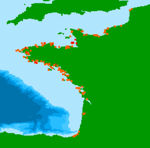
French intertidal and subtidal Macroalgae taxa data are collected during monitoring surveys on the English Channel / Bay of Biscay coasts. Protocols are implemented in the Water Framework Directive. Data are transmitted in a Seadatanet format (CDI + ODV) to EMODnet Biology european database. 131 ODV files have been generated from period 01/01/2006 to 31/12/2021.
-

The historical Seasonal Sargassum Forecast relies on the system described by Jouanno et al. (2023), operated by at the Laboratoire d’Etude en Géophysique et Océanographie Spatiale (LEGOS) and developed within ANR FORESEA and TOSCA SAREDA projects. This system relies on a mechanistic model of Sargassum populations, the NEMO-Sarg 1.0 model (Jouanno et al. 2021,2023, 2025), which integrates both transport and a physiology model of the macroalgae. The ensemble version of the Sargassum model at 1/4° horizontal resolution has been implemented and allows for the production of 7-month forecasts every month, initialized from Sargassum areal coverage near-real time estimates from the Moderate Resolution Imaging Spectroradiometer MODIS (Berline & Descloitres, 2021). The operational Seasonal Sargassum Forecasts (September 2025 – on going) are produced globally by Mercator Ocean International, building on the same mechanistic NEMO-Sarg 1.0 configuration (Jouanno et al., 2021, 2023, 2025, see details in 2.1). Sargassum biomass is initialized each month using near-real-time estimates derived from OLCI satellite observations (DOI: 10.24400/527896/a01-2022.007), providing an up-to-date representation of surface concentrations. This global operational framework thus complements the IRD regional setup and extends forecasting capability across the entire Atlantic basin. More details on both processing are available in the user manual.
-
Opportunistic macroalgae blooms (green tides) data are collected during monitoring surveys on the English Channel / Bay of Biscay French coasts since 2008 (Quadrige program code : BLOOMS). Protocols are implemented in the European Water Framework Directive.
-

Composite maps of sargassum detection index NFAI (Normalized Floating Algae Index). Daily gridded products provided in delayed time from February 2022 to a month before current date, made available as part of SeSaM SCO project (https://www.spaceclimateobservatory.org/sesam). Each map represents the sargassum presence (through normalized floatting alguae index) of the last 7 days at 0.01° resolution.
-

Composite maps of sargassum detection index NFAI (Normalized Floating Algae Index). Daily gridded products provided in delayed time from December 2020 to a month before current date, made available as part of SeSaM SCO project (https://www.spaceclimateobservatory.org/sesam) . Each map represents the sargassum presence (through normalized floatting alguae index) at 0.0025° (high) or 0.01° (low) resolutions.