 Catalogue PIGMA
Cogea Srl
Type of resources
Available actions
Topics
Keywords
Contact for the resource
Provided by
Years
Representation types
Scale
Resolution
-
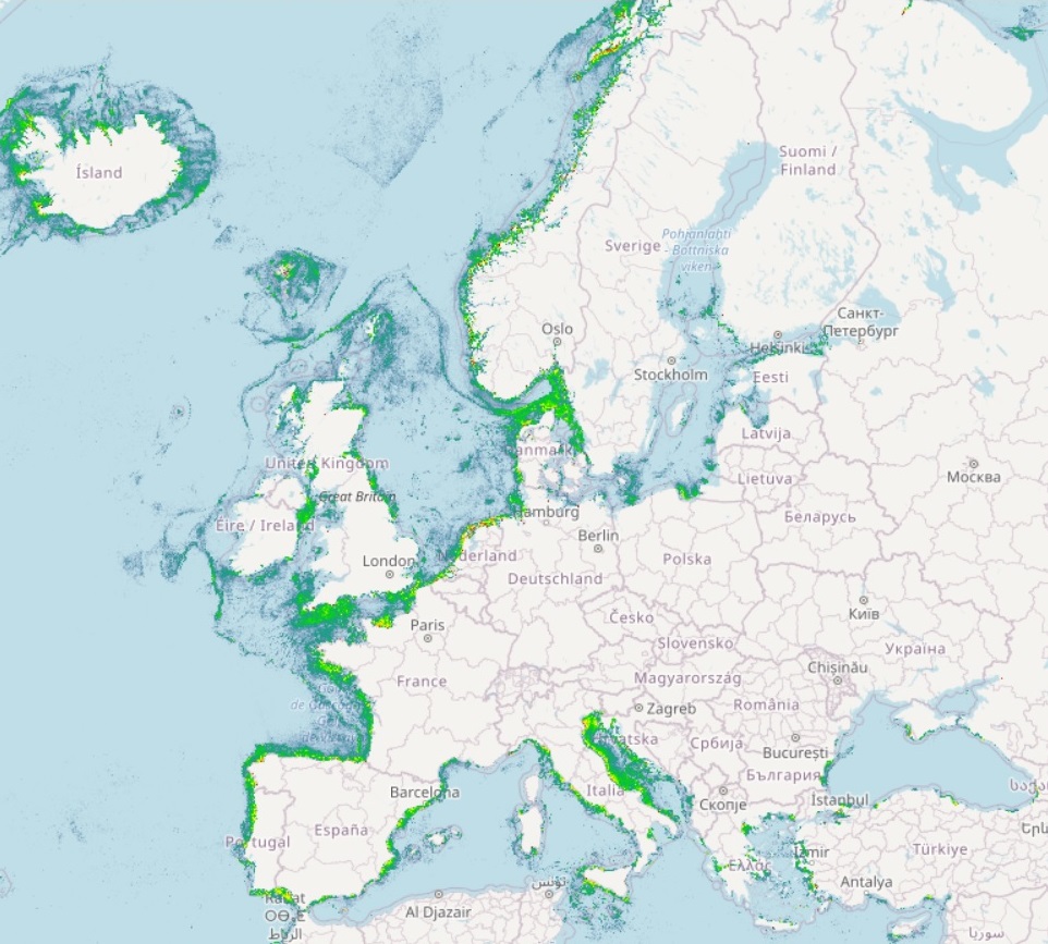
The Vessel Density maps in the EU are created since the 2019 by Cogea for the European Marine Observation and Data Network (EMODnet). The dataset is updated every year and is available for viewing and download on EMODnet web portal (Human Activities, https://emodnet.ec.europa.eu/en/human-activities). The maps are based on AIS data yearly purchased from Collecte Localisation Satellites (CLS) and ORBCOMM. The maps, GeoTIFF format, show shipping density in 1x1km cells of a grid covering all EU waters and some neighbouring areas. Density is expressed as hours per square kilometre per month. The following ship types are available:0 Other, 1 Fishing, 2 Service, 3 Dredging or underwater ops, 4 Sailing, 5 Pleasure Craft, 6 High speed craft, 7 Tug and towing, 8 Passenger, 9 Cargo, 10 Tanker, 11 Military and Law Enforcement, 12 Unknown and All ship types. Data are available by month of year. Yearly averages are also available.
-
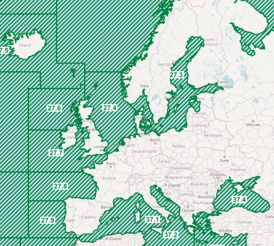
The dataset on fish catches in the European waters by FAO statistical areas was created in 2015 by Cogea for the European Marine Observation and Data Network (EMODnet). It is the result of the aggregation of EUROSTAT's fish catches datasets fish_ca_atl 27, fish_ca_atl 34, fish_ca_atl 37, fish_ca_atl271, fish_ca_atl272, fish_ca_atl34_h and fish_ca_atl37_h. It is available for viewing and download on EMODnet web portal (Human Activities, https://emodnet.ec.europa.eu/en/human-activities). EUROSTAT data have been related to FAO's georeferenced fishing areas (polygons) for statisticl purposes (FAO, 2020. FAO Statistical Areas for Fishery Purposes. In: FAO Fisheries and Aquaculture Department). Tonnes live weight is provided for each fish species caught (3-alpha code and english or scientific name if the english one is not available), by EUMOFA's larger aggregations such as EUMOFA's Commodity Groups and Main Commercial Species (see 'Species_Eumofa_ASFIS_2023' table), by year of reference and country (code and name). The dataset is updated yearly and it covers a time series from 1950 to 2021, where available. Compared with the previous version this new one's schema have been updated.
-
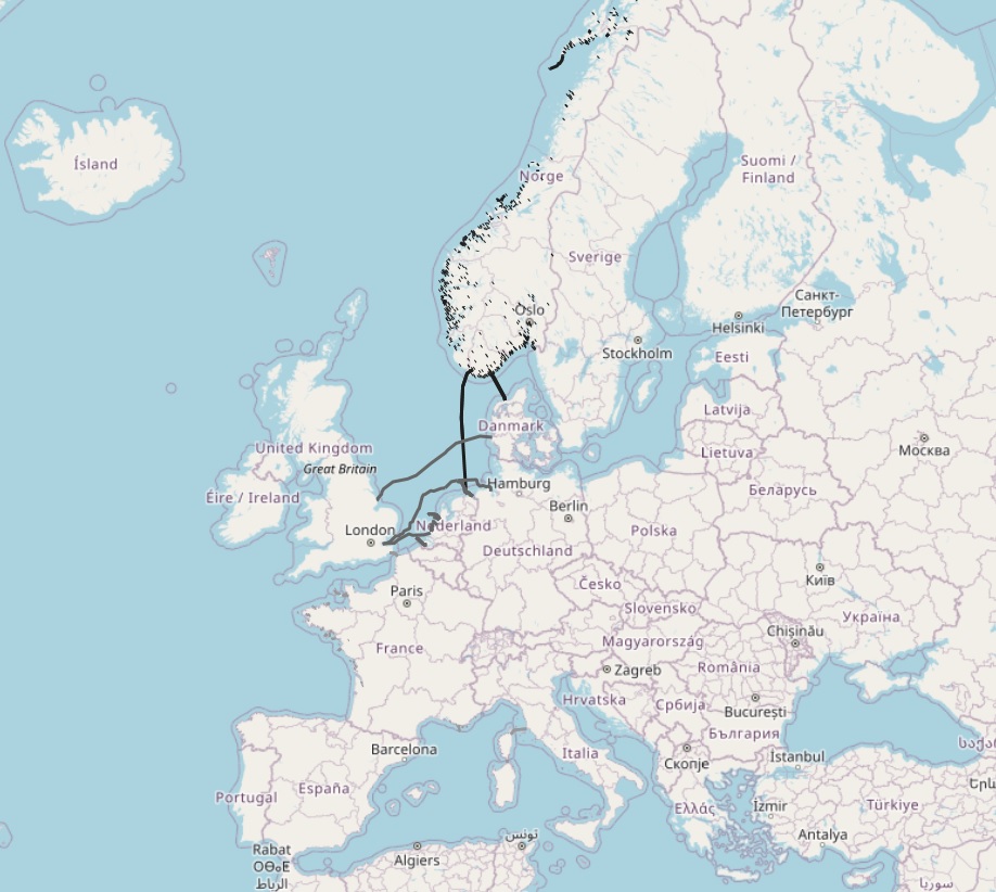
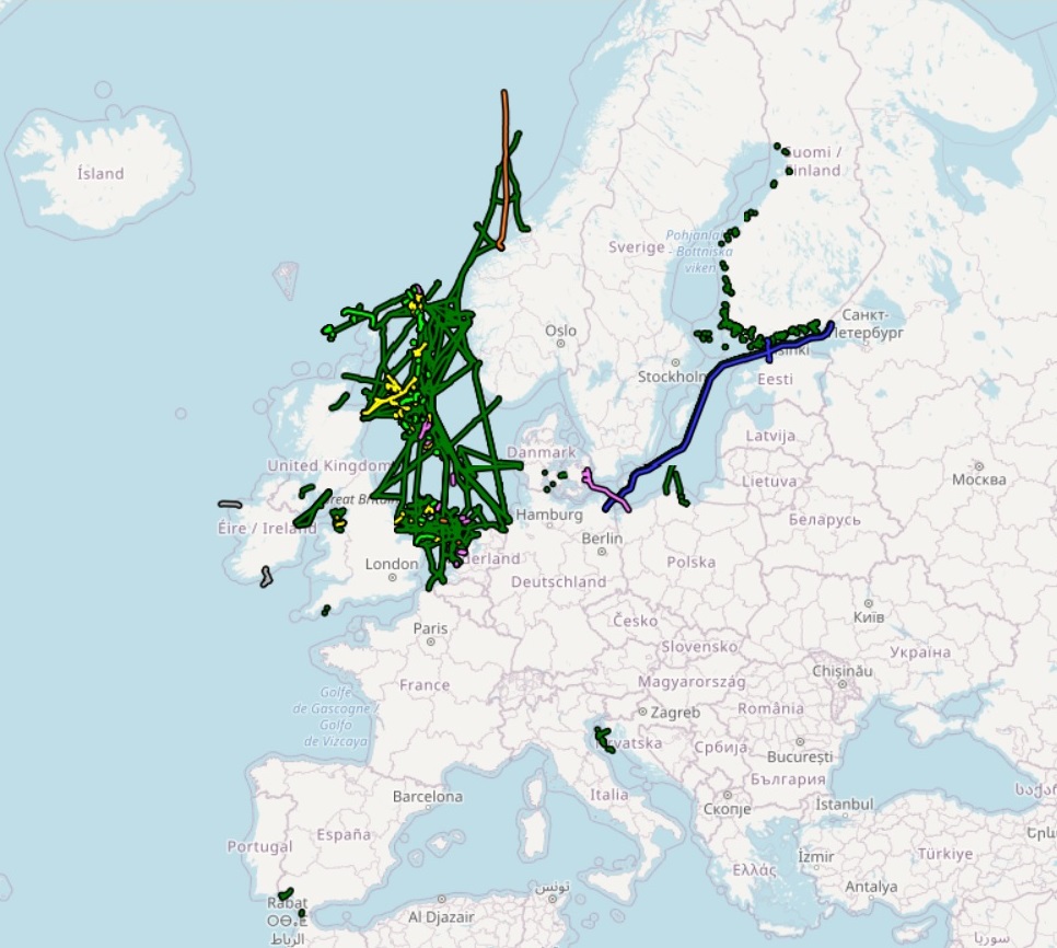
The dataset on subsea power cables in the European waters was created in 2014 by Cogea for the European Marine Observation and Data Network (EMODnet). It is the result of the aggregation of datasets provided by several EU and non-EU sources. It is updated every year, and is available for viewing and download on the EMODnet web portal (Human Activities, https://emodnet.ec.europa.eu/en/human-activities). The dataset contain lines representing actual cable routes locations. Compared with the previous version, this version now includes the German high voltage cables.
-
The dataset on subsea telecommunication cables in the European waters was created in 2014 by Cogea for the European Marine Observation and Data Network (EMODnet). It is the result of the aggregation of datasets provided by several EU and non-EU sources. It is updated every year, and is available for viewing and download on the EMODnet web portal (Human Activities, https://emodnet.ec.europa.eu/en/human-activities). The dataset contain lines representing actual cable routes locations. Compared with the previous version, this version includes an update of the German cables.
-
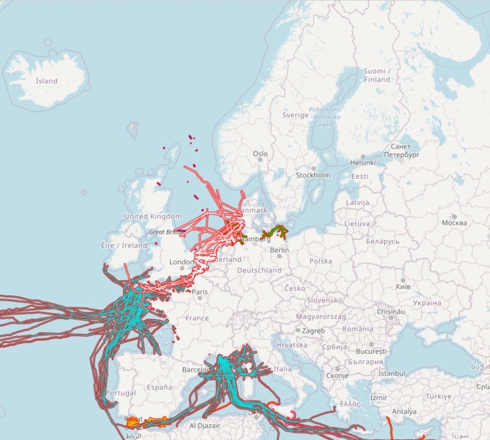
The dataset on offshore pipelines in the European seas was created in 2017 by Cogea for the European Marine Observation and Data Network (EMODnet). It is the result of the aggregation and harmonization of datasets provided by several several EU and non-EU sources. It is updated every year, and is available for viewing and download on the EMODnet web portal (Human Activities, https://emodnet.ec.europa.eu/en/human-activities). The dataset contains lines representing the actual routes of offshore pipelines (where available) in the following countries: Croatia, Denmark, Estonia, Finland, Germany, Ireland, Netherlands, Norway, Poland, Russia, Spain (Andalucía), Sweden and United Kingdom. Each line has the following harmonized attributes (where available): code, name, status (abandoned, active, application submitted, not in use, planned, pre-commissioning, proposed, under construction), medium (air, chemical glycol, chemical methanol, chemical n/a, condensate, control, cooling water, gas, geothermal heating, hydraulic, mixed hydrocarbons, oil, other fluid, sewage, water), operator, size (inches), length (metres), year, from and to locality or facility, country code, country name and notes. Compared with the previous version, this new version includes updated data from German BSH-CONTIS source.