 Catalogue PIGMA
210Pb
Type of resources
Available actions
Topics
Keywords
Contact for the resource
Provided by
Years
Formats
-
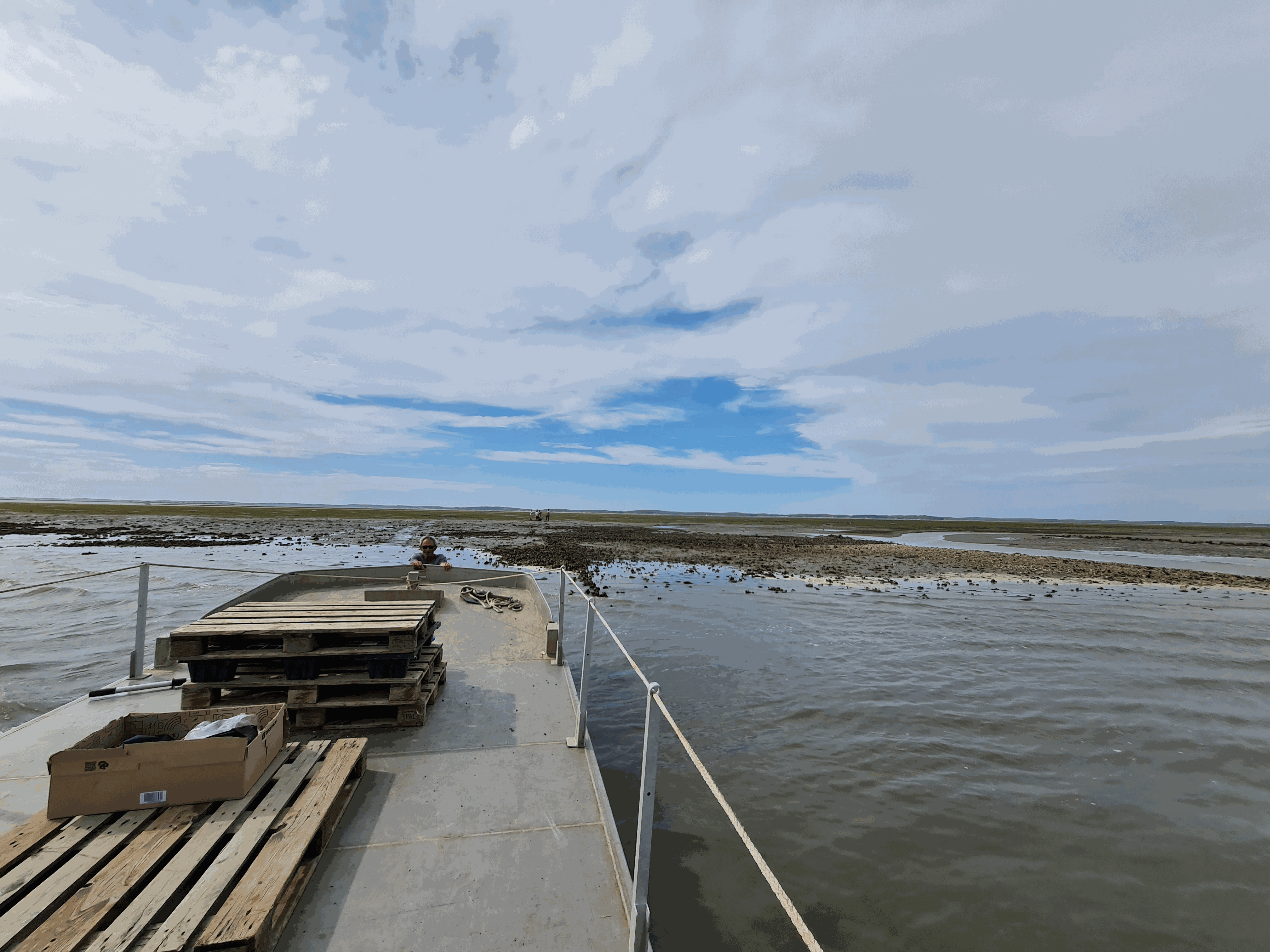
The Arcachon Bay is a unique and ecologically important meso-tidal lagoon on the Atlantic coast of south-west France. The Arcachon Bay has the largest area of dwarf seagrass (Z. noltei) in Europe, the extent of which was stable in their extent between the 1950s and 1990s, but a decline in seagrass was observed in mid-2000. The decline of Zostera (seagrass) may have a significant impact on sedimentation in this coastal ecosystem rich in marine life. Interface cores were collected in September 2022 to determine sediment and mass accumulation rates (SAR, MAR) in the Arcachon Bay. Ten study areas were selected, distributed over most of the areas where seagrass meadows are actually observed. Two sites were visited each time, one with the presence of Zostera noltei in good condition (Healthy) and the other where the sediment was bare (Bare). Maximum water heights during spring tides range from 3.44 m for the deepest site (Garrèche) to 2.09 m for the shallowest site (Fontaines). A total of 20 sediment cores were sampled and carefully extruded every 1 cm from the top to the bottom of the core. The sediment layers were used to determine dry bulk density and selected radioisotope activities: DBD, 210Pb, 226Ra, 137Cs, 228Th and 40K expressed as %K).
-
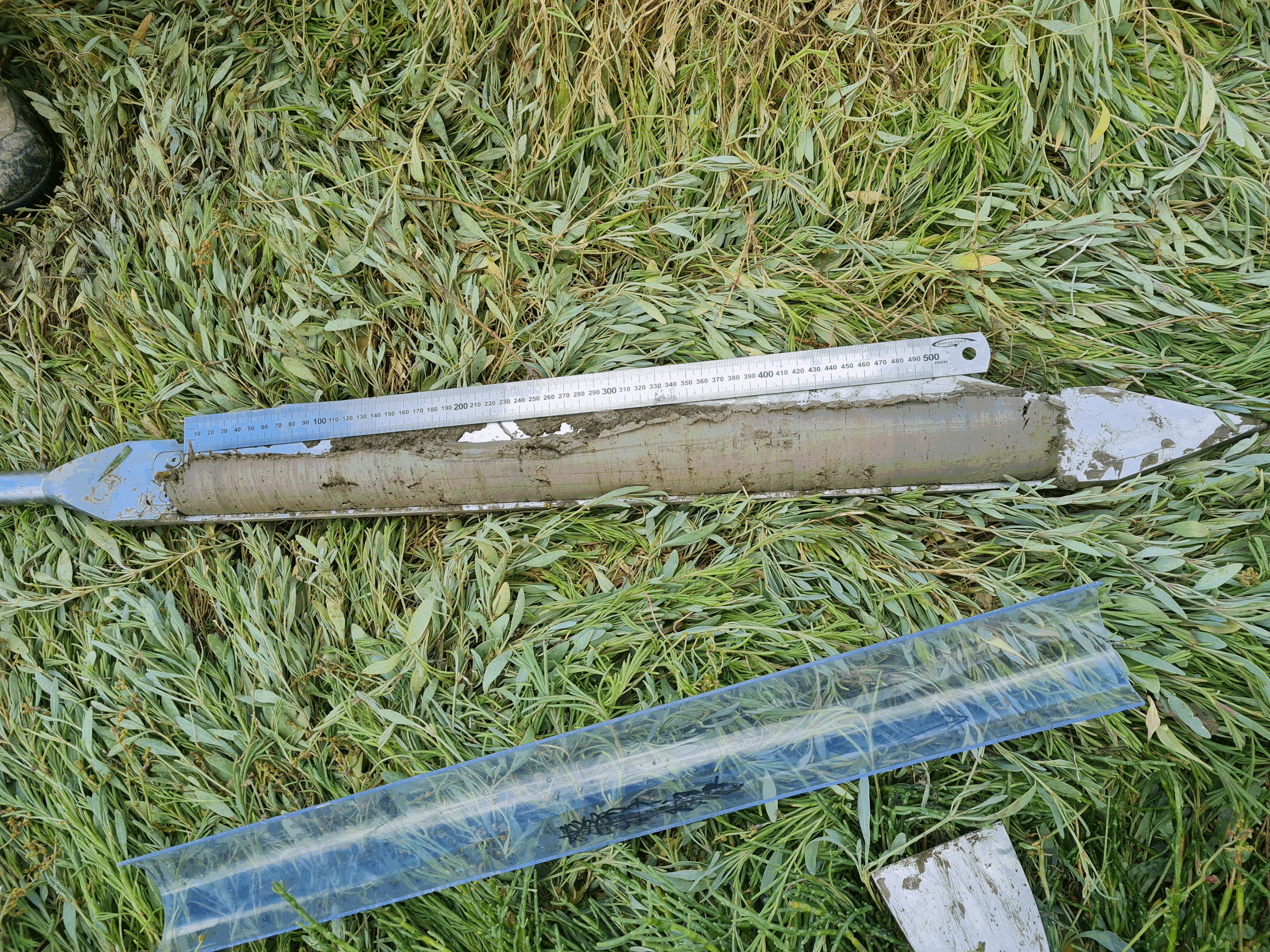
Three saltmarshes, Aiguillon, Brouage, Fier d'Ars, located in the Pertuis-Charentais Sea along the south-west coast of France, were studied to evaluate their sediment and mass accumulation rates (SAR; MAR) based on 210Pb and 137Cs profiles in sediments. Coastal saltmarshes play indeed an essential role in providing services such as coastal protection and supporting biodiversity. Saltmarshes are also critical environments for the accumulation of sedimentary organic carbon (blue carbon). However, the number of studies on saltmarshes remains underrepresented compared to studies on mangroves and seagrass. This work is a contribution to the effort to document sediment and mass accumulation rates of saltmarshes.A total of 16 1m sediment cores were collected in the three saltmarshes (Aiguillon, Brouage, Fier d'Ars) in 2021 and 2022 using an Eijkelkamp stainless steel peat sampler. Each sediment core was sampled every 1 cm from the top to the bottom of the core. The sediment layers were used to determine dry bulk density and selected radioisotope activities (210Pb, 226Ra, 137Cs, 228Th, 137Cs). Combining excess 210Pb and 137Cs has allowed to establish a reliable chronology of sediment deposition on a multidecadal timescale.
-
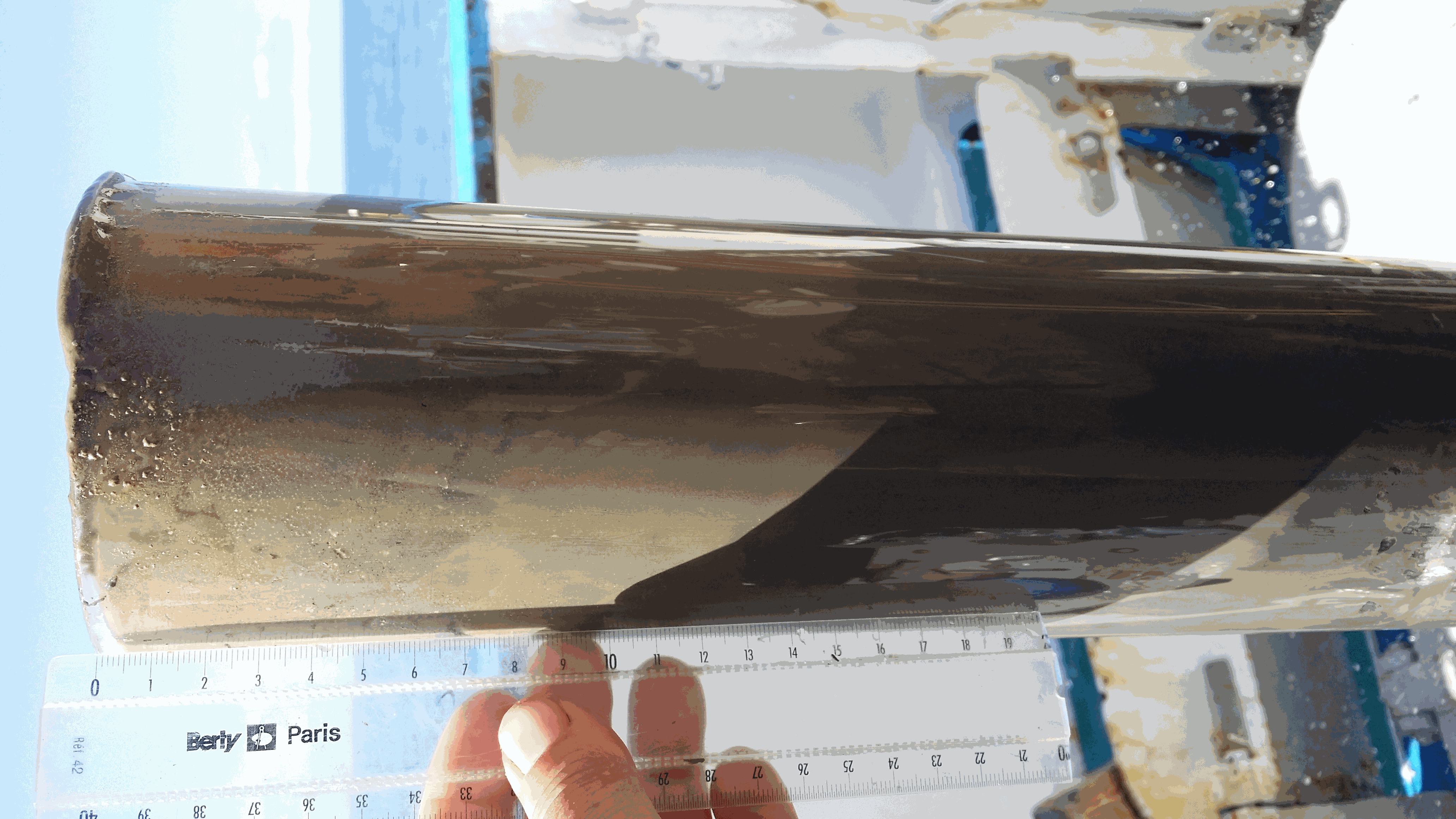
The West Gironde Mud Patch (WGMP) is a 420-km2 mud belt in the Bay of Biscay, located 25 km off the mouth of the Gironde estuary. This clay-silt feature of 4 m in thickness extends between 30 and 75m water depth, surrounded by the sands and gravels that cover the North Aquitaine continental shelf. Interface cores were collected during JERICOBent-1 cruise (October 2016; Deflandre (2016) doi.org/10.17600/16010400) along two cross-shelf transects for a total of 9 sites. Each sediment core was carefully extruded every 0.5 cm from the top core to 4 cm and every 1 cm below until the core bottom. The sediment layers were used to determine dry bulk density, grain size and selected radioisotope activities (210Pb, 226Ra, 137Cs, 228Th, K).
-

The West Gironde Mud Patch (WGMP) is a mud deposit located 25 km from the mouth of the Gironde Estuary in the Bay of Biscay. This 4-metre-thick clay-silt feature, which extends over an area of 420 km2, is found at depths between 30 and 80 meters. The main objectives of the JERICObent7 cruise, in July 2019, were to characterise the evolution of the WGMP’s benthic ecosystem in terms of its sedimentary, biogeochemical and ecological properties and to reconstruct climate variations and identify potential anthropogenic impacts over the last few centuries. To this end, a precise chronological framework was established for the sedimentary archives of the last few decades using 210Pbxs (T1/2 = 22.3 years). Interface cores were collected at stations 1, 3 and 4 along a cross-shelf transect. Twin Kullenberg cores were collected at sites 3 and 4 for geochemical (KGL) and palaeoceanographic (JB7-ST) investigations. Each interface core was carefully extruded at 0.5 cm intervals from the top of the core to 4 cm, and then at 1 cm intervals until the bottom was reached. Kullenberg cores were only collected at sites 3 and 4. Depending on their intended use, the Kullenberg cores were sampled at different resolutions, the depth of each sediment layer corresponded to the depth from the top of the core. These layers were then used to determine the dry bulk density and radioisotope activities of interest (210Pb, 226Ra, 228Th, 137Cs, 40K). Excess 210Pb was used to establish the realignment and chronological framework of the interface and Kullenberg cores.