 Catalogue PIGMA
Oceans
Type of resources
Available actions
Topics
Keywords
Contact for the resource
Provided by
Years
Formats
Representation types
Update frequencies
status
Scale
Resolution
-
Benthic Non Native Species Tool (Cefas)
-
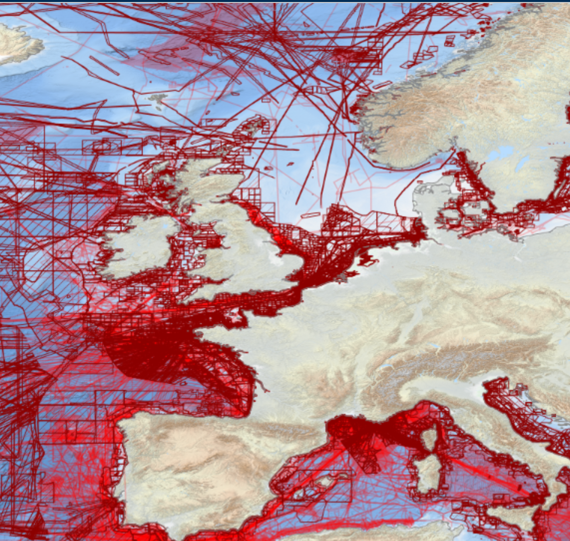
EMODnet Bathymetry has adopted the CDI Data Discovery & Access service as developed and operated by SeaDataNet, the pan-European network of NODCs, to bring together and provide access to available high resolution bathymetric survey data sets from many data providers, such as National Hydrographic Institutes, Research Institutes, and Survey companies. All bathymetric survey data are described with INSPIRE compliant metadata, following the CDI metadata profile, based on ISO 19115 – 19139 standards. This way, the CDI service gives users a highly detailed insight in the availability and geographical spreading of bathymetric survey data sets that are acquired and managed by an increasing group of data providers and for which users can request access for downloading. The CDI metadata are public domain and freely available for all users. However, a major part of the survey data sets is not freely available and requires negotiation with the data owners. The SeaDataNet CDI search, shopping and tracking mechanism facilitates identifying and requesting access to these background data sets from data providers. Note that all data sets are used internally with permission of the data owners for contributing to the EMODnet Digital Terrain Model (DTM) for the European sea regions. The service URL is : https://geo-service.maris.nl/emodnet_bathymetry/wfs?service=WFS&request=GetCapabilities. The layer in the Map Viewer facilitates users to view the locations of the CDI entries and to retrieve details of individual surveys by clicking on the map. From there users are linked to the actual CDI Data Discovery and Access service (https://cdi-bathymetry.seadatanet.org/search) for performing more queries and submitting requests for data access.
-
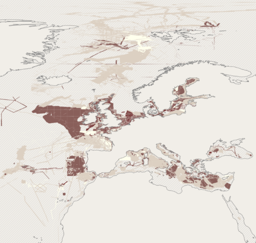
EMODnet bathymetry is composed of a multitude of datasets from a multitude of data providers. Users of the resulting grid and associated datasets need to be able to evaluate at the grid node level the quality of the bathymetric data and product they will be using. For this EMODnet Bathymetry has introduced a Quality index (QI). The QI is available as a WFS service providing vector data and as WMS providing the QI as an image service. The aim of the quality index is to: • help data users to evaluate quickly the dataset they are about to request, • indicate to the EMODnet Basin coordinators what are the limitations of the dataset they are about to merge while building the EMODnet DTM and to • be used as the basis of the evaluation of the quality of the EMODnet DTM. Service URL: https://ows.emodnet-bathymetry.eu/wfs
-
The mission for this tool, as well as its overriding goal, is "Solving problems in capture fisheries and aquaculture using GIS, remote sensing and mapping". Specifically, the objectives of GISFish are to: - Improve the sustainability of aquaculture and capture fisheries by promoting the use of GIS, remote sensing and mapping; - Facilitate the use of GIS, remote sensing, and mapping through easy access to comprehensive information on applications and training opportunities. The Fisheries and Aquaculture Management Division at FAO is actively promoting the use of spatial analytical tools and geo-referenced information for the analysis of Fisheries and Aquaculture data and in the development of Fisheries and Aquaculture management. GISFish is a "one stop" site from which to obtain the global experience on Geographic Information Systems (GIS), Remote Sensing and Mapping as applied to Fisheries and Aquaculture. GISFish sets out the issues in Fisheries and Aquaculture, and demonstrates the benefits of using GIS, remote sensing and mapping to resolve them. The global experience provided by GISFish is captured in Issues, Publications, Activities, Training, Data and Tools, Contacts,Discussions, News and events. GISFish is broadly divided into two domains, GISFish Aquaculture and GISFish Capture Fisheries with a wide range of material and information that is shared between the two domains to address the role of GIS to support the Ecosystem Approach to Fisheries (EAF) and the Ecosystem Approach to Aquaculture (EAF).
-
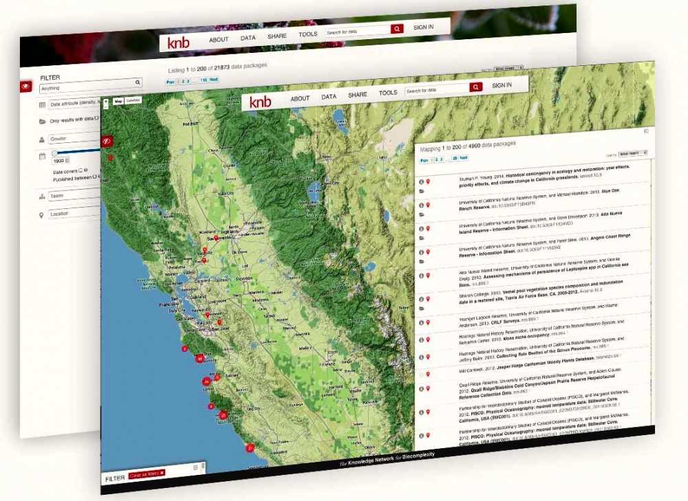
The Knowledge Network for Biocomplexity (KNB) is an international repository intended to facilitate ecological and environmental research. The KNB was launched in 1998 with a grant from the National Science Foundation (NSF), with the purpose of being the long term home for synthesis datasets and research products generated by National Center for Ecological Analysis and Synthesis (NCEAS) working groups. Since then, NCEAS has continued to operate the KNB not only as an archive for NCEAS working group products, but also for the broader ecology and environmental science community. The KNB acceps all environmental or ecological related data and publishes datasets with Digital Object Identifiers for the express purpose of ensuring long-term access to these datasets. We strive to abide by FAIR (findable, accessible, interoperable, resuble) principles of data sharing and preservation. For scientists, the KNB is an efficient way to share, discover, access and interpret complex ecological data. Due to rich contextual information provided with KNB data, scientists are able to integrate and analyze data with less effort. The data originate from a highly-distributed set of field stations, laboratories, research sites, and individual researchers. The foundation of the KNB is the rich, detailed metadata provided by researchers that collect data, which promotes both automated and manual integration of data into new projects.
-
-

rgbif is an R package from rOpenSci that allows searching and retrieving data from GBIF. rgbif wraps R code around the GBIF API to allow you to talk to GBIF from R and access metadata, species names, and occurrences. rgbif allows you to easily: - get data for single occurrences - retrieve multiple occurences - search for taxon names - generate maps of occurences
-
The Western Channel Observatory (WCO) is an oceanographic time-series and marine biodiversity reference site in the Western English Channel. In situ measurements are undertaken weekly at coastal station L4 and fortnightly at open shelf station E1 using the research vessels of the Plymouth Marine Laboratory and the Marine Biological Association. These measurements are complemented by PML's recognised excellence in ecosystem modelling and satellite remote sensing science. By integrating these different observational disciplines we can begin to disentangle the complexity of the marine ecosystem. The WCO measures several key parameters important to the functioning of the marine ecosystem such as light, temperature, salinity and nutrients. Station L4 has some of the longest time-series in the world for zooplankton and phytoplankton, and fish trawls have been made by the MBA for a century. Station E1 has a hydrographic series dating from 1903. These long series are complemented by hourly measurements made at our moorings situated at both stations. These can elucidate changes not captured by the routine weekly sampling.