 Catalogue PIGMA
Deltares
Type of resources
Available actions
Topics
Keywords
Contact for the resource
Provided by
Years
Formats
Representation types
Resolution
-
The coastal heights data combines two datasets: the land-sea mask of the gridded EMODnet bathymetry and the height of high-water (HAT) relative to chart datum (LAT) as computed with the GTSM tide model. Near the coast a diffusion scheme is applied to make the heights consistent with the land-sea mask. Finally, only grid cells that are classified as sea, but neighbor a land cell are selected. The main assumption in this approach is that the height of the topography near the coastline is close to the high-water mark. The main purpose of this dataset is to improve extrapolation towards the coast. In many areas around Europe there is a (small) gap between the point closest to the coast for which a survey is available and the coastline. In this way interpolation from coarser background data is avoided.
-

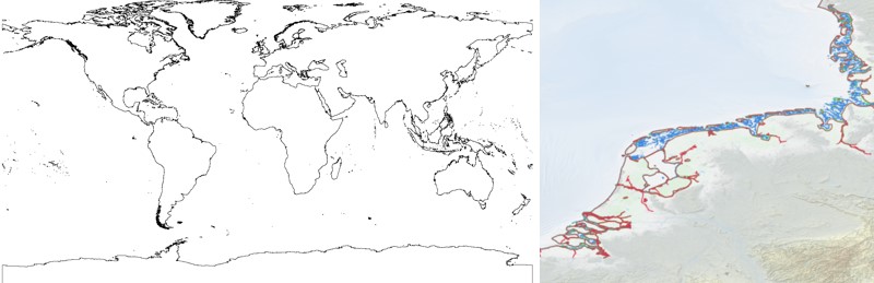
The EMODnet Bathymetry World Coastline is available as a WFS service from EMODnet Bathymetry. The service URL is: https://ows.emodnet-bathymetry.eu/wfs. The layer contains vector lines derived from land polygons available from OpenStreetMap. The original source url is https://osmdata.openstreetmap.de/. Parts of these polygons have been modified for use in EMODnet Bathymetry. In addition to the OSM EMODnet default coastline, three sub-layers are available as part of the EMODnet world coastline service. These sub-layers contain the best-estimate coastlines for Europe determined by Dutch research institute Deltares from satellite data (typically Sentinel-2 and Landsat-8) and in combination with the Global Tide Surge Model (GTSM) processed into digital coastlines for the European seas at LAT (Lowest Astronomical Tide), MSL (Mean-Sea-Level), and MHW (Mean-High-Water). The level of detail is bound to the resolution of the satellite sensor (e.g. 10m for Sentinel-2). The latest December 2022 version covers the entire coastline of Europe and now also part of the Caribbean. A detailed paper is available describing the methodology used to determine the three versions of the satellite derived coastline: https://emodnet.ec.europa.eu/sites/emodnet.ec.europa.eu/files/public/EMODnet-Bathymetry_2022_satellite_derived_coastlines_Deltares-Feb2023.pdf
-

The EMODnet Bathymetry World Coastline is available as a WFS service from EMODnet Bathymetry. The service URL is: https://ows.emodnet-bathymetry.eu/wfs. The layer contains vector lines derived from land polygons available from OpenStreetMap. The original source url is https://osmdata.openstreetmap.de/. Parts of these polygons have been modified for use in EMODnet Bathymetry. In addition to the OSM EMODnet default coastline, three sub-layers are available as part of the EMODnet world coastline service. These sub-layers contain the best-estimate coastlines for Europe determined by Dutch research institute Deltares from satellite data (typically Sentinel-2 and Landsat-8) and in combination with the Global Tide Surge Model (GTSM) processed into digital coastlines for the European seas at LAT (Lowest Astronomical Tide), MSL (Mean-Sea-Level), and MHW (Mean-High-Water). The level of detail is bound to the resolution of the satellite sensor (e.g. 10m for Sentinel-2). The latest December 2020 version now covers the entire coastline of Europe. A detailed paper is available describing the methodology used to determine the three versions of the satellite derived coastline: https://emodnet.ec.europa.eu/sites/emodnet.ec.europa.eu/files/public/20201219_emodnet_bathymetry_satellite_derived_coastline_report.pdf
-
The EMODnet Bathymetry World Coastline is available as a WFS service from EMODnet Bathymetry. The service URL is: https://ows.emodnet-bathymetry.eu/wfs. The layer contains vector lines derived from land polygons available from OpenStreetMap. The original source url is https://osmdata.openstreetmap.de/. Parts of these polygons have been modified for use in EMODnet Bathymetry. In addition to the OSM EMODnet default coastline, three sub-layers are available as part of the EMODnet world coastline service. These sub-layers contain the best-estimate coastlines for Europe determined by Dutch research institute Deltares from satellite data (typically Sentinel-2 and Landsat-8) and in combination with the Global Tide Surge Model (GTSM) processed into digital coastlines for the European seas at LAT (Lowest Astronomical Tide), MSL (Mean-Sea-Level), and MHW (Mean-High-Water). The level of detail is bound to the resolution of the satellite sensor (e.g. 10m for Sentinel-2). The latest 2024 version covers the entire coastline of Europe and now also part of the Caribbean. A detailed paper is available describing the methodology used to determine the three versions of the satellite derived coastline: https://emodnet.ec.europa.eu/sites/emodnet.ec.europa.eu/files/public/EMODnet_Bathymetry_2024-satellite_derived_coastline_report_Deltares_Feb2025.pdf
-

The "EMODnet Digital Bathymetry (DTM)- 2020" is a multilayer bathymetric product for Europe’s sea basins covering: • the Greater North Sea, including the Kattegat and stretches of water such as Fair Isle, Cromarty, Forth, Forties,Dover, Wight, and Portland • the English Channel and Celtic Seas • Western Mediterranean, the Ionian Sea and the Central Mediterranean Sea • Iberian Coast and Bay of Biscay (Atlantic Ocean) • Adriatic Sea (Mediterranean) • Aegean - Levantine Sea (Mediterranean). • Madeira and Azores (Macaronesia) • Baltic Sea • Black Sea • Norwegian and Icelandic Seas • Canary Islands (Macaronesia) • Arctic region and Barentz Sea The DTM is based upon more than 16360 bathymetric survey data sets and Composite DTMs that have been gathered from 49 data providers from 24 countries riparian to European seas. Also Satellite Derived Bathymetry data products have been included derived from Landsat 8 and Sentinel satellite images. Areas not covered by observations are completed by integrating GEBCO 2020 and IBCAO V4. The source reference layer in the portal viewing service gives metadata of the data sets used with their data providers; the metadata also acknowledges the data originators. The incorporated survey data sets itself can be discovered and requested for access through the Common Data Index (CDI) data discovery and access service that in December 2020 contained > 30.000 survey data sets from European data providers for global waters. This discovery service makes use of SeaDataNet standards and services and have been integrated in the EMODnet portal (https://emodnet.ec.europa.eu/en/bathymetry#bathymetry-services ). The Composite DTMs are described using the Sextant Catalogue Service that makes also use of SeaDataNet standards and services. Their metadata can be retrieved through interrogating the Source Reference map in the Central Map Viewing service (https://emodnet.ec.europa.eu/geoviewer/ ). In addition, the EMODnet Map Viewer gives users wide functionality for viewing and downloading the EMODnet digital bathymetry such as: • water depth (refering to the Lowest Astronomical Tide Datum - LAT) in gridded form on a DTM grid of 1/16 * 1/16 arc minute of longitude and latitude (ca 115 * 115 meters). • option to view depth parameters of individual DTM cells and references to source data • option to download DTM in 58 tiles in different formats: ESRI ASCII, XYZ, EMODnet CSV, NetCDF (CF), GeoTiff and SD • option to visualize the DTM in 3D in the browser without plug-in • layer with a number of high resolution DTMs for coastal regions • layer with wrecks from the UKHO Wrecks database. The EMODnet DTM is also available by means of OGC web services (WMS, WFS, WCS, WMTS), which are specified at the EMODnet Bathymetry portal. The original datasets themselves are not distributed but described in the metadata services, giving clear information about the background survey data used for the DTM, their access restrictions, originators and distributors and facilitating requests by users to originator.
-
The "EMODnet Digital Bathymetry (DTM) - 2018" is a multilayer bathymetric product for Europe’s sea basins covering: • the Greater North Sea, including the Kattegat and stretches of water such as Fair Isle, Cromarty, Forth, Forties,Dover, Wight, and Portland • the English Channel and Celtic Seas • Western Mediterranean, the Ionian Sea and the Central Mediterranean Sea • Iberian Coast and Bay of Biscay (Atlantic Ocean) • Adriatic Sea (Mediterranean) • Aegean - Levantine Sea (Mediterranean). • Madeira and Azores (Macaronesia) • Baltic Sea • Black Sea • Norwegian and Icelandic Seas • Canary Islands (Macaronesia) • Arctic region and Barentz Sea The DTM is based upon more than 9400 bathymetric survey data sets and Composite DTMs that have been gathered from 49 data providers from 24 countries riparian to European seas. Also Satellite Derived Bathymetry data products have been included derived from Landsat 8 satellite images. The source reference layer in the portal viewing service gives metadata of the data sets used with their data providers; the metadata also acknowledges the data originators. The incorporated survey data sets itself can be discovered and requested for access through the Common Data Index (CDI) data discovery and access service that in September 2018 contained > 27.000 survey data sets from European data providers for global waters. This discovery service makes use of SeaDataNet standards and services and have been integrated in the EMODnet portal (https://emodnet.ec.europa.eu/en/bathymetry#bathymetry-services ). The Composite DTMs are described using the Sextant Catalogue Service that makes also use of SeaDataNet standards and services. Their metadata can be retrieved through interrogating the Source Reference map in the Central Map Viewing service (https://emodnet.ec.europa.eu/geoviewer/ ). In addition, the EMODnet Map Viewer gives users wide functionality for viewing and downloading the EMODnet digital bathymetry such as: • water depth (refering to the Lowest Astronomical Tide Datum - LAT) in gridded form on a DTM grid of 1/16 * 1/16 arc minute of longitude and latitude (ca 115 * 115 meters) • option to view depth parameters of individual DTM cells and references to source data • option to download DTM in 58 tiles in different formats: EMO, EMO (without GEBCO data), ESRI ASCII, ESRI ASCII Mean Sea Level, XYZ, NetCDF (CF), RGB GeoTiff and SD • option to visualize the DTM in 3D in the browser without plug-in • layer with a number of high resolution DTMs for coastal regions • layer with wrecks from the UKHO Wrecks database. The EMODnet DTM is also available by means of OGC web services (WMS, WFS, WCS, WMTS), which are specified at the EMODnet Bathymetry portal. The original datasets themselves are not distributed but described in the metadata services, giving clear information about the background survey data used for the DTM, their access restrictions, originators and distributors and facilitating requests by users to originator.
-
The "EMODnet Digital Bathymetry (DTM) - 2018" is a multilayer bathymetric product for Europe’s sea basins covering: • the Greater North Sea, including the Kattegat and stretches of water such as Fair Isle, Cromarty, Forth, Forties,Dover, Wight, and Portland • the English Channel and Celtic Seas • Western Mediterranean, the Ionian Sea and the Central Mediterranean Sea • Iberian Coast and Bay of Biscay (Atlantic Ocean) • Adriatic Sea (Mediterranean) • Aegean - Levantine Sea (Mediterranean). • Madeira and Azores (Macaronesia) • Baltic Sea • Black Sea • Norwegian and Icelandic Seas • Canary Islands (Macaronesia) • Arctic region and Barentz Sea The DTM is based upon more than 9400 bathymetric survey data sets and Composite DTMs that have been gathered from 49 data providers from 24 countries riparian to European seas. Also Satellite Derived Bathymetry data products have been included derived from Landsat 8 satellite images. The source reference layer in the portal viewing service gives metadata of the data sets used with their data providers; the metadata also acknowledges the data originators. The incorporated survey data sets itself can be discovered and requested for access through the Common Data Index (CDI) data discovery and access service that in September 2018 contained > 27.000 survey data sets from European data providers for global waters. The Composite DTMs can be discovered through the Sextant Catalogue service. Both discovery services make use of SeaDataNet standards and services and have been integrated in the EMODnet portal (https://emodnet.ec.europa.eu/en/bathymetry#bathymetry-services ). In addition, the EMODnet Map Viewer (https://emodnet.ec.europa.eu/geoviewer/ ) gives users wide functionality for viewing and downloading the EMODnet digital bathymetry such as: • water depth (refering to the Lowest Astronomical Tide Datum - LAT) in gridded form on a DTM grid of 1/16 * 1/16 arc minute of longitude and latitude (ca 115 * 115 meters) • option to view depth parameters of individual DTM cells and references to source data • option to download DTM in 58 tiles in different formats: EMO, EMO (without GEBCO data), ESRI ASCII, ESRI ASCII Mean Sea Level, XYZ, NetCDF (CF), RGB GeoTiff and SD • option to visualize the DTM in 3D in the browser without plug-in • layer with a number of high resolution DTMs for coastal regions • layer with wrecks from the UKHO Wrecks database. The EMODnet DTM is also available by means of OGC web services (WMS, WFS, WCS, WMTS), which are specified at the EMODnet Bathymetry portal. The original datasets themselves are not distributed but described in the metadata services, giving clear information about the background survey data used for the DTM, their access restrictions, originators and distributors and facilitating requests by users to originator.
-
The "EMODnet Digital Bathymetry (DTM)- 2020" is a multilayer bathymetric product for Europe’s sea basins covering: • the Greater North Sea, including the Kattegat and stretches of water such as Fair Isle, Cromarty, Forth, Forties,Dover, Wight, and Portland • the English Channel and Celtic Seas • Western Mediterranean, the Ionian Sea and the Central Mediterranean Sea • Iberian Coast and Bay of Biscay (Atlantic Ocean) • Adriatic Sea (Mediterranean) • Aegean - Levantine Sea (Mediterranean). • Madeira and Azores (Macaronesia) • Baltic Sea • Black Sea • Norwegian and Icelandic Seas • Canary Islands (Macaronesia) • Arctic region and Barentz Sea The DTM is based upon more than 16360 bathymetric survey data sets and Composite DTMs that have been gathered from 49 data providers from 24 countries riparian to European seas. Also Satellite Derived Bathymetry data products have been included derived from Landsat 8 and Sentinel satellite images. Areas not covered by observations are completed by integrating GEBCO 2020 and IBCAO V4. The source reference layer in the portal viewing service gives metadata of the data sets used with their data providers; the metadata also acknowledges the data originators. The incorporated survey data sets itself can be discovered and requested for access through the Common Data Index (CDI) data discovery and access service that in December 2020 contained > 30.000 survey data sets from European data providers for global waters. This discovery service makes use of SeaDataNet standards and services and have been integrated in the EMODnet portal (https://emodnet.ec.europa.eu/en/bathymetry#bathymetry-services ). The Composite DTMs are described using the Sextant Catalogue Service that makes also use of SeaDataNet standards and services. Their metadata can be retrieved through interrogating the Source Reference map in the Central Map Viewing service (https://emodnet.ec.europa.eu/geoviewer/ ). In addition, the EMODnet Map Viewer gives users wide functionality for viewing and downloading the EMODnet digital bathymetry such as: • water depth (refering to the Lowest Astronomical Tide Datum - LAT) in gridded form on a DTM grid of 1/16 * 1/16 arc minute of longitude and latitude (ca 115 * 115 meters). • option to view depth parameters of individual DTM cells and references to source data • option to download DTM in 58 tiles in different formats: ESRI ASCII, XYZ, EMODnet CSV, NetCDF (CF), GeoTiff and SD • option to visualize the DTM in 3D in the browser without plug-in • layer with a number of high resolution DTMs for coastal regions • layer with wrecks from the UKHO Wrecks database. The EMODnet DTM is also available by means of OGC web services (WMS, WFS, WCS, WMTS), which are specified at the EMODnet Bathymetry portal. The original datasets themselves are not distributed but described in the metadata services, giving clear information about the background survey data used for the DTM, their access restrictions, originators and distributors and facilitating requests by users to originator.