 Catalogue PIGMA
Orthoimagery
Type of resources
Available actions
Topics
Keywords
Contact for the resource
Provided by
Years
Formats
Representation types
Update frequencies
status
Scale
Resolution
-
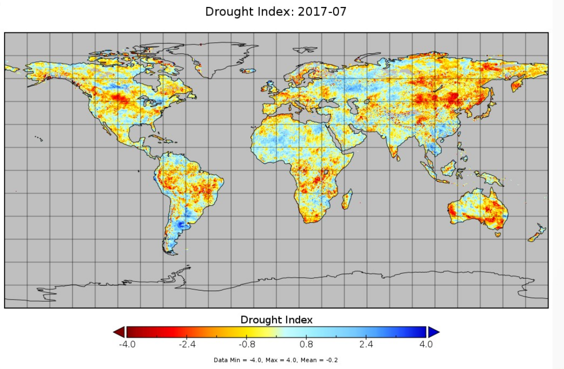
The drought index (DI) is computed using SMOS derived root zone soil moisture (RZSM) monthly fields. The concept is to consider 13 years of SMOS data (2010-2022). The RZSM monthly mean and max over the period is iused to compute a soil water deficit to remove seasonal variability. from teh soil water deficit a soil moisture drought index is computed .The range of values for SMDI lies between -4 to +4, with -4 representing extreme dry conditions and +4 representing extreme wet conditions.
-
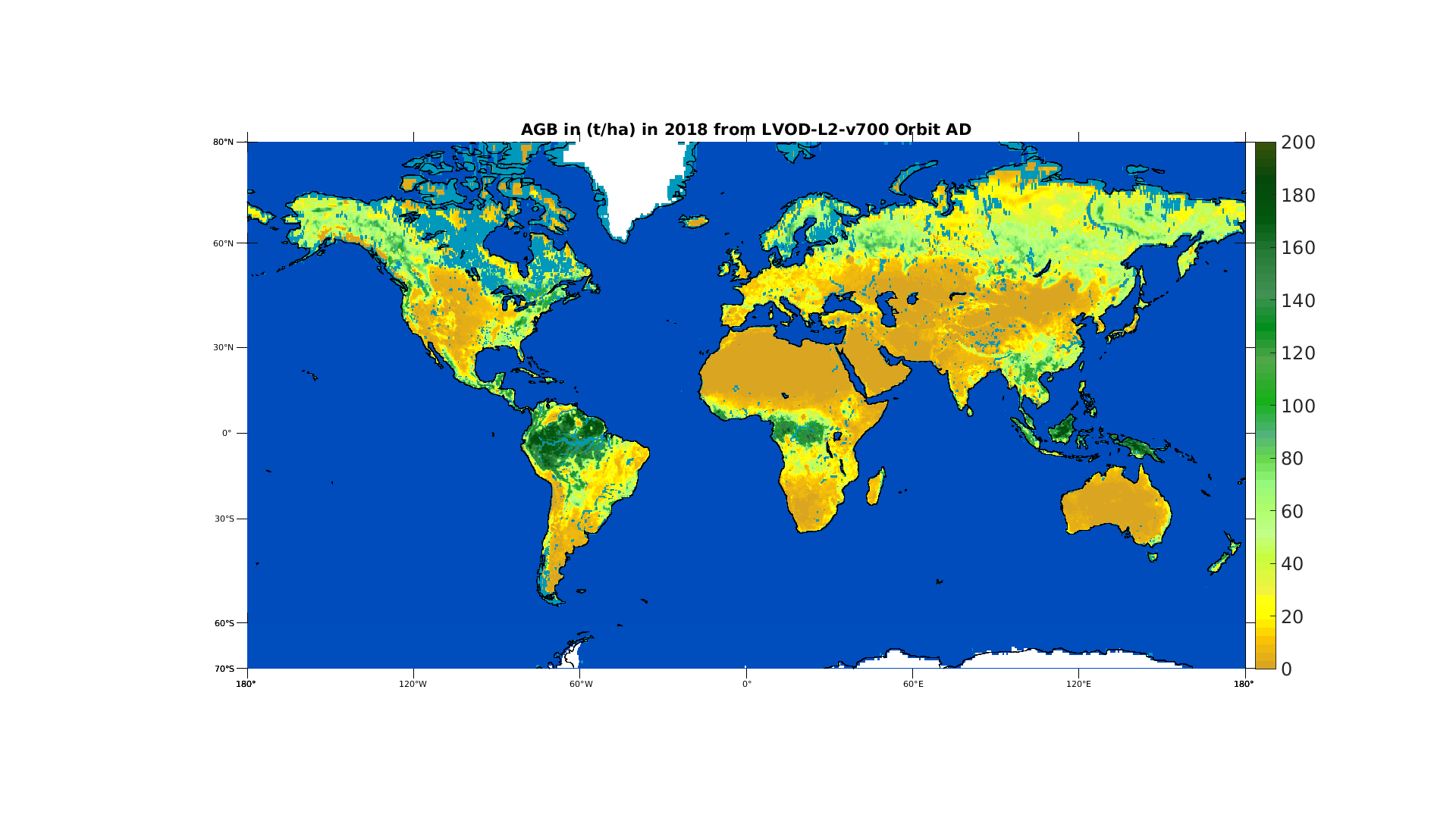
This product is established from one of the SMOS product: the optical thickness. The optical thickness or VOD is obtained directly from SMOS data by use of the multi-angular capability. For low vegetation (grass, crops,...) it is linked mainly to the water content while for forested areas it is more linked to the above ground biomass (AGB). The product is a yearly aggregation of AGB derived using different references (ESA BIOMASS CCI, Avitabile AGB estimates etc...) and is available for SMOS life time (2010 - now)
-

Orthomosaics of the study area were generated by drones on 19 September 2024 and 18 September 2025. They were created from 895 images (2024) and 1,282 images (2025), captured at altitudes of 120 meters (2024) and 100 meters (2025) using the DJI Mavic 3E RTK (2024) and Mavic 3M RTK (2025) drones. The ground resolutions were 3.19 cm/pixel (2024) and 2.63 cm/pixel (2025). The surveyed area covers approximately 1 km², and the orthomosaics were resampled to a resolution of 10 cm/pixel.
-
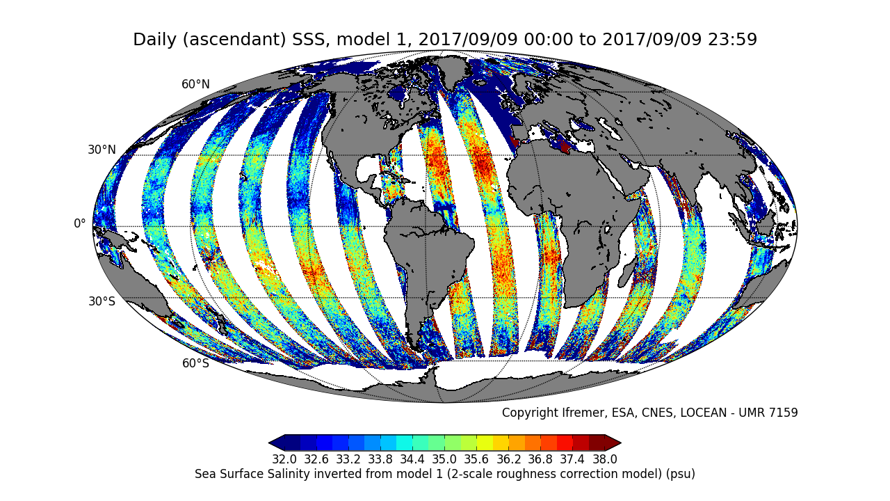
This product is an intermediate product, that provides, in daily files, SSS with qualification flags (associated confidence classes) which allow selecting valid data before averaging. Ascending and descending orbits are processed separately ** This product is no longer available, see below **
-
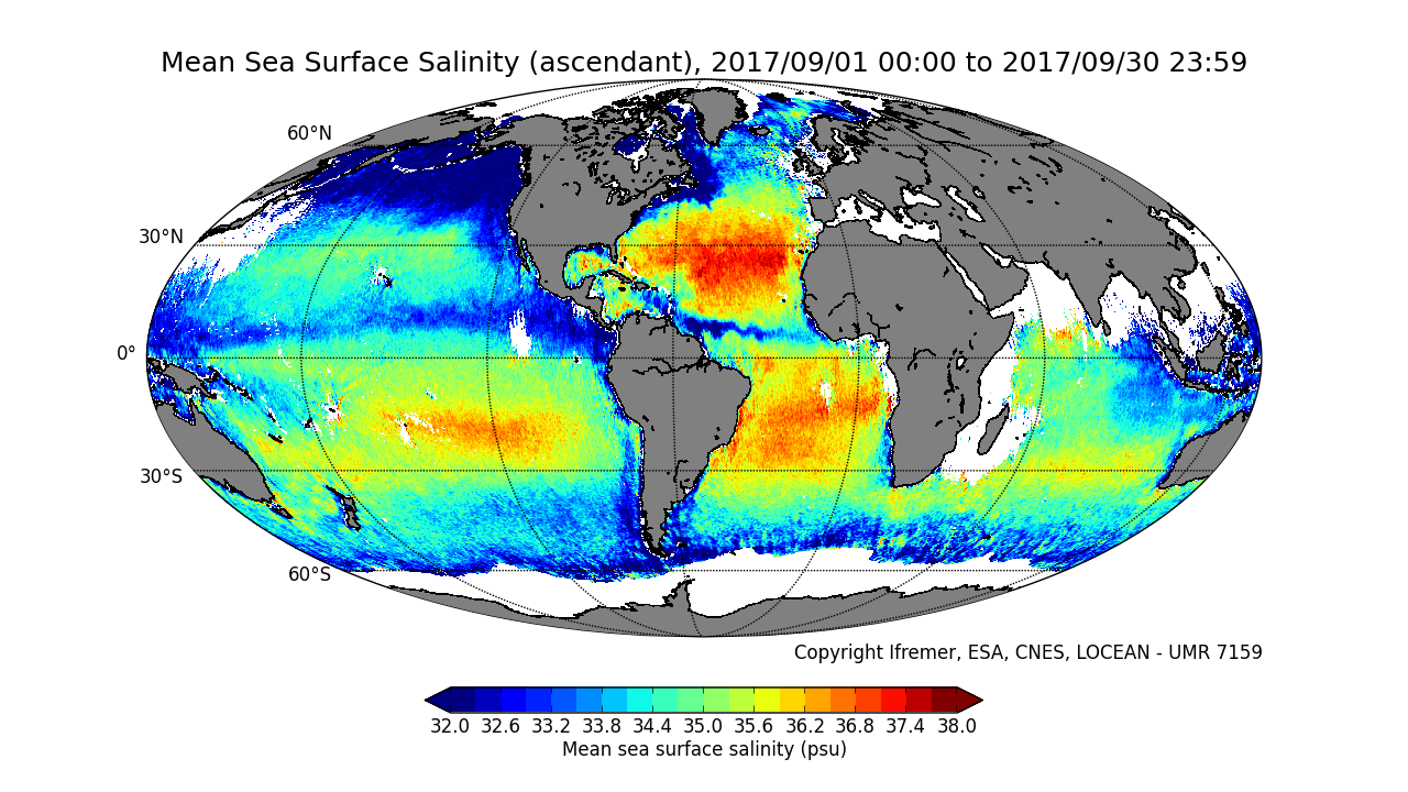
This product contains average 10 days & monthly salinity field based on L2P products, ascending and descending orbits being processed separately. ** This product is no longer available, see below **
-
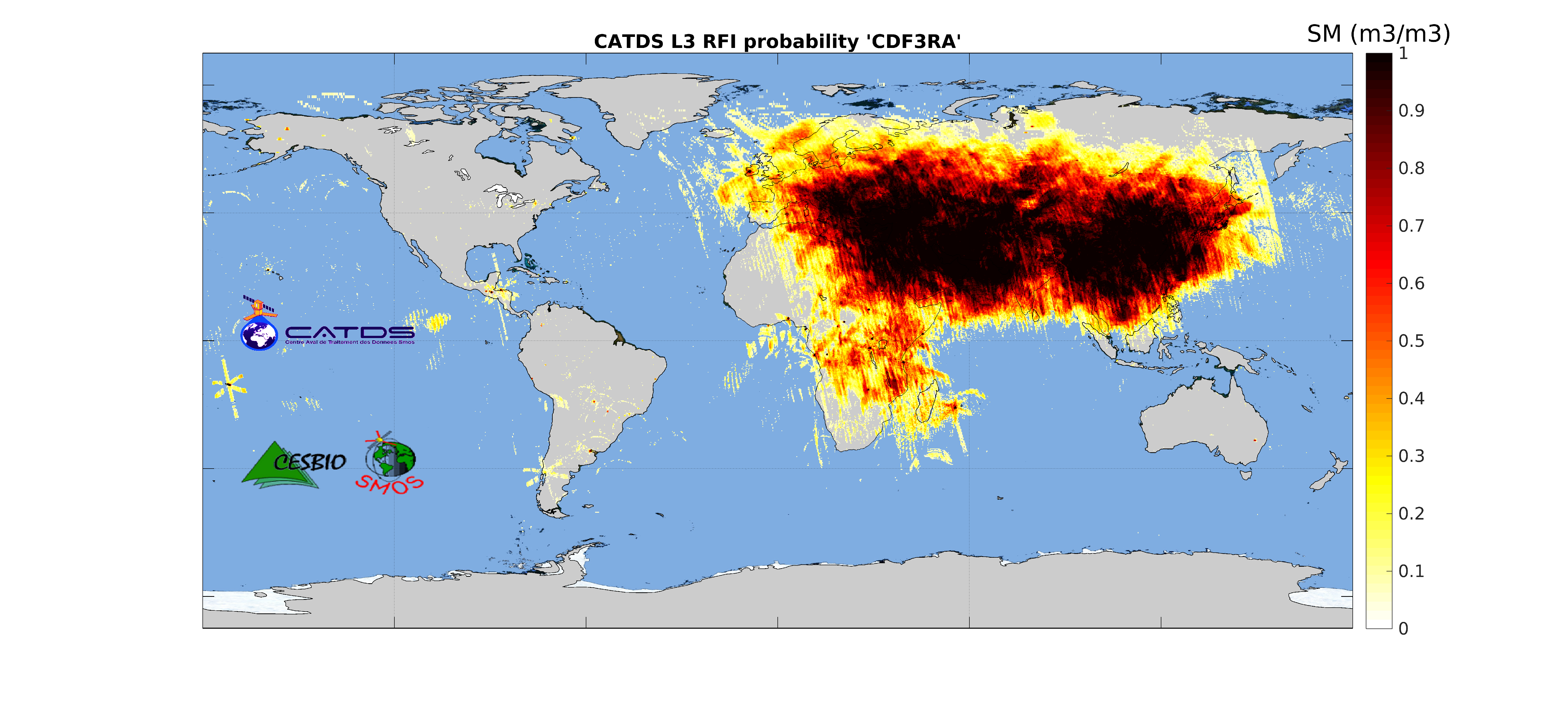
This product is radio frequency interference (RFI) probability for each angle bin computed daily and based on a monthly moving window average. Ascending and descending orbits are processed separately, and only in full polarization. ** This product is no longer available, see below **
-
This product contains average 10 days & monthly salinity field corrected from land-sea contamination and latitudinal bias, based on L2Q products, ascending and descending orbits being processed separately. ** This product is no longer available, see below **
-
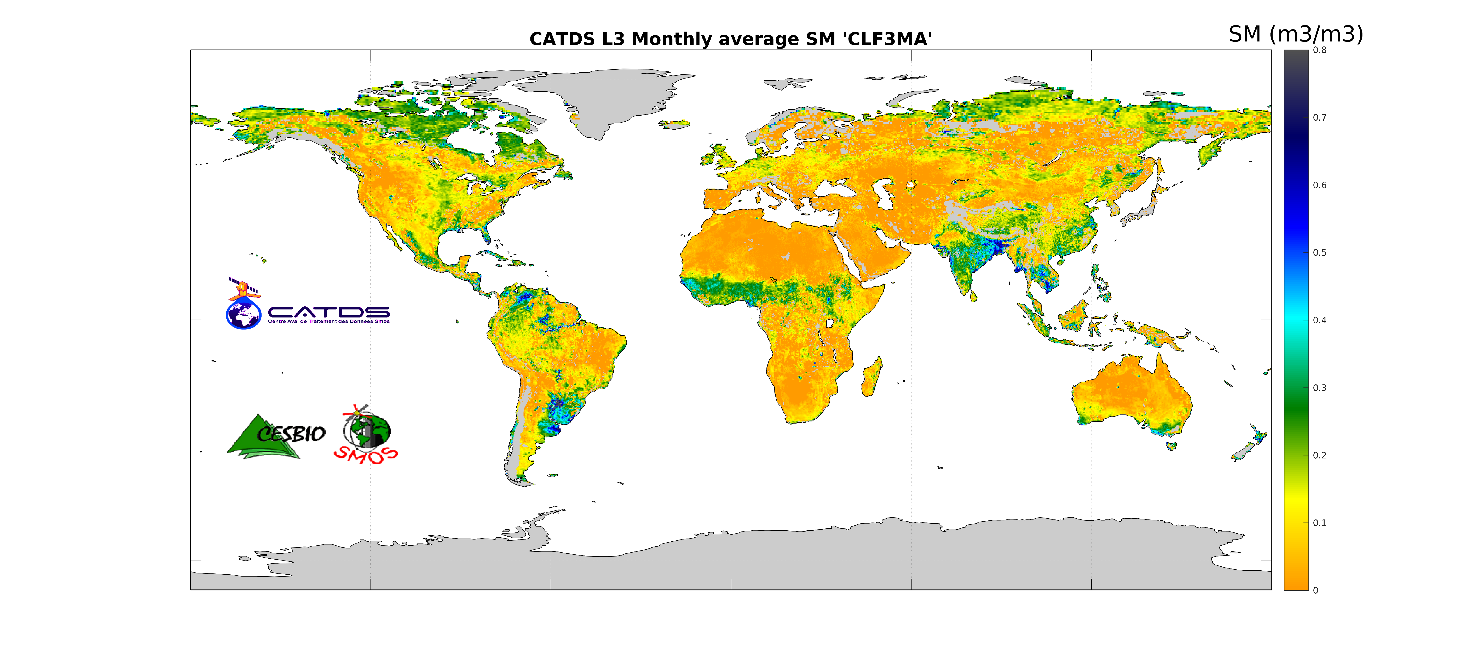
This product is an aggregation of daily maps of soil moisture, over a 3 day moving window, a decade or a month. Ascending and descending orbits are processed separately.
-
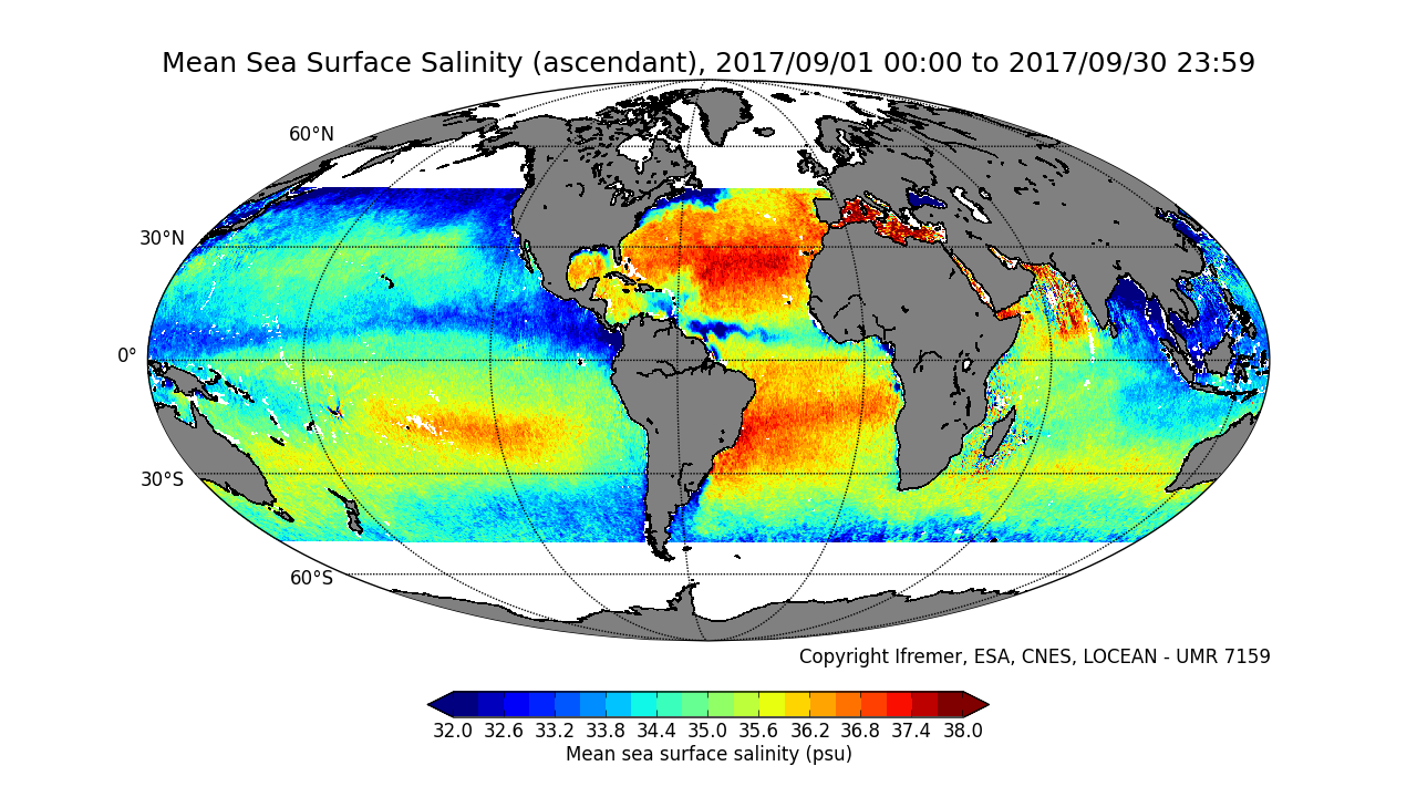
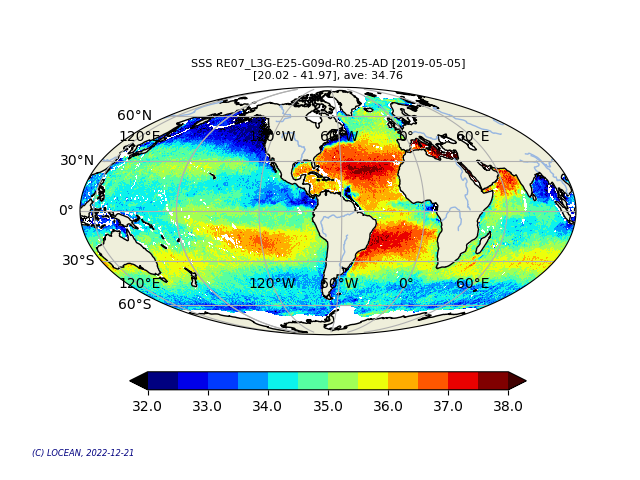
This product contains weekly salinity field, based on SMOS and SMAP satellite data, and ISAS (In-Situ Analysis System).
-
This product contains daily salinity fields from a 9 days temporal gaussian average, corrected from land-sea contamination and latitudinal bias, based on L2Q products, mixing ascending and descending orbits.