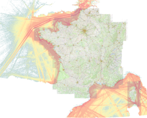
 Catalogue PIGMA
/Metropolitan France/Western Mediterranean
Type of resources
Available actions
Topics
Keywords
Contact for the resource
Provided by
Years
Representation types
Update frequencies
Scale
-
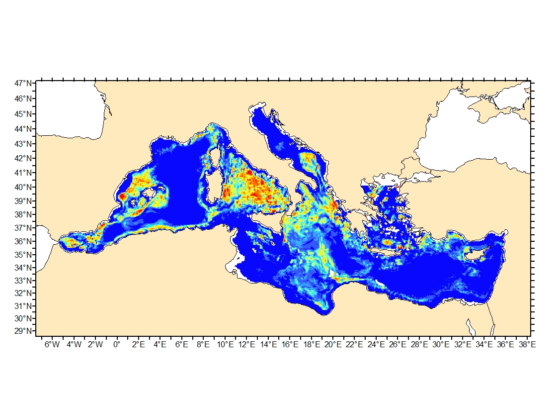
Process-driven seafloor habitat sensitivity (PDS) has been defined from the method developed by Kostylev and Hannah (2007), which takes into account physical disturbances and food availability as structuring factors for benthic communities. It is a conceptual model, relating species’ life history traits to environmental properties. Physical environment maps have been converted into a map of benthic habitat types, each supporting species communities with specific sensitivity to human pressures. It is based on two axes of selected environmental forces. The "Disturbance" (Dist) axis reflects the magnitude of change (destruction) of habitats (i.e. the stability through time of habitats), only due to natural processes influencing the seabed and which are responsible for the selection of life history traits. The "Scope for Growth" (SfG) axis takes into account environmental stresses inducing a physiological cost to organisms and limiting their growth and reproduction potential. This axis estimates the remaining energy available for growth and reproduction of a species (the energy spent on adapting itself to the environment being already taken into account). It can be related to the metabolic theory of the ecology. The process-driven sensitivity (PDS) can be seen as a risk map that combines the two previous axes and reflects the main ecological characteristics of the benthic habitats regarding natural processes. Areas with low disturbance are areas with a naturally low reworking of the sediment, allowing the establishment of a rich sessile epifauna community, with K-strategy species. Areas with low SfG means that the environmental factors, even though there are not limiting, are in lower values, i.e. that it imposes a cost for species to live. In areas combining low disturbance and low SfG, big suspension-feeder species with long life and slow growth can often be found: these species are more vulnerable in case of added disturbance.
-
IOWAGA sea-states hindcast database generated by the wave model WAVEWATCH-III and forced by ECMWF winds on the Mediterranean grid over 2005-2017 period.
-
IOWAGA sea-states hindcast database generated by the wave model WAVEWATCH-III and forced by ECMWF winds on the North mediterranean grid over 2004-2017 period.
-
-
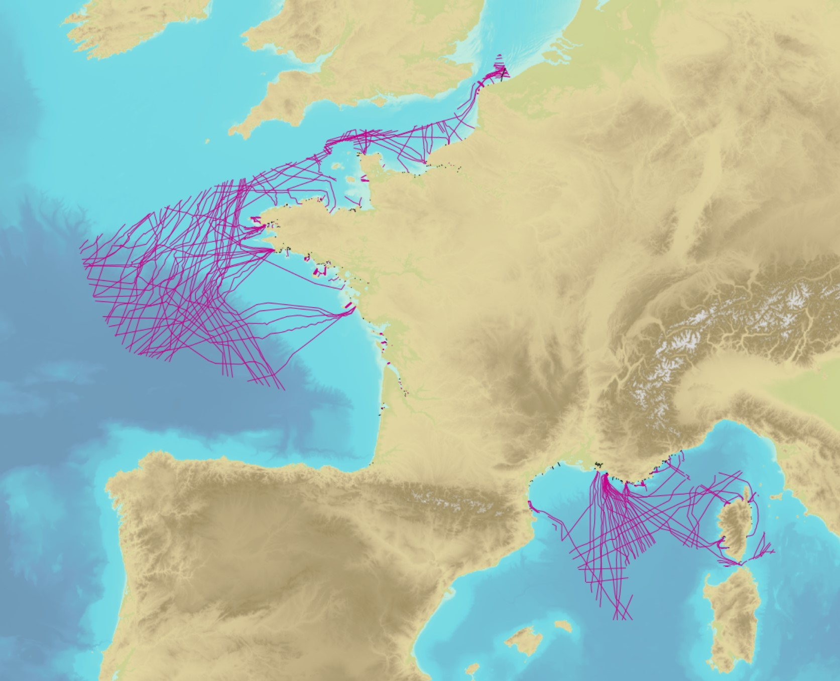
The product contains a description of submarine cables and pipelines brought to the attention of Shom on French areas of responsibility. These are 2D linear objects of the seabed that divide into two categories: • The submarine cables: these are cables placed on the seabed where electricity or information (telecommunication) flows. They represent the vast majority of objects (more than 90%); • Emissaries and submarine pipes: these are pipes that allow the discharge, sampling or circulation of fluids.
-

World list of seaports. In its 2021 version, the repository includes 13709 ports for 187 countries. The list of seaports has been drawn up on the basis of the information available in the European reference system of places used in the framework of the Common Fisheries Policy and, more particularly, by the Electronic Recording and Reporting System (ERS), the list of ports identified by the UNECE (2021-1). An assessment of the infrastructures present along the coastline made it possible to identify other ports that were not listed. Each geographical position has been verified with Google Earth in WGS84. Each port is associated with information relating to the country (ISO 3 coding), the UNECE or ERS 5-character coding, the name, the geographical position in WGS84 (latitude and longitude), the status of the port indicating whether it is referenced by Unece (UNECE), by the EU/ERS (ERS) or by both (UNECE/ERS) In case the port is not referenced by UNECE or ERS, the status is N/A. For French ports, the reference system integrates the ports of the French overseas departments and territories with the national codification. Inland ports have also been integrated in 2021.