 Catalogue PIGMA
climatologyMeteorologyAtmosphere
Type of resources
Available actions
Topics
Keywords
Contact for the resource
Provided by
Years
Formats
Representation types
Update frequencies
status
Scale
Resolution
-

Etat d’avancement de la mise en place des Plan de Protection de l'Atmosphère (PPA) 8 mars 2013 (mis à jour le 24 septembre 2015) Afin de mieux répondre à l’urgence sanitaire causée par la pollution atmosphérique dans plusieurs zones du territoire national, une dynamique de mise en révision des Plans de Protection de l’Atmosphère existants et d’élaboration de nouveaux Plans a été lancée dans toutes les zones polluées de France. A l’heure actuelle : On compte 36 PPA en France, dont 28 signés 1 PPA sont en cours de révision 7 PPA sont en cours d’élaboration 47% de la population française est couverte par un PPA
-

Carte sur le périmètre des 53 communes du Plan de Protection de l'Atmosphère (PPA) sur l'agglomération bordelaise. Élaborée le 24/10/2011
-

Les Schémas Régionaux Climat Air Énergie doivent définir des orientations destinées à prévenir ou réduire la pollution atmosphérique. Elles seront renforcées dans les « zones sensibles » où la qualité de l’air sera jugée prioritaire. La définition de ces zones a donc un impact important. Pour la région Aquitaine, 394 mailles kilométriques sont considérées comme sensibles. Ce sont 108 communes qui ont été sélectionnées comme étant sensibles au regard de l’ensemble des conditions de sélection. Ces communes représentent ainsi 8 % de la superficie du territoire et 42 % de la population en Aquitaine. La carte met en évidence le rôle du corridor nord sud dans la dégradation de la qualité de l’air en Aquitaine. C’est sur cet axe, ainsi que dans les agglomérations de la région, que l’on retrouve la plupart de ces communes classées sensibles.
-
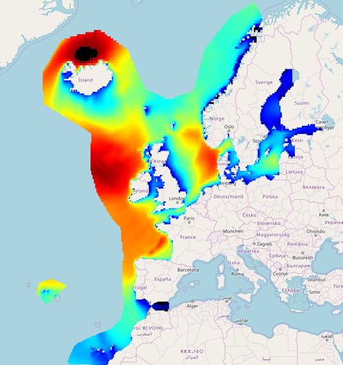
IOWAGA sea-states hindcast database generated by the wave model WAVEWATCH-III and forced by ECMWF winds on the North East Atlantic grid over 1990-2012 period.
-
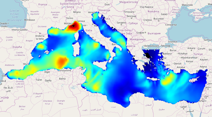
IOWAGA sea-states hindcast database generated by the wave model WAVEWATCH-III and forced by ECMWF winds on the North mediterranean grid over 2004-2017 period.
-

Carte sur le périmètre des 20 communes du Plan de Protection de l'Atmosphère (PPA) sur l'agglomération de bayonne. Élaborée le 30/01/2012
-
IOWAGA sea-states hindcast database generated by the wave model WAVEWATCH-III and forced by CFSR winds on the North East Atlantic grid over 1990-2012 period.
-
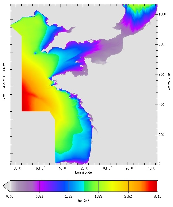
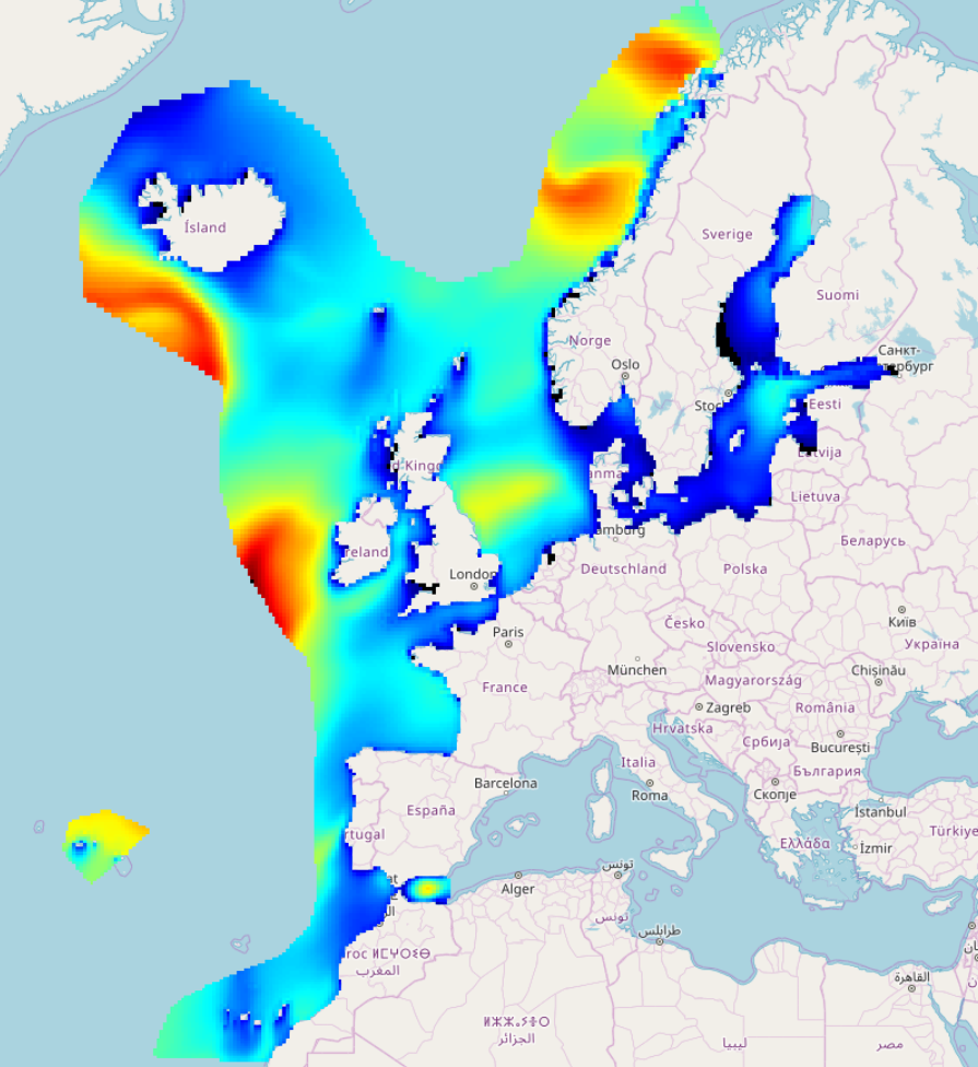
IOWAGA sea-states forecast best estimate generated by the wave model WAVEWATCH-III and forced by ECMWF winds on the French coast of the Atlantic ocean unstructured grid from 2017 to now
-

Le plan prévoit une série de mesures pour réduire les émissions de polluants atmosphériques. Certaines de ces mesures seront déclinées en arrêtés par le Préfet au fur et à mesure de la mise en oeuvre du PPA. Le plan a été bâti en trois temps : une partie introductive qui fixe le contexte de rédaction du plan ; une deuxième partie qui émet un diagnostic sur les facteurs influençant la qualité de l’air dans la zone du PPA ; une dernière partie qui présente des mesures visant à améliorer la qualité de l’air dans la zone du PPA. Produit d’une volonté commune et résultat d’une oeuvre collective le PPA doit permettre d’améliorer la qualité de l’air dans l’agglomération bordelaise pour le bien et la santé de tous.
-
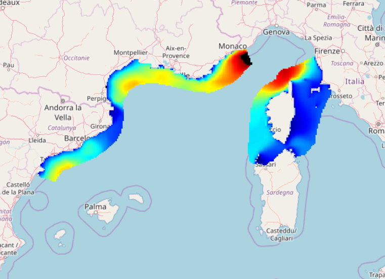
IOWAGA sea-states hindcast database generated by the wave model WAVEWATCH-III and forced by ECMWF winds on the Mediterranean grid over 2005-2017 period.