 Catalogue PIGMA
mean sea level
Type of resources
Available actions
Topics
Keywords
Contact for the resource
Provided by
Years
Formats
Representation types
Scale
Resolution
-
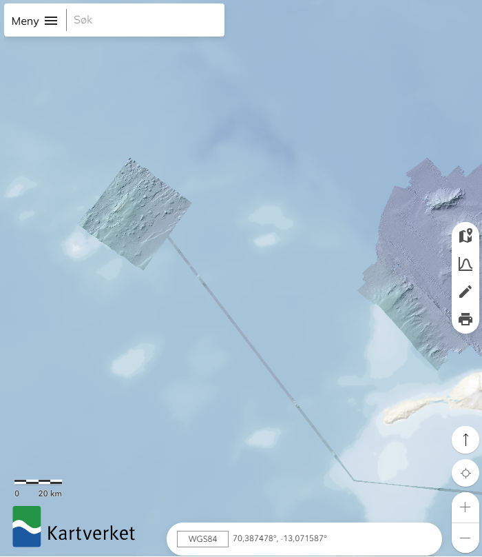
Dataset located in the North Sea. A survey from seabed mapping within the MAREANO programme, a collaboration between the Institute of Marine Research, the Geological Survey of Norway and the Norwegian Mapping Authority, Hydrographic Service. MAREANO maps depth and bathymetry, sediment composition, biodiversity, habitats and biotopes, and also pollution in the seabed within Norwegian offshore areas.
-

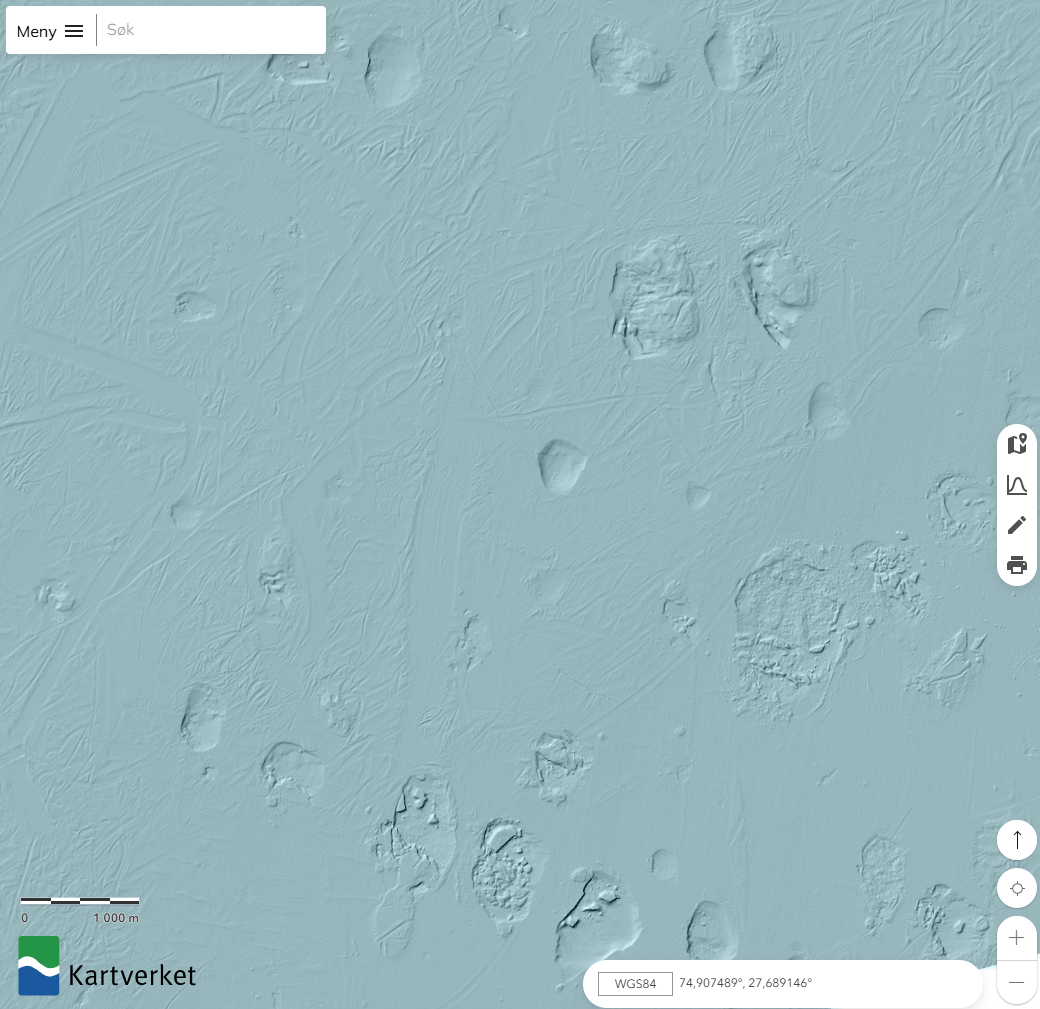
Dataset located on Spitsbergenbanken, a survey from seabed mapping within the MAREANO programme, a collaboration between the Institute of Marine Research, the Geological Survey of Norway and the Norwegian Mapping Authority, Hydrographic Service. MAREANO maps depth and bathymetry, sediment composition, biodiversity, habitats and biotopes, and also pollution in the seabed within Norwegian offshore areas.
-

The composite Digital Terrain Model of the Central Bulgarian Black Sea Slope is a result of processing and compilation of multibeam echosounder data gathered under several projects: the Caucasus on-line cable route survey (2007); The South Stream pipeline route survey (2009-2012); CBC Programme “MARINEGEOHAZARD” (2012). The DTM at a source resolution of approximately 55 meters was compiled for inclusion into the EMODnet HRSM dataset. The area embraces 2675 square kilometers from the shelf break to the abyssal plain in the center of the Bulgarian EEZ of the Black Sea.
-
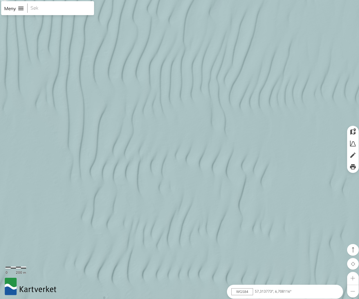
Dataset located in the Barents Sea. A survey from seabed mapping within the MAREANO programme, a collaboration between the Institute of Marine Research, the Geological Survey of Norway and the Norwegian Mapping Authority, Hydrographic Service. MAREANO maps depth and bathymetry, sediment composition, biodiversity, habitats and biotopes, and also pollution in the seabed within Norwegian offshore areas.
-
Dataset from seabed mapping within the MAREANO programme, a collaboration between the Institute of Marine Research, the Geological Survey of Norway and the Norwegian Mapping Authority, Hydrographic Service. MAREANO maps depth and bathymetry, sediment composition, biodiversity, habitats and biotopes, and also pollution in the seabed within Norwegian offshore areas.
-

This DTM is the result of merging of several multibeam surveys identified by their CDIs names:145_CNR-ISMAR-134, 145_CNR-ISMAR-135, 145_CNR-ISMAR-136 into a composite DTM. The processing was performed using the CARIS HIP&SIPS software with a standard procedure.
-
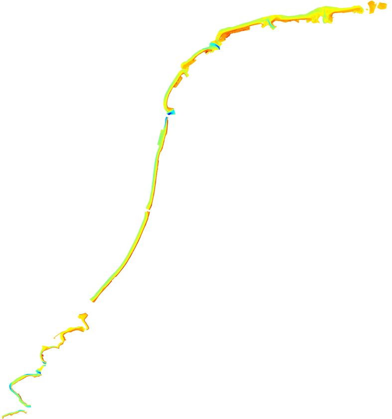
Yearly Survey for control of the position of the coastal shoreline
-
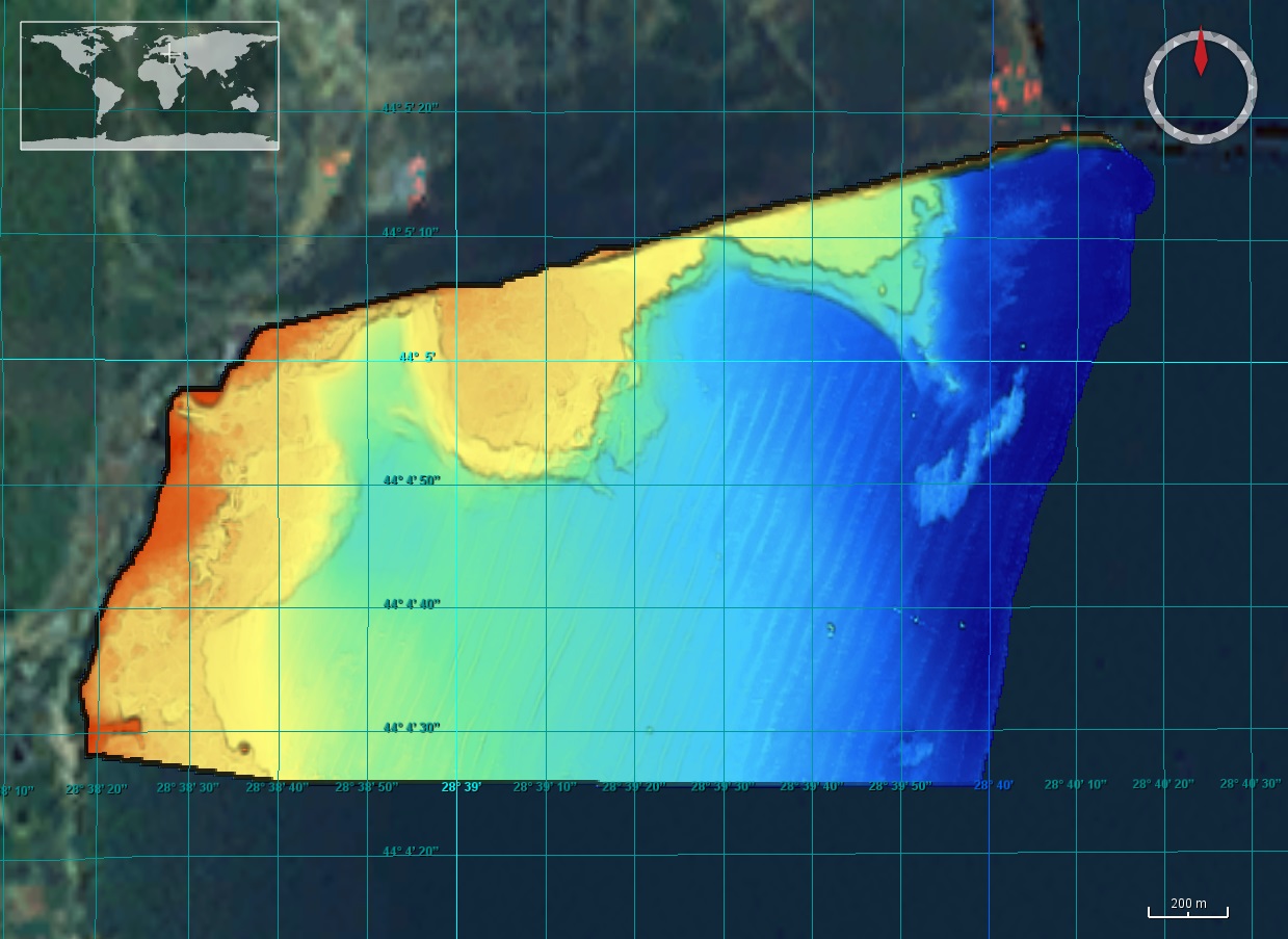
The DTM is produced with Kongsberg multibeam echosounder survey, acquired in 2015 by Marine Research Ltd. The resolution is 1/256 arc-minutes (~7.2m). It is located north of Mangalia Port, Romania, on the coastal region of the Black Sea. Depths are referenced to the Mean Sea Level and the coordinates are expressed into the WGS84 reference frame.
-
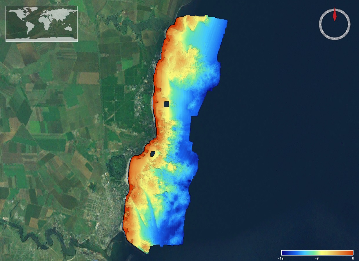
The DTM is produced with Kongsberg multibeam echosounder survey, acquired in 2015 by Marine Research Ltd. The resolution is 1/256 arc-minutes (~7.2m). It is located south of Constanta Port, Romania, on the coastal region of the Black Sea. Depths are referenced to the Mean Sea Level and the coordinates are expressed into the WGS84 reference frame.
-
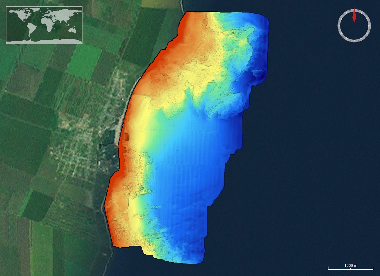
The DTM is produced with Kongsberg multibeam echosounder survey, acquired in 2015 by Marine Research Ltd. The resolution is 1/256 arc-minutes (~7.2m). It is located in Costinesti, Romania, on the coastal region of the Black Sea. Depths are referenced to the Mean Sea Level and the coordinates are expressed into the WGS84 reference frame.