 Catalogue PIGMA
5000
Type of resources
Available actions
Topics
Keywords
Contact for the resource
Provided by
Years
Formats
Representation types
Update frequencies
status
Scale
Resolution
-
Le Dossier Départemental des Risques Majeurs (DDRM) est un ouvrage de sensibilisation aux risques majeurs, illustré par des cartes d'aléas schématiques. Il a pour but de recenser, de décrire, et de porter à la connaissance du public l'ensemble des risques majeurs recensés dans le département et les communes concernées, ainsi que les mesures de sauvegarde prévues pour en limiter les effets.
-
Géolocalisation ponctuelle des maisons familiales et rurales (coordonnées WGS84). Information de précision des données : dans la mesure du possible, la donnée est au bâtiment près ou à la rue; il existe cependant des cas où le centre de la commune est le point de référence (cf. champ "Précision"). MAJ : 2016
-
L'objet de la présente étude est de réaliser une cartographie des aléas et des enjeux avec une précision suffisante pour déterminer le risque incendie de forêt sur 186 communes et servir de base, le cas échéant, aux Plans de Prévention du Risque Incendie de Forêts réglementaires.
-
Réseau TERÉGA (ex-TIGF) sur le département des Landes. Servitudes s'appliquant aux canalisations de transport de gaz ainsi que le linéaire de réseau abandonné.
-

Ensemble résultant du découpage par zones du chenal de navigation.Ces passes sont régulièrement hydrographiées.
-

-

Cette couche recense les Zones d’Activités Economiques (ZAE) présentes sur le département de la Charente. Initialement crée par Charente Développement, il s'agit d'un surfacique qui permet d'identifier précisément le contour de ces zones en se calant sur les données du Cadastre.
-
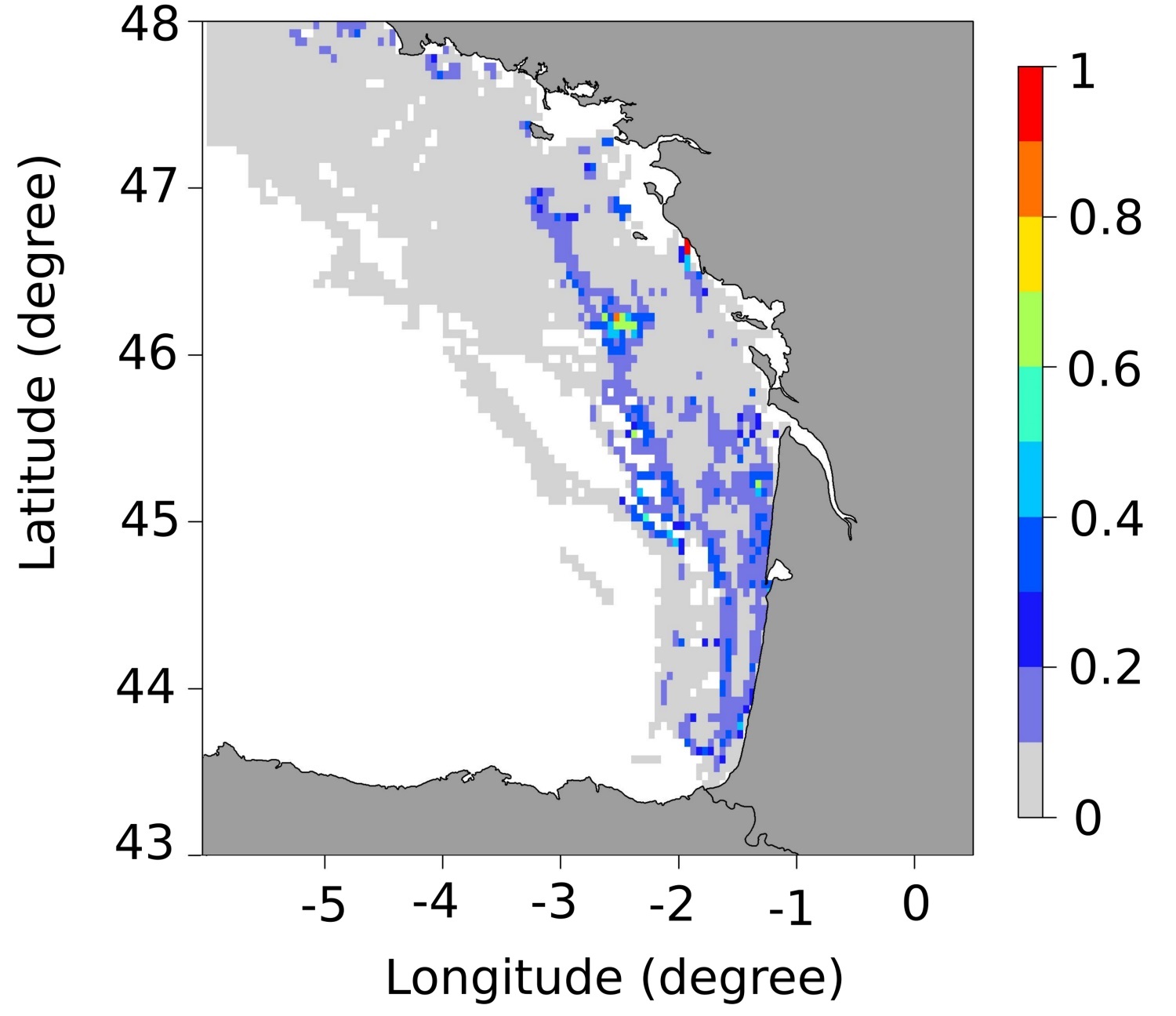
These maps represent the monthly probability of being a seabass spawning area for each month of the spawning season (January to March), and the mean probability of being a seabass spawning area over all spawning months in the Bay of Biscay. These probability maps were calculated by performing a geostatistical analysis of fishing data from geolocated vessels, and have a spatial resolution of 3 by 3 nautical miles.
-
Périmètre de la CAPB
-
Pôles de la CAPB correspondant aux anciens EPCI