 Catalogue PIGMA
Hydrography
Type of resources
Available actions
Topics
Keywords
Contact for the resource
Provided by
Years
Formats
Representation types
Update frequencies
status
Scale
Resolution
-
The coastal heights data combines two datasets: the land-sea mask of the gridded EMODnet bathymetry and the height of high-water (HAT) relative to chart datum (LAT) as computed with the GTSM tide model. Near the coast a diffusion scheme is applied to make the heights consistent with the land-sea mask. Finally, only grid cells that are classified as sea, but neighbor a land cell are selected. The main assumption in this approach is that the height of the topography near the coastline is close to the high-water mark. The main purpose of this dataset is to improve extrapolation towards the coast. In many areas around Europe there is a (small) gap between the point closest to the coast for which a survey is available and the coastline. In this way interpolation from coarser background data is avoided.
-
Annual time series of Total Nitrogen/Nitrates [mg/l] from in situ and model data
-
Annual time series of Total Suspended Matter (TSM) from satellite data [mg/l]
-
Monthly time series of Total Suspended Matter (TSM) from satellite data [mg/l]
-
Monthly time series of Total Phosphorous [mg/l] from model data
-
Annual time series of Total Phosphorous/Phosphates [mg/l] from in situ and model data
-
Annual time series of Water Discharge (Qw) [m3/s] from in situ and model data
-
Monthly time series of Water Discharge (Qw) [m3/s] from in situ and model data
-
Monthly time series of Total Nitrogen [mg/l] from model data
-
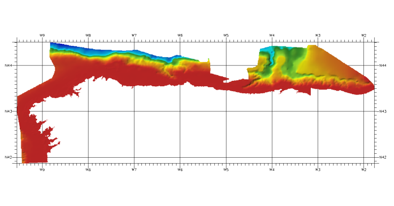
DTM of continental margin of Cantabric Sea, resolution 100 meters. This DTM includes the whole area from coast line to deepest level (5544,23 m).