 Catalogue PIGMA
3.75 Arc second
Type of resources
Topics
Keywords
Contact for the resource
Provided by
Years
Formats
Representation types
Scale
Resolution
-
Gridded data for the ESS-ULYX-PP-2023-2 cruise.
-

Grids of bathymetric surveys of the Hydrographic Survey Vessels of the Royal Netherlands Navy and other hydrographic sources are stored, and used to compile a representative bathymetric dataset for the Southern part of the Netherlands Caribbean waters (Bathy database).
-

Grids of bathymetric surveys of the Hydrographic Survey Vessels of the Royal Netherlands Navy and other hydrographic sources are stored, and used to compile a representative bathymetric dataset for the Northern part of the Netherlands Caribbean waters (Bathy database).
-

Composite Digital Terrain Model of Almeria. Submerged littoral and shallow water areas. From coastline to -100 m. ECOCARTOGRAFIAS. MAPAMA, Dirección General de Sostenibilidad de la Costa y del Mar. Ministerio para la Transición Ecológica. Spain - España. Records of the tracks and other particularities of the oceanographic cruises were probably traceable at the moment of compiling the cartographic project. However, for the final product the only document available for the particularities of the oceanic cruises is the "project report" (a paper document of MAPAMA). There are no digital documents currently available for the intermediate products.
-

Composite Digital Terrain Model of Cádiz. Submerged littoral and shallow water areas. From coastline to -340 m. ECOCARTOGRAFIAS. MAPAMA, Dirección General de Sostenibilidad de la Costa y del Mar. Ministerio para la Transición Ecológica. Spain - España. Records of the tracks and other particularities of the oceanographic cruises were probably traceable at the moment of compiling the cartographic project. However, for the final product the only document available for the particularities of the oceanic cruises is the "project report" (a paper document of MAPAMA). There are no digital documents currently available for the intermediate products.
-

Composite Digital Terrain Model of Málaga. Submerged littoral and shallow water areas. From coastline to -100 m. ECOCARTOGRAFIAS. MAPAMA, Dirección General de Sostenibilidad de la Costa y del Mar. Ministerio para la Transición Ecológica. Spain - España. Records of the tracks and other particularities of the oceanographic cruises were probably traceable at the moment of compiling the cartographic project. However, for the final product the only document available for the particularities of the oceanic cruises is the "project report" (a paper document of MAPAMA). There are no digital documents currently available for the intermediate products.
-

Composite Digital Terrain Model of Lanzarote. Submerged littoral and shallow water areas. From coastline to -200 m. ECOCARTOGRAFIAS. MAPAMA, Dirección General de Sostenibilidad de la Costa y del Mar. Ministerio para la Transición Ecológica. Spain - España. Records of the tracks and other particularities of the oceanographic cruises were probably traceable at the moment of compiling the cartographic project. However, for the final product the only document available for the particularities of the oceanic cruises is the "project report" (a paper document of MAPAMA). There are no digital documents currently available for the intermediate products.
-

Composite Digital Terrain Model of Granada. Submerged littoral and shallow water areas. From coastline to -183 m. ECOCARTOGRAFIAS. MAPAMA, Dirección General de Sostenibilidad de la Costa y del Mar. Ministerio para la Transición Ecológica. Spain - España. Records of the tracks and other particularities of the oceanographic cruises were probably traceable at the moment of compiling the cartographic project. However, for the final product the only document available for the particularities of the oceanic cruises is the "project report" (a paper document of MAPAMA). There are no digital documents currently available for the intermediate products.
-

Gridded multibeam data acquired during scientific surveys and transits of French research vessels from 1992 to 2017 off the French Caribbean Islands.
-
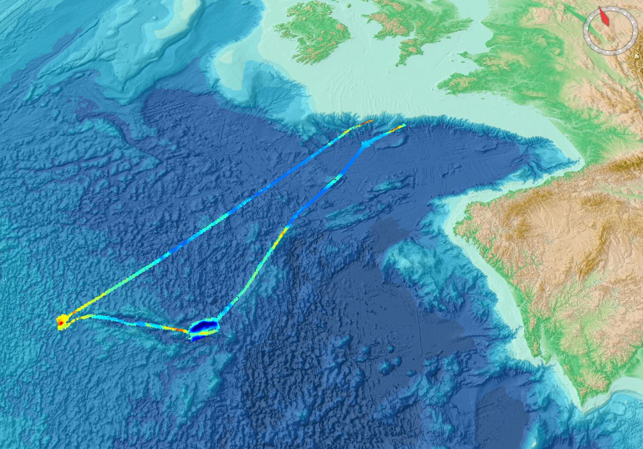
9496-25-DTM - Site Survey of Dogger Bank Tranche C Offshore Wind Farm Area by Gardline Geosurvey Ltd
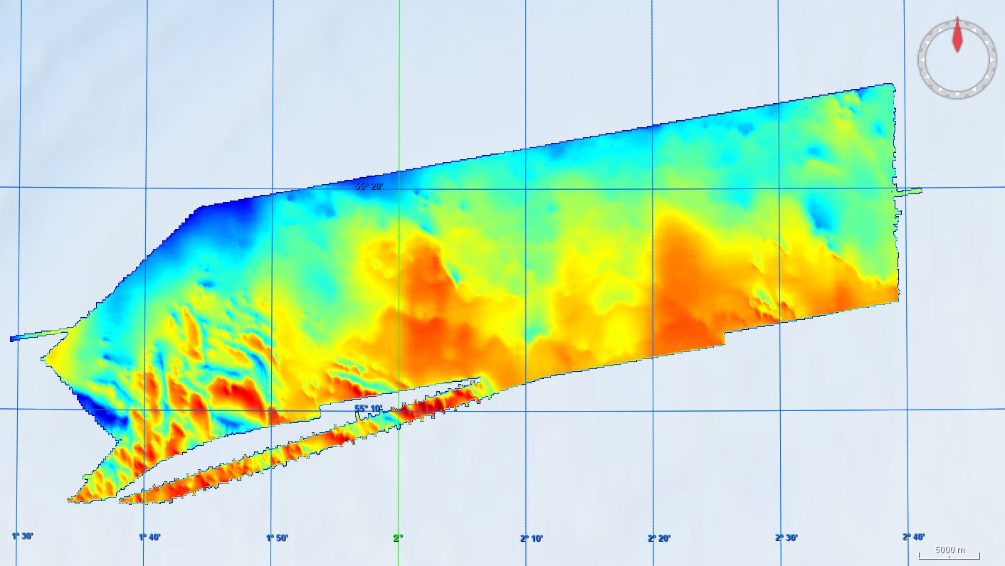
Gardline Geosurvey Limited was contracted to survey the Dogger Bank Offshore Wind Farm (OWF) Area between 04-Apr-2013 and 02-Aug-2013, comprising the Tranche C zonal surveys. The aim of the surveys was to carry out a geophysical investigation that would broadly assess the entire developable area of the zone. Seabed information was required to inform the site selection process and enable preliminary foundation design to be undertaken. The geological data acquisition programme was carried out on M.V. Sea Surveyor, which sailed from Hull and returned to Blyth, and M.V. Vigilant which sailed from, and returned to, Great Yarmouth upon completion of survey operations. The Crown Estate is the data owner and copyright holder.