 Catalogue PIGMA
SHAPEFILE
Type of resources
Available actions
Topics
Keywords
Contact for the resource
Provided by
Years
Formats
Representation types
Update frequencies
status
-
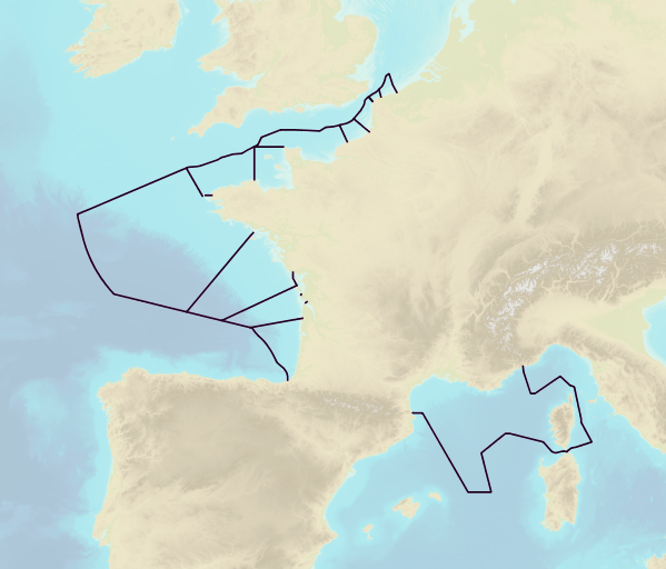
This product includes the boundaries of tidal zones for French Channel, Atlantic and Mediterranean coasts in shapefile format. Information on the characteristics of tidal zones is available as part of the "Maritime Altimetric Reference Values" product.
-
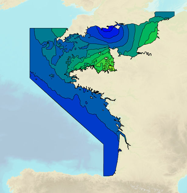
Tidal ranges on the French coasts of the Channel and the Atlantic for a coefficient of 95 : tidal range for mean neap tides for average atmospheric conditions..
-
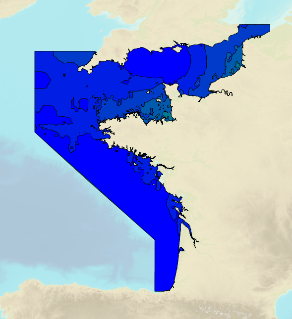
Tidal ranges on the French coasts of the Channel and the Atlantic for a coefficient of 20 : minimum tidal range for average atmospheric conditions..
-
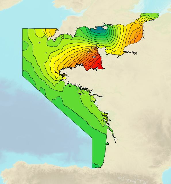
Tidal ranges on the French coasts of the Channel and the Atlantic for a coefficient of 95 : maximal tidal range for average atmospheric conditions..
-
Tidal ranges on the French coasts of the Channel and the Atlantic for a coefficient of 95 : tidal range for mean spring tides for average atmospheric conditions..
-

This product shows the international distribution of types of tides. Four types of tides exist, and are classified based on the number and height of high and low waters each day: semi-diurnal tide: two high tides and two low tides with approximately the same height are recorded each day. Mixed tides with diurnal inequality: two high and low tides are recorded daily (just like with semi-diurnal tides), however the heights of the high and low waters vary significantly over the same day. Diurnal tides: one single high tide and one single low tide are recorded each day. Composite: tides can be diurnal or semi-diurnal or mixed.
-
This dataset was built to feed a basin-wide spatial conservation planning exercise, targeting the deep sea of the North Atlantic, in the framework of the ATLAS H2020 project. This approach aimed to inform Marine Spatial Planning and conservation initiatives for the deep sea of the North Atlantic, by identifying conservation priority areas for the Vulnerable Marine Ecosystems (VMEs) and deep fish species and discussing the efficiency of the current spatial management context relatively to conservation stakes. This publication provides (1) the links to spatial datasets used as an input, (2) the R scripts used to run the final conservation scenarios together with associated table of targets and connectivity matrix, that can be run on the input data, and (3) the outputs of the final scenarios constructed and computed for ATLAS. Produced by IFREMER.
-
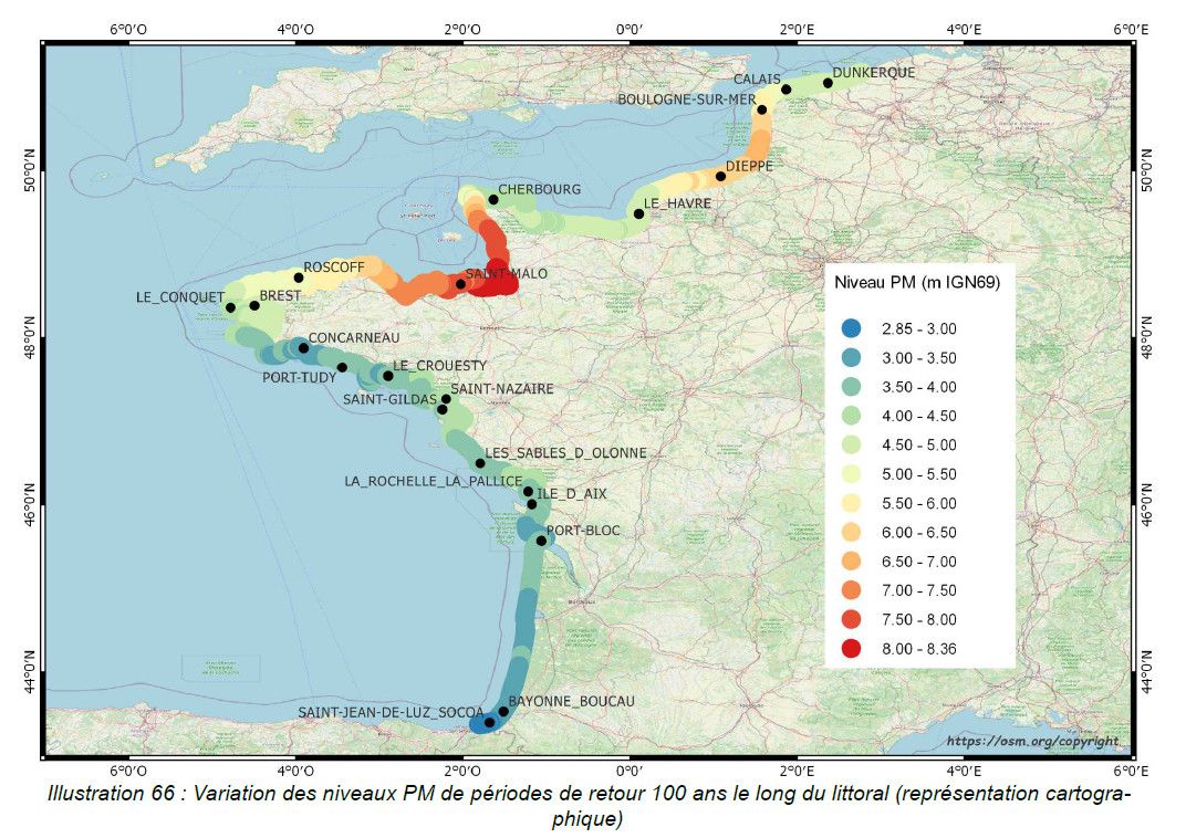
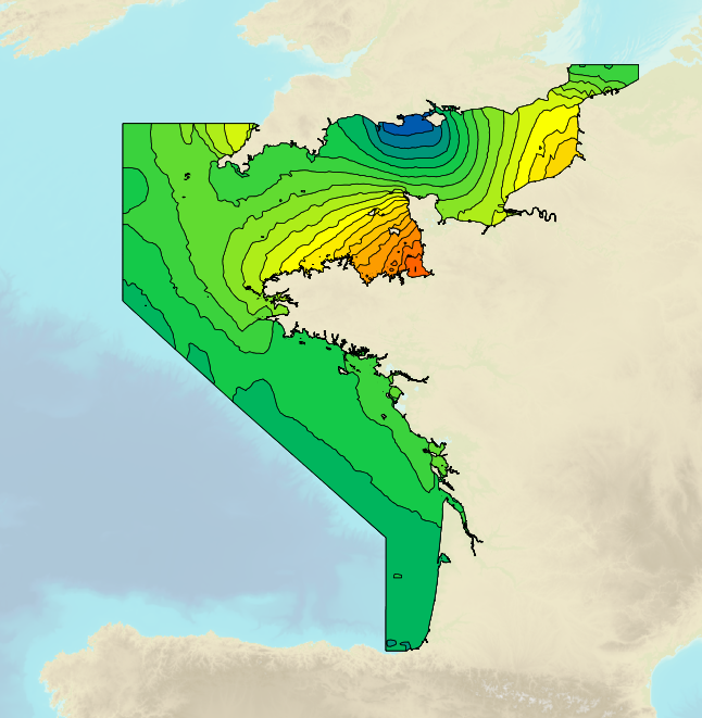
This study provides an initial global estimate of the extreme water level values along the French metropolitan coastline. These results are to be refined locally with all available data and knowledge. The method used is based on a statistical analysis of the tide gauge observations available in the ports. It does not take into account wave observations. The results between ports are obtained by an interpolation method. The study produces at the reference ports the statistical estimates: - extreme values of high water surge in the Channel and Atlantic; - extreme values of water level for the whole of Metropolitan France. And a set of statistical estimation maps of extreme water level values along the coastline. The estimates provided go up to the 1,000-year return period. In view of the duration of observations used at the ports, the user must check whether estimates with a return period of more than 50 or 100 years are still valid 50 or 100 years still make sense.