 Catalogue PIGMA
/Metropolitan France/Celtic Seas
Type of resources
Available actions
Topics
Keywords
Contact for the resource
Provided by
Years
Formats
Representation types
Update frequencies
status
Scale
Resolution
-
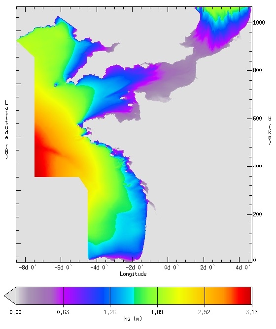
IOWAGA sea-states hindcast database generated by the wave model WAVEWATCH-III and forced by ECMWF winds on the French coast of the Atlantic ocean unstructured grid over 2008-2018 period.
-
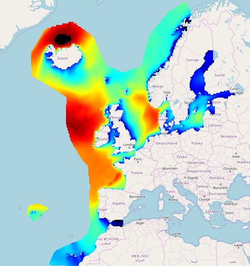
IOWAGA sea-states hindcast database generated by the wave model WAVEWATCH-III and forced by ECMWF winds on the North East Atlantic grid over 1990-2012 period.
-
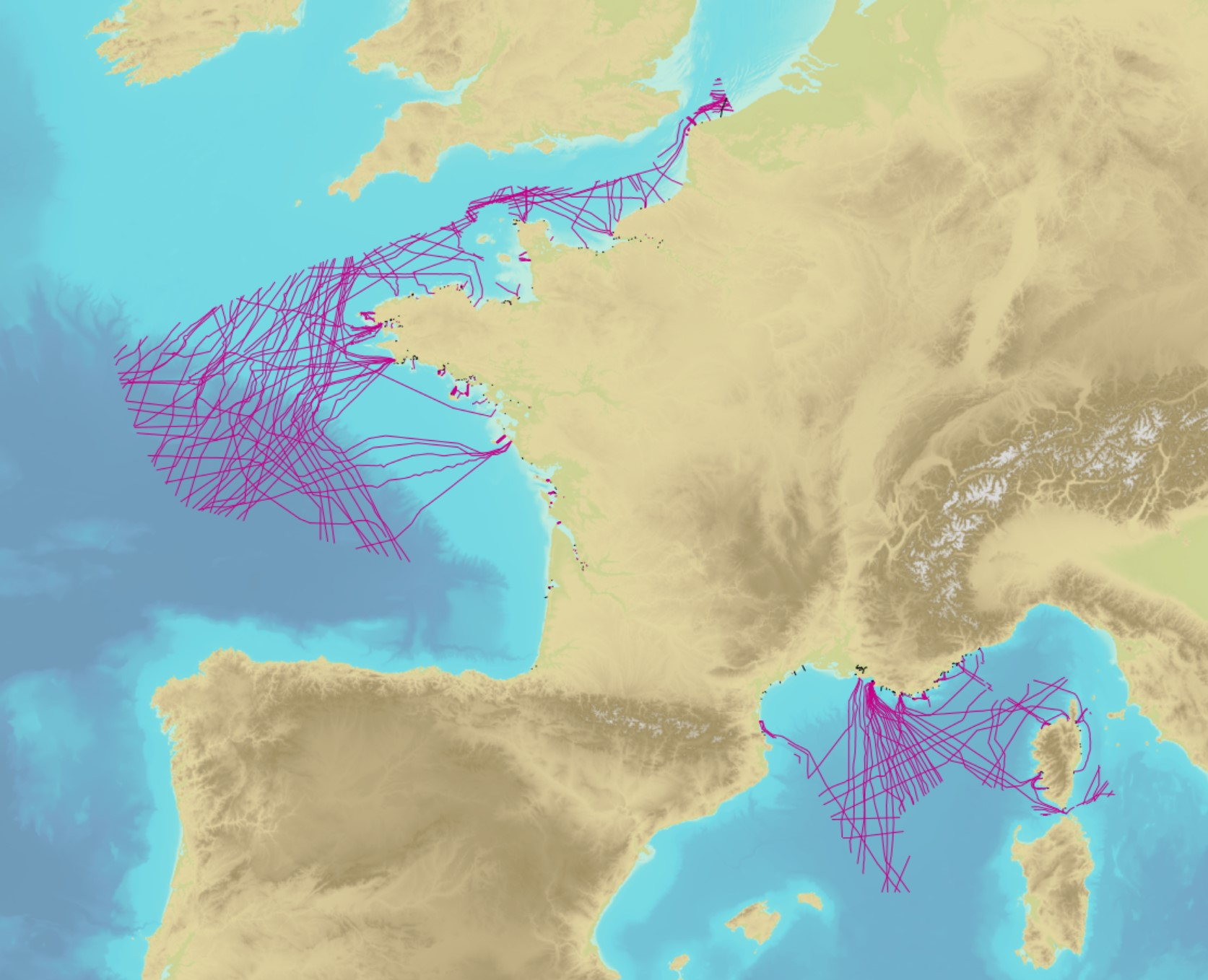
The product contains a description of submarine cables and pipelines brought to the attention of Shom on French areas of responsibility. These are 2D linear objects of the seabed that divide into two categories: • The submarine cables: these are cables placed on the seabed where electricity or information (telecommunication) flows. They represent the vast majority of objects (more than 90%); • Emissaries and submarine pipes: these are pipes that allow the discharge, sampling or circulation of fluids.
-
The dataset includes age- and length-based catch per unit effort data for commercial fish species collected by the French trawl survey EVHOE.
-
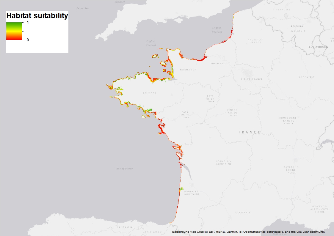
Ten Random Forest models were fitted in order to characterise the environmental niche and to predict the potential spatial distribution of Zostera marina along the French western seaboard. 3 rasters are provided: 1) Habitat suitability index (values ranging from 0 to 1 when conditions are estimated to be optimal), 2) standard deviation around the mean habitat suitability index, and 3) binary suitability estimates (0= not suitable, 1=suitable). These model estimates indicate areas where the species may occur and are overall consistent with field observations but note that these maps are model-based and do not correspond to actual field observations.
-

The dataset includes age- and length-based catch per unit effort data for commercial fish species collected by the French trawl survey EVHOE.