 Catalogue PIGMA
25000
Type of resources
Available actions
Topics
Keywords
Contact for the resource
Provided by
Years
Formats
Representation types
Update frequencies
status
Scale
Resolution
-
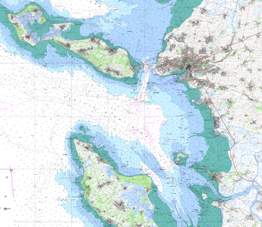
The product SCAN Littoral® is a collection of continuous colour digital map images of the coast, obtained via georeferenced assembling with grid squares of raster data from Shom nautical charts and IGN 1:25,000 land maps. The SCAN Littoral® solution includes a series of digital images with no additions, legends or georeferencing information.
-

Historiquement l'Agence Technique Départementale a été créée pour accompagner les maîtres d'ouvrage dans la réalisation des bâtiments ou infrastructures communaux. Elle a depuis développé un savoir-faire particulier grâce à une équipe technique performante pour accompagner les élus dans l'aide à la décision ou plus largement dans les réflexions à mener sur leur territoire. Aujourd'hui, avec le désengagement progressif des services d'ingénierie de l'Etat, l'ATD permet de conserver pour les collectivités Territoriales qui y adhèrent une offre d'ingénierie publique Territoriale compétente. Les missions statutaires constituées par les études de faisabilité ou de simple diagnostic sont désormais complétées par des missions d'assistance technique en phase pré-opérationnelles réalisées uniquement dans le cadre de prestations intégrées. L'ensemble de ces missions reste strictement circonscrit dans la sphère du maître d'ouvrage, l'ATD n'assurant pas de mission de maîtrise d'œuvre.
-
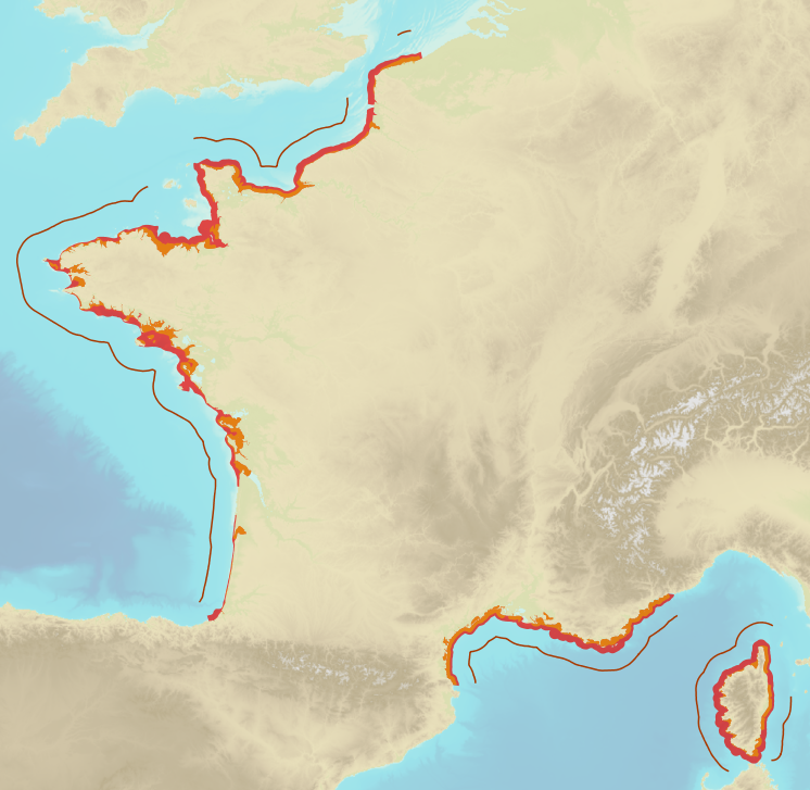
Limits defining ship classes based on their assigned operating maritime zones. These limits were produced by CEREMA in application of section II.14 of article 1 of decree no. 200945 amended on 30 August 1984. Navigation categories are defined in article 223.2 of the rules appended to the order of 23 November 1987 on shipping safety.
-

Gestion de la taxe de séjour des Etablissements Touristiques aux forfaits (Montant/suivi déclaration/suivi facturation) à l'échelle des communautés de communes.
-
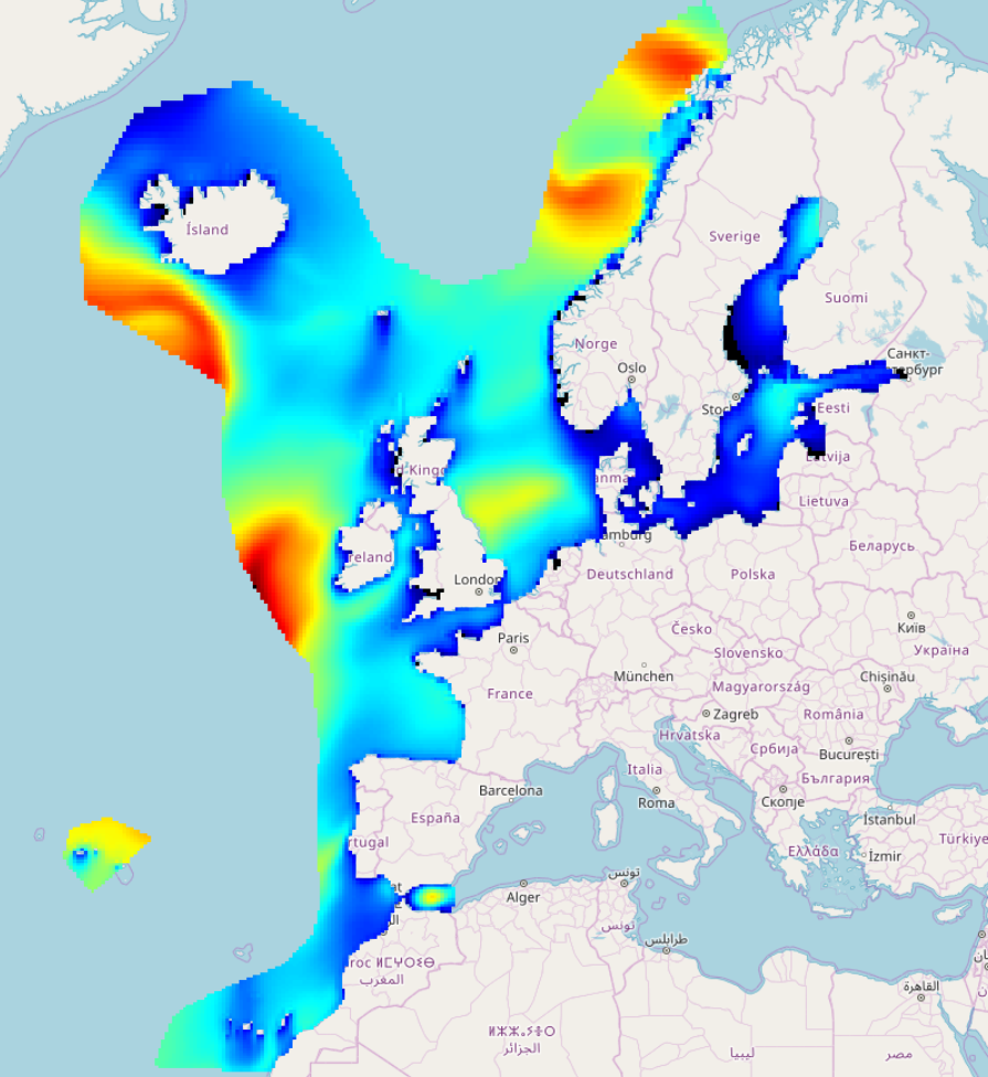
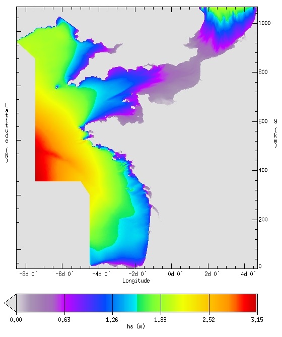
IOWAGA sea-states hindcast database generated by the wave model WAVEWATCH-III and forced by CFSR winds on the North East Atlantic grid over 1990-2012 period.
-
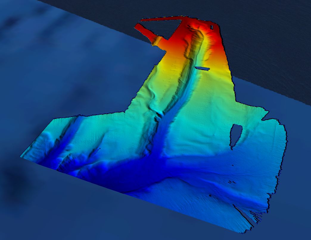
Grid processed for the purpose of the HR DTMs layer of EMODnet Bathymetry HRSM, October 2018
-

-
Ce jeu de données recense les communes du département de la Gironde suivies pour le Moustique Tigre.
-

Localisation et description des sentiers de randonnées (GR, PDIPR, itinérance à pied, chemin local,sans classement). Localisation et description des tronçons (accessibilité/nature du sol/état...). Bornes/mats (description/état/historique des interventions...) Mobiliers (description/état/historique des interventions...)
-
IOWAGA sea-states forecast best estimate generated by the wave model WAVEWATCH-III and forced by ECMWF winds on the French coast of the Atlantic ocean unstructured grid from 2017 to now