 Catalogue PIGMA
Biota
Type of resources
Available actions
Topics
Keywords
Contact for the resource
Provided by
Years
Formats
Representation types
Update frequencies
status
Scale
Resolution
-
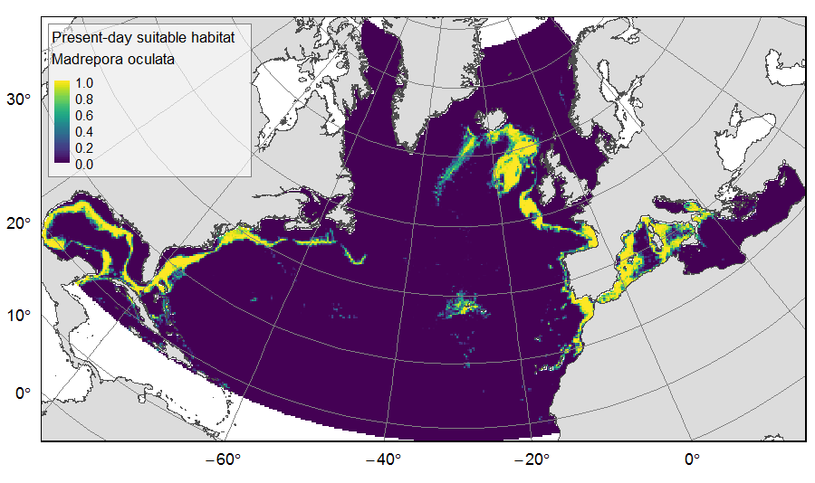
Distribution of predicted suitable habitat for six cold-water-coral, six deep-water fish and one sponge species, on the North Atlantic (18°N to 76°N and 36°E to 98°W). For each species, predicted habitat distribution was obtained for present-day conditions (1951-2000) and for the future climate refugias, i.e. the areas that were predicted as suitable both for present-day and forecasted future (2081-2010) conditions. The dataset gathers 26 raster layers created on the same grid of 25km * 25km resolution, downgraded from source layers (3km *3km resolution) that were created within the work package 3 of EU ATLAS project. The presence (value=1) of climate refugia and the relative cover (value ranging from 0 to 1) of present-day suitable habitat was extracted in gridsquares. This dataset was built to feed a basin-wide spatial conservation planning exercise, targeting the deep sea of the North Atlantic. The goal of this approach was to identify conservation priority areas for Vulnerable Marine Ecosystems (VMEs) and deep fish species, based on the distribution of species and habitats, human activities and current spatial management.
-

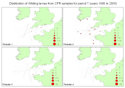
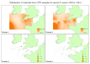
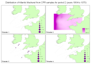
Fish larvae were collected by the continuous plankton recorder (CPR, operated by SAHFOS) all year long between 1951 and 2005 along transects in the Celtic Sea and English Channel. The CPR is towed by ships of opportunity at speeds of 15 to 20 knots, at an approximate depth of 10 m. Water enters the recorder through an aperture of 1.27 cm2, and is filtered through a continuously moving band of silk with an average mesh size of 270 μm.
-
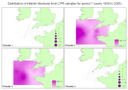
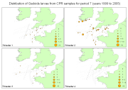
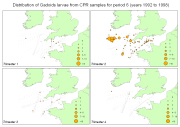
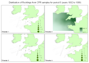
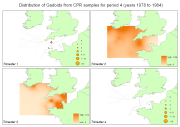
Fish larvae were collected by the continuous plankton recorder (CPR, operated by SAHFOS) all year long between 1951 and 2005 along transects in the Celtic Sea and English Channel. The CPR is towed by ships of opportunity at speeds of 15 to 20 knots, at an approximate depth of 10 m. Water enters the recorder through an aperture of 1.27 cm2, and is filtered through a continuously moving band of silk with an average mesh size of 270 μm.