 Catalogue PIGMA
ICES
Type of resources
Topics
Keywords
Contact for the resource
Provided by
Years
Formats
Representation types
Update frequencies
status
-

The dataset includes age- and length-based catch per unit effort data for commercial fish species collected by the French trawl survey EVHOE.
-
The dataset includes age- and length-based catch per unit effort data for commercial fish species collected by the French trawl survey EVHOE.
-
ICES database of trawl surveys
-
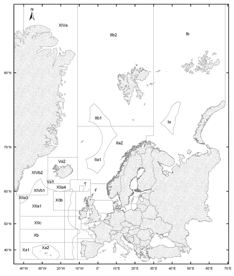
The ICES Statistical Areas delineates the divisions and subdivisions of FAO Major Fishing area 27
-

The International Council for the Exploration of the Sea (ICES), is a global organization that develops science and advice to support the sustainable use of the oceans. ICES is a network of more than 5,000 scientists from over 690 marine institutes in 20 member countries and beyond. 1,500 scientists participate in our activities annually. ICES has a well-established Data Centre, which manages a number of large dataset collections related to the marine environment. The majority of data – covering the Northeast Atlantic, Baltic Sea, Greenland Sea, and Norwegian Sea – originate from national institutes that are part of the ICES network. The ICES Data Centre provides marine data services to ICES member countries, expert groups, world data centres, regional seas conventions (HELCOM and OSPAR), the European Environment Agency (EEA), Eurostat, and various other European projects and biodiversity portals. ICES aims to provide all data collections online and according to the ICES Data policy, which enables open access to all data that are do not fall under specific commercial or personal privacy concerns.
-
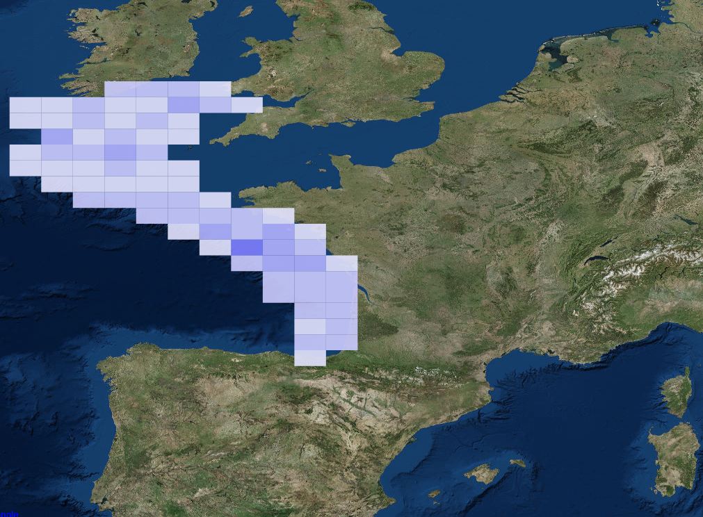
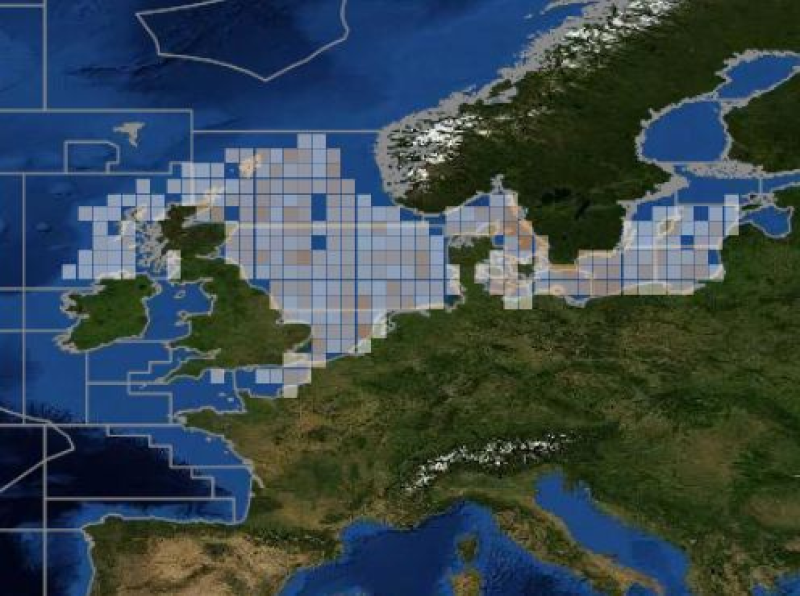
ICES hosts data collected from both net trawl surveys (primarily bottom trawling), and from echo sounding (acoustic sampling in the pelagic zone). The net trawls are primarily hosted in the DATRAS data portal, and the acoustics in the acoustic trawl surveys portal. DATRAS (the Database of Trawl Surveys) stores data collected primarily from bottom trawl fish surveys coordinated by ICES expert groups. The survey data are covering the Baltic Sea, Skagerrak, Kattegat, North Sea, English Channel, Celtic Sea, Irish Sea, Bay of Biscay and the eastern Atlantic from the Shetlands to Gibraltar. At present, there are more than 45 years of continuous time series data in DATRAS, and survey data are continuously updated by national institutions. The acoustic database hosts information on fisheries observations collected from various pelagic surveys coordinated by ICES and falls into two categories: acoustic data, derived from readings taken on vessels, and those obtained through trawls in the open ocean – pelagic – zone. Combined, this provides key biological data on fish stocks such as herring, mackerel and blue whiting as well as krill and other prey species. The data from both systems are used for stock assessments and fish community studies by the ICES community and form the basis of management advice to the relevant regulatory bodies.
-

Base de données du CIEM sur les campagnes au chalut
-
Assessments run at AFWG provide the scientific basis for the management of cod, haddock, saithe, redfish, Greenland halibut and capelin in subareas 1 and 2. Taking the catch values provided by the Norwegian fisheries ministry for Norwegian catches1 and raising the total landed value to the total catches gives an approximate nominal first-hand landed value for the combined AFWG stocks of ca. 20 billion NOK or ca. 2 billion EUR (2018 estimates).