 Catalogue PIGMA
CNES/CLS
Type of resources
Available actions
Topics
Keywords
Contact for the resource
Provided by
Years
Formats
Representation types
status
Resolution
-

These gridded products are produced from the along-track (or Level-3) SEA LEVEL products (DOI: doi.org/10.48670/moi-00147) delivered by the Copernicus Marine Service (CMEMS, marine.copernicus.eu) for satellites SARAL/AltiKa, Cryosat-2, HaiYang-2B, Jason-3, Copernicus Sentinel-3A/B, Sentinel-6 MF, SWOT nadir, and SWOT Level-3 KaRIn sea level products (DOI: https://doi.org/10.24400/527896/A01-2023.018). Three mapping algorithms are proposed: MIOST, 4DvarNET, 4DvarQG: - the MIOST approach which give the global SSH solutions: the MIOST method is able of accounting for various modes of variability of the ocean surface topography (e.g., geostrophic, barotrope, equatorial waves dynamic …) by constructing several independent components within an assumed covariance model. - the 4DvarNET approach for the regional SSH solutions: the 4DvarNET mapping algorithm is a data-driven approach combining a data assimilation scheme associated with a deep learning framework. - the 4DvarQG approach for the regional SSH solutions: the 4DvarQG mapping technique integrates a 4-Dimensional variational (4DVAR) scheme with a Quasi-Geostrophic (QG) model.
-

The Sentinel-6 Level-2P skewness products was developed to estimate the skewness from Sentinel-6 LR (Low Resolution Mode) and HR (High Resolution Mode) acquisitions. That demonstration product is generated by different retracking processes, provides an initial estimation of such a phenomenon and allows a finer description of the sea state.
-

The SWOT L3_LR_SSH product provides ocean topography measurements obtained from the SWOT KaRIn and nadir altimeter instruments, merged into a single variable. The dataset includes measurements from KaRIn swaths on both sides of the image, while the measurements from the nadir altimeter are located in the central columns. In the areas between the nadir track and the two KaRIn swaths, as well as on the outer edges of each swath (restricted to cross-track distances ranging from 10 to 60 km), default values are expected. SWOT L3_LR_SSH is a cross-calibrated product from multiple missions that contains only the ocean topography content necessary for thematic research (e.g., oceanography, geodesy) and related applications. This product is designed to be simple and ready-to-use, and can be combined with other altimetry missions. The SWOT L3_LR_SSH product is a research-orientated extension of the L2_LR_SSH product, distributed by the SWOT project (NASA/JPL and CNES). SWOT L3_LR_SSH is managed by the SWOT Science Team project DESMOS. The "Expert" version of SWOT L3_LR_SSH (the "Basic" version is the subject of a separate metadata sheet) includes each algorithm, correction, or external model incorporated into the SWOT L3_LR_SSH product as a separate layer. In addition to the SSH anomalies, this "Expert" version also includes mean dynamic topography (as in the "Basic" version), backscatter coefficient (sigma0), mean sea surface and geostrophic currents (absolute and anomalies).
-
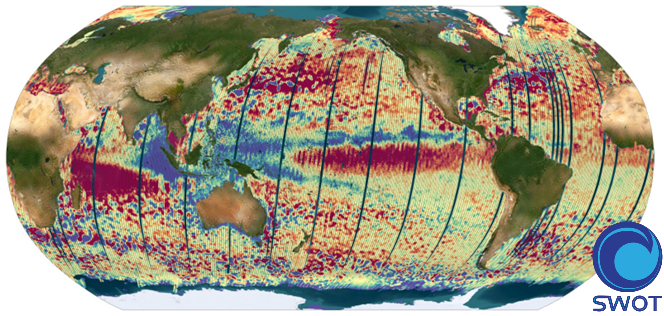
The SWOT L3_LR_SSH product provides ocean topography measurements obtained from the SWOT KaRIn and nadir altimeter instruments, merged into a single variable. The dataset includes measurements from KaRIn swaths on both sides of the image, while the measurements from the nadir altimeter are located in the central columns. In the areas between the nadir track and the two KaRIn swaths, as well as on the outer edges of each swath (restricted to cross-track distances ranging from 10 to 60 km), default values are expected. SWOT L3_LR_SSH is a cross-calibrated product from multiple missions that contains only the ocean topography content necessary for thematic research (e.g., oceanography, geodesy) and related applications. This product is designed to be simple and ready-to-use, and can be combined with other altimetry missions. The SWOT L3_LR_SSH product is a research-orientated extension of the L2_LR_SSH product, distributed by the SWOT project (NASA/JPL and CNES). SWOT L3_LR_SSH is managed by the SWOT Science Team project DESMOS. The ['Unsmoothed'] version of SWOT L3_LR_SSH (the "Basic" and "Expert" versions are the subject of separate metadata sheets) includes each algorithm, correction, or external model incorporated into the SWOT L3_LR_SSH product as a separate layer. This ['Unsmoothed'] version which includes the MSS, MDT and geostrophic currents (absolute and anomalies) in addition to the SSHA and MDT on the 250 m KaRIn native grid. Like the Expert subproduct, it also integrates a quality flag, corrections and external models as separate layers.
-
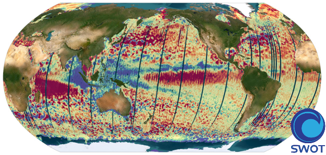
The SWOT L3_LR_SSH product provides ocean topography measurements obtained from the SWOT KaRIn and nadir altimeter instruments, merged into a single variable. The dataset includes measurements from KaRIn swaths on both sides of the image, while the measurements from the nadir altimeter are located in the central columns. In the areas between the nadir track and the two KaRIn swaths, as well as on the outer edges of each swath (restricted to cross-track distances ranging from 10 to 60 km), default values are expected. SWOT L3_LR_SSH is a cross-calibrated product from multiple missions that contains only the ocean topography content necessary for thematic research (e.g., oceanography, geodesy) and related applications. This product is designed to be simple and ready-to-use, and can be combined with other altimetry missions. The SWOT L3_LR_SSH product is a research-orientated extension of the L2_LR_SSH product, distributed by the SWOT project (NASA/JPL and CNES) and managed by the SWOT Science Team project DESMOS. The "Basic" version of SWOT L3_LR_SSH (the "Expert" version is the subject of a separate metadata sheet) includes only the SSH anomalies and mean dynamic topography.
-

The SWOT L3_LR_SSH product provides ocean topography measurements obtained from the SWOT KaRIn and nadir altimeter instruments, merged into a single variable. The dataset includes measurements from KaRIn swaths on both sides of the image, while the measurements from the nadir altimeter are located in the central columns. In the areas between the nadir track and the two KaRIn swaths, as well as on the outer edges of each swath (restricted to cross-track distances ranging from 10 to 60 km), default values are expected. SWOT L3_LR_SSH is a cross-calibrated product from multiple missions that contains only the ocean topography content necessary for thematic research (e.g., oceanography, geodesy) and related applications. This product is designed to be simple and ready-to-use, and can be combined with other altimetry missions. The SWOT L3_LR_SSH product is a research-orientated extension of the L2_LR_SSH product, distributed by the SWOT project (NASA/JPL and CNES) and managed by the SWOT Science Team project DESMOS. The "Technical" version of SWOT L3_LR_SSH (the "Basic", "Expert" and "Unsmoothed" versions are the subject of separate metadata sheets) includes additional parameters and geophysical fields that may be of interest for certain applications or that provide an alternative solution to those used in the core (Basic/Expert) products.
-
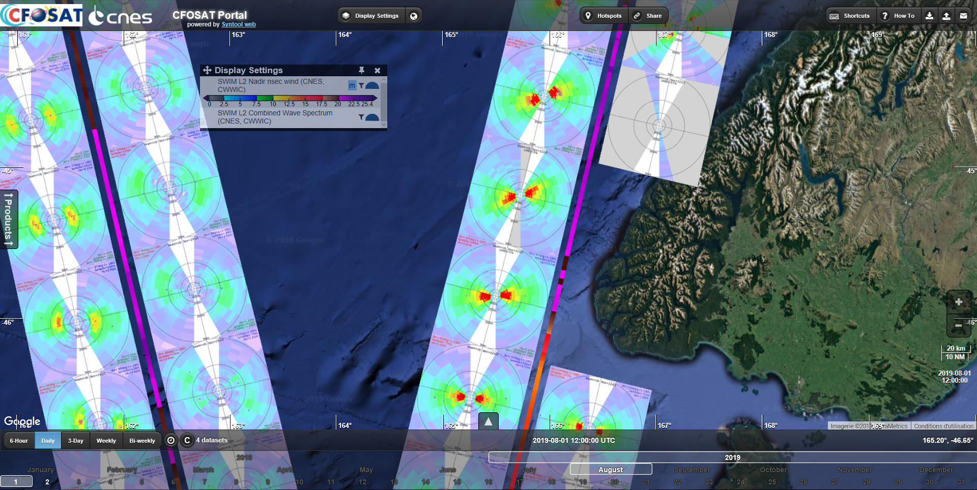
Produits issus de la mission satellite CFOSAT avec plusieurs paramètres de vagues de l'instrument français SWIM (hauteur, direction, longueur d'onde, spectre, ...) et produit vent du diffusiomètre chinois SCAT (vitesse, direction). Quelques variables météorologiques échantillonnées à la localisation des acquisitions SWIM sont aussi distribuées dans des fichiers dédiés.
-

La surface moyenne océanique (Mean Sea Surface MSS, en anglais) est un élément important en océanographie physique, en géophysique et en géodésie. Elle correspond à la hauteur moyenne stable, de la surface de l'océan.. Ce produit auxiliaire Surface Moyenne Océanique MSS globale combinant MSS SIO_2022; MSS CNES_CLS_2022 ; MSS DTU_2021 contient la hauteur moyenne de l'océan par rapport à l'ellipsoïde de référence T/P ou WGS84. Cette surface est fournie sur une grille régulière (1/60°x1/60°). Une grille d'erreur d'estimation est également fournie. La Surface Moyenne Océanique hybride globale 2023 résulte de la combinaison de trois MSS de référence différentes sur l'océan : - la MSS SIO Sandwell, D. T. (2024). Adding Mean Sea Surface (MSS) as an Altimetry Product. UC San Diego: Scripps Institution of Oceanography. http://dx.doi.org/10.21221/S26P4H Retrieved from https://escholarship.org/uc/item/08z6v9wq - la MSS CNES_CLS22 Schaeffer, P., Pujol, M.-I., Veillard, P., Faugere, Y., Dagneaux, Q., Dibarboure, G., & Picot, N. (2023). The CNES CLS 2022 Mean Sea Surface: Short Wavelength Improvements from CryoSat-2 and SARAL/AltiKa High-Sampled Altimeter Data. Remote Sensing, 15(11), 2910. https://doi.org/10.3390/rs15112910 - la MSS DTU21 Andersen, O. B., Rose, S. K., Abulaitijiang, A., Zhang, S., & Fleury, S. (2023). The DTU21 global mean sea surface and first evaluation. Earth System Science Data, 15(9), 4065–4075. https://doi.org/10.5194/essd-15-4065-2023
-
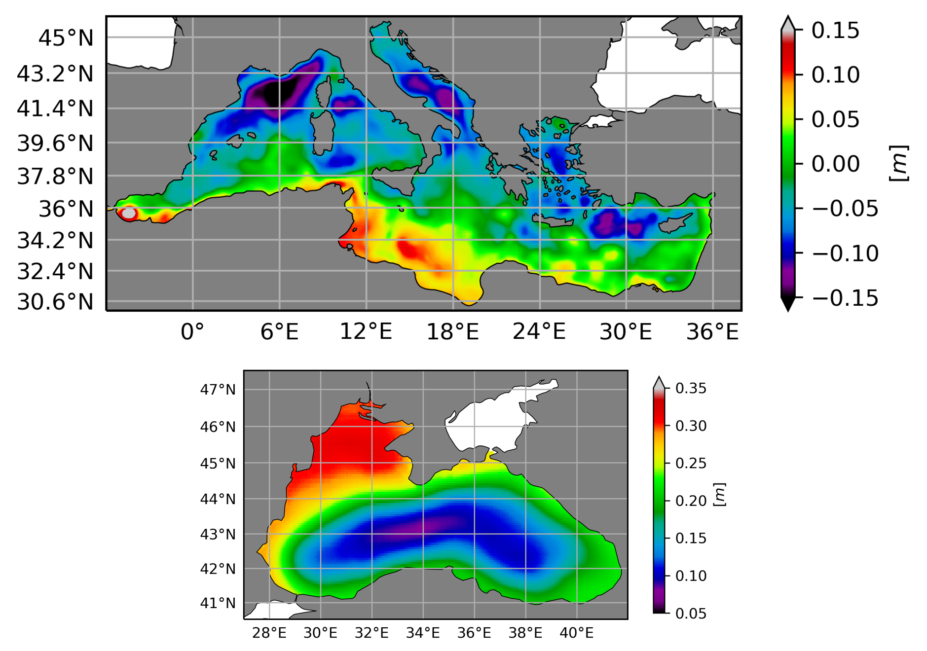
La Topographie Dynamique moyenne (MDT - Mean Dynamic Topography) résulte d'une moyenne des hauteurs de mer (SSH Sea Surface Height) au-dessus du géoïde sur une période de référence, ici la période1993-2012. La topographie dynamique moyenne hybride contient la MDT-CNES-CLS18 pour la couverture globale et la MDT CMEMS 2020 pour la mer Noire (MDT-CMEMS2020-BLK) et la mer Méditerranée (MDT-CMEMS2020-MED). La MDT hybride MDT-HYBRID-CNES-CLS18-CMEMS2020 est un produit combiné utilisant les données de la mission complète de GOCE (nov. 2009- oct. 2013), 10.5 années de données de la mission GRACE, ainsi que 25 années de données altimétriques (1993-2018) et 23 années de données in-situ (hydrologiques 1993-2016, bouées dérivantes 1997-2016). La méthode utilisée pour calculer la topographie dynamique moyenne est similaire à celle utilisée dans les versions précédentes de la MDT CNES-CLS. Une description détaillée peut être trouvée dans Rio et Hernandez, 2004, Rio et al, 2011, Rio et al, 2014a. Il s'agit d'une approche en trois étapes. 1/ Dans une première étape, une solution MDT de première approximation est calculée à partir des différences filtrées de manière optimale entre une surface moyenne de la mer (MSS) altimétrique et un modèle de géoïde. 2/ Dans la deuxième étape de la méthode, des estimations synthétiques de la MDT et des vitesses géostrophiques moyennes sont calculées en utilisant des mesures in-situ des hauteurs dynamiques de l'océan et des vitesses de surface. Les mesures in situ sont d'abord traitées de manière à extraire la composante géostrophique uniquement des vitesses totales des bouées dérivantes, et à compléter les hauteurs dynamiques avec les composantes barotropes et baroclines profondes manquantes. La variabilité temporelle des hauteurs et des vitesses mesurées est ensuite éliminée en soustrayant respectivement les anomalies de niveau de la mer et de vitesse géostrophique de l'altimètre. Les mesures in-situ traitées sont ensuite moyennées dans des boîtes pour obtenir respectivement les hauteurs et les vitesses moyennes synthétiques. 3/ dans la troisième étape, en utilisant une méthode d'analyse objective multivariée, l'estimation synthétique des hauteurs moyennes et des vitesses moyennes sont combinées pour effectuer une première ébauche de la MDT.
-
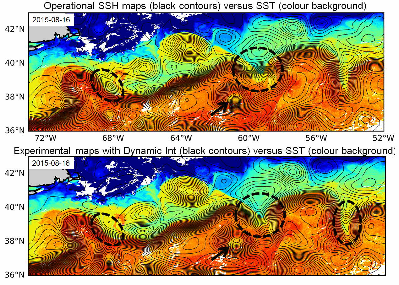
Produit altimétrique combiné expérimental intégrant une meilleure résolution, en vue de la préparation de l'ère SWOT comprenant les hauteurs de mer par rapport à une moyenne sur 20 années ainsi que les courants géostrophiques, issu de traitement spécifiques, disponibles en temps différé. Utilisation pour des études de variabilité océanique à méso-échelles. Produits régionaux: - le long de la trace, anomalies de hauteur de mer à 5Hz: Atlantique Nord, courant des Aiguilles - grillés, hauteurs de mer et vitesses géostrophiques calculés par Interpolation Dynamique: 2 zones: Gulf Stream, Udinstev. - grillés, anomalies de hauteur de mer et vitesses géostrophiques combinant altimétrie et bouées dérivantes: Golfe du Mexique Produit en zone globale: - grillés, vitesses combinées de façon optimale de données altimétriques et SST: global. A noter que ce produit grillé, combinant les données altimétriques et SST ont été calculés dans le cadre de 3 projets différents: 1/ une association Marie-Curie cofondée par l'Union Européenne sous le FP7-PEOPLE-Cofunding of Regional, National and International Programmes Grant Agreement 600407 et le projet RITMARE FLAG project (2014-2016), 2/ le projet ESA Globcurrent (2014-2018), 3/ le projet DUACS-MR CNES (2016-2018). Références pour les produits grillés calculés par interpolation dynamique: - Ubelmann, C., P. Klein, and L.-L. Fu, 2015: Dynamic interpolation of sea surface height and potential applications for future high-resolution altimetry mapping. J. Atmos. Oceanic Technol., 32, 177–184, doi:10.1175/JTECH-D-14-00152.1. - Ubelmann C., B. Cornuelle and L-L Fu, 2016: Dynamic Mapping of Along-Track Ocean Altimetry: Method and Performance from Observing System Simulation Experiments. J. Atmos. Oceanic Technol., doi:10.1175/JTECH-D-15-0163.1 - Rogé, M., Morrow R., Ubelmann C. and G. Dibarboure, 2017 : Using a dynamical advection to reconstruct a part of the SSH evolution in the context of SWOT, application to the Mediterranean Sea. Ocean Dynamics, 67-8, 1047–1066 - Ubelmann C., M. Ballarotta, Y. Faugere, M. Rogé, R. Morrow, G. Dibarboure, Upcoming high-resolution regional products of Sea Level Anomaly from Dynamic Interpolation, OSTS 2017 Références pour les produits grillés combinant altimétrie et bouées dérivantes: - Synergetic use of surface drifters and altimetry to increase resolution and accuracy of maps of sea level anomaly in the Gulf of Mexico, Mulet et al, OSTST 2017 Référencespour les produits grillés combinant données altimétriques et SST: - Rio, M-H, R. Santoleri, R. Bourdalle-Badie, A. Griffa, L. Piterbarg, G. Taburet, 2016: Improving the altimeter derived surface currents using high-resolution Sea Surface Temperature data: A feasibility study based on model outputs. Journal of Atmospheric and Oceanic Technology, Vol. 33, DOI: 10.1175/JTECH-D-16-0017.1.