CNES
Type of resources
Available actions
Topics
Keywords
Contact for the resource
Provided by
Years
Formats
Representation types
status
Resolution
-
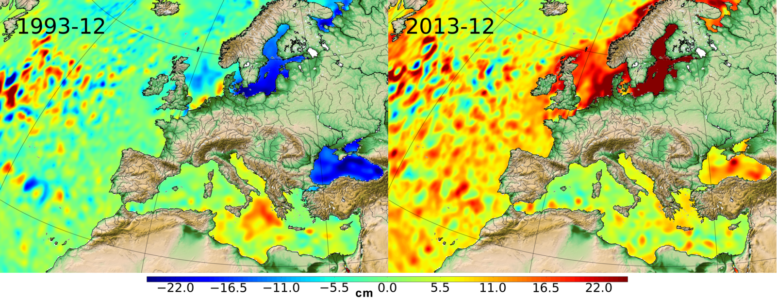
The Level-2 Ka-band Radar Interferometer (KaRIn) low rate (LR, ocean) sea surface height (SSH) data product from the Surface Water and Ocean Topography (SWOT) mission, also referenced by the short name L2_LR_SSH, provides ocean topography measurements from the low rate ocean data stream of the KaRIn instrument, spanning 60 km on either side of the nadir altimeter with a nadir gap. The L2_LR_SSH product is available continuously and globally, although different versions of the product may be produced at different latencies and/or through different reprocessing with refined input data. Note that L2_LR_SSH does not include SSH data from the SWOT nadir altimeter. SWOT launched on December 16, 2022 into a 1-day repeat orbit for the "calibration" or "fast-sampling" phase of the mission, which completed in early July 2023. After the calibration phase, SWOT entered a 21-day repeat orbit in August 2023 to start the "science" phase of the mission. The SWOT L2_LR_SSH product is organized in four files : ['Basic'], ['WindWave'], ['Expert'] and ['Unsmoothed'], each identified by its own DOI and described on a metadata sheet via the links below. - The ['Basic'] file is intended for users who are interested in SSH measurements and who will use the KaRIn measurements as provided. - The ['WindWave'] file is intended for users interested in wind and wave information. The ['Unsmoothed'] file, also intended for expert users, is provided on a finer 'native' grid of 250-m (with minimal smoothing applied), and has a significantly larger data volume than the other files. - The ['Expert'] file is intended for expert users who are interested in the details of how the KaRIn measurements were derived and who may use detailed information for their own custom processing. - The ['Unsmoothed'] file, also intended for expert users, is provided on a finer 'native' grid of 250-m (with minimal smoothing applied), and has a significantly larger data volume than the other files. Variables included: - Basic L2_LR_SSH includes corrected sea surface height (SSH), sea surface height anomaly (SSHA), data quality flags, geophysical reference fields, and height correction information on a 2 km geographically fixed grid. - WindWave L2_LR_SSH includes measured significant wave height (SWH), normalized radar cross section (NRCS or backscatter cross section or sigma0), wind speed derived from sigma0 and SWH, wind and wave model information, and quality flags on a 2 km geographically fixed grid. - Expert L2_LR_SSH, which includes copies of all variables in the Basic and WindWave files, plus more detailed information on the KaRIn instrument and environmental corrections, radiometer data, and geophysical models on a 2 km geographically fixed grid. - Unsmoothed L2_LR_SSH, which includes sea surface height (SSH) and sigma0 without additional smoothing relative to the native KaRIn downlink resolution on a ~250 m native (center-beam) grid. The Unsmoothed file contains two groups, left and right, each of which contains the data for half (one side from nadir) of the KaRIn swath. August 2024: V2.0 L2_LR_SSH version 2.0 (version C) products declared as validated by the SWOT project. March 2024: V2.0 Production and distribution of the pre-validated L2_LR_SSH version 2.0 (or version C) products: - PIC0 for forward-processed version C products: November 23, 2023 to present, - PGC0 for reprocessed version C products: - March 30 to July 10, 2023 (phase CalVal) and from July 26,2023 to January 25, 2024 (phase Science) November 2023: V1.0 The beta pre-validated L2_LR_SSH version 1.0 product (summer 2023 reprocessing release) is available only for the 1-day CalVal orbit phase, from March 29 to July 10, 2023, and the 21-day Science orbit phase from September 7 to November 21, 2023.
-
Produit altimétrique expérimental Sentinel-3 mode LR-RMC (niveau2, monomission, le long de la trace)
Produit altimétrique monomission Sentinel-3A en mode LR-RMC (Low-Resolution with Range Migration Correction) avec des données le long de la trace de niveau 2 échantillonnées à 20Hz en mode LR-RMC. Les formes d'onde associées au mode LR-RMC sont aussi contenues dans les produits ainsi que les corrections géophysiques appliquées à la distance altimétrique (fichiers SGDR).
-
Produits altimétriques monomissions OSTM/Jason-2. Ces produits ont été produits par CLS dans le cadre du projet Pistach, financé par le Cnes.
-
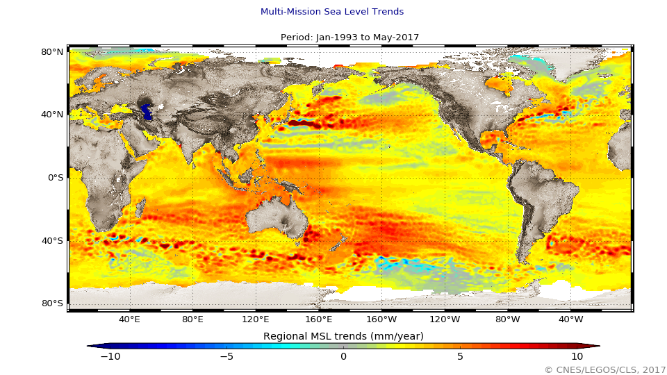
Le niveau moyen global des océans est un des indicateurs les plus importants du réchauffement climatique. Il intègre la réponse de plusieurs composantes du système climatique. Le suivi précis de l'évolution du niveau moyen des océans, grâce notamment aux satellites altimétriques, est d'une importance majeure, non seulement pour la compréhension du climat mais aussi pour les conséquences socio-économiques de son élévation.
-
Produit altimétrique combiné Ssalto/Duacs des moyennes et climatologies des anomalies de hauteurs de mer. Ces produits sont calculées par rapport à une moyenne sur 20 ans (1993-2012), incluant la variabilité saisonnière (aucun cycle n'est retiré)
-
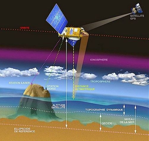
Produit altimétrique combiné Ssalto/Duacs des moyennes mensuelles de l'énergie cinétique des tourbillons (Eddy Kinetic Energy -EKE) dérivés des hauteurs de la surface de la mer (SSH) calculées par rapport à un profil moyen sur vingt ans [1993-2012], et incluant la variabilité saisonnière (NB. le cycle annuel n'est pas supprimé), moyennées mois par mois depuis janvier 1993.
-
Produits altimétriques auxiliaires - élévations de marées, courants de marées, effets de charge dues à la marée
-
Produits altimétriques auxiliaires
-
Produit altimétrique combiné Ssalto/Duacs des moyennes mensuelles de l'énergie cinétique des tourbillons (Eddy Kinetic Energy -EKE) dérivés des hauteurs de la surface de la mer (SSH) calculées par rapport à un profil moyen sur vingt ans [1993-2012], et incluant la variabilité saisonnière (NB. le cycle annuel n'est pas supprimé), moyennées mois par mois depuis janvier 1993.
-
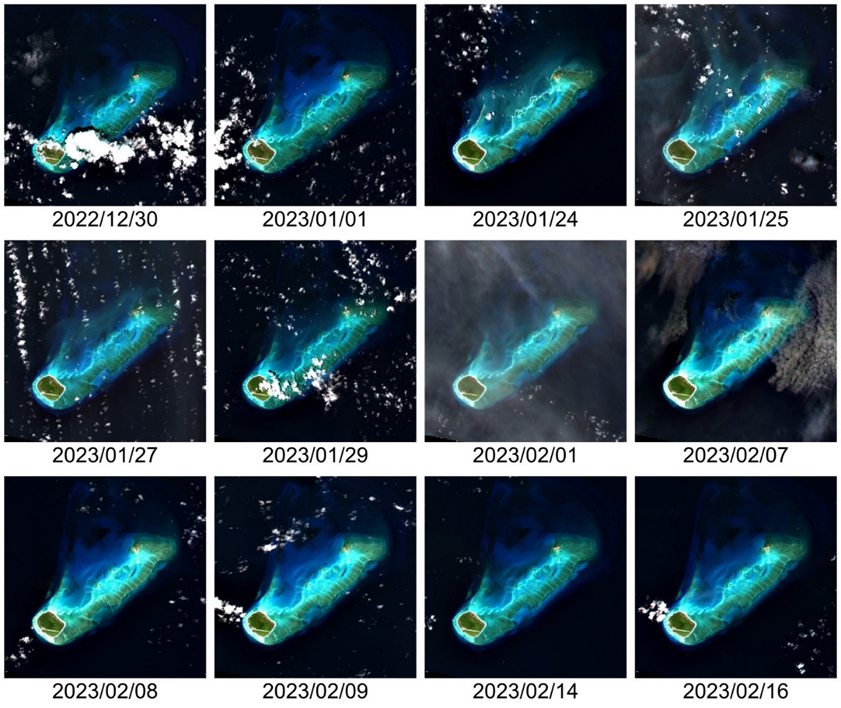
This Level 2 product provides marine reflectances from the VENµS mission, processed with the Polymer algorithm, on a subset of sites with coastal or inland areas. VENµS (Vegetation and Environment monitoring on a New Micro-Satellite) is a Franco-Israeli satellite launched in 2017, dedicated to the fine and regular monitoring of terrestrial vegetation, in particular cultivated areas, forests, protected natural areas, etc. The images acquired in 12 spectral bands by a camera provided by CNES, on a selection of about one hundred scientific sites spread over the planet, are of high spatial (5 m) and temporal resolution. The lifetime of the VENµS satellite has been divided into two phases: a first phase VM1 at an altitude of 720 km with a 2-day revisit, a native spatial resolution of 5.3 m and a swath of 27.6 km from August 2017 to November 2020, and a second phase VM5 at an altitude of 560 km with a daily revisit, a native spatial resolution of 4.1 m and a swath of 21.3 km from March 2022 to July 2024. VENµS is the first sensor on board an orbiting satellite to combine such revisit frequency and spatial finesse for vegetation monitoring. A subset of sites with coastal areas or inland waters have been identified to generate Level 2 data dedicated to marine reflectance. The geographical areas covered are given through a kmz file, see below to download it. This Level 2 data product has been processed using the Polymer algorithm developed by Hygeos (https://hygeos.com/en/polymer/) and provides marine reflectances for the VENµS bands from 420 to 865 nm. These reflectances, without units, include a bidirectional normalization for the Sun at nadir and the observer at nadir. VENµS data products (Level-1, Level-2 and Level-3) are primarily generated with the MAJA algorithm, further information can be found on THEIA website: https://www.theia-land.fr/en/product/venus/ References - Dick, A., Raynaud, J.-L., Rolland, A., Pelou, S., Coustance, S., Dedieu, G., Hagolle, O., Burochin, J.-P., Binet, R., Moreau, A., 2022. VENμS: Mission Characteristics, Final Evaluation of the First Phase and Data Production. Remote Sensing 14, 3281. https://doi.org/10.3390/rs14143281 - Steinmetz, F., Deschamps, P.-Y., Ramon, D., 2011. Atmospheric correction in presence of sun glint: application to MERIS. Optics Express 19, 9783–9800. https://doi.org/10.1364/OE.19.009783 - Steinmetz, F., Ramon, D., 2018. Sentinel-2 MSI and Sentinel-3 OLCI consistent ocean colour products using POLYMER, in: SPIE Asia-Pacific Remote Sensing Proceedings. https://doi.org/10.1117/12.2500232 - Cox, C., Munk, W., 1954. Measurement of the Roughness of the Sea Surface from Photographs of the Sun’s Glitter. J. Opt. Soc. Am. 44, 838. https://doi.org/10.1364/JOSA.44.000838