 Catalogue PIGMA
IR-ILICO
Type of resources
Available actions
Topics
Keywords
Contact for the resource
Provided by
Years
Formats
Representation types
Update frequencies
status
Scale
Resolution
-
The BenthOBS dataset includes long-term time series on marine benthic macrofauna, since 1967, along the whole French metropolitan coast. It includes 20 sampling location. BenthOBS aims to establish a national network for the observation of macrozoobenthos. In a context of global change, It is essential to have time series capable of highlighting and understanding ongoing changes in the specific diversity within communities and their consequences on the functioning of marine ecosystems. The BenthOBS network provides the scientific community and stackers with validated data on the following parameters: specific abundance, sediment size composition, sediment organic matter, sediment C content, sediment N content.
-
Une nouvelle réanalyse des données du système mondial de navigation par satellite (GNSS) au niveau ou à proximité des marégraphes du monde entier a été produite par le groupe de l'Université de La Rochelle (ULR) dans le cadre de la troisième campagne de retraitement de l'International GNSS Service (IGS) (repro3). La nouvelle solution, appelée ULR-repro3, est conforme aux normes IGS adoptées pour repro3, mettant en œuvre les progrès réalisés dans la modélisation des données et les corrections depuis la campagne de réanalyse précédente et prolongeant la durée moyenne des enregistrements d'environ 7 ans. Ces produits sont utiles pour estimer avec précision le mouvement vertical des terres sur la côte et compléter les données issues de l'altimétrie satellitaire ou des marégraphes pour une meilleure compréhension des changements du niveau de la mer et de leurs impacts le long des zones côtières. Afin de fournir des estimations réalistes de l'incertitude de la vitesse, le contenu du bruit dans les séries temporelles de position a été étudié en tenant compte de l'impact de la charge atmosphérique non marémotrice. Dans l'ensemble, les séries temporelles de position ULR-repro3 présentent des amplitudes de bruit blanc et de loi de puissance réduites et des incertitudes de vitesse de station plus faibles par rapport à la réanalyse précédente. Les produits sont disponibles via la page "Vertical Land Movements" du site-web du SNO Sonel (lien dans les ressources associées).
-
The PHYTOBS-Network dataset includes long-term time series on marine microphytoplankton, since 1987, along the whole French metropolitan coast. Microphytoplankton data cover microscopic taxonomic identifications and counts. The whole dataset is available, it includes 25 sampling locations. PHYTOBS-Network studies microphytoplankton diversity in the hydrological context along French coasts under gradients of anthropogenic pressures. PHYTOBS-Network allows to analyse the responses of phytoplankton communities to environmental changes, to assess the quality of the coastal environment through indicators, to define ecological niches, to detect variations in bloom phenology, and to support any scientific question by providing data. The PHYTOBS-Network provides the scientific community and stakeholders with validated and qualified data, in order to improve knowledge regarding biomass, abundance and composition of marine microphytoplankton in coastal and lagoon waters in their hydrological context. PHYTOBS-Network originates of two networks. The historical REPHY (French Observation and Monitoring program for Phytoplankton and Hydrology in coastal waters) supported by Ifremer since 1984 and the SOMLIT (Service d'observation en milieu littoral) supported by INSU-CNRS since 1995. The monitoring has started in 1987 on some sites and later in others. Hydrological data are provided by REPHY or SOMLIT network as a function of site locations.
-
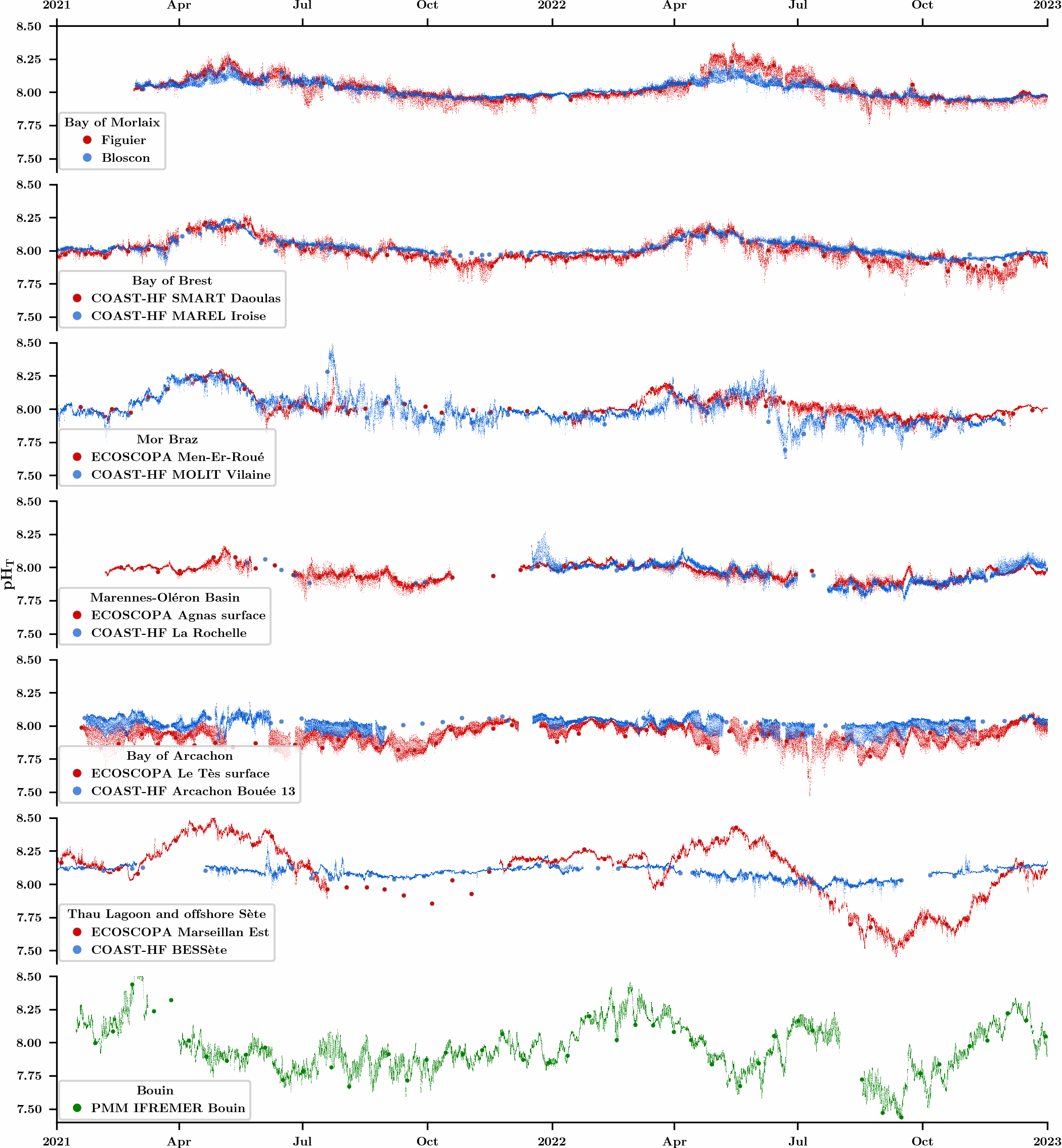
An observation network was initiated in 2021 in the framework of the CocoriCO2 project to monitore carbonate parameters along the French coastal systems. Six sites were selected along the French Atlantic and Mediterranean coastlines based on their importance in terms of shellfish production and the presence of high- and low-frequency monitoring activities. At each site, autonomous pH sensors were deployed both inside and outside shellfish production areas, next to high-frequency CTD (conductivity-temperature-depth) probes operated through two operating monitoring networks (SNO COAST-HF and Ifremer ECOSCOPA). pH sensors were set to an acquisition rate of 15 min and discrete seawater samples were collected biweekly in order to control the quality of pH data (laboratory spectrophotometric measurements) as well as to measure total alkalinity and dissolved inorganic carbon concentrations for full characterization of the carbonate system. While this network has been up and running for more than two years, the acquired dataset has already revealed important differences in terms of pH variations between monitored sites related to the influence of diverse processes (freshwater inputs, tides, temperature, biological processes).
-
The PHYTOBS-MARCOBOLO dataset comprises long-term time series on marine microphytoplankton, from 2003 to 2021, along the entire French metropolitan coastline. Microphytoplankton data cover microscopic taxonomic identifications and counts. The PHYTOBS-MARCOBOLO dataset corresponds to a dataset extracted from the PHYTOBS network (DOI:10.17882/85178). The PHYTOBS network provides the scientific community and stakeholders with validated and qualified data on the biomass, abundance and composition of marine microphytoplankton in coastal and lagoon waters, with the aim of supporting scientific research. PHYTOBS-MARCOBOLO is a dataset used as part of the Horizon Europe MARCO-BOLO project (https://marcobolo-project.eu/), in which we are currently working to understand and analyze multi-decadal trends in coastal and marine biodiversity on a European scale. The PHYTOBS-MARCOBOLO dataset gathers data from 18 sampling sites, selected from the PHYTOBS-Network dataset according to requirements of time series quality and geographical location of sampling sites established as part of the MARCO-COLO project. This dataset was also formatted according to a template imposed for the European project.
-

Le SNO DYNALIT collecte et met à disposition les paramètres moyens de l'état de mer issus du traitement de données de capteurs de pression installés devant les sites-atelier.
-
Le SNO DYNALIT collecte et met à disposition les paramètres moyens de l'état de mer issus du traitement de données de capteurs de pression installés devant les sites-atelier.
-
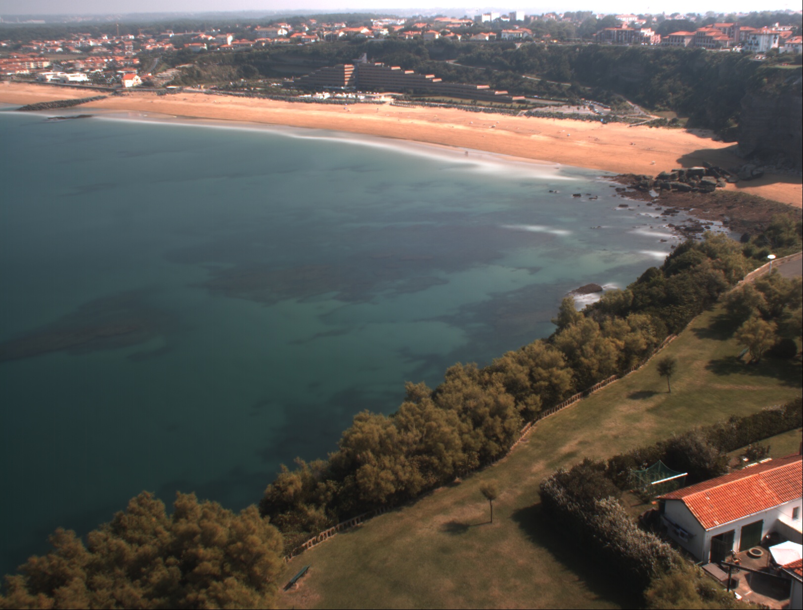
La topographie de la plage sableuse du VVF située au sud du Cap Saint Martin sur la commune d’Anglet (Nouvelle-Aquitaine) est suivie par DGPS-NRTK depuis 2013 pendant les marées basses de vives eaux en moyenne deux fois par an au début et à la fin de l’hiver. La zone couverte s’étend sur 650 m. Les données sont interpolées sur une grille régulière de résolution 2 m dans la direction longitudinale et transversale à la côte.
-
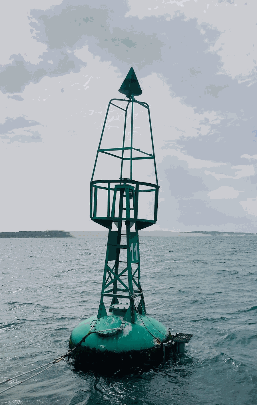
The COAST-HF/Arcachon-Ferret time series characterizes the hydrology of the interface between the Arcachon lagoon, located in the South-Western France, and the Atlantic Ocean. A buoy belonging to Phares et Balises is instrumented with a multi-parametric probe that records sub-surface temperature, conductivity, depth, turbidity and fluorescence every 10 minutes since February 2018. It is opérated by the OASU and EPOC teams (Univ. Bordeaux/CNRS). COAST-HF (Coastal OceAn observing SysTem - High Frequency; www.coast-hf.fr) is a national observation network accredited by the CNRS as a national Earth Science Observatory (Service National d’Observation: SNO). It aims to federate and coordinate a set of 14 fixed platforms instrumented with high-frequency in situ measurements for key parameters of coastal waters. The COAST-HF/Arcachon-Ferret buoy is one of them. COAST-HF is part of the French Research Infrastructure dedicated to coastal ocean observations (RI ILICO, https://www.ir-ilico.fr). Data are transmitted to the Coriolis Côtier database (https://data.coriolis-cotier.org/). Data are raw data.
-

This database consists of several time series recorded at 30-minute intervals on the ASTAN cardinal buoy, located 3.1 km offshore from Roscoff in the western English Channel (France). It was originally developed by Gac et al. (2020, DOI:10.3389/fmars.2020.00712). The present version corresponds to the dataset used in Robache and Schmitt (2025, DOI:10.5194/egusphere-2025-972). Sea surface temperature (SST, °C) and salinity (SSS, psu) were recorded using a SeaBird Inc. SBE16+ sensor. Dissolved Oxygen (DO) and chlorophyll a (chl a, µg L-1) concentrations were respectively recorded with a SeaBird Inc. SBE43 sensor and a Cyclops7 sensor. Oxygen saturation (Osat, %) was estimated by Gac et al. (2020) following the method of Weiss (1970, DOI: 10.1016/0011-7471(70)90037-9). Atmospheric pressure (Patm, hPa) data were obtained from the weather station at the Roscoff Marine Station. The seawater surface partial pressure of CO2 (pCO2, µatm) data was collected on the buoy using a SAMI-CO2 sensor (SunBurst Sensors).