 Catalogue PIGMA
bathymetric LiDARs
Type of resources
Available actions
Topics
Keywords
Contact for the resource
Provided by
Years
Formats
Representation types
Scale
Resolution
-

Lidar data taken on the Netherlands side of Sint Maarten, on land and shallow sea.
-

High Resolution DTM of the German Ems Approach, based on the DTM provided by The Federal Waterways and Shipping Administration (WSV) at a resolution of 1*1m².
-
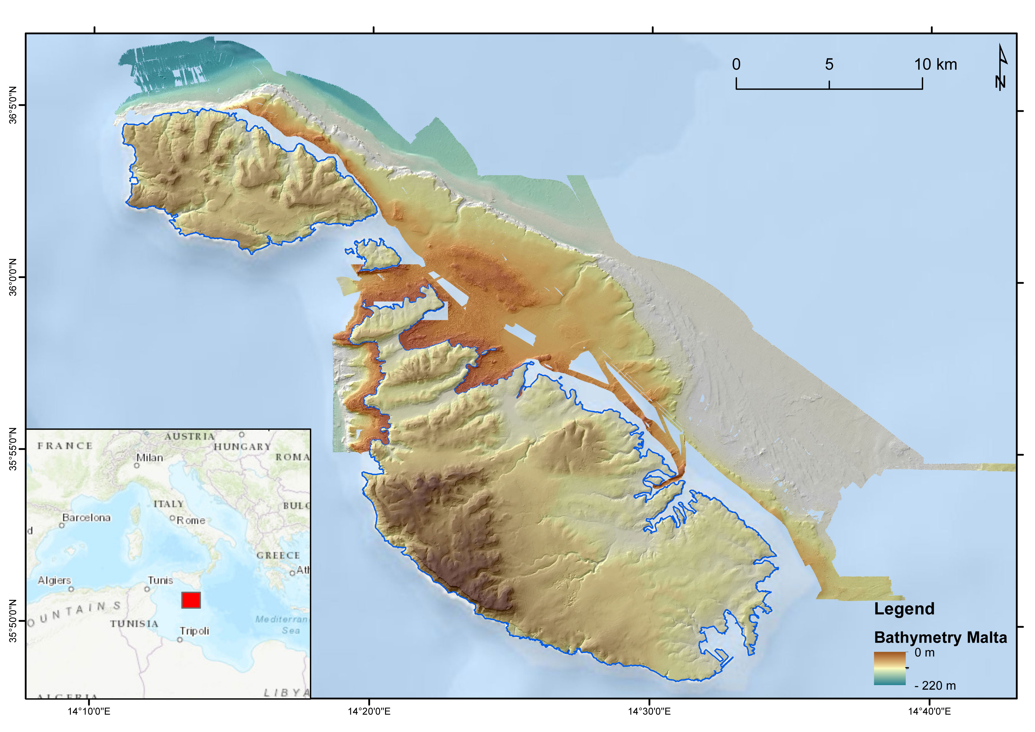
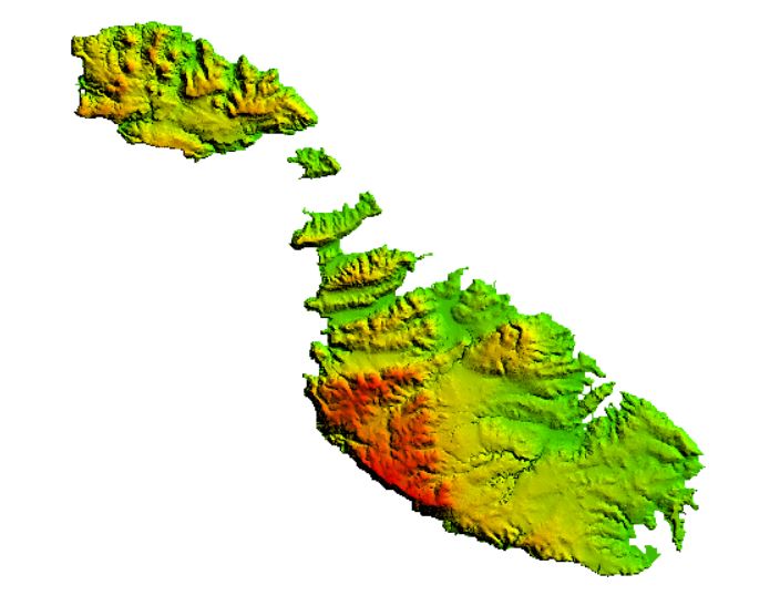
DTM of the Maltese seafloor resulting from the merge of 3 MBES-derived DTMs (cruises MEDCOR, DECORS and MAPSCAPE) and a bathymetric LiDAR-derived DTM (ERDF20112). Horizontal resolution of 2 m. It comprises the seabed offshore N Gozo, E Maltese Islands and NW Malta. The DTM refers to the following CDIs: 145_CNR-ISMAR-125, MAPSCAPE2012, 145_CNR-ISMAR-126, ERDF_LIDAR_2012
-

High Resolution DTM of the German Elbe Approach, based on the DTM provided by The Federal Waterways and Shipping Administration (WSV) at a resolution of 1*1m².
-
Topographic LiDAR data were acquired during a 5.5 h flight in February 2012 using an IGI LiteMapper 6800 system. The data have a cell size of 1m and were collected as part of the project “Development of Environmental Monitoring Strategy and Environmental Monitoring Baseline Surveys” funded by ERDF-156.
-

The DTM is produced with Teledyne multibeam echosounder survey, acquired in March 2023 by Marine Research Ltd. The resolution 5m x 5m. It is located at Sulina, Romania, on the coastal region of the Black Sea. Depths are referenced to the Local Sea Level - Marea Neagra 1975 (Mean Sea Level) and the coordinates are expressed into the WGS84 reference frame.