 Catalogue PIGMA
AIS
Type of resources
Available actions
Topics
Keywords
Contact for the resource
Provided by
Years
Formats
Representation types
Update frequencies
Scale
-
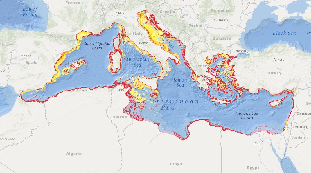
to deliver maps showing the extent of the trawling fishing grounds for identifying the areas which are most disturbed by bottom trawling over the past ten years and identifying the gaps of fishing vessels’ tracking systems in the Mediterranean Sea
-

Global Fishing Watch's AIS Apparent Fishing Effort dataset, version 3.0 (March 2025 release). Data is available for 2012 to 2024 and is based on positions of more than 190,000 unique automatic identification system (AIS) devices on fishing vessels, of which up to around 96,000 are active in a given year. Fishing vessels are identified via a machine learning model, vessel registry databases, and manual review by Global Fishing Watch and regional experts. Vessel time is measured in hours, calculated by assigning to each AIS position the amount of time elapsed since the previous AIS position of the vessel. The time is counted as apparent fishing hours if the Global Fishing Watch fishing detection model, a neural network machine learning model, determines the vessel is engaged in fishing behavior during that AIS position. Data are spatially binned into grid cells that measure 0.01 or 0.1 degrees on a side. The coordinates defining each cell are provided in WGS84 and correspond to the lower-left corner. Data are available in three formats: fishing hours by flag state and gear type at 100th degree resolution; monthly apparent fishing hours by flag state and gear type at 10th degree resolution; and fishing hours by MMSI at 10th degree resolution. The dataset is accompanied by a table of vessel information such as gear type, flag state and dimensions. Free for non-commercial use. This static dataset covers 2012 to 2024. For more recent data, or for a custom area, use the Global Fishing Watch APIs or the gfwr (R) and gfw-api-python-client (Python) packages, linked below. Read the data caveats before interpreting results.
-
MEDSEA_CH5_Product_7 / Change level of disturbance from AIS data combined with habitat vulnerability
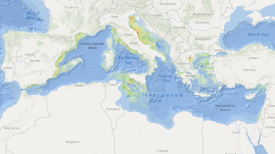
to deliver maps showing the extent of the trawling fishing grounds for identifying the changes in level of disturbance over the past ten years and identifying the gaps of fishing vessels’ tracking systems in the Mediterranean Sea
-
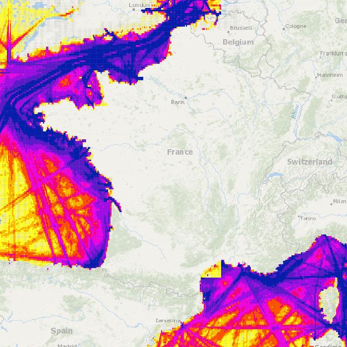
Densité du trafic maritime en 2016 par grands types de navires: tanker, cargo, yacht, pêche, passager, classB. Une densité tous navires confondus est également disposnible. La densité représente un nombre de navires par maille de 3 minutes et pour 340 jours en Atlantique et 354 en Méditerranée.
-
Densités de navires estimées par maille de 1 minutes pendant l'année 2019 d'après le dispositif AIS (système de géolocalisation automatique des navires).