 Catalogue PIGMA
Sedimentology
Type of resources
Available actions
Topics
Keywords
Provided by
Representation types
Update frequencies
status
Scale
-

Map of the sedimentation rates within the French metropolitan EEZ produced in the work-package 3 (seabed substrate) of the European project EMODnet Geology. This version of the dataset corresponds to the phase III of the project.
-

Aggregates map at 1 : 100 000 of the French metropolitan EEZ produced in the work-package 5 (coastline behavior) of the European project EMODnet Geology. This version of the dataset corresponds to the phase III of the project.
-
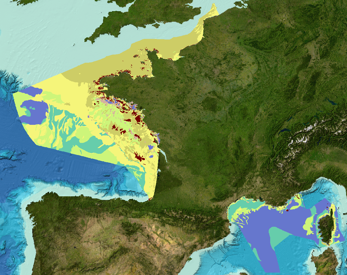
Sediment substrate maps at different scales, of the French metropolitan EEZ produced in the work-package 3 the European project EMODNet Geology (phase IV). Available scales : - 1 : 1 000 000 - 1 : 250 000 - 1 : 100 000 - 1 : 50 000 - 1 : 20 000 - 1 : 15 000 - 1 : 10 000 - 1 : 5 000 Bibliographic references : - Coltman, N., Gilliland, P. & van Heteren, S. 2007. What can I do with my map? In: MESH Guide to Habitat Mapping, MESH Project, 2007, JNCC, Peterborough. Available online at: (http://www.searchmesh.net/default.aspx?page=1900) - Foster-Smith, R., Connor, D. & Davies, J. 2007. What is habitat mapping? In: MESH Guide to Habitat Mapping, MESH Project, 2007, JNCC, Peterborough. Available online at: (http://www.searchmesh.net/default.aspx?page=1900) - Väänänen, T. (ed), Hyvönen, E., Jakonen, M., Kupila, J., Lerrsi, J., Leskinen, J., Liwata, P., Nevalainen, R., Putkinen, S., Virkki, H. 2007. Maaperän yleiskartan tulkinta- ja kartoitusprosessi. Maaperän yleiskartoitus –hankkeen sisäinen raportti. 17 p.
-
Aggregates map at 1 : 250 000 of the French metropolitan EEZ produced in the work-package 7 (marine minerals) of the European project EMODnet Geology. This version of the dataset corresponds to the phase IV of the project.
-
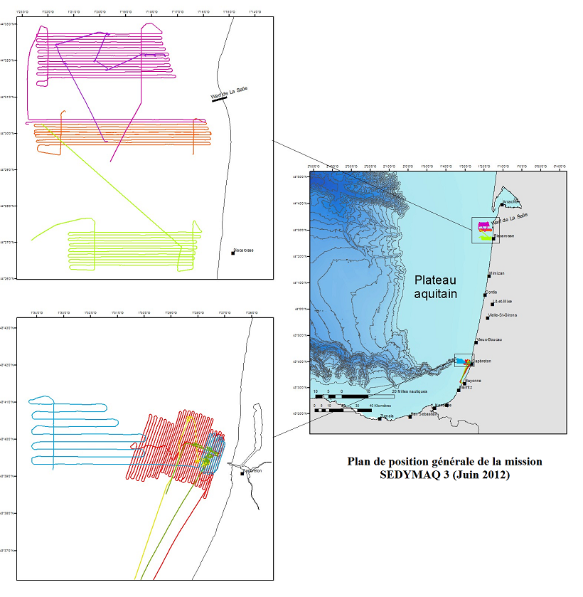
Monitoring the evolution of the Aquitain platform off the coast of the Médoc region (at depths of between 70 and 120 m) and the internal pladeau at la Salie and Truc vert (at depths of between 10 and 40 m) as well as at the head of the Capbreton Canyon (at depths of between 10 and 300m).
-
The ECORS project – marine section – contributes to improving the representation of the marine environment and its evolution, within the context of aquatic operations : waves, currents, beach terrain.
-
Study of dune dynamics on the French continental plate Period : First stage : 2005 to 2009 ; Second Stage : 2013-2017
-
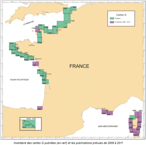
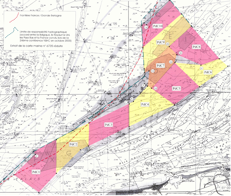
G maps represent the nature of the sea floor in the background of a maritime map used in navigation. Most such maps are published at a scale of nearly 1/50 000, and are as often as possible drawn up within the context of collaborations with university laboratories with knowledge of the area to be mapped.
-
In its 2013-2016 version, the National Hydrographic Programme (PNH) details hydrographic surveys in the maritime areas under French responsibility which are conducted in order to meet France’s international obligations relating to navigational safety (International SOLAS convention). The PNH will be updated yearly in order to account for the new requirements put forward by the maritime community, and the hydrographic capability of the SHOM which can be put into practice in areas under French responsibility.