 Catalogue PIGMA
product
Type of resources
Available actions
Topics
Keywords
Provided by
Representation types
Update frequencies
status
Scale
-
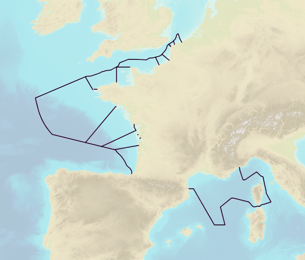
This product includes the boundaries of tidal zones for French Channel, Atlantic and Mediterranean coasts in shapefile format. Information on the characteristics of tidal zones is available as part of the "Maritime Altimetric Reference Values" product.
-
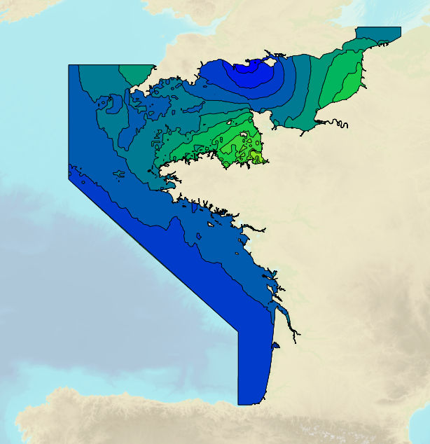
Tidal ranges on the French coasts of the Channel and the Atlantic for a coefficient of 95 : tidal range for mean neap tides for average atmospheric conditions..
-
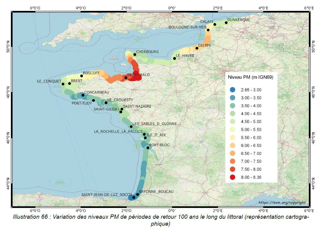
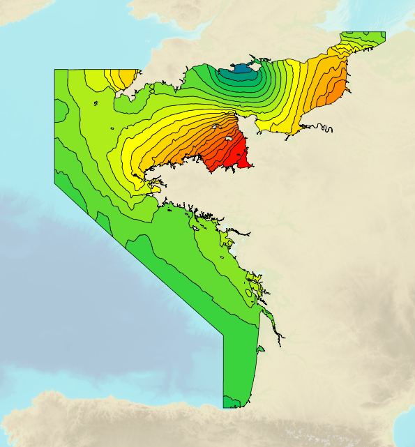
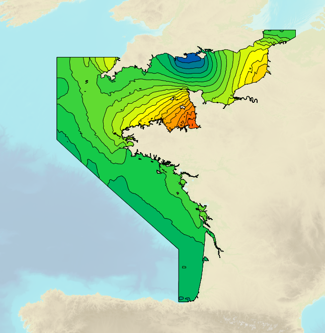
This study provides an initial global estimate of the extreme water level values along the French metropolitan coastline. These results are to be refined locally with all available data and knowledge. The method used is based on a statistical analysis of the tide gauge observations available in the ports. It does not take into account wave observations. The results between ports are obtained by an interpolation method. The study produces at the reference ports the statistical estimates: - extreme values of high water surge in the Channel and Atlantic; - extreme values of water level for the whole of Metropolitan France. And a set of statistical estimation maps of extreme water level values along the coastline. The estimates provided go up to the 1,000-year return period. In view of the duration of observations used at the ports, the user must check whether estimates with a return period of more than 50 or 100 years are still valid 50 or 100 years still make sense.
-
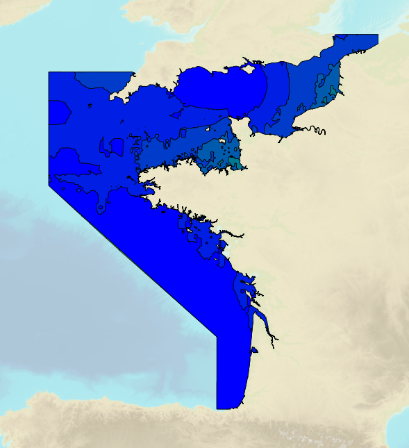
Tidal ranges on the French coasts of the Channel and the Atlantic for a coefficient of 20 : minimum tidal range for average atmospheric conditions..
-
Tidal ranges on the French coasts of the Channel and the Atlantic for a coefficient of 95 : maximal tidal range for average atmospheric conditions..
-
Tidal ranges on the French coasts of the Channel and the Atlantic for a coefficient of 95 : tidal range for mean spring tides for average atmospheric conditions..
-
Non-georeferenced digital images in JPEG2000 format from former hydrographical survey fair sheets obtained from Shom's historical archives.
-
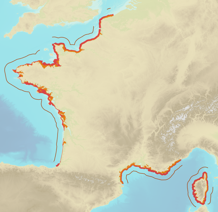
The Histolitt® coastline corresponds to the high tide line with an astronomic tidal coefficient of 120 and in normal weather conditions (no sea breeze and no low pressure systems likely to raise sea level). The Histolitt® coastline models this theoretical input as a series of 2D polylines. In mainland France, it is recommended to use the land-sea limit product which replaces this Histolitt® coastline. There is no land-sea limit in the French overseas areas for the moment.
-
Limits defining ship classes based on their assigned operating maritime zones. These limits were produced by CEREMA in application of section II.14 of article 1 of decree no. 200945 amended on 30 August 1984. Navigation categories are defined in article 223.2 of the rules appended to the order of 23 November 1987 on shipping safety.
-
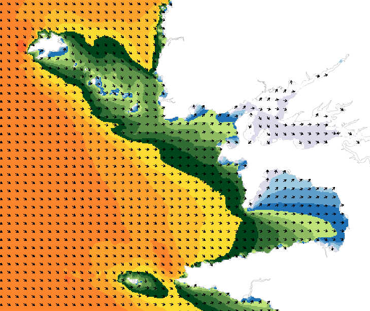
Wave forecasting models allow the representation of sea states based on a spectral resolution at the global scale or at the scale of ocean basins. This code calculates the evolution of the sea state by decomposing it into a wave spectrum that propagates in different directions and with different periods. During the propagation, the wave energy is increased or decreased by the effects of wind, breaking waves and energy exchanges between the different components. The wave forecasts available on data.shom.fr are calculated with 2 different types of models: MFWAM for the offshore domain (resolution from 0.5° to 0.1°) and Wavewatch III ® (WW3) for the coastal domain (resolution from 2' to 200m). MFWAM is a sea state forecasting model (wind wave and swell) derived from the third generation WAM code (WAMDI Group, 1988). Wavewatch III ® (WW3) is developed in a collaboration between the United States Weather Service (NOAA/NCEP), Shom, the University of Darmstadt in Germany, and other partners. The forecasts published on data.shom.fr are issued from the parameterization carried out and optimized by the Shom and Météo-France within the framework of the Homonim project (national coastal flood/wave/storm warning system).