 Catalogue PIGMA
raster
Type of resources
Topics
Keywords
Provided by
Years
Formats
Representation types
Update frequencies
Scale
Resolution
-

The georeferenced digital image solution for the nautical chart is a digital conversion of the corresponding printed nautical chart produced by Shom or its legends, with georeferencing indications and including miscellaneous text.
-
RasterMarine is a series of digital images taken from nautical charts, with no additions, legends or georeferencing information. The RasterMarine range is available at six sets of scales: - RasterMarine10 1:10,000 - RasterMarine25 1:25,000 - RasterMarine50 1:50,000 - RasterMarine100 1:100,000 - RasterMarine350 1:350,000 - RasterMarine1M 1:1,000,000. Unless exceptional circumstances apply, the RasterMarine range is updated on a weekly basis and the modified grid squares are re-published, replacing the previous versions. All corrections, publications, editions and suppressions with an effect on the reference nautical charts are taken into consideration. <br /> 09/07/2026 version <br />
-
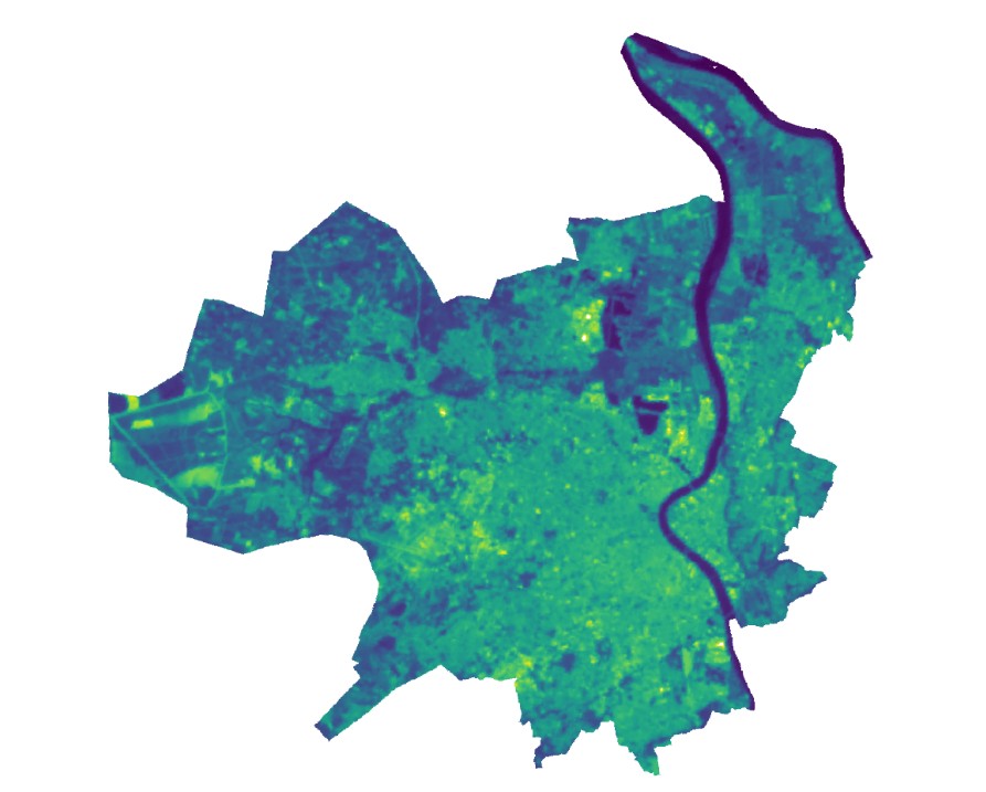
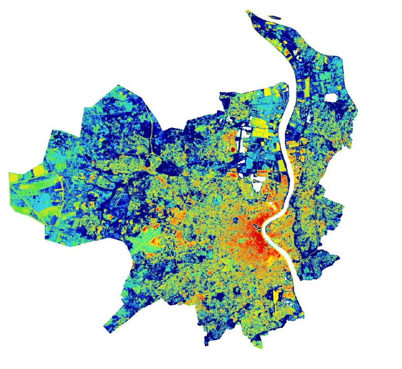
Ce jeu de données raster représente les températures de surface par un dégradé de couleurs figurant les zones froides/chaudes (du bleu au jaune). Chaque pixel représente un carré de 30 m de côté. Le cliché a été pris le 11 juillet 2022 à 12h48 (heure locale). Les températures sont exprimées en degré Celsius. Cette carte donne une première idée de la localisation des Ilots de Chaleur et de Fraîcheur Urbains, mais ne les représente pas de façon précise, puisque la température de surface n’est pas obligatoirement la température de l’air. En zone dense, cette carte représente principalement la température des toits, des voiries et des sols. Dans tous les cas, l’impact des façades n’est pas visible. A noter que les conditions du 11 juillet 2022 (situation de chaleur moyenne) sont similaires à celle du 8 juillet 2018 (situation de canicule).
-
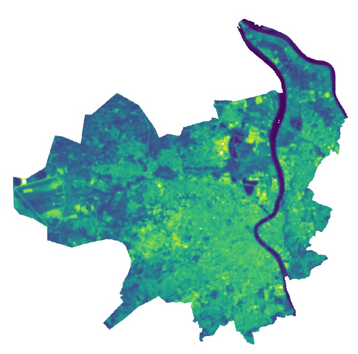
Ce jeu de données raster représente les températures de surface par un dégradé de couleurs figurant les zones froides/chaudes (du bleu au jaune). Chaque pixel représente un carré de 30 m de côté. Le cliché a été pris le 17 juin 2022 à 12h47 (heure locale). Les températures sont exprimées en degré Celsius. Cette carte donne une première idée de la localisation des Ilots de Chaleur et de Fraîcheur Urbains, mais ne les représente pas de façon précise, puisque la température de surface n’est pas obligatoirement la température de l’air. En zone dense, cette carte représente principalement la température des toits, des voiries et des sols. Dans tous les cas, l’impact des façades n’est pas visible.
-
Cette information mesure la densité de végétation dans un rayon de 300 m correspondant à la possibilité d’accéder au végétal en moins de 5 minutes de marche lente. Cette information rend compte de la capacité à rejoindre rapidement un îlot de verdure, un lieu de fraîcheur.
-
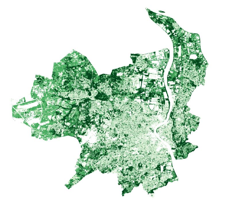
Nos travaux ont conduit à distinguer 11 niveaux de végétation comportant des structures végétales hautes (arbres, arbustes et haies). La canopée au sens strict ne comprend que les 8 premiers niveaux correspondant à une densité végétale et à des niveaux de la polarisation des ondes électromagnétiques correspondant à des structures hautes e densément feuillues
-
Nos travaux ont conduit à distinguer 11 niveaux de végétation comportant des structures végétales hautes (arbres, arbustes et haies).
-
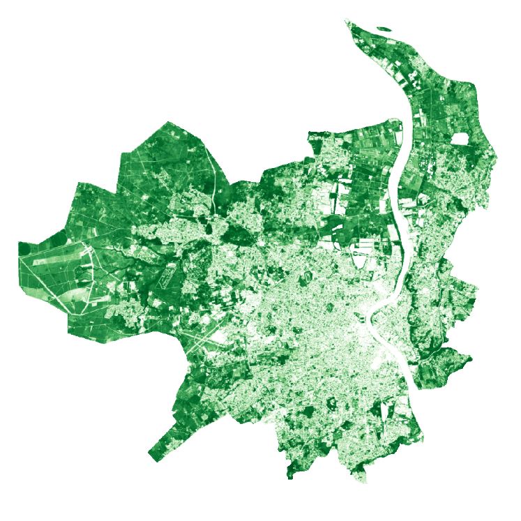
Cette information mesure le niveau de stress hydrique des espaces verts et de la canopée en juin 2021
-
Le produit DEBROUSSAILLEMENT présente le zonage informatif des Obligations Légales de Débroussaillement (OLD). C’est une carte qui permet aux particuliers de pouvoir localiser leur terrain et savoir s’ils sont soumis à la réglementation sur les obligations de débroussaillement. Ce zonage informatif ne précise pas les règles à appliquer pour débroussailler correctement (profondeur de débroussaillement depuis l’habitation, distance entre les arbres, hauteur d’élagage, etc.).
-
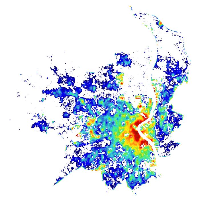
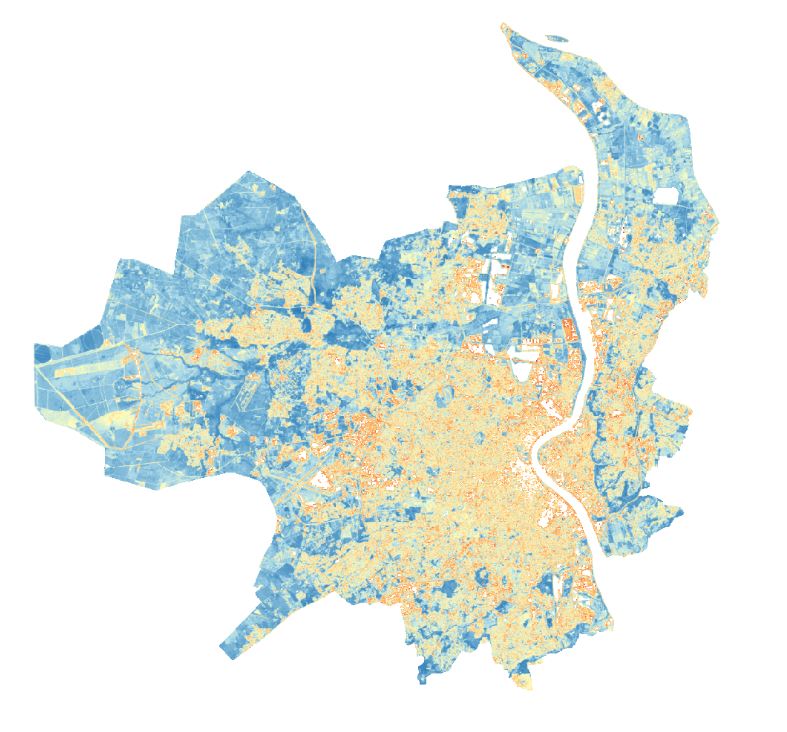
L’Indice de Confort Thermique Urbain traduit la sensibilité morphologique d’un lieu à l’inconfort thermique en tout point de la métropole, à une précision de 2m x 2m réalisée au cours de l'été 2021. Cette sensibilité morphologique est liée à : - La densité de bâti, favorise l'inconfort thermique - La présence du minéral au sol, favorise l'inconfort thermique - La qualité végétale : densité (de 11 strates végétales depuis le gazon jusqu'aux plus hautes strates de canopées) et stress hydrique, favorise le confort thermique - La qualité de la canopée : densité et stress hydrique favorise le confort thermique Cet indice varie de 3 (Confort) à 0 (Inconfort). 0 est bleu et 3 est rouge. Un espace inconfortable n’est pas forcément le plus chaud à tout instant de la journée et de la nuit, c’est un espace qui aura une température moyenne diurne et nocturne plus élevée que le reste des espaces urbains. Dans des objectifs de calculs statistiques et dynamiques de l'ICTU à différents échelons géographiques (IRIS, commune, pôle territorial), l'ICTU a été vectorisé et agrégé sur un maillage régulier du territoire de Bordeaux Métropole, représenté par des hexagonales de 250m (espacement horizontal et vertical).