 Catalogue PIGMA
IFREMER / GM-MARINE GEOSCIENCES
Type of resources
Available actions
Topics
Keywords
Contact for the resource
Provided by
Years
Formats
Representation types
Scale
Resolution
-
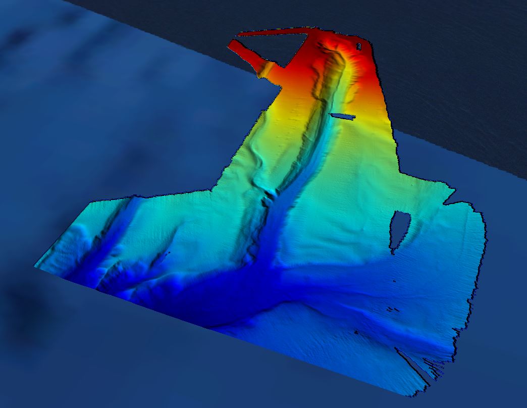
Grid processed for the purpose of the HR DTMs layer of EMODnet Bathymetry HRSM, October 2018
-
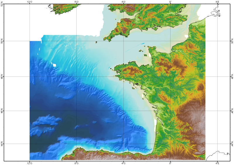
The Digital Terrain Model of the Bay of Biscaye and of the Channel is the result of the processing of a compilation of single and multibeam echosounder data, of DTMs and of chart countours produced before 2008 for hydrodynamic modeling..
-
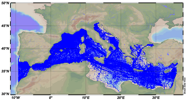
SDC_MED_DATA_TS_V2 SeaDataCloud Temperature and Salinity data collection for the Mediterranean Sea contains all open access temperature and salinity in situ data retrieved from SeaDataNet infrastructure at the end of July 2019. The data span between -9.25 and 37 degrees of longitude, thus including an Atlantic box and the Marmara Sea. It covers the time period 1900-2019. Data have been quality checked using ODV 5.3.2 software. Quality Flags of anomalous data have been revised using basic QC procedures. The dataset format is ODV binary collections. You can read, analyse and export from the ODV application provided by Alfred Wegener institute at http://odv.awi.de/. For data access please register at http://www.marine-id.org/.
-
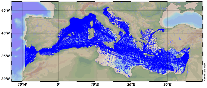
SDC_MED_DATA_TS_V1 SeaDataCloud Temperature and Salinity data collection for the Mediterranean Sea contains all open access temperature and salinity in situ data retrieved from SeaDataNet infrastructure at the end of October 2017. The data span between -9.25 and 37 degrees of longitude, thus including an Atlantic box and the Marmara Sea. It covers the time period 1900-2017. Data have been quality checked using ODV 5.0 software. Quality Flags of anomalous data have been revised using basic QC procedures. The dataset format is ODV binary collections. You can read, analyse and export from the ODV application provided by Alfred Wegener institute at http://odv.awi.de/. For data access please register at http://www.marine-id.org/.
-
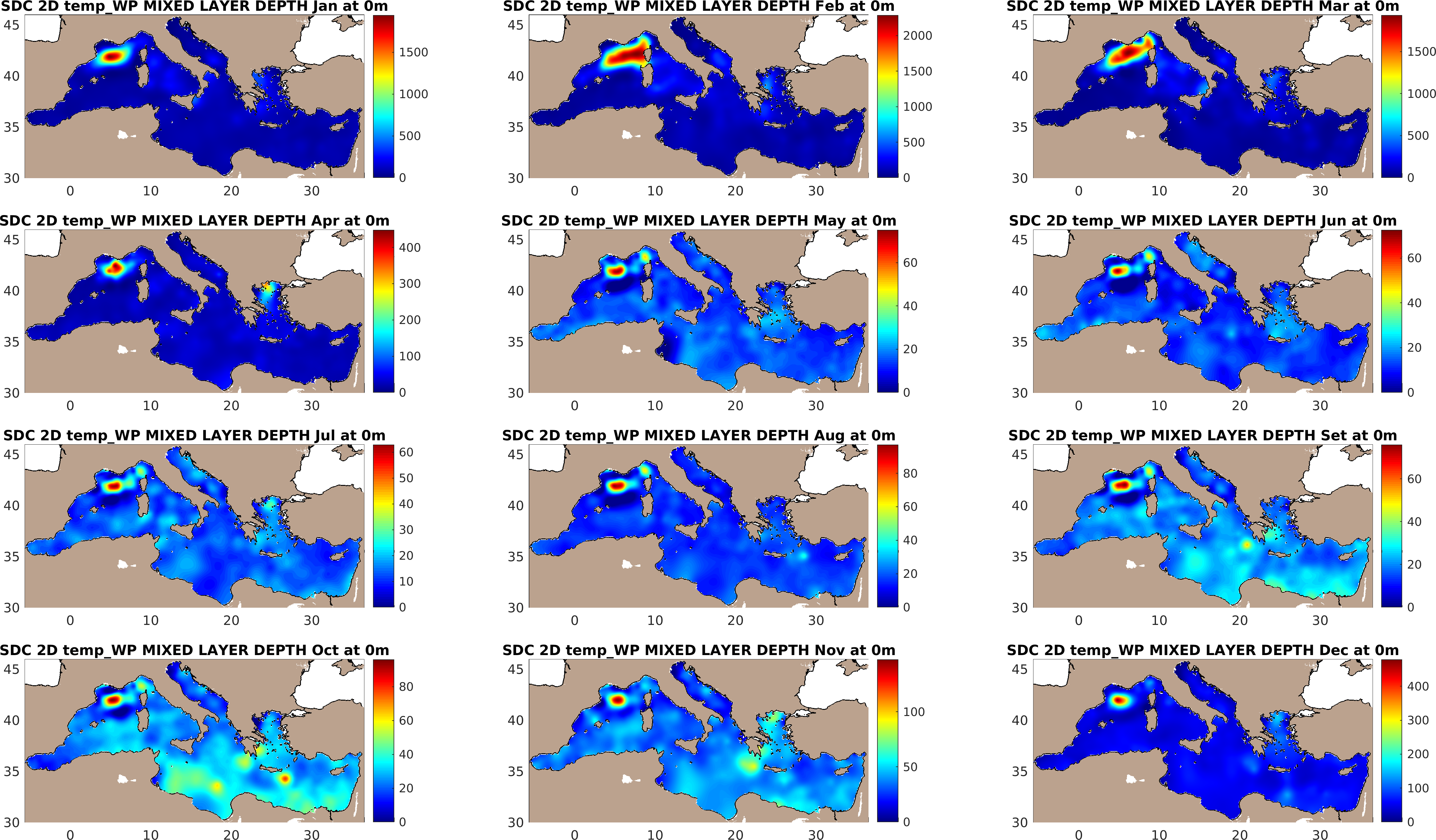
The SDC_MED_DP1 consists of Mixed Layer Depth (MLD) monthly climatology at 1/8 of degree for the Mediterranean Sea computed from an integrated dataset of collocated temperature and salinity profiles which combines data extracted from SeaDataNet infrastructure (SDC_MED_DATA_TS_V1, https://doi.org/10.12770/2698a37e-c78b-4f78-be0b-ec536c4cb4b3) and the Coriolis Ocean Dataset for Reanalysis (CORA), version 5.2 (https://archimer.ifremer.fr/doc/00595/70726/). The products comprehends three versions of MLD climatology over the 1955-2017 time period obtained computing the MLD from three different methods. A MLD climatology for the time span 1987-2017 computed with the fixed density criteria is also available. The analysis was done with the DIVAnd (Data-Interpolating Variational Analysis in n dimensions), version 2.6.1.
-
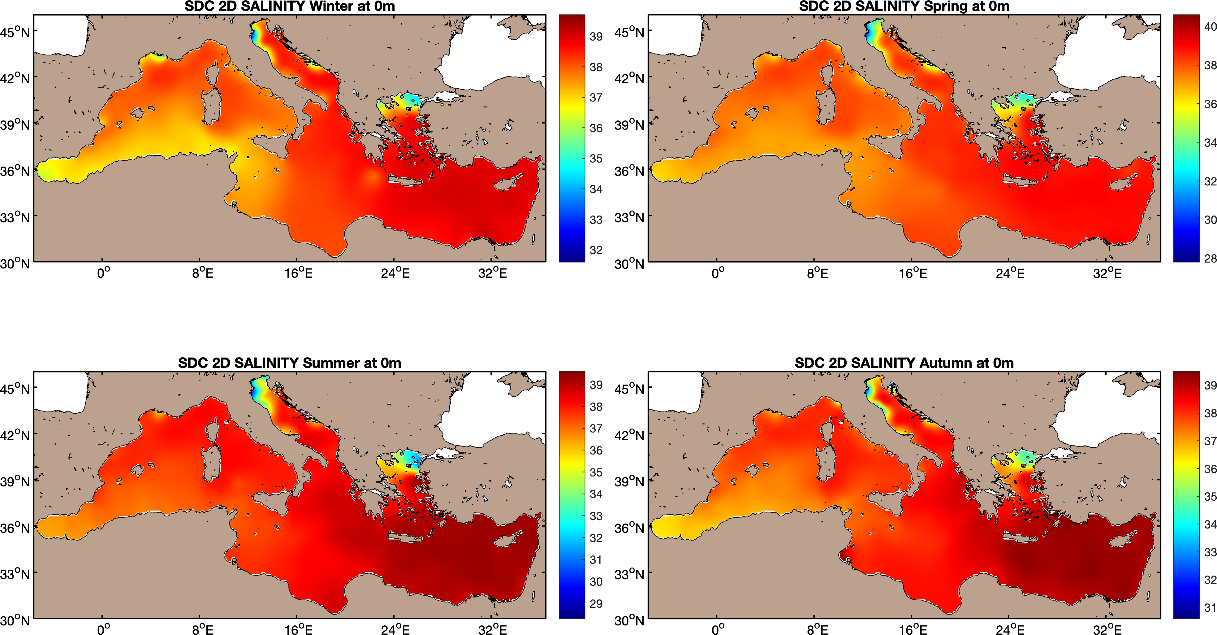
The SDC_MED_CLIM_TS_V2 product contains Temperature and Salinity Climatologies for Mediterranean Sea: monthly and seasonal fields for time periods 1955-2018, 1955-1984 and 1985-2018 and seasonal fields for 6 decades covering the time period 1955 to 2018. The climatic fields were computed from an integrated Mediterranean Sea data set that combines data extracted from SeaDataNet infrastructure (SDC_MED_DATA_TS_V2, https://doi.org/10.12770/2a2aa0c5-4054-4a62-a18b-3835b304fe64) and Coriolis Ocean Dataset for Reanalysis (CORA5.2) distributed by the Copernicus Marine Service (INSITU_GLO_TS_REP_OBSERVATIONS_013_001_b). The computation was done with the DIVAnd (Data-Interpolating Variational Analysis), version 2.4.0.
-

The SDC_MED_CLIM_TS_V1 product contains Temperature and Salinity Climatologies for Mediterranean Sea: monthly and seasonal fields for periods 1955-2017, 1955-1984 and 1985-2017 and seasonal fields for 6 decades covering the time period 1955 to 2017. The climatic fields were computed from an integrated Mediterranean Sea data set that combines data extracted from SeaDataNet infrastructure (https://doi.org/10.12770/2698a37e-c78b-4f78-be0b-ec536c4cb4b3) and Coriolis Ocean Dataset for Reanalysis (CORA5.2) distributed by the Copernicus Marine Service (http://marine.copernicus.eu/services-portfolio/access-to-products/?option=com_csw&view=details&product_id=INSITU_GLO_TS_REP_OBSERVATIONS_013_001_b). The computation was done with the DIVAnd (Data-Interpolating Variational Analysis in n dimensions), version 2.4.0.
-
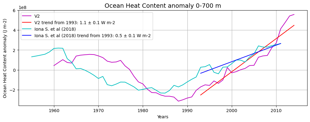
The SDC_MED_DP2 product contains 55 sliding decadal temperature fields (1955-1964, 1956-1965, 1957-1966, …, 2009-2018) at 1/8° horizontal resolution obtained in the 0-2000m layer and two derived OHC annual anomaly estimates for the 0-700m and the 0-2000m layers. Sliding decades of annual Temperature fields were obtained from an integrated Mediterranean Sea dataset covering the time period 1955-2018, which combines data extracted from SeaDataNet infrastructure at the end of July 2019 (SDC_MED_DATA_TS_V2, https://doi.org/10.12770/3f8eaace-9f9b-4b1b-a7a4-9c55270e205a) and the Coriolis Ocean Dataset for Reanalysis (CORA 5.2, accessed in July 2020, https://archimer.ifremer.fr/doc/00595/70726/). The resulting annual OHC anomaly time series span the 1960-2014 period. The analysis was performed with the DIVAnd (Data-Interpolating Variational Analysis in n dimensions), version 2.6.1.
-
This product displays the stations where hexachlorobenzene has been measured in biota and the values present in EMODnet Chemistry infrastructure are not compliant with EQSD, i.e for the substance, in that station, quality values found in EMODnet validated dataset can be equal to 6 or Q and values are above the 30% of the value established by EQSD for hexachlorobenzene in biota. It is necessary to take into account that LOD/LOQ can change with time. These products aggregate data by station, producing only one final value for each station. EMODnet Chemistry has included the gathering of contaminants data since the beginning of the project in 2009. For the maps for EMODnet Chemistry Phase III, it was requested to plot data per matrix (water,sediment, biota), per biological entity and per chemical substance. The series of relevant map products have been developed according to the criteria D8C1 of the MSFD Directive, specifically focusing on the requirements under the new Commission Decision 2017/848 (17th May 2017). The Commission Decision points to relevant threshold values that are specified in the WFD, as well as relating how these contaminants should be expressed (units and matrix etc.) through the related Directives i.e. Priority substances for Water. EU EQS Directive does not fix any threshold values in sediments. On the contrary Regional Sea Conventions provide some of them, and these values have been taken into account for the development of the visualization products. To produce the maps the following process has been followed: 1. Data collection through SeaDataNet standards (CDI+ODV) 2. Harvesting, harmonization, validation and P01 code decomposition of data 3. SQL query on data sets from point 2 4. Production of map with each point representing at least one record that match the criteria The harmonization of all the data has been the most challenging task considering the heterogeneity of the data sources, sampling protocols. Preliminary processing were necessary to harmonize all the data : • For water: contaminants in the dissolved phase; • For sediment: data on total sediment (regardless of size class) or size class < 2000 μm • For biota: contaminant data will focus on molluscs, on fish (only in the muscle), and on crustaceans • Exclusion of data values equal to 0
-
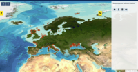
This product displays the stations present in EMODnet validated dataset where benzo[A]pyrene levels have been measured in sediment. EMODnet Chemistry has included the gathering of contaminants data since the beginning of the project in 2009. For the maps for EMODnet Chemistry Phase III, it was requested to plot data per matrix (water,sediment, biota), per biological entity and per chemical substance. The series of relevant map products have been developed according to the criteria D8C1 of the MSFD Directive, specifically focusing on the requirements under the new Commission Decision 2017/848 (17th May 2017). The Commission Decision points to relevant threshold values that are specified in the WFD, as well as relating how these contaminants should be expressed (units and matrix etc.) through the related Directives i.e. Priority substances for Water. EU EQS Directive does not fix any threshold values in sediments. On the contrary Regional Sea Conventions provide some of them, and these values have been taken into account for the development of the visualization products. To produce the maps the following process has been followed: 1. Data collection through SeaDataNet standards (CDI+ODV) 2. Harvesting, harmonization, validation and P01 code decomposition of data 3. SQL query on data sets from point 2 4. Production of map with each point representing at least one record that match the criteria The harmonization of all the data has been the most challenging task considering the heterogeneity of the data sources, sampling protocols. Preliminary processing were necessary to harmonize all the data : • For water: contaminants in the dissolved phase; • For sediment: data on total sediment (regardless of size class) or size class < 2000 μm • For biota: contaminant data will focus on molluscs, on fish (only in the muscle), and on crustaceans • Exclusion of data values equal to 0