 Catalogue PIGMA
Geoscientific information
Type of resources
Available actions
Topics
Keywords
Contact for the resource
Provided by
Years
Formats
Representation types
Update frequencies
status
Scale
Resolution
-
-
-

The "Magnetic Stations" product contains measurements from magnetic reference stations deployed by the French Hydrographic and Oceanographic Service (SHOM) near marine magnetic survey areas. Measurement files are available by station and by year. These magnetic reference measurements correct marine measurements for diurnal and high-frequency variations in the Earth's magnetic field.
-
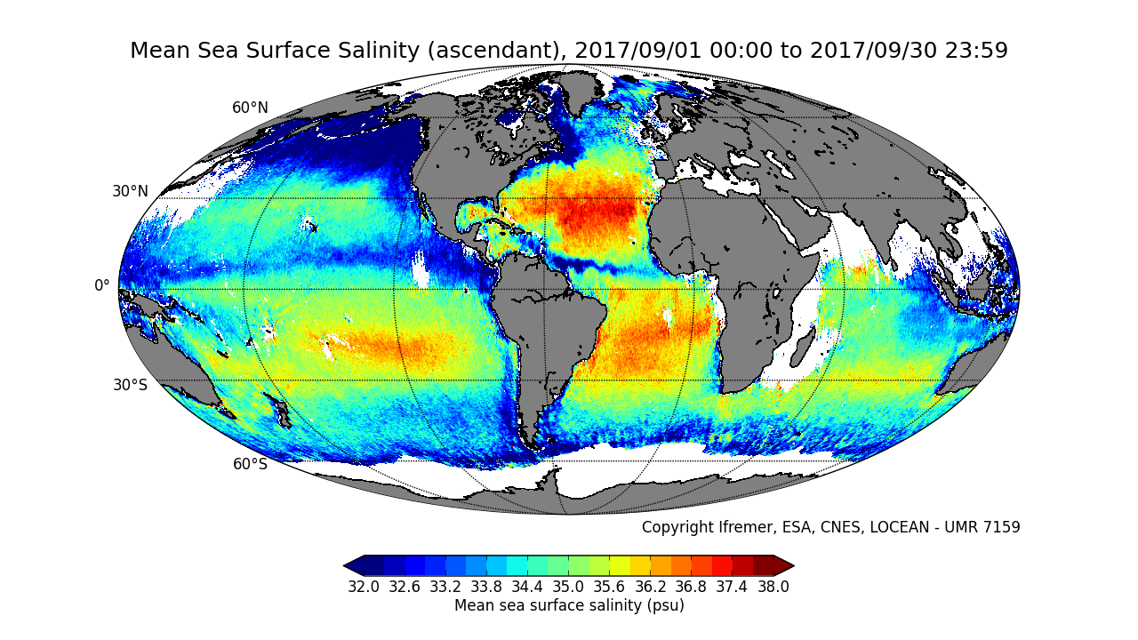
This product contains average 10 days & monthly salinity field based on L2P products, ascending and descending orbits being processed separately. ** This product is no longer available, see below **
-
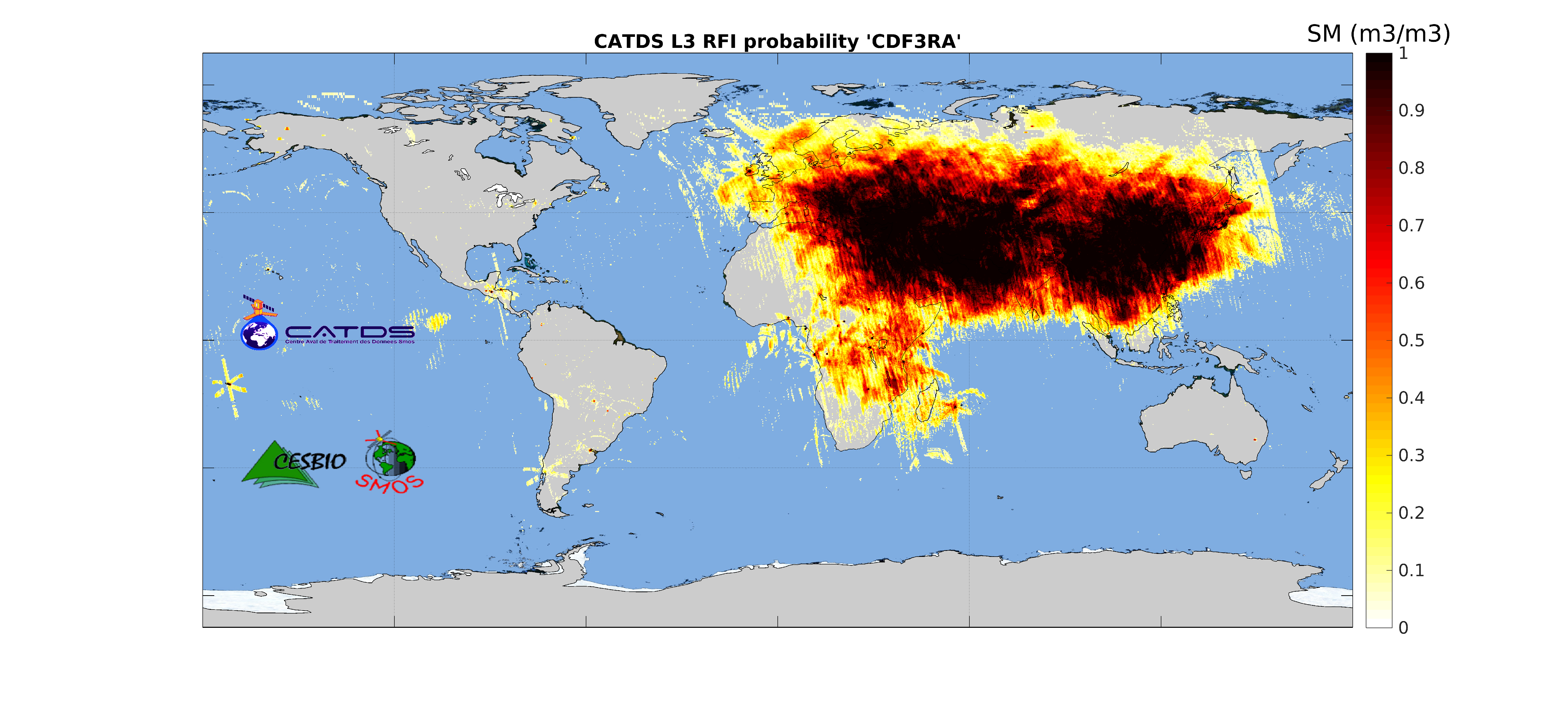
This product is radio frequency interference (RFI) probability for each angle bin computed daily and based on a monthly moving window average. Ascending and descending orbits are processed separately, and only in full polarization. ** This product is no longer available, see below **
-
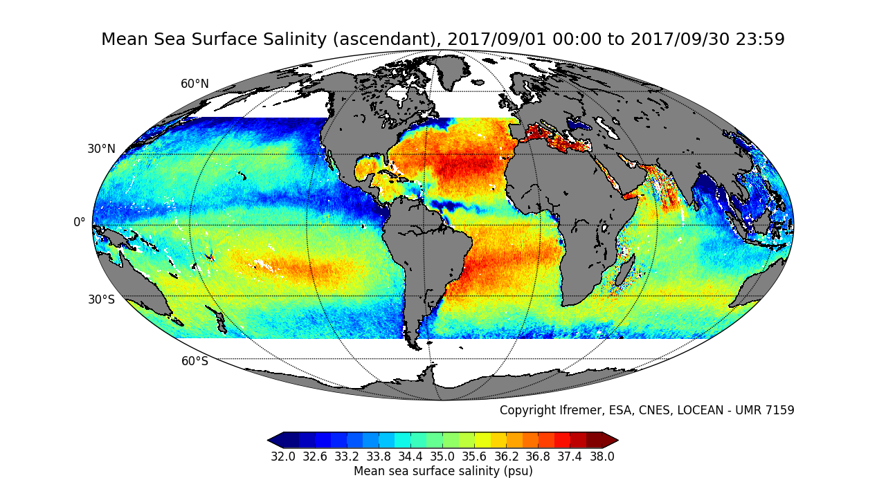
This product contains average 10 days & monthly salinity field corrected from land-sea contamination and latitudinal bias, based on L2Q products, ascending and descending orbits being processed separately. ** This product is no longer available, see below **
-
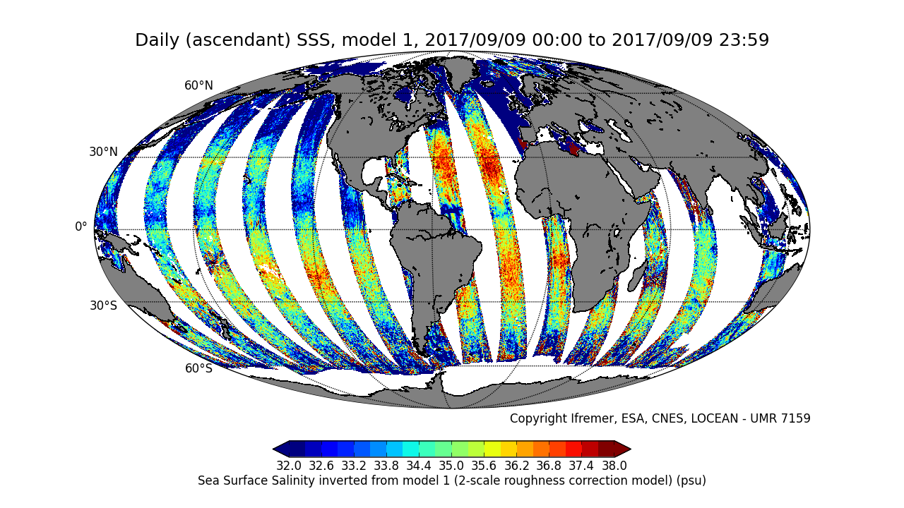
This product is an intermediate product, that provides, in daily files, SSS with qualification flags (associated confidence classes) which allow selecting valid data before averaging. Ascending and descending orbits are processed separately ** This product is no longer available, see below **
-
Position théorique du trait de côte (pied de dune) estimée en 2020, sans les ouvrages (sauf ouvrages majeurs du Verdon, de l'Adour et de l'Artha à St-Jean-de-Luz), uniquement sur la côte sableuse. (métadonnée en cours)
-
Coastal zones are presented as a series of 10 consecutive buffers of 1km width each (towards inland). For this dataset, were treated as sea data all areas with a class value of 523 (sea and ocean) in Corine Land Cover (details in lineage).
-
Coastal zones are presented as a series of 10 consecutive buffers of 1km width each (towards inland). For this dataset, were treated as sea data all areas with class values of 52x (521: coastal lagoons, 522: estuaries, 523: sea and ocean) in Corine Land Cover (details in lineage).