 Catalogue PIGMA
Fluorescence
Type of resources
Available actions
Topics
Keywords
Contact for the resource
Provided by
Years
Formats
Representation types
Update frequencies
status
Scale
Resolution
-
This In Situ delayed mode product integrates the best available version of in situ oxygen, chlorophyll / fluorescence and nutrients data. The latest version of Copernicus delayed-mode BGC (bio-geo-chemical) product is also distributed from Copernicus Marine catalogue.
-

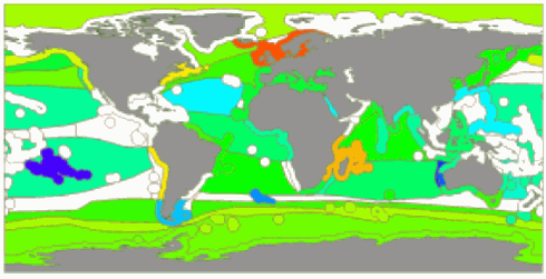
This dataset provides a global Look-Up Table (LUT) of physiological ratios for the real-time adjustment of chlorophyll-a fluorescence measured by biogeochemical Argo (BGC-Argo) profiling floats. The physiological ratios aim to account for the global variability in the relationship between fluorescence and chlorophyll-a concentration, as influenced by phytoplankton physiology. The LUT was developed using two different gap-filled observational Argo-based products (SOCA machine learning-based methodology ; Sauzède et al., 2016; Sauzède et al., 2024). The first product provides gap-filled chlorophyll-a data derived from fluorescence corrected for dark signal and non-photochemical quenching (NPQ) following Schmechtig et al. (2023), while the second product provides chlorophyll-a concentrations derived from light attenuation. The latter is based on the downward irradiance at 490 nm (ED490) derived from the SOCA-light method (Renosh et al., 2023). From this, the diffuse attenuation coefficient (KD490) is computed, which is subsequently used to estimate the chlorophyll-a concentration through the bio-optical relationships described by Morel et al. (2007). These two products, based on fluorescence and radiometry, enable the derivation of spatially varying correction factors, or physiological ratios. These ratios provide a validated grounded framework for adjusting real-time fluorescence observations from OneArgo floats into chlorophyll-a concentrations. The LUT is distributed in NetCDF format and is provided on a regular 1°×1° latitude–longitude grid covering the global ocean. Each grid cell contains the temporal mean, averaged over the water column (from the surface to 1.5 times the euphotic depth), of the physiological ratio. The file also includes metadata describing variable definitions, units, and other relevant information. Variables included: - physiological_ratio — fluorescence-to-radiometry-based chlorophyll correction factor (dimensionless) - physiological_ratio_sd — temporal standard deviation (over the twelve months) of the fluorescence-to-radiometry-based chlorophyll correction factor (dimensionless) - lat, lon — spatial coordinates (degrees north/east) - Global attributes — dataset description, reference citation, and contact information
-

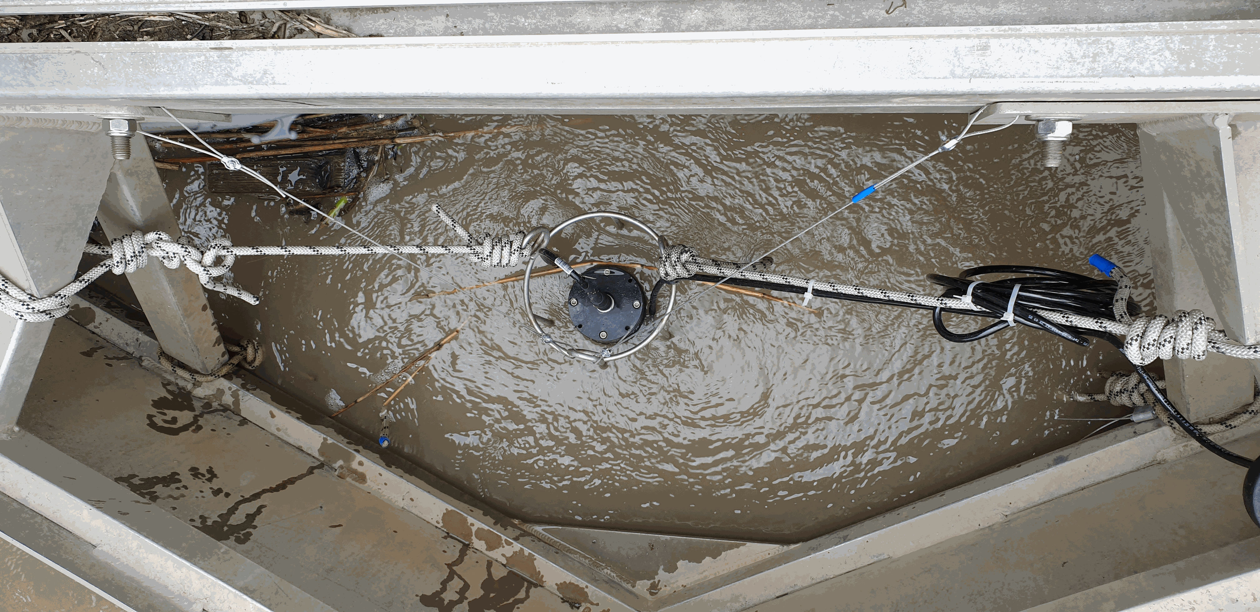
As part of the marine water quality monitoring of the “Pertuis” and the “baie de l’Aiguillon” (France), commissioned by the OFB and carried out by setec énergie environnement, three monitoring stations were installed. Two of them were set up at the mouths of the Charente and Seudre rivers on February 6 and 27, 2019, respectively, while a third was deployed in the Bay of Aiguillon on March 24, 2021. The dataset presented here concerns the station installed in the Charente estuary. Measurements are organized into .csv files, with one file per year. Data is collected using a SAMBAT multiparameter probe, which records the following parameters: - Temperature (-5 to 35 °C) - Conductivity (0 to 10 mS/cm) - Pressure (0 to 10 m) - Turbidity (0 to 300 NTU) - Dissolved Oxygen (0 to 20 mg/L & 0 to 200 %) - Fluorescence (0 to 50 µg/l) - PH (0/14)
-

As part of the marine water quality monitoring of the “Pertuis” and the “baie de l’Aiguillon” (France), commissioned by the OFB and carried out by setec énergie environnement, three monitoring stations were installed. Two of them were set up at the mouths of the Charente and Seudre rivers on February 6 and 27, 2019, respectively, while a third was deployed in the Bay of Aiguillon on March 24, 2021. The dataset presented here concerns the station installed in the Bay of Aiguillon. Measurements are organized into .csv files, with one file per year. Data is collected using a WiMO multiparameter probe, which records the following parameters: • Temperature (-2 to 35 °C) • Conductivity (0 to 100 mS/cm) • Pressure (0 to 30 m) • Turbidity (0 to 4000 NTU) • Dissolved Oxygen (0 to 23 mg/L & 0 to 250 %) • Fluorescence (0 to 500 ppb)
-
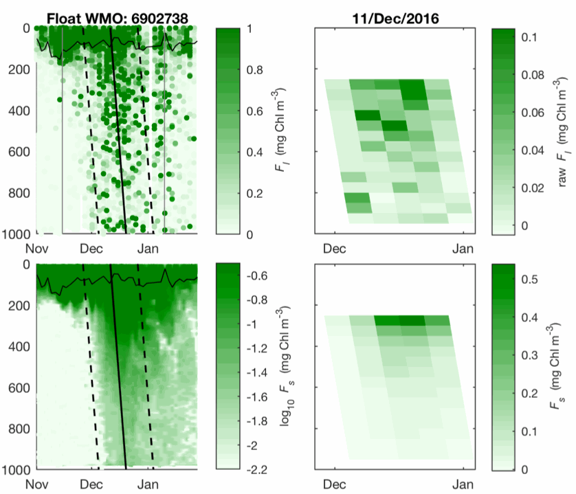
This dataset contains bin-averaged optical particle measurements from Biogeochemical Argo floats. Full description of data and methodology is contained in the manuscript submitted to Science entitled "Particle fragmentation exerts strong control on biological sequestration of CO2 by the oceans". Optical measurements are particulate backscattering and chlorophyll fluorescence, and each have been partitioned into large (>100 µm) and small (<100 µm) size classes for use in estimating the rate of fragmentation of large, sinking partiles. The data cover 34 high-latitude open-ocean mesopelagic sinking particle plumes in the supolar North Atlantic and the Southern Ocean observed at 1 m vertical resolution and 2-5 day temporal resolution by profiling floats over a 30-day period. Each 30-day period is divided into five temporal bins of six days each. Vertical binning is at 50-meter intervals from the 250-950 m.
-
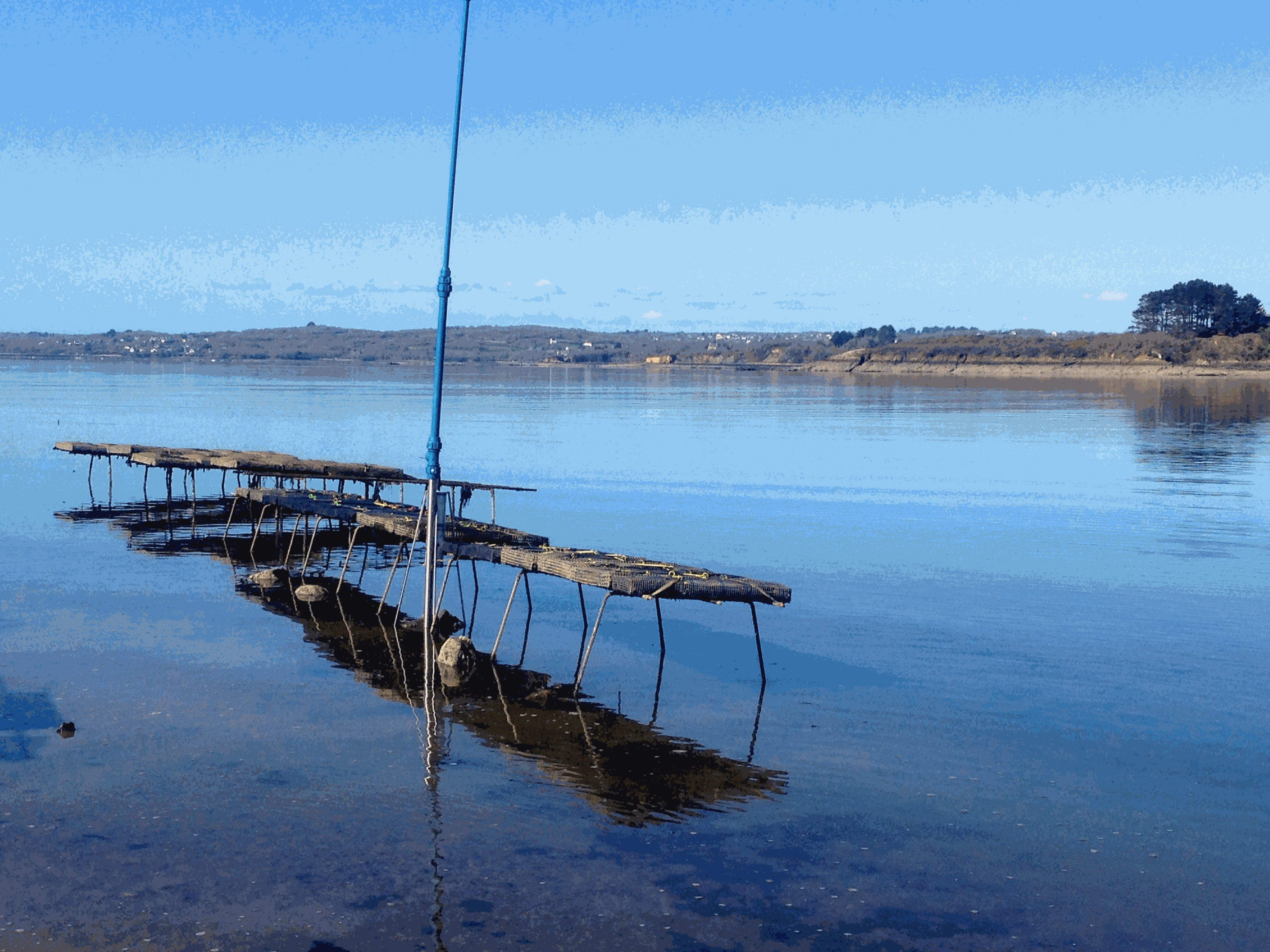
Based on the consolidation of the Ifremer networks RESCO (https://doi.org/10.17882/53007) and VELYGER (https://doi.org/10.17882/41888), the general objective of the ECOSCOPA project is to analyze the causes of spatio-temporal variability of the main life traits (Larval stage - Recruitment - Reproduction - Growth – Survival – Cytogenetic anomalies) of the Pacific oyster in France and follow their evolution over the long term in the context of climate change. The high frequency environmental data are monitored since 2010 at several stations next to oyster farm areas in eight bays of the French coast (from south to north): Thau Lagoon and bays of Arcachon, Marennes Oléron, Bourgneuf, Vilaine, Brest, Mont Saint-Michel and Veys (see map below). Sea temperature and practical salinity are recorded at 15-mins frequency. For several sites, fluorescence and turbidity data are also available. Data are acquired with automatic probes directly put in oyster bags or fixed on metallic structure at 50 cm over the sediment bottom, except for Thau Lagoon whose probes are deployed at 2m below sea surface. Since 2010, several types of probes were used: STP2, STPS, SMATCH or WiSens CTD from NKE (www.nke-instrumentation.fr) and recently ECO FLNTU (www.seabird.com). The probes are regularly qualified by calibrations in the Ifremer coastal laboratories. Precision estimated of the complete data collection process is: temperature (±0.1°C), salinity (±0.5psu), in vivo fluorescence (±10%), turbidity (±10%). The data are qualified into several levels: 0-No Quality Check performed, 1-Good data, 2-Probably good data, 3-Probably bad data, 4-Bad data, 5-Value changed, 7-Nominal value, 8-Interpolated value, 9-Missing value.
-
There are at least a dozen small hyper-turbid estuaries facing the Bay of Biscay, geographically situated between the two major estuaries of the Gironde and the Loire. MAGEST and SYVEL high-frequency multi-site monitoring revealed that the Loire, and to a lesser extent the Gironde, are subject to summer hypoxia. These observations raised the question of the potential occurrence of hypoxia in the small estuaries in between, motivating an investigation of dissolved oxygen in one of them, the Charente estuary. Oxygen and salinity sensors were placed at L'Houmée (2019), Tonnay-Charente (2018; 2019), Rochefort (2020; 2021; 2022), Martrou (2020) during summer, the most critical period for dissolved oxygen; a multiparameter probe was placed at Tonnay-Charente from April to November 2020. Longitudinal investigations along the estuary axis were also carried out during the summers of 2018 and 2019. All the measurements were acquired at 0.5 ± 0.2 meters below the surface. The dataset enabled us to identify the occurrence of summer hypoxia and an oxygen depletion zone in the Charente estuary. These results resulted in the implementation of high-frequency monitoring at Tonnay-Charente, operational since November 2020.
-
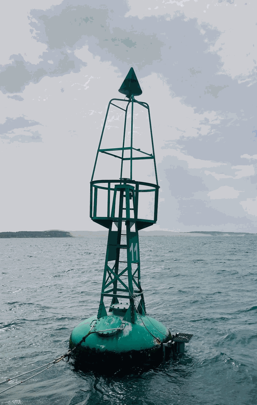
The COAST-HF/Arcachon-Ferret time series characterizes the hydrology of the interface between the Arcachon lagoon, located in the South-Western France, and the Atlantic Ocean. A buoy belonging to Phares et Balises is instrumented with a multi-parametric probe that records sub-surface temperature, conductivity, depth, turbidity and fluorescence every 10 minutes since February 2018. It is opérated by the OASU and EPOC teams (Univ. Bordeaux/CNRS). COAST-HF (Coastal OceAn observing SysTem - High Frequency; www.coast-hf.fr) is a national observation network accredited by the CNRS as a national Earth Science Observatory (Service National d’Observation: SNO). It aims to federate and coordinate a set of 14 fixed platforms instrumented with high-frequency in situ measurements for key parameters of coastal waters. The COAST-HF/Arcachon-Ferret buoy is one of them. COAST-HF is part of the French Research Infrastructure dedicated to coastal ocean observations (RI ILICO, https://www.ir-ilico.fr). Data are transmitted to the Coriolis Côtier database (https://data.coriolis-cotier.org/). Data are raw data.
-
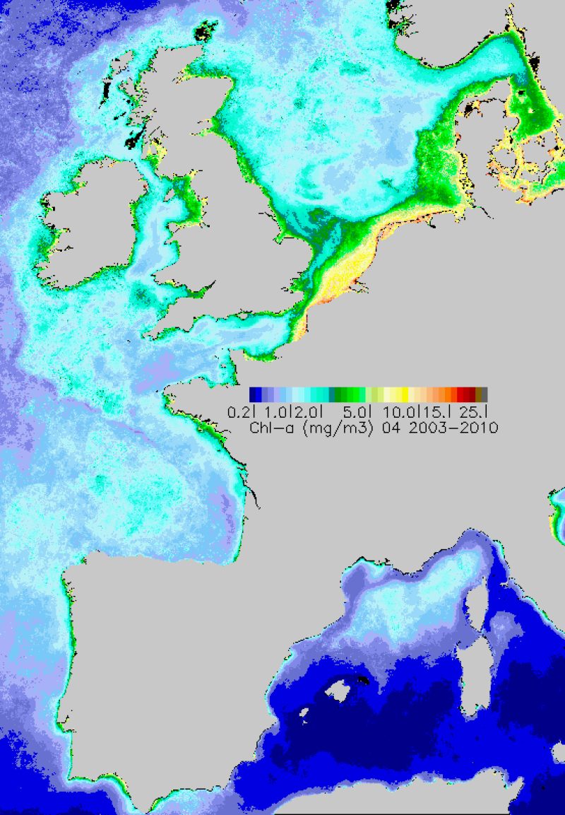
Percentile 90 calculé sur la période productive au sens DCE (mars-octobre) 2003-2009, à partir des Chl-a MODIS traitées par l'algorithme Ifremer OC5.
-
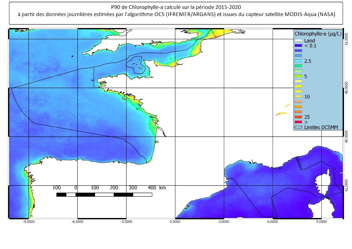
Percentile 90 calculé sur la période productive au sens DCE (mars-octobre) 2015-2020, à partir des Chl-a MODIS traitées par l'algorithme OC5 IFREMER/ARGANS (Gohin et al 2002, Gohin 2011).