 Catalogue PIGMA
Networks
Type of resources
Available actions
Topics
Keywords
Contact for the resource
Provided by
Years
Formats
Representation types
Update frequencies
status
Scale
-
The European Tracking Network (ETN) aims at bringing together marine researchers based in Europe that use aquatic biotelemetry as a tool. The main goals of the network are the promotion of transboundary cooperation, the establishment of a pan-European aquatic telemetry infrastructure network, improved data sharing through a central data portal and enhanced funding opportunities. ETN is co-coordinated by IMAR/University of the Azores and the Canadian Ocean Tracking Network (OTN) initiative. ETN is a partner node of OTN. The central data platform is hosted by the Flanders Marine Institute (VLIZ) and provides three key services to the users. 1) Data and metadata are stored centrally at a PostgreSQL database. To facilitate the data entry and data management for the users, a web application was developed in PHP using Symfony framework. 2) A data explorer is available to visualize the data. Datasets can be filtered based on area, species or time frame. In addition, detection data can be linked to other data types ( (e.g. moon index and tides) and several plot options are available. 3) In the R-studio environment, more detailed analyses can be performed.
-
GOSUD aims at assembling in-situ observations of the world ocean surface collected by a variety of ships and at distributing quality controlled datasets. At present time the variables considered by GOSUD are temperature and salinity. The GOSUD data are mostly collected using thermosalinographs (TSG) installed on research vessels, on commercial ships and in some cases on sailing exploration ships. GOSUD manages both near-real time (RT and NRT) data and delayed mode (DM-reprocessed) data. The GOSUD GDAC is hosted by the Coriolis data centre (France) and a back-up (permanent archived) is performed on a daily basis by NCEIS (NOAA's National Centers for Environmental Information).
-
.jpg)
The Sir Alister Hardy Foundation for Ocean Science (SAHFOS) is an international charity that operates the Continuous Plankton Recorder (CPR) Survey. The dataset covers the North Atlantic and the North Sea on since 1958.
-
The EuroMapApp task of the AtlantOS project aims to integrate Europe’s existing and future bathymetric data sets from the Atlantic Ocean into a seamless whole and put these results into a widely accessible format allowing immediate visualization of the seafloor for the specialist and non-specialist user alike. The partner institutions are GEOMAR, Ifremer, NIOZ, and NERC-BODC.
-
The Global Sea Level Observing System (GLOSS) was established by the Intergovernmental Oceanographic Commission (IOC) of UNESCO in 1985 to establish a well-designed, high-quality in situ sea level observing network to support a broad research and operational user base. Various tide gauge networks have contributed to GLOSS, each with a different focus and each changing over time as research priorities evolve. The main component is the GLOSS Core Network (GCN), a global set of ~300 tide gauges that serves as the backbone of the global in situ sea level network. GCN gauges were allocated to each island or group of islands at intervals not closer than 500 km, and along continental coasts at intervals generally not less than 1000 km. Preference was given to islands in order to maximise exposure to the open ocean. Established in 1933, the Permanent Service for Mean Sea Level (PSMSL) is responsible for the collection, publication, analysis and interpretation of sea level data from the global network of tide gauges, including the GLOSS Core Network.
-
VOS/SOOP tracks are usually repeated several times a year and inform about the marine sinks and sources of atmospheric carbon dioxide on a global bases and their variability. Data from this network has been made available to the scientific community and interested public via the Carbon Dioxide Information Analysis Centre (CDIAC) Oceans at the Department of Energy, USA, since the early 1990’s where PIs submitted and shared their data. In 2017, CDIAC Ocean will be named Ocean Carbon Data System (OCADS) and join NOAA’s National Centers for Environmental Information (NCEI). In 2007, the marine biogeochemistry community coordinated by the International Ocean Carbon Coordination Project (IOCCP), launched the Surface Ocean Carbon Dioxide ATlas (SOCAT) in order to uniformly quality control and format the data with detailed documentation. Underway carbon dioxide data from the VOS network are integrated in SOCAT.
-
ICES hosts data collected from both net trawl surveys (primarily bottom trawling), and from echo sounding (acoustic sampling in the pelagic zone). The net trawls are primarily hosted in the DATRAS data portal, and the acoustics in the acoustic trawl surveys portal. DATRAS (the Database of Trawl Surveys) stores data collected primarily from bottom trawl fish surveys coordinated by ICES expert groups. The survey data are covering the Baltic Sea, Skagerrak, Kattegat, North Sea, English Channel, Celtic Sea, Irish Sea, Bay of Biscay and the eastern Atlantic from the Shetlands to Gibraltar. At present, there are more than 45 years of continuous time series data in DATRAS, and survey data are continuously updated by national institutions. The acoustic database hosts information on fisheries observations collected from various pelagic surveys coordinated by ICES and falls into two categories: acoustic data, derived from readings taken on vessels, and those obtained through trawls in the open ocean – pelagic – zone. Combined, this provides key biological data on fish stocks such as herring, mackerel and blue whiting as well as krill and other prey species. The data from both systems are used for stock assessments and fish community studies by the ICES community and form the basis of management advice to the relevant regulatory bodies.
-
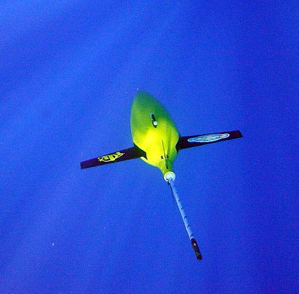
The Drifting Buoys GDAC -Global Data Assembly Centre- is the repository of surface drifters data. Both NRT -Near Real Time- and DM -Delayed Mode- data are available on the GDAC. Drifters report generally trajectories, sea-surface temperatures, atmospheric pressures at sea-level, as well as sea-surface salinity or sub-surface temperature in the ocean top layer.
-
The Everyone's Gliding Observatories (EGO) initiative is a gathering of several teams of oceanographers, interested in developing the use of gliders for ocean observations. EGO started in Europe with members from France, Germany, Italy, Norway, Spain, and the United Kingdom. The partners of EGO have been funded by both European and national agencies to operate gliders for various purposes and at different sites. Coordinated actions are being set up for these sites in order to demonstrate the capabilities of a fleet of gliders for sampling the ocean, with a given scientific and/or operational objective. Gliders were developed since the 90’s to carry out in-situ observations of the upper 1km of the ocean, filling the gaps left by the existing observing systems. Gliders look like small autonomous robotic underwater vehicles which that uses an engine to change their buoyancy. While gliding from surface to about 1000 meters, gliders provide real-time physical and biogeochemical data along their transit. They observe temperature, salinity, pressure, biogeochemical data or acoustic data.
-
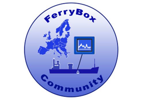
Data from FerryBoxes on ships of opportunity going on permanent routes are stored inside this database (ferrydata.hzg.de). Parameters are temperature, salinity, chlorophyll-a fluorescence, oxygen and different others. The data model is transect oriented. A data portal to access and visualise the data is also provided.