 Catalogue PIGMA
GDB
Type of resources
Available actions
Topics
Keywords
Contact for the resource
Provided by
Years
Formats
Representation types
Update frequencies
status
Scale
Resolution
-
This data set corresponds to the global offshore wind farm boundaries with the following attributes for each project: + WindfarmId (ID of the windfarm) + Name (Name of the windfarm) + Country (Country code) + Status (Status code) + WindfarmStatus (Windfarm Status or Project Status) + StatusComments (Comments on the Windfarm Status or Project Status) + CapacityMWMin (Capacity of the windfarm - Min) + CapacityMWMax (Capacity of the windfarm - Max) + NoTurbinesMin (Number of turbines - Min) + NoTurbinesMax (Number of turbines - Max) + Comments (Comments) + TurbineMWMin (Capacity of the turbine (set-up in the windfarm) - Min) + TurbineMWMax (Capacity of the turbine (set-up in the windfarm) - Max) + OtherNames (Other name of the windfarm) + CountryName (Country where the windfarm is set) + Lat (Geographic coordinate - centre latitude) + Lon (Geographic coordinate - centre longitude) + IsEstimatedLocation (This is where we know that a project exists but we don't know its exact location.) + IsOnHold + Developers (Developer(s) of the windfarm) + Owners (Owner of the windfarm) + Operators (Operator of the windfarm) + OffshoreConstructionStarts The frequency of the database release is monthly. This data set corresponds to the release of January 2020. This data set is strictly for internal EEA use as is subjected to a commercial license. Given the limited user subscriptions available, interested users should contact the SDI Team (sdi@eea.europa.eu) to be granted access to the data set.
-
This metadata corresponds to the EUNIS Littoral biogenic habitat types (salt marshes), distribution based on vegetation plot data dataset. Littoral biogenic habitats (commonly known as salt marshes) are formed by animals such as worms and mussels or plants. The verified saltmarsh habitat samples used are derived from the Braun-Blanquet database (http://www.sci.muni.cz/botany/vegsci/braun_blanquet.php?lang=en) which is a centralised database of vegetation plots and comprises copies of national and regional databases using a unified taxonomic reference database. The geographic extent of the distribution data are all European countries except Armenia and Azerbaijan. The dataset is provided both in Geodatabase and Geopackage formats.
-
This metadata corresponds to the EUNIS Coastal habitat types, predicted distribution of habitat suitability dataset. Coastal habitats are those above spring high tide limit (or above mean water level in non-tidal waters) occupying coastal features and characterised by their proximity to the sea, including coastal dunes and wooded coastal dunes, beaches and cliffs. Includes free-draining supralittoral habitats adjacent to marine habitats which are normally only very rarely subject to any type of salt water, in as much as they may be inhabited predominantly by terrestrial species, strandlines characterised by terrestrial invertebrates and moist and wet coastal dune slacks and dune-slack pools. Supralittoral sands and wracks may be found also in marine habitats (M). Excludes supralittoral rock pools and habitats, the splash zone immediately above the the mean water line, as well the spray zone and zone subject to sporadic inundation with salt water in as much as it may be inhabited predominantly by marine species, which are included in marine (M). The modelled suitability for EUNIS coastal habitat types is an indication of where conditions are favourable for the habitat type based on sample plot data (Braun-Blanquet database) and the Maxent software package. The modelled suitability map may be used as a proxy for the geographical distribution of the habitat type. Note however that it is not representing the actual distribution of the habitat type. As predictors for the suitability modelling not only climate and soil parameters have been taken into account, but also so-called RS-EVB's, Remote Sensing-enabled Essential Biodiversity Variables, like land use, vegetation height, phenology, and LAI (Leaf Area Index). Because the EBV's are restricted by the extent of the remote sensing data (EEA38 countries and the United Kingdom) the modelling result does also not go beyond this boundary. The dataset is provided both in Geodatabase and Geopackage formats.
-
This metadata corresponds to the EUNIS Coastal habitat types, distribution based on vegetation plot data dataset. Coastal habitats are those above spring high tide limit (or above mean water level in non-tidal waters) occupying coastal features and characterised by their proximity to the sea, including coastal dunes and wooded coastal dunes, beaches and cliffs. Includes free-draining supralittoral habitats adjacent to marine habitats which are normally only very rarely subject to any type of salt water, in as much as they may be inhabited predominantly by terrestrial species, strandlines characterised by terrestrial invertebrates and moist and wet coastal dune slacks and dune-slack pools. Supralittoral sands and wracks may be found also in marine habitats (M). Excludes supralittoral rock pools and habitats, the splash zone immediately above the the mean water line, as well the spray zone and zone subject to sporadic inundation with salt water in as much as it may be inhabited predominantly by marine species, which are included in marine (M). The verified coastal habitat samples used are derived from the Braun-Blanquet database (http://www.sci.muni.cz/botany/vegsci/braun_blanquet.php?lang=en) which is a centralised database of vegetation plots and comprises copies of national and regional databases using a unified taxonomic reference database. The geographic extent of the distribution data are all European countries except Armenia and Azerbaijan. The dataset is provided both in Geodatabase and Geopackage formats.
-
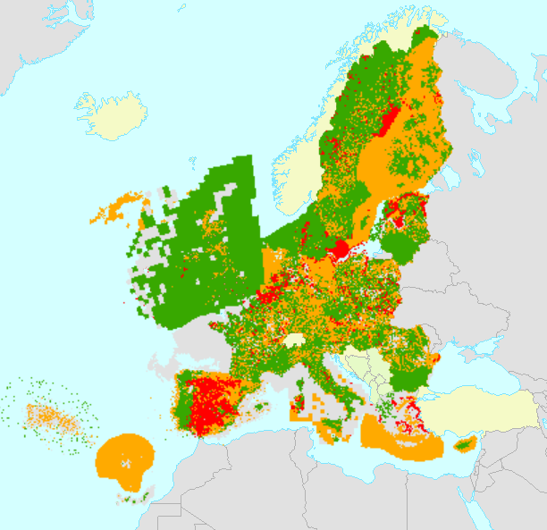
All Member States are requested by the Habitats Directive (92/43/EEC) to monitor habitat types and species listed in its annexes and send a report every 6 years following an agreed format. The assessment of conservation status is based on information about the status and trends of species populations and of habitats at the level of the biogeographical or marine region. The spatial dataset contains habitat and species distribution data (10km grid cells) as reported by EU 27 (2007-2013) Member States for the 2007-2012 period. This metadata refers to the public dataset, without sensitive species. The data sets are divided in two sets for species and two sets for habitat types. Habitats: Art17_habitats_distribution_2007_2012_EU (distribution by European Union aggregate) Art17_habitats_distribution_2007_2012_MS (distribution by Member State) Species: Art17_species_distribution_2007_2012_EU (distribution by European Union aggregate) Art17_species_distribution_2007_2012_MS (distribution by Member State) Furthermore, a series of tables are also provided with the assessments of conservation status of species and habitats at Member State biogeographical level (done by Member States) and at EU biogeographical level (done by the ETC/BD and the EEA). Both MS datasets are aggregated by habitat/species code, country and biogeographical /marine region [COMSRE]. Using this attribute [COMSRE] the tabular conservation status, which is available in the table, per biogeographical/marine region of the Member State level (MS) can be joined directly to the spatial dataset. Both EU datasets are aggregated by habitat/species code and biogeographical /marine region [CORE]. Using this attribute [CORE] the tabular conservation status, which is available in the table, of the biogeographical/marine region of the EU-27 (2007-2013) level (EU) can be directly joined to the spatial dataset. NOTE: The original datasets have been reviewed and re-published in February 2021, including delayed deliveries from Greece.
-
This metadata corresponds to the EUNIS Littoral biogenic habitat (salt marshes) types, predicted distribution of habitat suitability dataset. Littoral habitats are those formed by animals such as worms and mussels or plants (salt marshes). The verified littoral biogenic habitat samples used are derived from the Braun-Blanquet database (http://www.sci.muni.cz/botany/vegsci/braun_blanquet.php?lang=en) which is a centralised database of vegetation plots and comprises copies of national and regional databases using a unified taxonomic reference database. The geographic extent of the distribution data are all European countries except Armenia and Azerbaijan. The modelled suitability for EUNIS saltmarsh habitat types is an indication of where conditions are favourable for the habitat type based on sample plot data (Braun-Blanquet database) and the Maxent software package. The modelled suitability map may be used as a proxy for the geographical distribution of the habitat type. However, note that it is not representing the actual distribution of the habitat type. As predictors for the suitabilty modelling not only Climate and Soil parameters have been taken into account, but also so-called RS-EVB's, Remote Sensing-enabled Essential Biodiversity Variables like Landuse, Vegetation height, Phenology, LAI(Leave Area Index) and Population density. Because the EBV's are restricted by the extent of the Remote Sensing data (EEA38 countries and the United Kingdom) the modelling result does also not go beyond this boundary. The dataset is provided both in Geodatabase and Geopackage formats. The Training map files show the modelled suitable distribution, omitting the 10% of occurrence records in the least suitable environment under the assumption that they are not representative of the overall suitable habitat distribution. The 10 percentile training presence is an arbitrary threshold which omits all regions with habitat suitability lower than the suitability values for the lowest 10% of occurrence records.
-

UWWTD Discharge Points, Jan. 2022 is one of the datasets produced within the frame of the reporting under 11th UWWTD Art.15 reporting period (UWWTD data call 2019). The Urban Waste Water Treatment Directive (UWWTD) (91/271/EEC) obliges Member States to report data on the implementation of the Directive upon request from the European Commission bi-annually. Reported data include receiving areas as designated under UWWTD, agglomerations, urban waste water treatment plants serving the agglomerations and points of discharges. Dataset UWWTD_DischargePoints contains information on individual points of discharge from urban waste water treatment plants or collecting systems, including their coordinates of discharge, link to specific treatment plant, type of receiving area into which the effluent / wastewater is discharged, related waterbody (or river basin), information on the discharge on land and potential reuse of the treated waste water. This dataset includes the reported discharge points which are displayed on the UWWTD maps (https://www.eea.europa.eu/themes/water/european-waters/water-use-and-environmental-pressures/uwwtd/interactive-maps/urban-waste-water-treatment-maps-3). The active discharge points with correct coordinates in the reported data were selected from the source European UWWTD tabular dataset, which is available on the download link https://www.eea.europa.eu/data-and-maps/data/waterbase-uwwtd-urban-waste-water-treatment-directive-7. The definition of the UWWTD Discharge Points dataset attributes (fields) is available on the link https://dd.eionet.europa.eu/datasets/latest/UWWTDArt15/tables/DischargePoints The full (internal) dataset including inactive discharge points is available under "Urban Waste Water Treatment Directive, Discharge points reported under UWWTD data call 2019 - INTERNAL VERSION, Jan. 2022". In comparison to the previous version (Nov. 2020), late redeliveries and corrections provided by several countries during 2021 are included in current revision. Next, the dataset is provided in GeoPackage and ESRI File geodatabase formats instead of shapefile used up to now, to avoid truncation of attribute names.
-
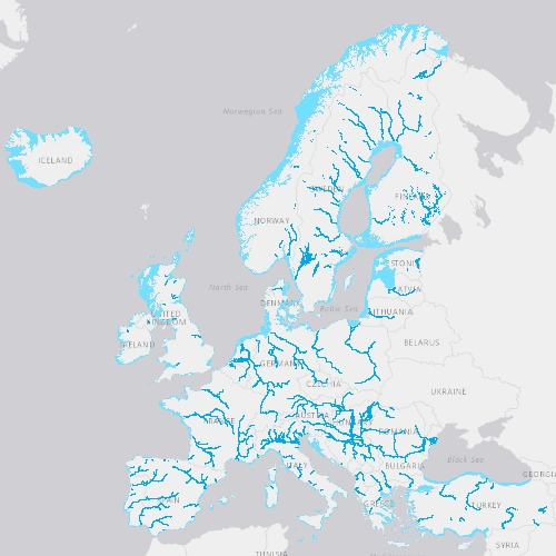
EU-Hydro is a dataset for all EEA38 countries and the United Kingdom providing photo-interpreted river network, consistent of surface interpretation of water bodies (lakes and wide rivers), and a drainage model (also called Drainage Network), derived from EU-DEM, with catchments and drainage lines and nodes. The EU-Hydro dataset is distributed in separate files (river network and drainage network) for each of the 35 major basins of the EEA38 + UK area, in GDB and GPKG formats. The production of EU-Hydro and the derived layers was coordinated by the European Environment Agency in the frame of the EU Copernicus programme.
-
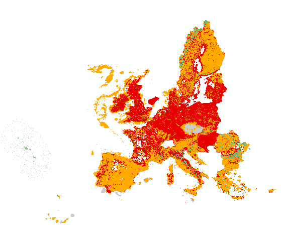
All Member States are requested by the Habitats Directive (92/43/EEC) to monitor habitat types and species listed in its annexes and send a report every 6 years following an agreed format. The assessment of conservation status is based on information about the status and trends of species populations and of habitats at the level of the biogeographical or marine region. The spatial dataset contains habitat and species distribution data (10km grid cells) as reported by Member States for the 2013-2018 period. This metadata refers to the public dataset, without sensitive species. The data sets are divided in two sets for species and two sets for habitat types. Species: ART17 species distribution MS (by Member State) ART17 species distribution EU (European Union aggregate) Habitats: ART17 habitats distribution MS (by Member State) ART17 habitats distribution EU (European Union aggregate) Both MS datasets are aggregated by habitat/species code, country and biogeographical /marine region [CO_MS_RE]. Using this attribute [CO_MS_RE] the tabular conservation status, which is available in the table, per biogeographical/marine region of the Member State level (MS) can be joined directly to the spatial dataset. Both EU datasets are aggregated by habitat/species code and biogeographical /marine region [CO_RE]. Using this attribute [CO_RE] the tabular conservation status, which is available in the table, of the biogeographical/marine region of the EU-28 level (EU) can be directly joined to the spatial dataset. Further description of the Article 17 tabular and spatial dataset and a Article 17 web tool can be accessed with the download data.