 Catalogue PIGMA
Format
xyz
Type of resources
Topics
Keywords
Contact for the resource
Provided by
Years
Formats
Representation types
Update frequencies
status
Scale
Resolution
From
1
-
2
/
2
-
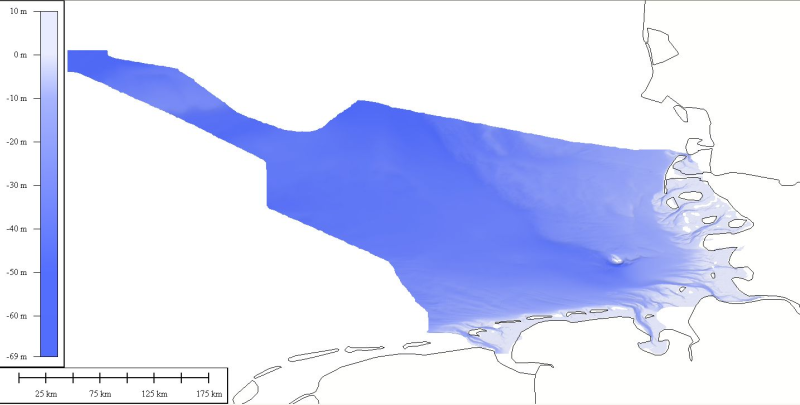
DTM data source was received from the data center (Bathymetrisches Datenzentrum) of the German Hydrographic Office (Bundesamt für Seeschifffahrt und Hydrographie) at a variable resolution. The data was then processed by ATLIS b.v. using the ATLIS SENS software suite and compiled into an EMODnet regional DTM. Although the resolution varied throughout the dataset, no interpolation was required to create a geographic grid of 0.0041667 degrees resolution.
-