 Catalogue PIGMA
Elevation
Type of resources
Available actions
Topics
Keywords
Contact for the resource
Provided by
Years
Formats
Representation types
Update frequencies
status
Scale
Resolution
-

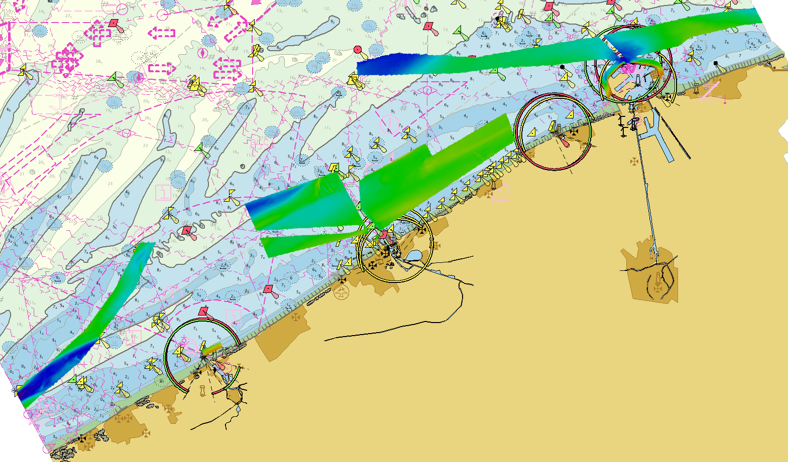
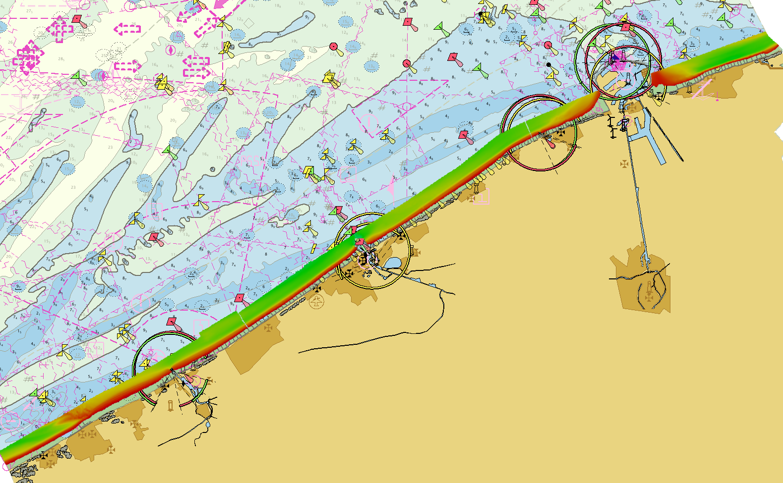
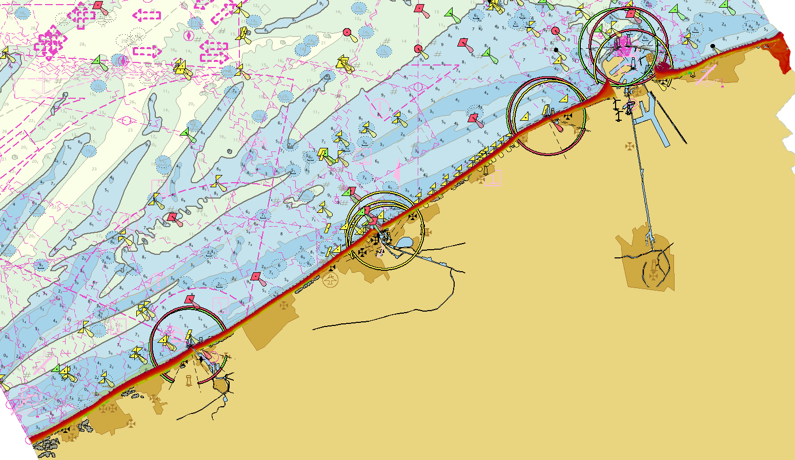
Litto3D provides 3D, continuous sea-land description of French coastal areas. Data is acquired by airborne topo-bathymetric LiDARs. Litto3D products come in 3D point clouds and digital terrain models formats. The product "Litto3D - Nouvelle-Aquitaine 2020-2022" covers the geographical area from the Charente-Maritime to the Spanish border. For the maritime part, the data produced by Shom extend offshore down to signal extinction, approximatively 20 depth when environmental conditions are optimal. On land, the data are truncated at a limit that ensures the product retain its coastal character.
-
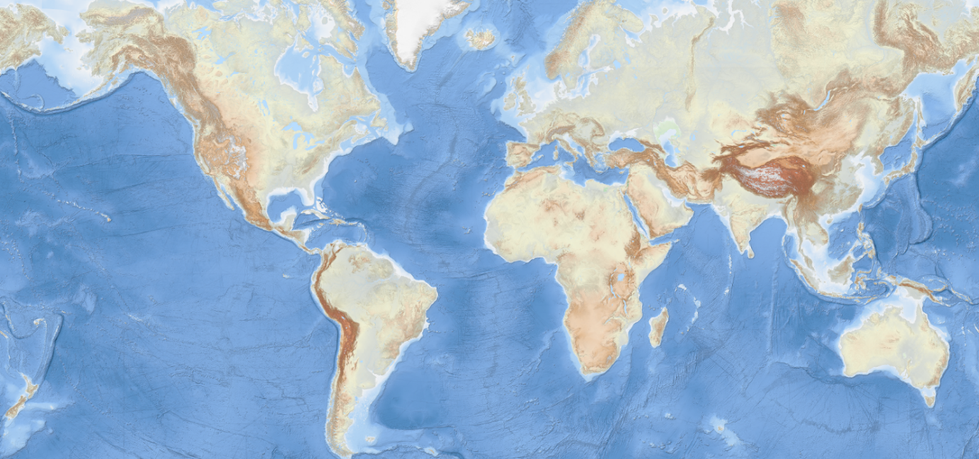
The EMODnet Bathymetry World Base Layer (EBWB) service is a gridded representation of worldwide bathymetric and topographic coverage adapted for a better representation of seabed morphological features. Based on modern WMTS schema, it allows a fluid and powerful rendering. For the global oceans EBWB1 is composed of the 2018 EMODnet Bathymetric grid around Europe (approx. 100m resolution) and uses the GEBCO 2019 grid (approx. 500m resolution) elsewhere in the marine environment. Land coverage is based on a combination of 30 arc second ASTER GDEM, SRTM3, EU-DEM, and Global 1 second world-wide water body map for the topographic part. This compilation of publicly available data sources have been merged and pre-tiled for rendering, at 10 levels of zoom starting from 1/24th of an arcminute (approx. 75m resolution). The EBWB1 service is available in non-projected system (Lat, Long, WGS84: EPSG:4086), Web Mercator (EPSG:3857), Inspire compliant ETRS-EALA projection (EPSG:3035) and projections adapted to both poles (ESPG 3031 and 3996) Service URL: https://tiles.emodnet-bathymetry.eu/wmts/1.0.0/WMTSCapabilities.xml
-
Source data for the EMODNet DTM for the Belgium Coastal Waters is compiled by the Vlaamse Hydrografie (http://www.afdelingkust.be/en/bathymetric-database) at a resolution of 1/512 arc minute. The data set covers the waters along the Belgian coast.
-
Source data for the EMODNet DTM for the Belgium Coastal Waters is compiled by the Vlaamse Hydrografie (http://www.afdelingkust.be/en/bathymetric-database) at a resolution of 1/64 arc minute. The data set covers the waters along the Belgian coast.
-
Source data for the EMODNet DTM for the Belgium Coastal Waters is compiled by the Vlaamse Hydrografie (http://www.afdelingkust.be/en/bathymetric-database) at a resolution of 1/512 arc minute. The data set covers dry coast and dunes along the Belgian coast.
-

The multispectral images of the study area were acquired by drone on 18 September 2025 using the DJI Mavic 3M RTK. The orthomosaic was generated from 5,128 images across five spectral bands (Green, Red, Red Edge, Near-Infrared (NIR), and Alpha), captured at an altitude of 100 meters (2025). The ground resolution achieved was 4.568 cm/pixel, covering a surveyed area of approximately 0.94 km². The Digital Surface Models (DSMs) were resampled to a resolution of 10 cm.
-

Source data for the EMODNet DTM for the Belgium Continental Shelf (BCP) is compiled by the Maritime and Coastal Services - Flemish Hydrograpy (https://www.agentschapmdk.be/nl/hydrografische-data) at a resolution of 1/64'. The data set covers the Belgium Continental shelf area.
-
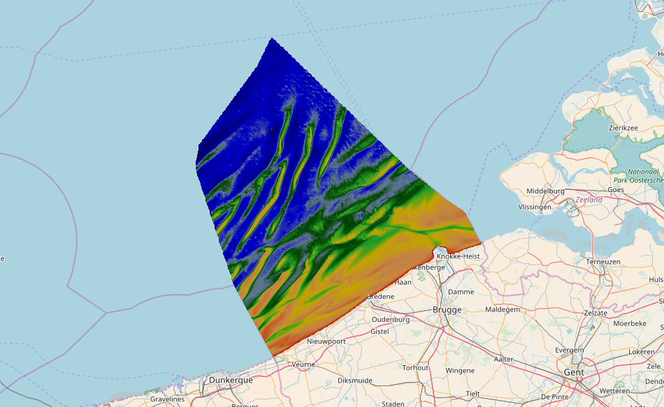
Source data for the EMODNet DTM for the Belgium Continental Shelf (BCP) is compiled by the Vlaamse Hydrografie (http://www.afdelingkust.be/en/bathymetric-database) at a resolution of 1/64". The data set covers the Belgium Continental shelf area.
-

Source data for the EMODNet DTM for the Belgium Continental Shelf (BCP) is compiled by the Vlaamse Hydrografie (http://www.afdelingkust.be/en/bathymetric-database) at a resolution of 1/64'. The data set covers the Belgium Continental shelf area.
-

Source data for the EMODNet DTM for the Belgium Continental Shelf (BCP) is compiled by the Maritime and Coastal Services - Flemish Hydrograpy (https://www.agentschapmdk.be/nl/hydrografische-data) at a resolution of 1/64'. The data set covers the Belgium Continental shelf area.