 Catalogue PIGMA
500000
Type of resources
Available actions
Topics
Keywords
Contact for the resource
Provided by
Years
Formats
Representation types
Update frequencies
status
Scale
Resolution
-

Sea bed sediment maps for the 4 marine sub-regions prepared as part of the initial evaluation of the MSFD (Marine Strategy Framework Directive).
-

Les périmètres des quartiers prioritaires de la politique de la ville sont fixés par le décret n° 2014-1750 du 30 décembre 2014 pour la métropole et par le décret n° 2014-1751 du 30 décembre 2014 pour les départements et collectivités d’outre-mer, rectifiés par le décret n°2015-1138 du 14 septembre 2015.
-

Composite DTM for the Baltic Sea at approx. 0.375 arc minutes resolution. The DTM was derived from the 50m grid provided by the Federal Maritime and Hydrographic Agency (BSH).
-
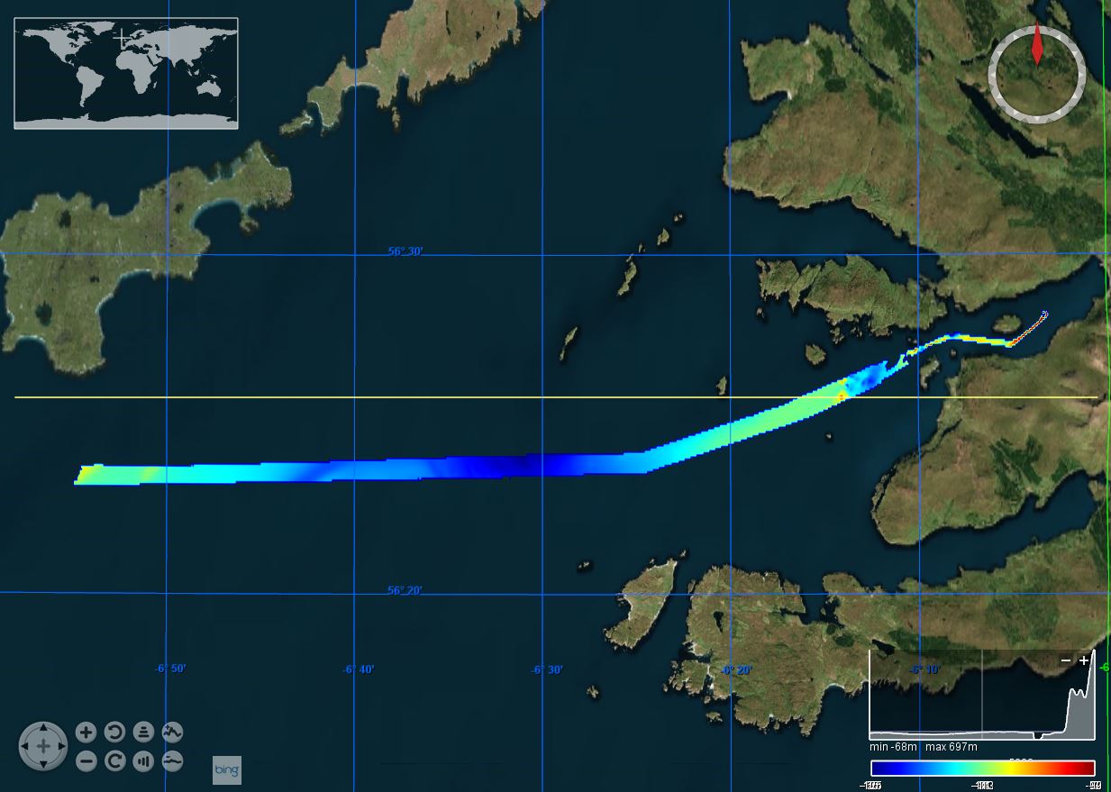
This marine geophysical and multibeam survey was undertaken by British Geological Survey on behalf of Marine Scotland utilising the Northern Lighthouse Board vessel NLV Polestar, it took place in July/August 2012 off south-west Tiree. The purpose was to further our understanding of Scotland’s marine environment, increase the efficiency of use of public resources, enhance the safety of those at sea and contribute to new policy priorities such as marine protected areas, wider conservation measures, marine planning and renewable. Bathymetric data was collected using a Kongsberg EM3002D dual head, multibeam system. Data was acquired using a Kongsberg SIS operating system, logging raw .ALL files. This data was processed offline by BGS using CARIS HIPS and SIPS 7.1 SP2.
-
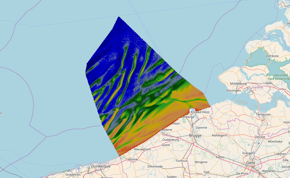
Source data for the EMODNet DTM for the Belgium Continental Shelf (BCP) is compiled by the Vlaamse Hydrografie (http://www.afdelingkust.be/en/bathymetric-database) at a resolution of 1/64". The data set covers the Belgium Continental shelf area.
-
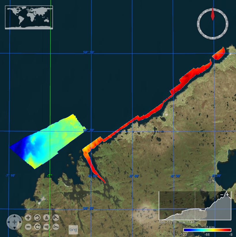
This BGS marine geophysical survey took place in July 2005 in the Summer Isles region aboard the RV Calanus. The survey was a part of the BGS Offshore Mapping and Modelling Project, North Atlantic Correlation. Subsurface data were gathered using a Surface Tow Boomer and a very detailed swath coverage of the Summer Islands region together with Loch Broom and Little Loch Broom was achieved using a Geoacoustics GeoSwath system supplied and operated by Fathoms Ltd.
-
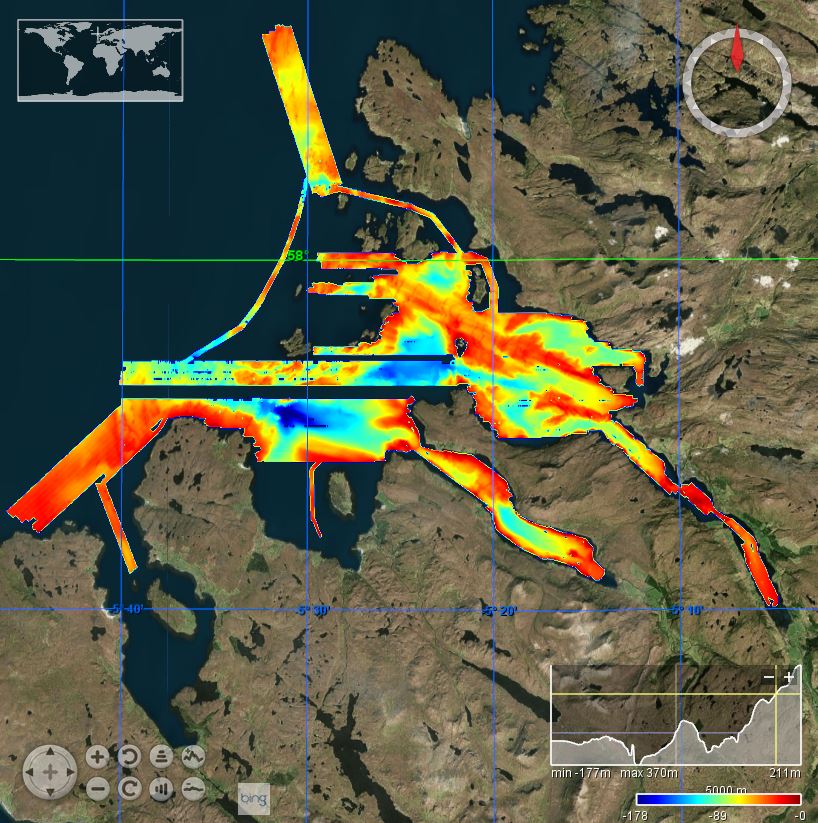
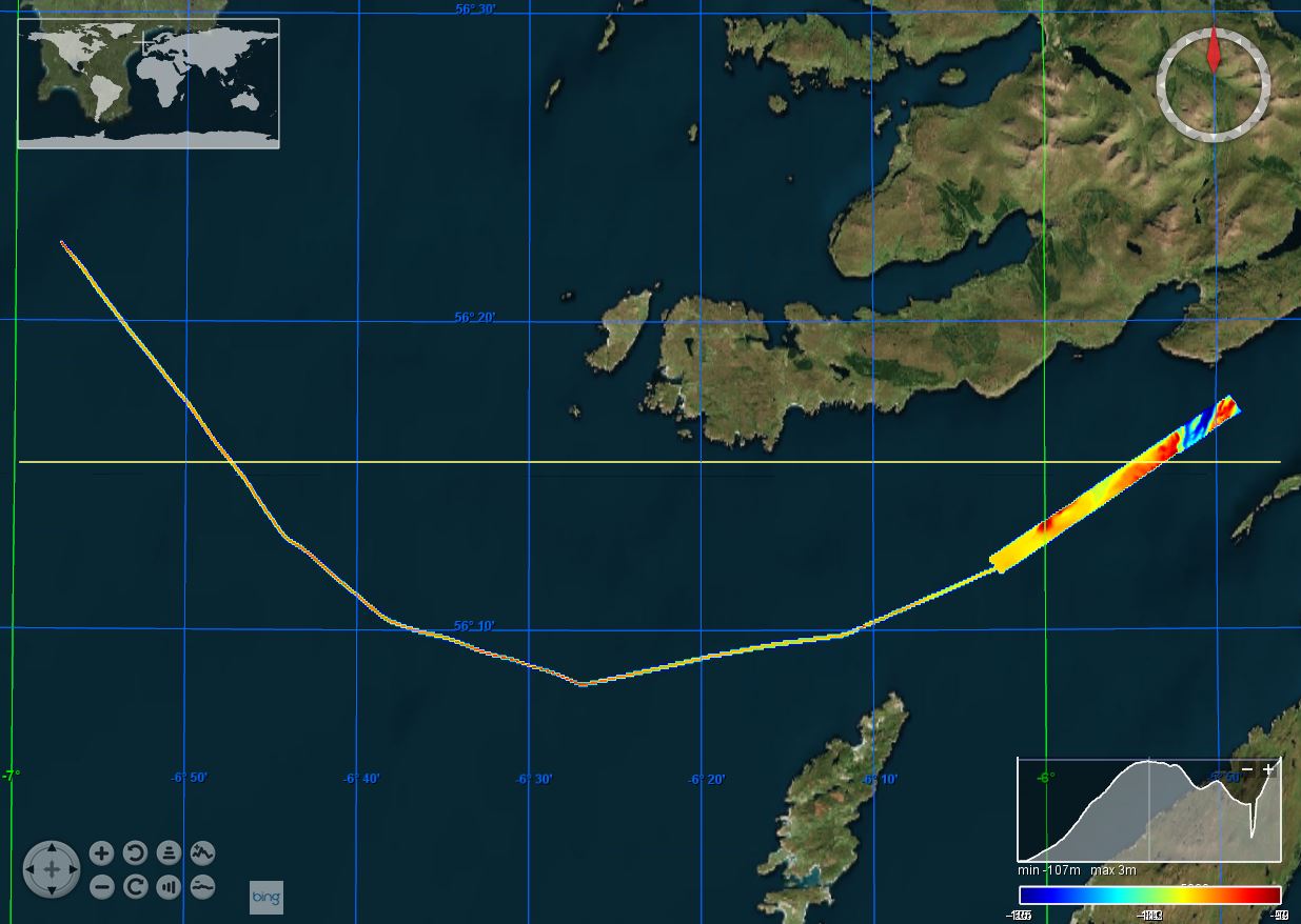
This marine multibeam survey took place in August/September 2011 in the area of Lewis on board the Northern Lighthouse Board vessel NLV Pole Star. The survey was carried out by the British Geological Survey (BGS) on behalf of Marine Scotland. Sea floor bathymetry data were collected using a Kongsberg EM3002D multibeam system.
-
This marine geophysical and multibeam survey was undertaken by British Geological Survey on behalf of Marine Scotland utilising the Northern Lighthouse Board vessel NLV Polestar, it took place in July/August 2012 off south-west Tiree. The purpose was to further our understanding of Scotland’s marine environment, increase the efficiency of use of public resources, enhance the safety of those at sea and contribute to new policy priorities such as marine protected areas, wider conservation measures, marine planning and renewable. Bathymetric data was collected using a Kongsberg EM3002D dual head, multibeam system. Data was acquired using a Kongsberg SIS operating system, logging raw .ALL files. This data was processed offline by BGS using CARIS HIPS and SIPS 7.1 SP2.
-
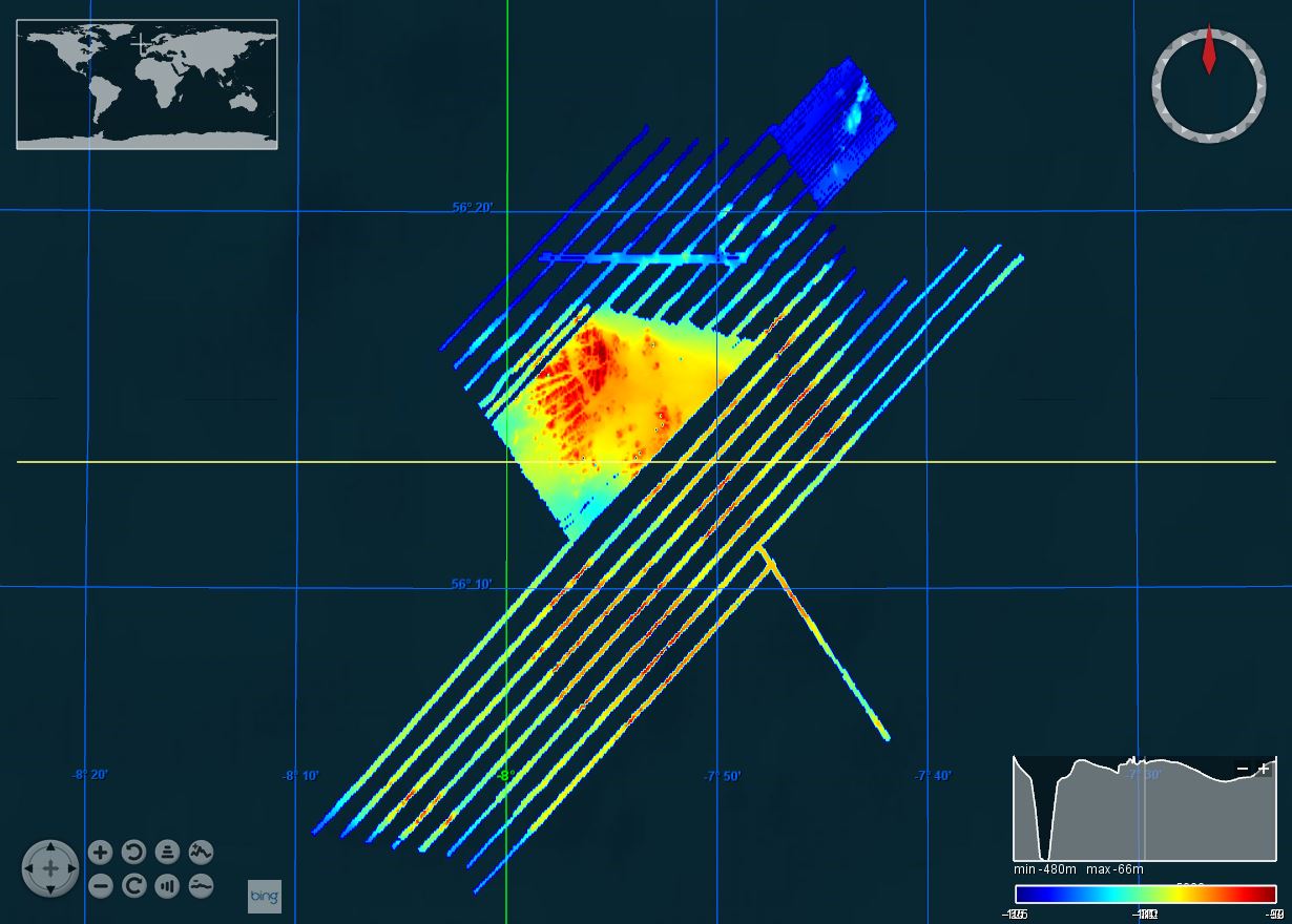
This marine multibeam and sampling survey was undertaken on Stanton Banks by the Joint Nature Conservation Committee (JNCC), Centre for Environment, Fisheries & Aquaculture Science (CEFAS) and British Geological Survey (BGS) in July/August 2012 on board the Northern Lighthouse Board vessel NLV Polestar. The survey was led by the JNCC and included a team from CEFAS who were involved in benthic sampling. A combination of surveys methods were employed, including seabed imagery (drop camera), day grabs and rock dredges. BGS collected sea floor multibeam bathymetry data using a Kongsberg EM3002D multibeam system.
-
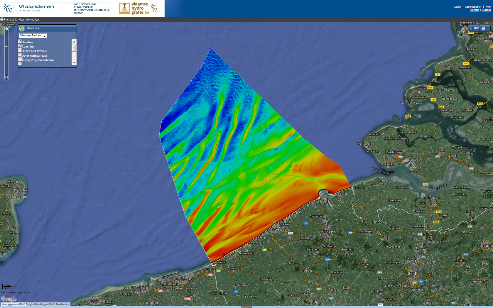
Source data for the EMODNet DTM for the Belgium Continental Shelf (BCP) is compiled by the Vlaamse Hydrografie (http://www.vlaamsehydrografie.be/) at a resolution of 60x60 meter. The data set covers the Belgium Continental shelf area.