 Catalogue PIGMA
CDS-IS-SISMER
Type of resources
Available actions
Topics
Keywords
Provided by
Years
Formats
Representation types
Update frequencies
status
Scale
-
-
-
-
-
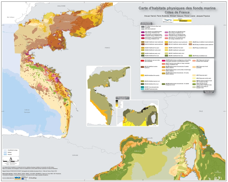
Eunis-classified physical habitats physiques resulting from the combination of three physical variables meshed at a resolution of 100 metres: nature of the substrates, biological area, shearing tension on the sea floor. Coasts of mainland France. Ifremer report "Hamdi Anouar, Vasquez Mickael, Populus Jacques (2010). Cartographie des habitats physiques Eunis - Côtes de France. Ifremer/AAMP agreement n° 09/12177764/FY. http://archimer.ifremer.fr/ doc/00026/13751/ "
-
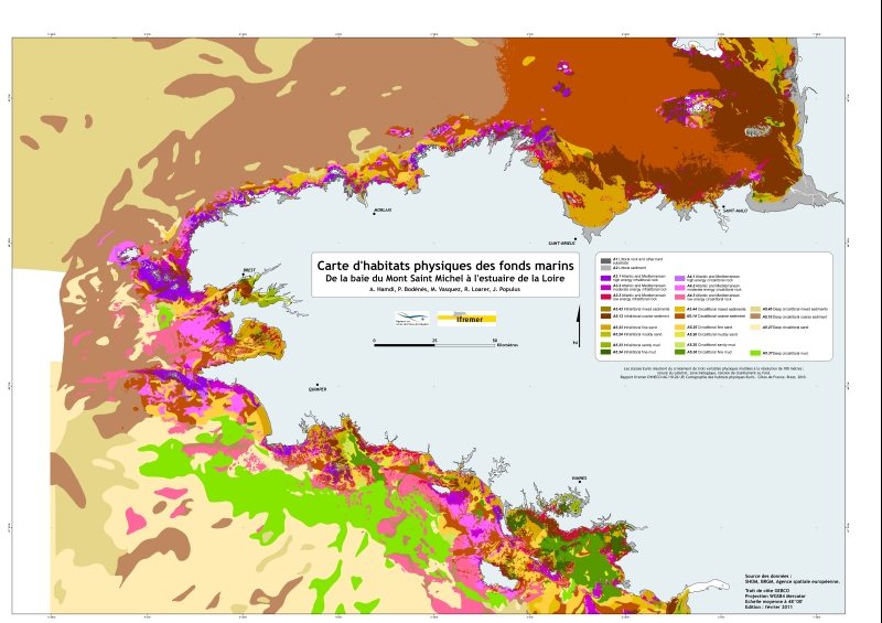
Eunis-classified physical habitats physiques resulting from the combination of three physical variables meshed at a resolution of 250 metres: nature of the substrates, biological area, shearing tension on the sea floor. Coasts of mainland France. Ifremer report "Hamdi Anouar, Vasquez Mickael, Populus Jacques (2010). Cartographie des habitats physiques Eunis - Côtes de France. Ifremer/AAMP agreement n° 09/12177764/FY. http://archimer.ifremer.fr/ doc/00026/13751/ "
-
-
Volet de réseau national REMI (Réseau de Contrôle Microbiologique), anciennement REMIC jusqu'en avril 2011. Ces données concernent la surveillance microbiologique régulière des zones de production conchylicoles afin de vérifier que le niveau de contamination, sur la base du dénombrement des Escherichia coli, reste conforme au classement (A, B et C) défini dans les arrêtés préfectoraux.
-
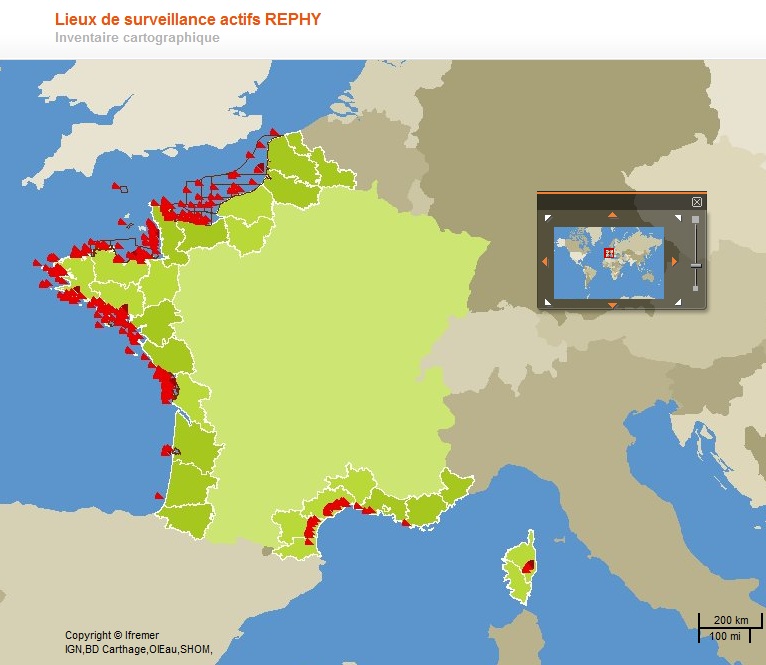
Réseau de surveillance des phycotoxines dans les organismes marins (REPHYTOX) assure des prélèvements de coquillages dans un réseau de lieux de prélèvement répartis sur l’ensemble du littoral (environ 250 lieux potentiellement mobilisables). Les lieux de prélèvement REPHYTOX peuvent être communs avec des lieux REPHY. Les prélèvements peuvent concerner divers types de coquillages, en gisements naturels ou bien élevés selon des modes variés (bouchots, filières, tables, etc.). En tout état de cause, l’association entre lieux REPHYTOX et un certain nombre de lieux REPHY est étroite, les résultats REPHY pouvant déterminer le déclenchement de la recherche de toxines sur les lieux REPHYTOX de la zone. Ce jeu présente plusieurs fichiers de paramètres mesurés pour des types de toxines distincts entre 2006 et 2016 sur les lieux de surveillance : toxines amnésiantes (REPHYTOX-ASP) ; toxines paralysantes (REPHYTOX-PSP) ; et toxines lipophiles (REPHYTOX_LIP_AC et BE) avec les résultats des bio-essais (BE) et analyses chimiques (AC depuis 2010). A chaque paramètre de concentration mesuré sont associés le lieu de prélevement de l'échantillon, la date, le support, la fraction et la méthode utilisée.
-
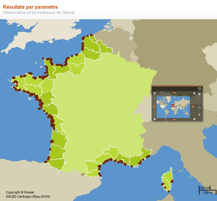
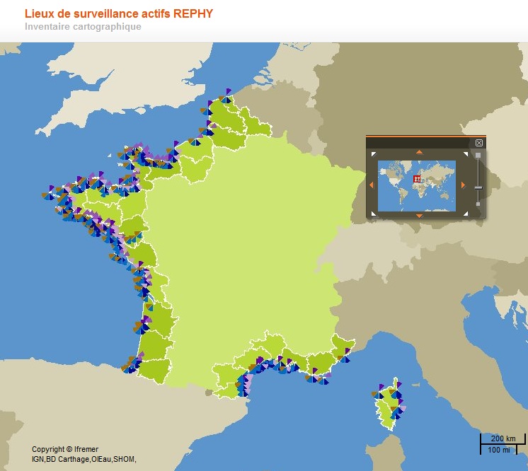
Données du Réseau d’Observation et de Surveillance du Phytoplancton et de l’Hydrologie dans les eaux littorales. Ce jeu présente deux fichiers de paramètres distincts mesurés entre 2015 et 2020 sur les lieux de surveillance de la façade Atlantique - Manche : - Chlorophylle-a et nutriments (Ammonium, Nitrates + Nitrites, Phosphate et Silicate) - Flores phytoplanctoniques totales : : c’est l’identification et le dénombrement de toutes les espèces phytoplanctoniques pouvant être identifiées dans les conditions d’observation, c’est à dire globalement toutes les espèces dont la taille est supérieure à 20 µm, et celles dont la taille est inférieure mais qui sont en chaîne. Les espèces plus petites sont dénombrées seulement quand elles concernent des espèces potentiellement toxiques (ex : Chrysochromulina). Ces fichiers sont formatés pour le rapportage à la convention des mers régionales OSPAR.