 Catalogue PIGMA
tableDigital
Type of resources
Available actions
Topics
Keywords
Contact for the resource
Provided by
Years
Formats
Representation types
Update frequencies
status
Scale
Resolution
-

Digital Surface Models (DSMs) of the study area surveyed by drone between June 2024 and March 2025. Each pixel contains the elevation value corresponding to the terrain at the time of the mission. These DSMs were generated from around 1,300 images (depending of the survey) acquired using the DJI Mavic 3E RTK drone, with a resolution of 3.2 cm/pixel. The surveyed area covers around 2.1 km². The campaign was conducted on the highest tides of each month. The drone acquisitions were carried out by Nicolas Lachaussée from the LIENSs UMR Drone Platform. Photogrammetric processing was performed by Natacha Volto (LIENSs) using Agisoft Metashape software. The vertical coordinate system is NGF IGN69. The vertical accuracy (RMSD ~ 3 cm), calculated using around 100 control points, randomly distributed across the study area. It is derived from the vertical difference for each control point between the value measured with the DGPS SP80 and the value extracted from the photogrammetry-generated DSM. These drone surveys were carried out as part of the thesis of Loës Le Goff Le Gourrierec supervised by Xavier Bertin.
-

The multispectral images of the study area were acquired by drone on 18 September 2025 using the DJI Mavic 3M RTK. The orthomosaic was generated from 5,128 images across five spectral bands (Green, Red, Red Edge, Near-Infrared (NIR), and Alpha), captured at an altitude of 100 meters (2025). The ground resolution achieved was 4.568 cm/pixel, covering a surveyed area of approximately 0.94 km². The Digital Surface Models (DSMs) were resampled to a resolution of 10 cm.
-

Digital Surface Models (DSMs) of the study area were generated by drones on 19 September 2024 and 18 September 2025. Each pixel represents the elevation value of the terrain at the time of the survey. These DSMs were generated from 895 (2024) and 1,282 images (2025), captured at an altitude of 120 (2024) and 100 meters (2025) using the DJI Mavic 3E RTK and Mavic 3M RTK drones, with ground resolutions of 3.19 (2024) and 2.63 cm/pixel (2025). The surveyed area covers approximately 1 km². The DSMs were resampled to a resolution of 20 cm. The vertical coordinate system used is NGF IGN69.
-

Orthomosaics of the study area were generated by drones on 19 September 2024 and 18 September 2025. They were created from 895 images (2024) and 1,282 images (2025), captured at altitudes of 120 meters (2024) and 100 meters (2025) using the DJI Mavic 3E RTK (2024) and Mavic 3M RTK (2025) drones. The ground resolutions were 3.19 cm/pixel (2024) and 2.63 cm/pixel (2025). The surveyed area covers approximately 1 km², and the orthomosaics were resampled to a resolution of 10 cm/pixel.
-

Des prélèvements d'eau ont été réalisés en même temps que le suivi du plancton, à savoir sur les 3 sites d'études de Pampas, entre 2019 et 2022, pour mesurer les sels nutritifs : silicates, nitrates, nitrites, phosphates et ammonium
-
Enquêtes semi-dirigées auprès des usagers des marais : les acteurs territoriaux, les gestionnaires de la réserve naturelle de Lilleau des Niges (LPO), les résidents permanents et secondaires. Près de 140 entretiens ont été réalisés entre mars et juillet 2022. La conception du questionnaire et l'analyse des résultats ont été réalisées sous Sphinx.
-

Orthomosaïque de la zone d'étude survolée par drone le 4 février 2025. Elle a été générée, à partir de 928 images RGB acquises avec le drone Mavic 3E RTK connecté au réseau collaboratif de bases GNSS ouvertes CentipedeRTK, avec une résolution de 2,6 cm/pixel. Le vol a été réalisé par Natacha Volto de la plateforme Drones de l’UMR LIENSs le 4 février 2025 pour Lilia Mzalia de l'INRAE. Les traitements photogrammétriques ont été réalisés par Natacha Volto du LIENSs à l'aide du logiciel Agisoft Metashape.
-
Identifiant dans la base de données : AHFCharente-Crue_0002. Niveau : Niveau 3 : Crue avec débordement de gravité élevée. Date(s) : 1962-04-02 au 1962-04-15Touche les communes de {Saintes,Cognac,Jarnac,Angoulême,Gond-Pontouvre}. Fiche synthèse sur une crue s'étant produite sur le fleuve Charente réalisée dans le cadre de l'étude "Atlas Historique du fleuve Charente" et de la thèse d'Amélie Duquesne. La fiche précise le niveau d'intensité de la crue évalué selon le type de dommages suivant la classification semi-quantitative originale à la thèse et les dates de début et de fin de l'événement. Elle décrit ensuite les conditions météorologiques à l'origine de l'événement, le déroulement général et en détail par commune de l'inondation. Les hauteurs d'eau sont données si celles-ci sont disponibles pour certaines communes suivant une fréquence qui varie selon les sources (de 3h en 3h ou à la journée). La fiche apporte des renseignements sur les dommages occasionnés par la crue. Ceux-ci sont classés par type de dommages. Chaque dommage est associé à une description et à une date liée à son endommagement. Elle précise ensuite les solutions post-inondation mises en oeuvre suite à l'événement, classées par type de solutions associé à une localisation et une date. Dans certains cas, les impacts sur la géomorphologie du fleuve sont précisés (type, description de l'impact, date). Chaque fiche fournit la liste des sources connues relatives à cette inondation ayant permis de construire cette fiche. Les archives sont décrites par le nom du fond consultable, leur cote, le titre, la date du document et leur identifiant. Ce dernier permet d'identifier le document dans une base de données listant l'ensemble des données historiques sur le fleuve Charente. Les sources contiennent aussi l'iconographie (fond consultable, cote, titre, date), la presse (fond consultable, cote, titre de la revue, titre de l'article, date), la bibliographie (auteur, titre, édition, date) savante sur le sujet. Les autres documents éventuels (fichier Excel ou de règlementation) sont précisés dans la section Autres Documents (type de document, titre, auteur, date).
-
Caractérisation des communautés de poissons dans les marais de Tasdon (La Rochelle) en 2019, dans le cadre de l'ANR PAMPAS : - dans le 'Lac de Villeneuve', station 2, réservoir d'eaux pluviales, situé en zone péri-urbaine de La Rochelle, relié à la rivière, 'La Moulinette', en 2019 - en aval de la rivière de La Moulinette, La Rochelle, entre 2019 et 2021
-

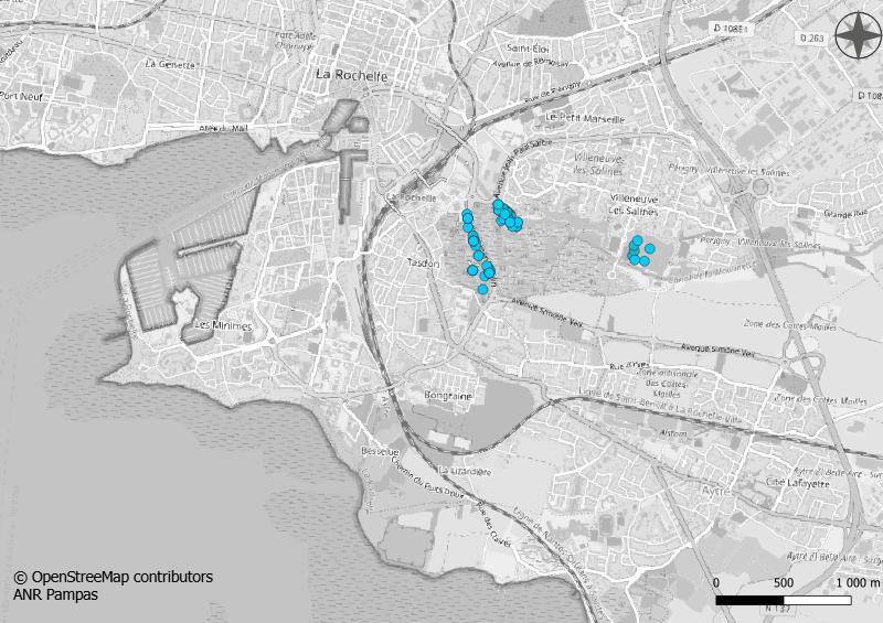
Dans le cadre de l'ANR Pampas, plusieurs stations ont été définies et identifiées. Ces stations regroupent l'ensemble des captures, des prélèvements, des carottages, des mesures et des enquêtes réalisées, pour chaque compartiment étudié : Arthropode; Benthos; Enquête Art Sciences; Enquêtes de perception; Enquête Patrimoine; Flux de Carbone; Hydrodynamisme; Oiseaux; Plancton; Poissons; Sédimentation et Carbone.