 Catalogue PIGMA
Protected sites
Type of resources
Available actions
Topics
Keywords
Contact for the resource
Provided by
Years
Formats
Representation types
Update frequencies
status
Scale
Resolution
-
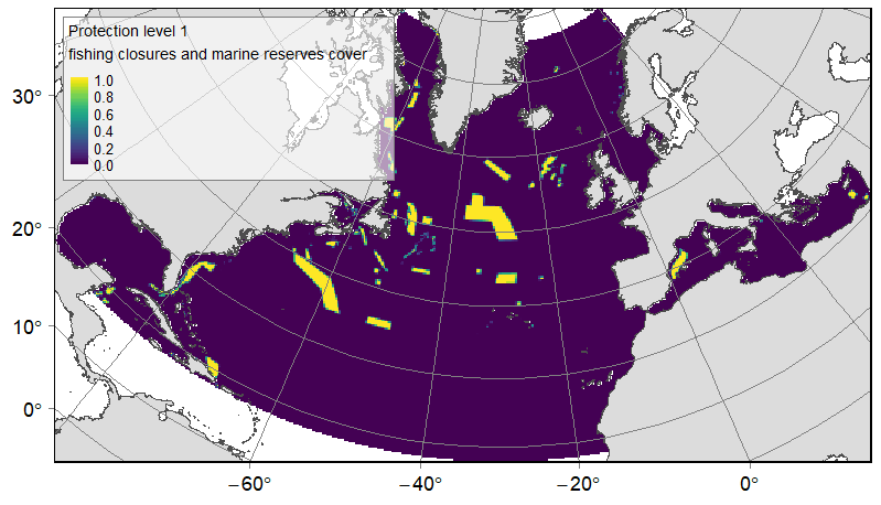
Distribution of three categories of protected or significant areas on the North Atlantic (18°N to 76°N and 36°E to 98°W). Categories were delineated according to relative levels of protection, from the highest to the lowest: fishing closures implemented by Regional Fisheries Management Organisations (RFMOs) and marine reserves; other MPAs likely to benefit from a lower protection; and Ecologically or Biologically Significant Marine Areas (EBSAs). Source vector data originated from the RFMOs (NAFO, NEAFC and GFCM), the World Database on Protected Areas (WDPA), national MPAs databases (US: NOAA and SAFMC; Canada: Fisheries and Oceans Canada; Norway: Institute of Marine Research) and the CBD website. The relative cover or each protection category on 25km *25km gridsquares was computed. This dataset was built to feed a basin-wide spatial conservation planning exercise, targeting the deep sea of the North Atlantic. The goal of this approach was to identify conservation priority areas for Vulnerable Marine Ecosystems (VMEs) and deep fish species, based on the distribution of species and habitats, human activities and current spatial management.
-
Med protection initiatives (management and conservation areas)
-
Shape file with the layers containing the information as in Product CH2-1 and depth/biological zones. Fisheries Restricted Areas with specifics on the prohibitions and the type of closure.
-
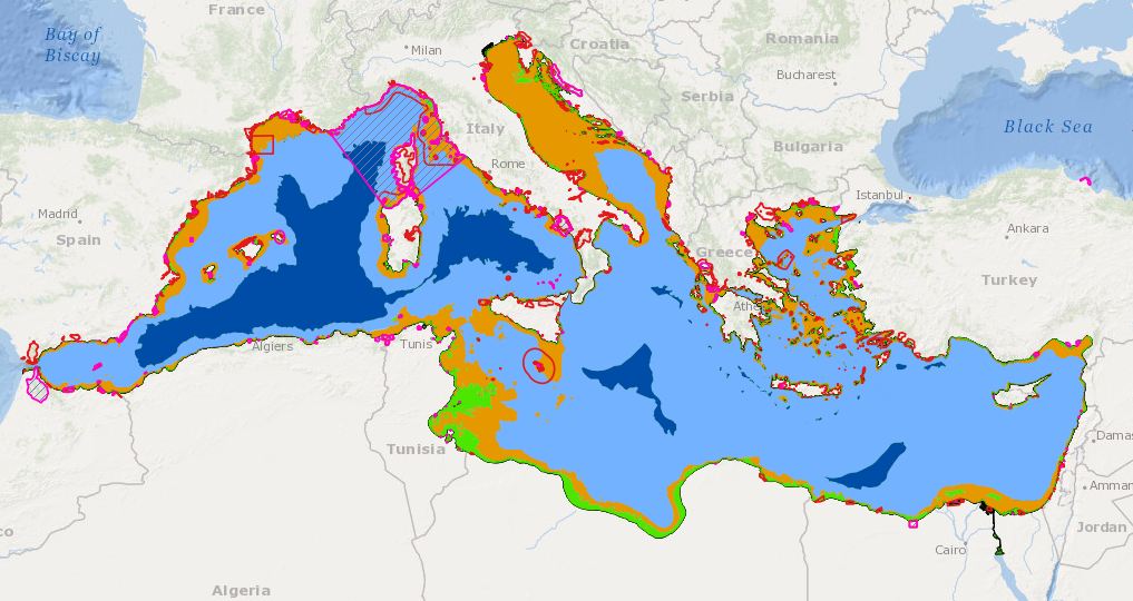
Shape file with the layers containing the information as in Product CH2-1 and depth/biological zones. Fisheries Restricted Areas with specifics on the prohibitions and the type of closure.
-
Med protection initiatives (management and conservation areas)
-
-

-

-

-
