 Catalogue PIGMA
1000
Type of resources
Available actions
Topics
Keywords
Contact for the resource
Provided by
Years
Formats
Representation types
Update frequencies
status
Scale
Resolution
-

Zone arrière du point de mutualisation (ZAPM) des territoires gérés par la SPL NATHD non déployées
-
Zone AMII (Appel à Manifestation d'Intention d'Investissement) présentes sur le territoire de compétence de la SPL NATHD
-

Réseaux d'assainissement collectif des collectivités territoriales de Charente ayant transmis leurs données à l'ATD16 pour intégration dans le SIG Départemental. La donnée n'est pas complète car elle est intégrée au compte goutte pour le compte des collectivités. La donnée est agrégée à l'échelle départementale dans le standard RAEPA
-

Tronçons linéaires de voies de l'Aquitaine romaine - projet Aquitaviae
-
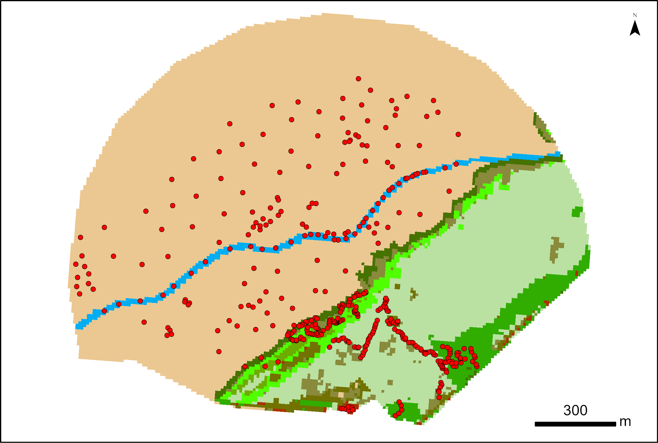
387 points were surveyed with a SP80 DGPS by Maxime Paschal as part of the La Rochelle Zero Carbon Territory (LRTZC) project on 26/05/23. At each point, the type of vegetation was specified.
-

Zone arrière du point de mutualisation (ZAPM) des territoires gérés par la SPL NATHD déployées
-

Prises IPE présentes sur les territoires gérés par la SPL NATHD
-
Ensemble de données permettant de matérialiser les différents éléments constituant un plan de cimetière communal. Limites de cimetière, Murs, Clôtures, Espace verts Emplacements, Monuments, Allées, Secteurs Bâtiments, Points d'eaux, déchets, etc... Ces données sont intégrées au SIG Départemental mis en œuvre par l'ATD16 permettant aux communes de gérer leurs concessions de cimetière via un logiciel métier.
-

A total of 210 points in 2024 (28 May, 18 april, 13 September, 19 September, and 25 October) and 195 points in 2025 (8 April, 18 and 29 April, 3 June, 17 June, and 4 July) were surveyed with an SP80 DGPS as part of the ESA Coastal Blue Carbon project. Additionally, 174 and 160 points obtained from photointerpretation of multispectral drone orthomosaics from 19 September 2024 and 18 September 2025, respectively, were recorded. At each point, the vegetation type was specified.
-

Within the ESA Coastal Blue Carbon project, the LIENSs laboratory contributed drone-derived products, SP80 ground survey points (with longitude, latitude, and plant data) and biomass measurements to test classification models for mapping salt marsh vegetation (e.g., Esnandes) and associated biomass/carbon stocks. Links to associated datasets are provided at the bottom of this sheet.