 Catalogue PIGMA
Database
Type of resources
Available actions
Topics
Keywords
Contact for the resource
Provided by
Years
Formats
Representation types
Update frequencies
status
Scale
Resolution
-
The ODIS "Catalogue of Sources" aims to be an online browsable and searchable catalogue of existing ocean related web-based sources/systems of data and information as well as products and services. It will also provide information on products and visualize the landscape (entities and their connections) of ocean data and information sources. It will contribute to the objectives of the Agenda 2030, and in particular the UN Decade for Ocean Science for Sustainable Development. The Catalogue is not an ocean database or metadata repository. The catalogue includes descriptive information such as the URL, title, description, language, point of contact, geographic scope, available technologies for machine-to-machine interaction, keywords, etc. and can be searched on many of these fields. The IODE network of NODCs has been collecting, managing and serving data for decades. This effort has yielded an extensive, but distributed and heterogeneous collection of data and information sources. Additionally, the low threshold for technical capabilities required to offer data and information over the Internet means that many of the hosted resources are not readily discoverable through NODCs, regional or international data and information systems ODIS will provide an online catalogue of (ideally) all online data/information sources (and, where possible, metadata on off-line sources as well). Many regional and international programmes and projects have developed online data/information services but there is currently no "one-stop shop" where users are offered an overview and/or common data/information discovery interface. There are currently 3090 sources (2172 are searchable) catalogued in the system.
-
The Marine Environmental Data and Information Network (MEDIN) is a partnership of UK organisations committed to improving access to UK marine data. MEDIN is open to all with an interest in marine data and information. We are sponsored by a consortium of 15 sponsors and partnered with over 50 organisations. MEDIN Sponsors include a range of UK marine organisations who support MEDIN’s principles and lead the UK in marine data management. To officially join the network and become a MEDIN Sponsor, please email MEDIN stating your interest at enquiries@medin.org.uk. Our partners represent government departments and agencies, research organisations and private companies and have committed to practise good data management to help future-proof and secure UK’s valuable marine data. MEDIN reports to the Marine Science Coordination Committee. The MEDIN portal contains information about 15,000 marine datasets. The United Kingdom Directory of Marine Observing Systems (UKDMOS), is a unique internet-based searchable database of marine monitoring conducted by UK organisations. Aiming to fulfil the basic requirement to know where, when and what is being monitored in the marine environment around the UK and provide information to help coordinate monitoring across different organisations, UKDMOS is a tool for searching monitoring programmes and series based on information such as the parameters measured or the frequency of measurements taken. UKDMOS is managed and updated by the Marine Environmental Data and Information Network (MEDIN).
-
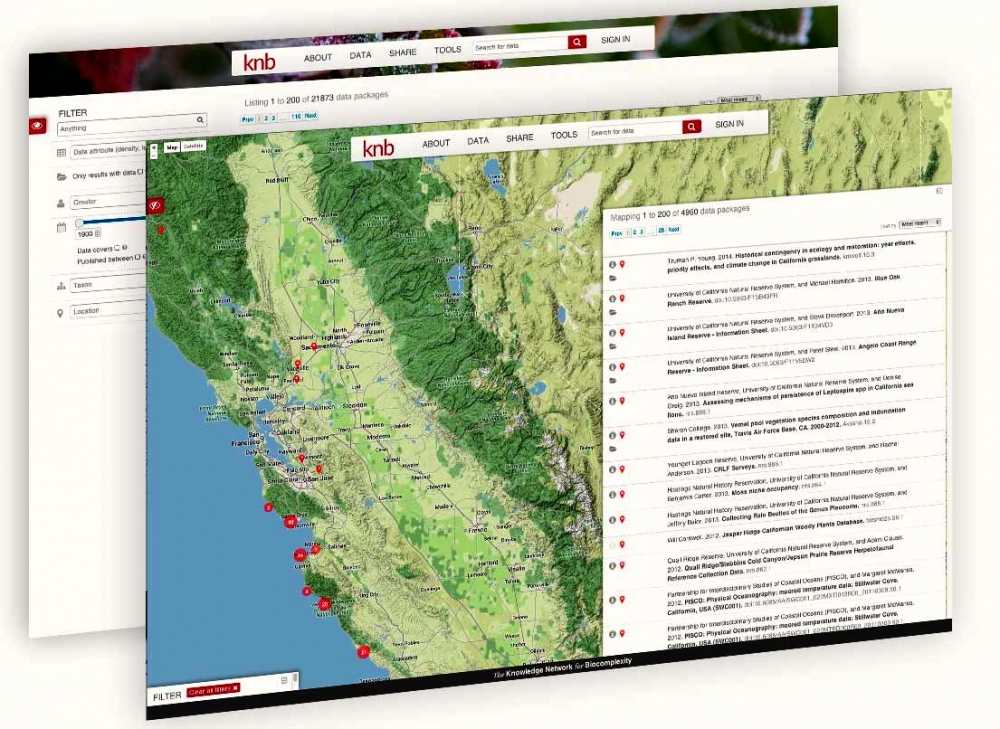
The Knowledge Network for Biocomplexity (KNB) is an international repository intended to facilitate ecological and environmental research. The KNB was launched in 1998 with a grant from the National Science Foundation (NSF), with the purpose of being the long term home for synthesis datasets and research products generated by National Center for Ecological Analysis and Synthesis (NCEAS) working groups. Since then, NCEAS has continued to operate the KNB not only as an archive for NCEAS working group products, but also for the broader ecology and environmental science community. The KNB acceps all environmental or ecological related data and publishes datasets with Digital Object Identifiers for the express purpose of ensuring long-term access to these datasets. We strive to abide by FAIR (findable, accessible, interoperable, resuble) principles of data sharing and preservation. For scientists, the KNB is an efficient way to share, discover, access and interpret complex ecological data. Due to rich contextual information provided with KNB data, scientists are able to integrate and analyze data with less effort. The data originate from a highly-distributed set of field stations, laboratories, research sites, and individual researchers. The foundation of the KNB is the rich, detailed metadata provided by researchers that collect data, which promotes both automated and manual integration of data into new projects.
-
The Western Channel Observatory (WCO) is an oceanographic time-series and marine biodiversity reference site in the Western English Channel. In situ measurements are undertaken weekly at coastal station L4 and fortnightly at open shelf station E1 using the research vessels of the Plymouth Marine Laboratory and the Marine Biological Association. These measurements are complemented by PML's recognised excellence in ecosystem modelling and satellite remote sensing science. By integrating these different observational disciplines we can begin to disentangle the complexity of the marine ecosystem. The WCO measures several key parameters important to the functioning of the marine ecosystem such as light, temperature, salinity and nutrients. Station L4 has some of the longest time-series in the world for zooplankton and phytoplankton, and fish trawls have been made by the MBA for a century. Station E1 has a hydrographic series dating from 1903. These long series are complemented by hourly measurements made at our moorings situated at both stations. These can elucidate changes not captured by the routine weekly sampling.
-
Marine data sharing and preservation, managed & operated by the National Oceanography Centre. Part of the UK's National Oceanography Centre, BODC provide instant access to over 130,000 unique data sets. BODC data helps provide answers to both local questions such as the likelihood of coastal flooding, or global issues such as the impact of climate change. Data categories include: - Acoustics - Bathymetry and topography - Currents — horizontal and vertical velocity, Lagrangian currents and water transport rates - Meteorology — Radiosonde, Met. stations and data buoys - Optical properties — pigments, turbidity, irradiance - Sea level - Water column temperature and salinity - Water column chemistry — nutrients, carbons, oxygen - Waves — statistics and spectra
-
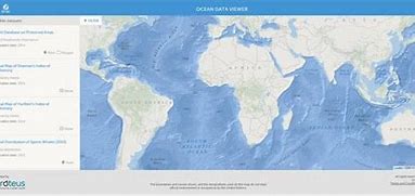
The Ocean Data Viewer offers users the opportunity to view and download a range of spatial datasets that are useful for informing decisions regarding the conservation of marine and coastal biodiversity. These decisions ultimately affect the ocean's health and productivity, which provide the ecosystem services that are necessary for our well-being, livelihoods, and survival. To date, the users of this tool have included government agencies, scientists, researchers, the corporate sector, and non-governmental organisations. These data come from internationally respected scientific institutions and other organisations that have agreed to make their data available to the global community, with the hope that these data will support and encourage informed decision-making that sustains global biodiversity and ecosystem services. The Ocean Data Viewer is primarily a mechanism to view and download data, and is not intended to be used for analysis or to query data.
-
GBIF, the Global Biodiversity Information Facility, is an international network and data infrastructure funded by the world's governments and aimed at providing anyone, anywhere, open access to data about all types of life on Earth. Coordinated through its Secretariat in Copenhagen, the GBIF network of participating countries and organizations, working through participant nodes, provides data-holding institutions around the world with common standards and open-source tools that enable them to share information about where and when species have been recorded. This knowledge derives from many sources, including everything from museum specimens collected in the 18th and 19th century to geotagged smartphone photos shared by amateur naturalists in recent days and weeks. The GBIF network draws all these sources together through the use of data standards, such as Darwin Core, which forms the basis for the bulk of GBIF.org's index of hundreds of millions of species occurrence records. Publishers provide open access to their datasets using machine-readable Creative Commons licence designations, allowing scientists, researchers and others to apply the data in hundreds of peer-reviewed publications and policy papers each year. Many of these analyses, which cover topics from the impacts of climate change and the spread of invasive and alien pests to priorities for conservation and protected areas, food security and human health, would not be possible without this. GBIF arose from a 1999 recommendation by the Biodiversity Informatics Subgroup of the Organization for Economic Cooperation and Development's Megascience Forum. This report concluded that "An international mechanism is needed to make biodiversity data and information accessible worldwide", arguing that this mechanism could produce many economic and social benefits and enable sustainable development by providing sound scientific evidence.
-
Built and developed by researchers, to ensure that everyone can join in Open Science. The OpenAIRE project, in the vanguard of the open access and open data movements in Europe was commissioned by the EC to support their nascent Open Data policy by providing a catch-all repository for EC funded research. CERN, an OpenAIRE partner and pioneer in open source, open access and open data, provided this capability and Zenodo was launched in May 2013. In support of its research programme CERN has developed tools for Big Data management and extended Digital Library capabilities for Open Data. Through Zenodo these Big Science tools could be effectively shared with the long-tail of research. Zenodo helps researchers receive credit by making the research results citable and through OpenAIRE integrates them into existing reporting lines to funding agencies like the European Commission. Citation information is also passed to DataCite and onto the scholarly aggregators.
-
The Ocean Action Hub is an open, interactive website providing information and promoting action globally to support the implementation of SDG 14: Life below Water before 2030. The Hub was initiated by the United Nations Development Programme (UNDP), in partnership with the Governments of Sweden and Fiji, to facilitate multistakeholder engagement as part of the Ocean Conference process. The Hub hosted online discussions on ocean issues as an input into the development of the 1st Ocean Conference "Call for Action" in 2017, and facilitated co-development of solutions and voluntary commitments by multi-stakeholders, as well as providing a space for connecting and sharing ideas. In the run-up to the 2nd Ocean Conference the Hub continues to be maintained as a central source for information on implementation of SDG 14. The ocean plays a key role in the achievement of the 2030 Agenda for Sustainable Development. The ocean covers nearly three quarters of the Earth’s surface and contributes substantially to human development, including to the provision of food security, transport, energy supply, tourism and many of the planet’s most critical ecosystem services (carbon and nutrient cycling, climate regulation, oxygen production). The market value of marine and coastal resources and industries is approximately USD 3 trillion per year, or 5 percent of global GDP. Yet, today it is estimated that 40 per cent of our oceans are heavily affected by unsustainable practices, including over-fishing, land-based sources of pollution, habitat destruction, invasive species and climate change, particularly ocean acidification. SDG 14: Life below Water aims to address these threats.
-
Google Earth Engine combines a multi-petabyte catalog of satellite imagery and geospatial datasets with planetary-scale analysis capabilities. Scientists, researchers, and developers use Earth Engine to detect changes, map trends, and quantify differences on the Earth's surface. Earth Engine is now available for commercial use, and remains free for academic and research use.