 Catalogue PIGMA
1997
Type of resources
Available actions
Topics
Keywords
Contact for the resource
Provided by
Years
Formats
Representation types
Update frequencies
status
Scale
-
Auteur(s): Hondelatte Raphaëlle , Compte-rendu de toutes les phases d'un projet de reconversion d'un chai en appartement, quai des Chartrons à Bordeaux.
-
OBIS is a global open-access data and information clearing-house on marine biodiversity for science, conservation and sustainable development. VISION: To be the most comprehensive gateway to the world’s ocean biodiversity and biogeographic data and information required to address pressing coastal and world ocean concerns. MISSION: To build and maintain a global alliance that collaborates with scientific communities to facilitate free and open access to, and application of, biodiversity and biogeographic data and information on marine life. More than 20 OBIS nodes around the world connect 500 institutions from 56 countries. Collectively, they have provided over 45 million observations of nearly 120 000 marine species, from Bacteria to Whales, from the surface to 10 900 meters depth, and from the Tropics to the Poles. The datasets are integrated so you can search and map them all seamlessly by species name, higher taxonomic level, geographic area, depth, time and environmental parameters. OBIS emanates from the Census of Marine Life (2000-2010) and was adopted as a project under IOC-UNESCO’s International Oceanographic Data and Information (IODE) programme in 2009. Objectives - Provide world’s largest scientific knowledge base on the diversity, distribution and abundance of all marine organisms in an integrated and standardized format (as a contribution to Aichi biodiversity target 19) - Facilitate the integration of biogeographic information with physical and chemical environmental data, to facilitate climate change studies - Contribute to a concerted global approach to marine biodiversity and ecosystem monitoring, through guidelines on standards and best practices, including globally agreed Essential Ocean Variables, observing plans, and indicators in collaboration with other IOC programs - Support the assessment of the state of marine biological diversity to better inform policymakers, and respond to the needs of regional and global processes such as the UN World Ocean Assessment (WOA) and the Intergovernmental Science-Policy Platform on Biodiversity and Ecosystem Services (IPBES) - Provide data, information and tools to support the identification of biologically important marine and coastal habitats for the development of marine spatial plans and other area-based management plans (e.g. for the identification of Ecologically or Biologically Significant marine Areas (EBSAs) under the Convention on Biological Diversity. - Increase the institutional and professional capacity in marine biodiversity and ecosystem data collection, management, analysis and reporting tools, as part of IOC’s Ocean Teacher Global Academy (OTGA) - Provide information and guidance on the use of biodiversity data for education and research and provide state of the art services to society including decision-makers - Provide a global platform for international collaboration between national and regional marine biodiversity and ecosystem monitoring programmes, enhancing Member States and global contributions to inter alia, the Global Ocean Observing System (GOOS) and the Global Earth Observing System of Systems (GEOSS)
-

Ensemble des espaces aménagé pour le stockage du bois sur le département des Landes. Le stockage du bois rentre dans le cadre de la gestion des forêts et intervient suite au débardage qui consiste à déplacer le bois depuis le lieu de coupe jusqu'à l'aire de dépôt. Ces aires de dépôts se matérialisent par un renforcement (empierrement sur une largeur et une longueur importantes) en début de piste. Date de Publication : 2009
-

Données issues du modèle WxTide32 version 4.7 du 25 février 2007, copyright 1998-2007 de Michael Hopper. Disponible sur http://wxtide32.com Ces données de la station du Cap Ferret-Arcachon sont disponibles du 30 janvier 1997 au 1 juin 2008 à une fréquence horaire.
-
Depuis 1989, des levés périodiques de profils en travers (orientation Est-Ouest) sont réalisés. 40 profils sont actuellement identifiés sur le littoral aquitain (20 points en Gironde et 20 points dans les Landes) correspondant aux bornes de suivi du trait de côte. Le lot de données correspond aux points des transects relevés en 1997 dans les Landes. Les points sont représentés en X, Y et Z tels qu'ils ont été levés sur le terrain.
-

Infrastructure visant à prélever l’eau de la nappe phréatique dans le cadre de la Défense des Forêts contre les Incendies. Ces forages nécessitent l’utilisation d’une moto pompe immergée. Date de Publication : 2009
-

Données issues du modèle américain Wave watch III de houle et de vent au nœud nord 45 et 1.25 ouest. Données de hauteur significatives, période pic et direction principale ainsi que les composantes U et V du vent, toutes les 3h entre fin janvier 1997 et début juin 2008.
-
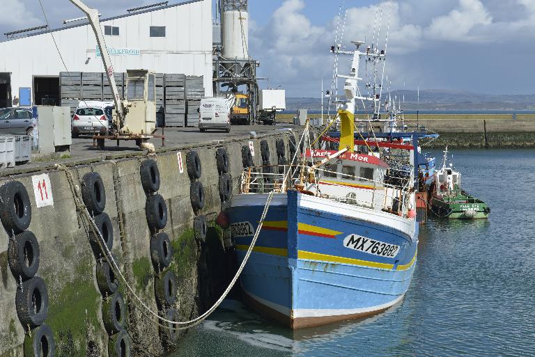
Jusqu’en 1997, parmi les réseaux nationaux de suivi du milieu littoral existants, aucun ne prenait en compte la problématique portuaire. Or, les activités pratiquées dans les ports maritimes influent sur la qualité du milieu aquatique malgré les mesures de prévention mises en place sans toutefois que leur impact soit réellement bien connu. C’est pourquoi, par circulaire du 7 mars 1997, le ministère du Développement durable a mis en place le Réseau national de surveillance de la qualité des eaux et des sédiments des ports maritimes, dénommé REPOM. Ce dernier a été constitué à partir des réseaux départementaux de suivi de la qualité des ports que géraient les Cellules Qualité des Eaux Littorales (CQEL).
-

Le jeu de données est produit depuis 1997 par l'UMR EPOC: observation à moyen et long terme de l'évolution des communautés zooplanctoniques dans le Bassin d'Arcachon.
-
Ce jeu de données représente des emprises à vocation particulière sur le domaine public non cadastré (emprise des voies publiques telles que les rues, les places publiques, les routes nationales et départementales, les voies métropolitaines et les chemins ruraux) sur le territoire de Bordeaux Métropole. Levé sous la forme d'objets surfaciques il renseigne sur l'usage particulier de ces emprises (parking, espaces verts, etc.) et son concessionnaire.