 Catalogue PIGMA
energy
Type of resources
Topics
Keywords
Contact for the resource
Provided by
Years
Formats
Representation types
Update frequencies
Scale
Resolution
-
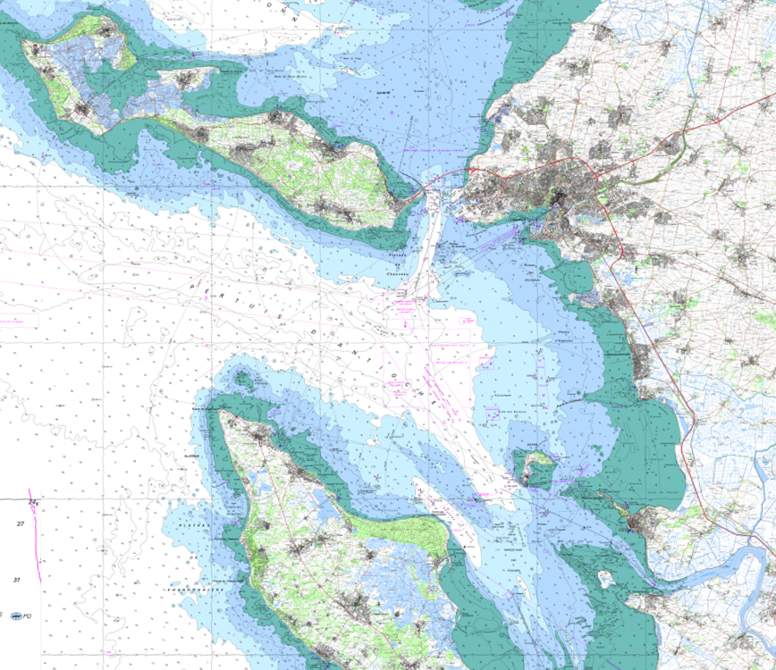
The product SCAN Littoral® is a collection of continuous colour digital map images of the coast, obtained via georeferenced assembling with grid squares of raster data from Shom nautical charts and IGN 1:25,000 land maps. The SCAN Littoral® solution includes a series of digital images with no additions, legends or georeferencing information.
-
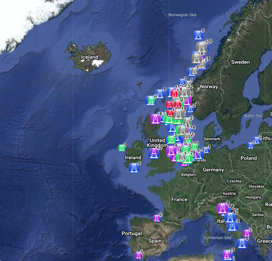
The dataset on offshore installations for Oil and Gas exploitation and exploration activities was created in 2015 by Cogea for the European Marine Observation and Data Network (EMODnet). It is the result of the aggregation and harmonization of datasets provided by several EU and non-EU sources. It is updated every year, and is available for viewing and download on EMODnet - Human Activities web portal (www.emodnet-humanactivities.eu). The dataset contains points representing offshore installations and where available each point has the following attributes: ID, name, country, location block, operator, production start year, primary production, current status, category and function of the installation, sub-structure and topside weights (tonnes), water depth (metres), distance to coast (metres) and remarks. The OSPAR commission source covers data for Germany, Ireland, Spain and the United Kingdom, while for Italy data have been collected and harmonized from the Italian Ministry of Economic Development, for Norway from the Norwegian Petroleum Directorate, for Denmark from the Danish Energy Agency, for the Netherlands from the TNO - Geological Survey of the Netherlands, for Croatia from the Croatian Hydrocarbon Agency, from Marine Traffic and Helcom data on Polish and Russian installations in the Baltic Sea, from Marine Traffic data on Bulgarian, Russian and Ukrainian installations in the Black Sea, Lybian and Spanish installations in the Mediterranean Sea. Compared with the previous version this new version has been updated for all countries.
-
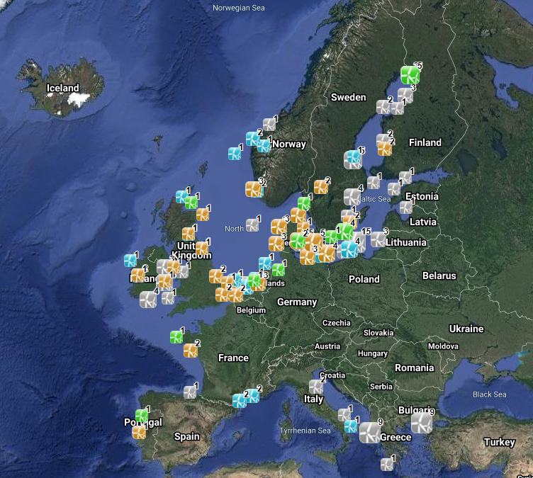
The database on offshore wind farms in the EU was created in 2014 by CETMAR for the European Marine Observation and Data Network (EMODnet). It is the result of the aggregation and harmonization of datasets provided by several sources. It is updated every year and is available for viewing and download on EMODnet Human Activities web portal (www.emodnet-humanactivities.eu). The database contains points and/or (where available) polygons representing offshore wind farms in the following countries: Belgium, Denmark, Estonia, Finland, France, Germany, Greece, Ireland, Italy, Latvia, Lithuania, Netherlands, Norway, Poland, Portugal, Spain, Sweden and United Kingdom. Each point has the following attributes (where available): Name, Nº of turbines, Status (Approved, Planned, Dismantled, Construction, Production, Test site), Country, Year, Power (MW), Distance to coast (metres) and Area (square kilometres). The distance to coast (EEA coastline shapefile) has been calculated using the UTM WGS84 Zone projected coordinate system where data fall in.
-
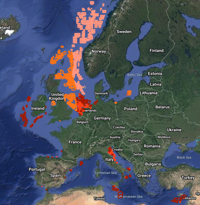
The dataset on offshore active licences for Oil and Gas exploitation and exploration in the EU was created in 2014 by Cogea for the European Marine Observation and Data Network (EMODnet). It is the result of the aggregation and harmonization of datasets provided by several EU and non-EU sources. It is updated every year, and is available for viewing and download on EMODnet - Human Activities web portal (www.emodnet-humanactivities.eu). It contains polygons representing active offshore licenced areas in the following countries: Croatia, Cyprus, Denmark, France, Germany, Ireland, Italy, Malta, Netherlands, Norway, Poland, Spain and United Kingdom. Where available each polygon has the following attributes: country, code, name, type (exploitation, exploration, exploitation and exploration, other, N/A), licensing round (it includes also pending applications in France and Spain), area (square km), area info (it indicates if the area value is original from the source or has been calculated), starting year, ending year, operator or administrator. Compared with the previous release, 'Exploitation, exploration' new type of licence has been added. Italy's exploration licences are all temporarily suspended.