 Catalogue PIGMA
/Données administratives
Type of resources
Available actions
Topics
Keywords
Contact for the resource
Provided by
Years
Formats
Representation types
Update frequencies
status
Scale
Resolution
-
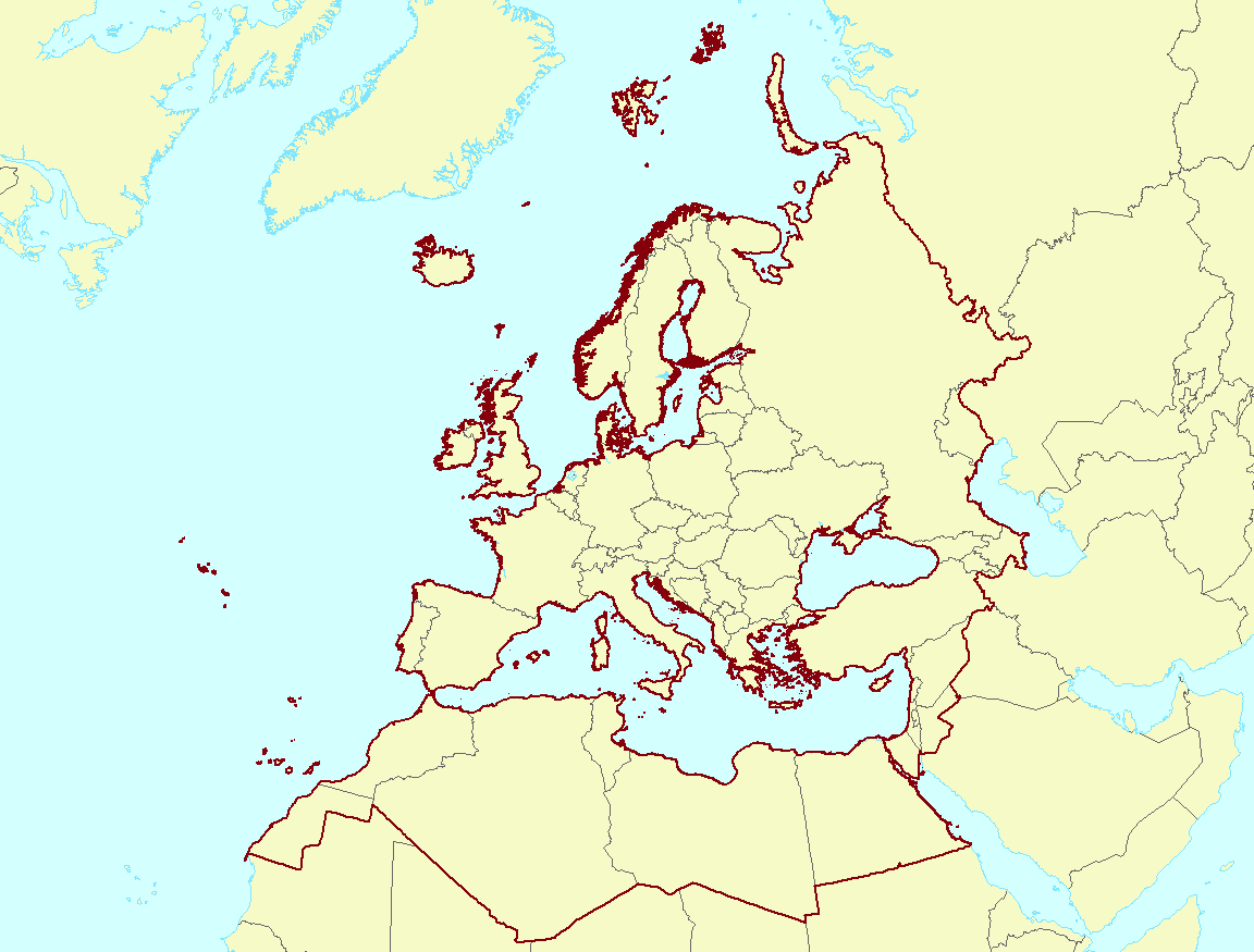
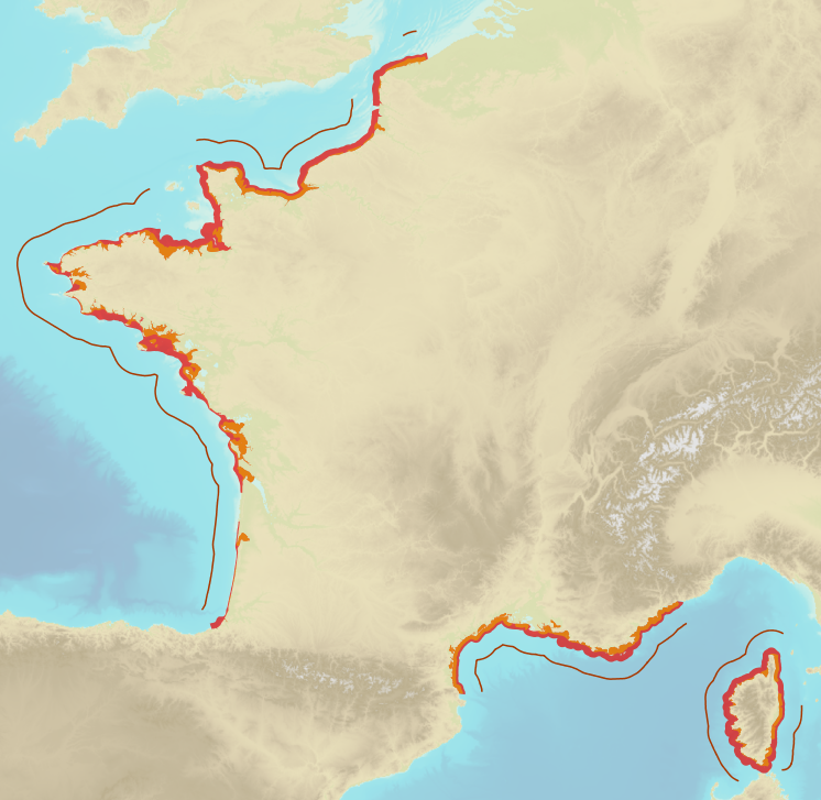
The EEA coastline for analysis is created for highly detailed analysis, e.g. 1:100 000, for geographical Europe. The coastline is a hybrid product obtained from projects using satellite imagery as data source: EUHYDRO (https://land.copernicus.eu/imagery-in-situ/eu-hydro) and GSHHG (http://www.soest.hawaii.edu/pwessel/gshhg/). The defining criteria was altitude level = 0 from EUDEM (https://land.copernicus.eu/pan-european/satellite-derived-products/eu-dem/view). Outside the coverage of the EUDEM, the coastline from GSHHG was used without modifications. A few manual amendments to the dataset were necessary to meet requirements from EU Nature Directives, Water Framework Directive and Marine Strategy Framework Directive. In 2015, several corrections were made in the Kalogeroi Islands (coordinates 38.169, 25.287) and two other Greek little islets (coordinates 36.766264, 23.604318), as well as in the peninsula of Porkkala (around coordinates 59.99, 24.42). In this revision (v3, 2017), 2 big lagoons have been removed from Baltic region, because, according to HELCOM, are freshwater lagoons.
-
The EEA coastline dataset is created for detailed analysis with a Minimum Mapping Unit of e.g. 1:100000, for geographical Europe. The coastline is a hybrid product obtained from satellite imagery from two projects: 1) EUHYDRO (Pan-European hydrographic and drainage database) [https://land.copernicus.eu/pan-european/satellite-derived-products/eu-hydro/view] and 2) GSHHG (A Global Self-consistent, Hierarchical, High-resolution Geography Database) [http://www.soest.hawaii.edu/pwessel/gshhg/]. The defining criteria was altitude level = 0 from EUDEM [https://land.copernicus.eu/pan-european/satellite-derived-products/eu-dem/view]. Outside the coverage of the EUDEM, the coastline from GSHHG was used without modifications. A few manual amendments to the dataset were necessary to meet requirements from EU Nature Directives, Water Framework Directive and Marine Strategy Framework Directive. In 2015, several corrections were made in the Kalogeroi Islands (coordinates 38.169, 25.287) and two other Greek little islets (coordinates 36.766264, 23.604318), as well as in the peninsula of Porkkala (around coordinates 59.99, 24.42). In this revision (v3, 2017), 2 big lagoons have been removed from Baltic region, because, according to HELCOM, are freshwater lagoons. This dataset is a polygon usable as a water-land mask.
-
The Marine Reporting Units (MRUs) are used within the reporting obligations of the Marine Strategy Framework Directive (MSFD) in order to link the implementation of the different articles to specific marine areas. The MRUs can be of varying sizes, according to the appropriate scale for the different reports (e.g. region, sub-region, regional or sub-regional subdivision, Member State marine waters, WFD coastal waters, etc.), as indicated in the Good Environmental Status 2017 Decision. The present data set is the first public version released of the MRUs used during the first cycle of implementation of the MSFD (2012-2018) in all the reporting exercises (2012 reporting of Articles 8, 9 and 10; 2014 reporting of Article 11; and 2016 reporting of Articles 13 & 14). The data set is distributed in SHP and in INSPIRE-compliant GML format.
-
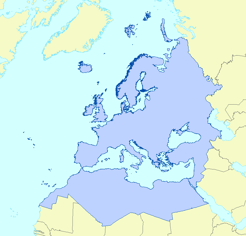
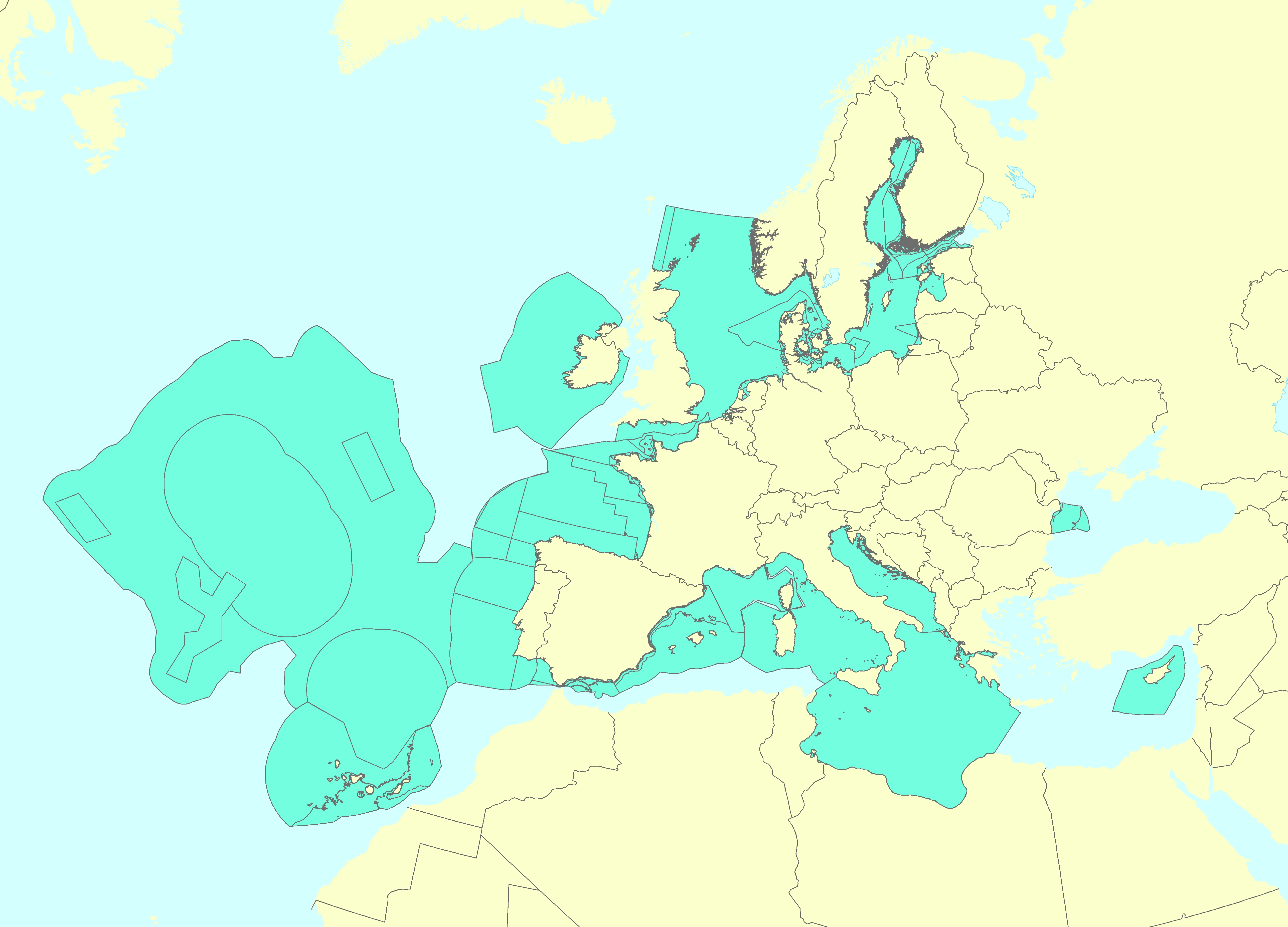
This vector data set is the first public version released of the EU marine waters used for the implementation of the Marine Strategy Framework Directive (MSFD), submitted by the Member States to the European Commission. The Marine Strategy Framework Directive (MSFD) applies to all marine waters of EU Member States, which in Article 3 are defined as follows: (a) waters, the seabed and subsoil on the seaward side of the baseline from which the extent of territorial waters is measured extending to the outmost reach of the area where a Member State has and/or exercises jurisdictional rights, in accordance with the UNCLOS, with the exception of waters adjacent to the countries and territories mentioned in Annex II to the Treaty and the French Overseas Departments and Collectivities; and (b) coastal waters as defined by Directive 2000/60/EC, their seabed and their subsoil, in so far as particular aspects of the environmental status of the marine environment are not already addressed through that Directive or other Community legislation.
-
Limits defining ship classes based on their assigned operating maritime zones. These limits were produced by CEREMA in application of section II.14 of article 1 of decree no. 200945 amended on 30 August 1984. Navigation categories are defined in article 223.2 of the rules appended to the order of 23 November 1987 on shipping safety.
-
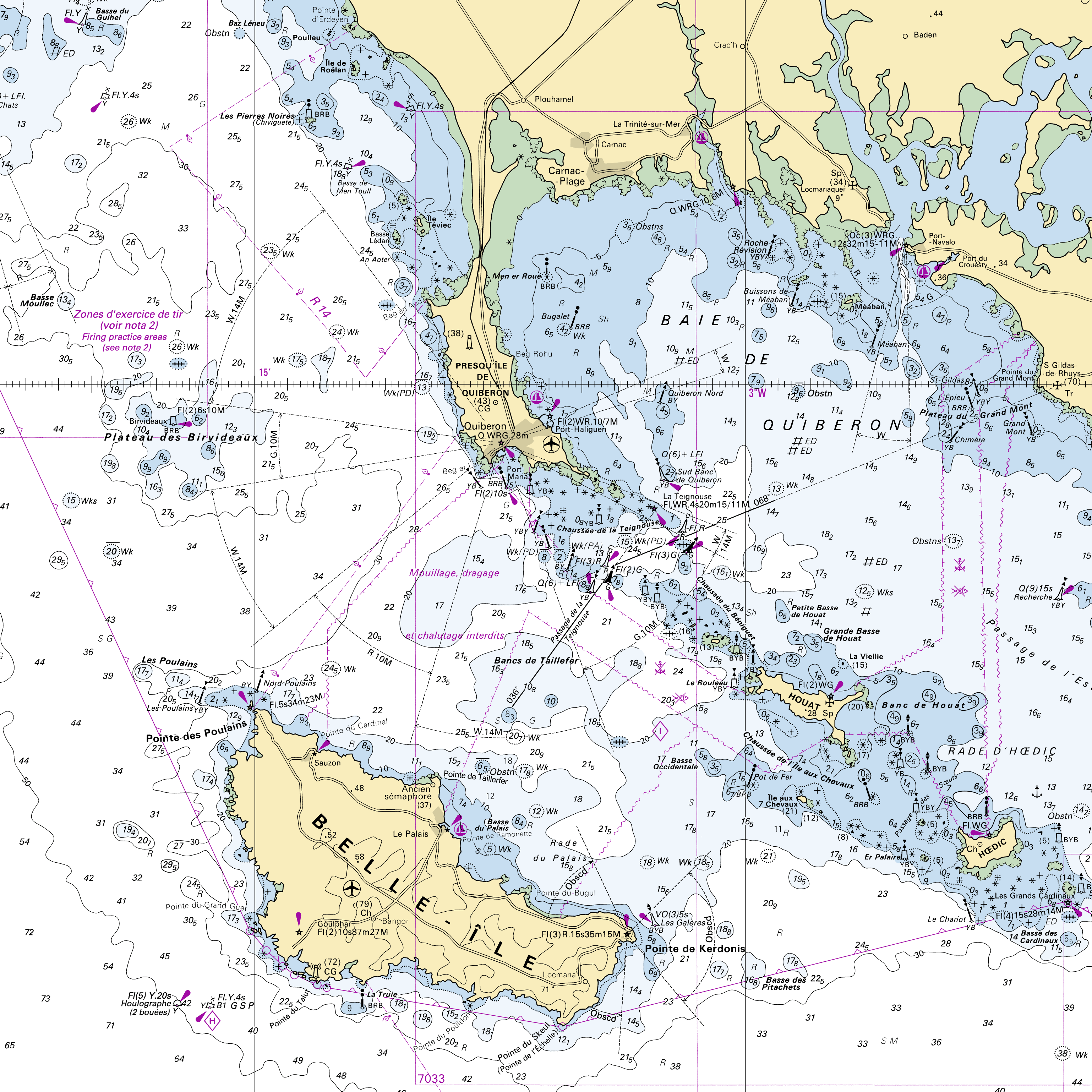
RasterMarine is a series of digital images taken from nautical charts, with no additions, legends or georeferencing information. The RasterMarine range is available at six sets of scales: - RasterMarine10 1:10,000 - RasterMarine25 1:25,000 - RasterMarine50 1:50,000 - RasterMarine100 1:100,000 - RasterMarine350 1:350,000 - RasterMarine1M 1:1,000,000. Unless exceptional circumstances apply, the RasterMarine range is updated on a weekly basis and the modified grid squares are re-published, replacing the previous versions. All corrections, publications, editions and suppressions with an effect on the reference nautical charts are taken into consideration. <br /> 04/06/2026 version <br />
-
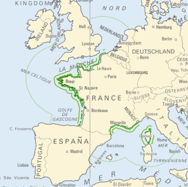
<strong>This data is not up to date with the order dated 30 August 2021 amending the order dated 23 November 1987 on ship safety, which now raises the limit for category 4 ships to 5 miles from the nearest coast.</strong> The navigation category allocated to a ship is indicated on its shipping license, together with any applicable restrictions. This limit was produced by Shom in application of section II.14 of article 1 of decree no. 84-810 amended on 30 August 1984. Navigation categories are defined in article 110.10 of the rules appended to the order of 23 November 1987 on shipping safety.
-

UWWTD Discharge Points, Jan. 2022 is one of the datasets produced within the frame of the reporting under 11th UWWTD Art.15 reporting period (UWWTD data call 2019). The Urban Waste Water Treatment Directive (UWWTD) (91/271/EEC) obliges Member States to report data on the implementation of the Directive upon request from the European Commission bi-annually. Reported data include receiving areas as designated under UWWTD, agglomerations, urban waste water treatment plants serving the agglomerations and points of discharges. Dataset UWWTD_DischargePoints contains information on individual points of discharge from urban waste water treatment plants or collecting systems, including their coordinates of discharge, link to specific treatment plant, type of receiving area into which the effluent / wastewater is discharged, related waterbody (or river basin), information on the discharge on land and potential reuse of the treated waste water. This dataset includes the reported discharge points which are displayed on the UWWTD maps (https://www.eea.europa.eu/themes/water/european-waters/water-use-and-environmental-pressures/uwwtd/interactive-maps/urban-waste-water-treatment-maps-3). The active discharge points with correct coordinates in the reported data were selected from the source European UWWTD tabular dataset, which is available on the download link https://www.eea.europa.eu/data-and-maps/data/waterbase-uwwtd-urban-waste-water-treatment-directive-7. The definition of the UWWTD Discharge Points dataset attributes (fields) is available on the link https://dd.eionet.europa.eu/datasets/latest/UWWTDArt15/tables/DischargePoints The full (internal) dataset including inactive discharge points is available under "Urban Waste Water Treatment Directive, Discharge points reported under UWWTD data call 2019 - INTERNAL VERSION, Jan. 2022". In comparison to the previous version (Nov. 2020), late redeliveries and corrections provided by several countries during 2021 are included in current revision. Next, the dataset is provided in GeoPackage and ESRI File geodatabase formats instead of shapefile used up to now, to avoid truncation of attribute names.
-
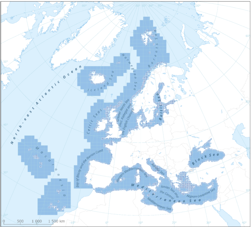
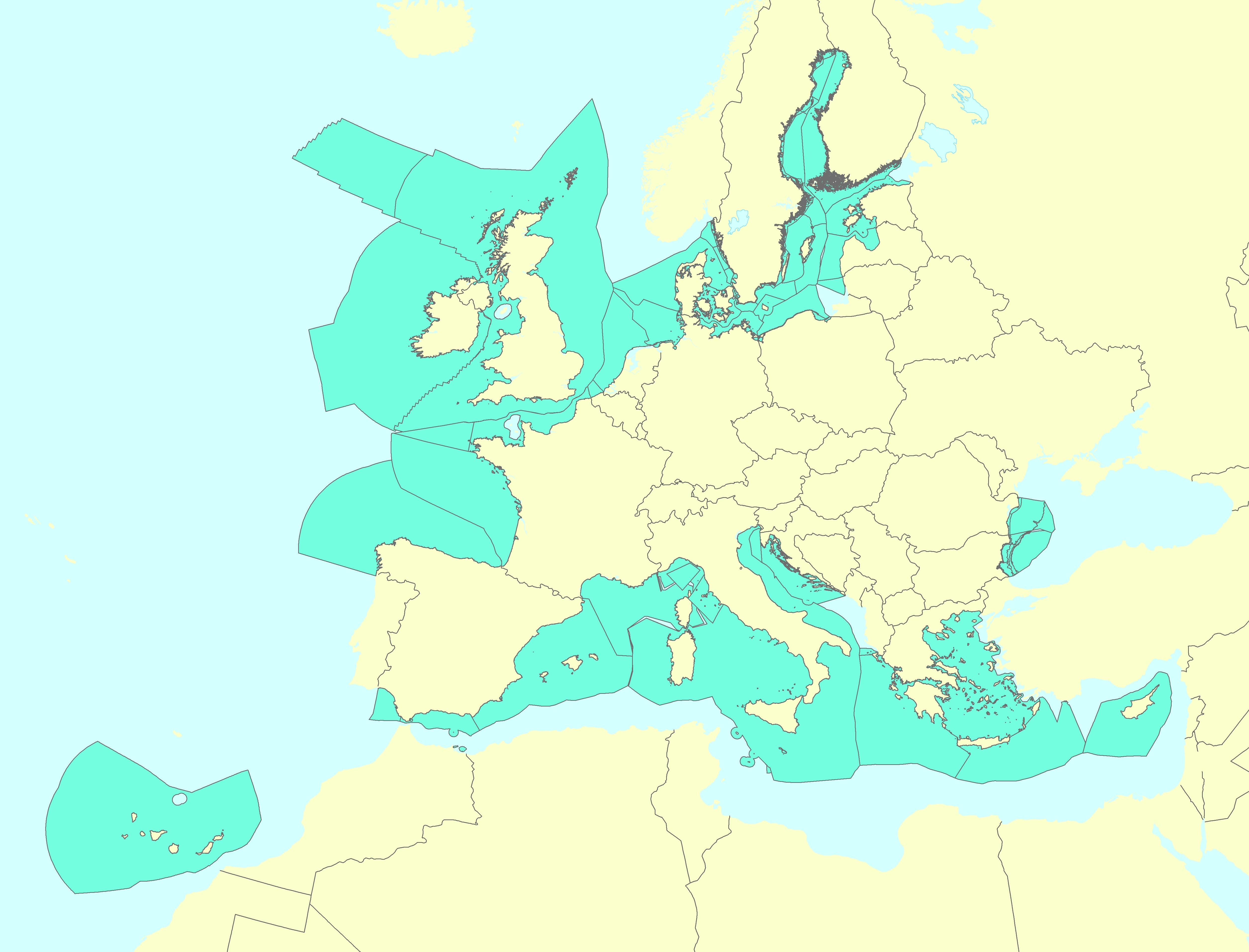
This metadata refers to the EEA marine assessment grid, to which all data and assessment results have been spatially mapped in order to ensure that data can be compared in a uniform way across the European regional seas. The marine assessment grid is based on the EEA reference grid system. The EEA reference grid is based on ERTS89 Lambert Azimuthal Equal Area projection with parameters: latitude of origin 52° N, longitude of origin 10° E, false northing 3 210 000.0 m, false easting 4 321 000.0 m. All grid cells are named with a unique identifier containing information on grid cell size and the distance from origin in meters (easting and northing). An important attribute of the EEA reference grid system is that by using an equal area projection all grid cells are having the same area for the same grid size. In this marine assessment grid, two grid sizes are used: * 100 x 100 km in offshore areas (> 20 km from the coastline) * 20 x 20 km in coastal areas (<= 20 km from the coastline) The grid sizes were choosen after an evaluation of data availability versus the need for sufficient detail in the resulting assessment. The resulting assessment grid is a combination of two grid sizes using the EEA reference grid system. The overall area of interest used in the grid is based on the marine regions and subregions under the Marine Strategy Framework Directive (MSFD). Additionally, Norwegian (Barent Sea and Norwegian Sea) and Icelandic waters (’Iceland Sea’) have been added (see Surrounding seas of Europe). Note that, within the North East Atlantic region, only the subregions within EEZ boundaries (~200 nm) have been included.
-
The Marine Reporting Units (MRUs) are used within the reporting obligations of the Marine Strategy Framework Directive (MSFD) in order to link the implementation of the different articles to specific marine areas. The MRUs can be of varying sizes, according to the appropriate scale for the different reports (e.g. region, sub-region, regional or sub-regional subdivision, Member State marine waters, WFD coastal waters, etc.), as indicated in the Good Environmental Status 2017 Decision. The present data set is the second public version released of the MRUs used during the MSFD 2018 reporting exercise on the update of Articles 8, 9 and 10. Only the MRUs of those countries that have gone through the reporting exercise by June 2020 have been included in this data set. Apart from the countries included already in version 1 of the dataset (SE, FI, EE, LV, PL, DE, DK, NL, BE, FR, ES, HR and RO), this version also includes seven more countries, namely MT, LT, IT, SI, CY, PT and IE. The data set is distributed in SHP and in INSPIRE-compliant GML format, made available also through an INSPIRE compliant ATOM service.