 Catalogue PIGMA
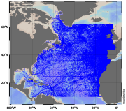
1 km
Type of resources
Available actions
Topics
Keywords
Contact for the resource
Provided by
Years
Formats
Representation types
Update frequencies
status
Scale
Resolution
-

These products contain global non time critical (NTC) Level 2P skin Sea Surface Temperature (SST) derived from SLSTR-A on Copernicus Sentinel-3 at full-resolution swath (1 km at nadir) in GHRSST compliant NetCDF format. All SSTs from the Sea and Land Surface Temperature Radiometer (SLSTR) series of instruments are SST skin measurements. For more details please see “What is SST?” on the GHRSST web pages. At night, the skin temperature is typically a few tenths of a degree cooler than the temperature measured by in situ systems; in the day, the skin can be considerably higher if strong diurnal warming is present. The SLSTRs are dual-view self-calibrating radiometers with SST retrieved from spectral bands at nominally 3.74, 10.85 and 12 µm (referred to as S7, S8 & S9). Corrections for water vapour atmospheric absorption are performed using a triple window at night, and a split window during the day as the 3.7 µm channel is not used due to solar contamination. All pixels in the dual-view part of the swath are viewed twice, via nadir and oblique views with different atmospheric path lengths, allowing for correction for aerosol effects. Consequently, there are four possible retrieved SSTs, referred to as N2 (nadir-only 11 µm and 12 µm), N3 (nadir-only 3.7 µm, 11 µm and 12 µm), D2 (dual-view 11 µm and 12 µm) and D3 (dual-view 3.7 µm, 11 µm and 12 µm). The L2P file contains the best SST available for each pixel and flags are included to identify which retrieval is used. If the observation is in the nadir-only / single-view part of swath then "sst_algorithm_types" is N2 or N3, and if the observation is in the dual-view part of swath then "sst_algorithm_types" is D2 or D3. For D2 or D3 pixels it is possible to generate their N2 or N3 equivalent by subtracting the value in the "dual_nadir_sst_difference" field. Users are advised to use only QL = 5 dual-view SSTs for reference sensor applications and to use single-view (all quality levels) and quality level 3 and 4 dual-view data only for other qualitative analysis. Users are reminded to apply the SSES bias adjustments as SLSTR-B is harmonised to SLSTR-A through SSES. Users can consider using the "theoretical_uncertainty" for weighting observations rather than the simple SSES standard deviation values. Primary access to data is via the EUMETSAT Data Store (linked below). Other access methods can be found in the EUMETSAT Product Navigator https://navigator.eumetsat.int/product/EO:EUM:DAT:SENTINEL-3:SL_2_WST___NTC?query=slstr&results=22&s=advanced. Please also read the EUMETSAT SLSTR Product Notices (linked below) as they provide a lot of useful information. All products currently contain SLSTRA-MAR-L2P-v1.0 as the GHRSST Collection ID in the file metadata, which will be revised in a future release.
-
-

This vector dataset represents the benthic broad habitat types in Europe Seas potentially affected by the ship wakes. When navigating, the propellers of ships generate a turbulent mixing of the water that can produce sediment re-suspension in soft bottoms of shallow areas. This can increase the turbidity in those areas, affecting the seafloor organisms (especially those that are directly dependent on light, such as aquatic plants). It may also contribute to an increase of the the eutrophication level of the ecosystem (since the turbid waters may become warmer, which may turn into a reduction of dissolved oxygen in water). Finally, turbidity can produce an increase in the inputs of contaminants and microbial pathogens, since those can become attached to the suspended solids. The dataset has been prepared in the context of the development of the first European Maritime Transport Environmental Report (https://www.eea.europa.eu/publications/maritime-transport).
-
-
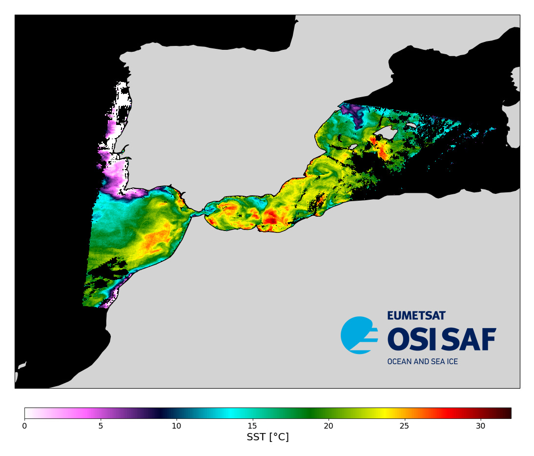
Level 2 sub-skin Sea Surface Temperature derived from AVHRR on Metop, global and provided in full-resolution swath (1 km at nadir), in GHRSST compliant netCDF format. The satellite input data has successively come from Metop-A, Metop-B and Metop-C level 1 data processed at EUMETSAT. SST is retrieved from AVHRR infrared channels (3.7, 10.8 and 12.0 µm) using a multispectral algorithm and a cloud mask. Atmospheric profiles of water vapor and temperature from a numerical weather prediction model, Sea Surface Temperature from an analysis, together with a radiative transfer model, are used to correct the multispectral algorithm for regional and seasonal biases due to changing atmospheric conditions. The quality of the products is monitored regularly by daily comparison of the satellite estimates against buoy measurements.The product format is compliant with the GHRSST Data Specification (GDS) version 2. Users are advised to use data only with quality levels 3,4 and 5.
-
These products contain global non time critical (NTC) Level 2P skin Sea Surface Temperature (SST) derived from SLSTR-B on Copernicus Sentinel-3 at full-resolution swath (1 km at nadir) in GHRSST compliant NetCDF format. All SSTs from the Sea and Land Surface Temperature Radiometer (SLSTR) series of instruments are SST skin measurements. For more details please see “What is SST?” on the GHRSST web pages. At night, the skin temperature is typically a few tenths of a degree cooler than the temperature measured by in situ systems; in the day, the skin can be considerably higher if strong diurnal warming is present. The SLSTRs are dual-view self-calibrating radiometers with SST retrieved from spectral bands at nominally 3.74, 10.85 and 12 µm (referred to as S7, S8 & S9). Corrections for water vapour atmospheric absorption are performed using a triple window at night, and a split window during the day as the 3.7 µm channel is not used due to solar contamination. All pixels in the dual-view part of the swath are viewed twice, via nadir and oblique views with different atmospheric path lengths, allowing for correction for aerosol effects. Consequently, there are four possible retrieved SSTs, referred to as N2 (nadir-only 11 µm and 12 µm), N3 (nadir-only 3.7 µm, 11 µm and 12 µm), D2 (dual-view 11 µm and 12 µm) and D3 (dual-view 3.7 µm, 11 µm and 12 µm). The L2P file contains the best SST available for each pixel and flags are included to identify which retrieval is used. If the observation is in the nadir-only / single-view part of swath then "sst_algorithm_types" is N2 or N3, and if the observation is in the dual-view part of swath then "sst_algorithm_types" is D2 or D3. For D2 or D3 pixels it is possible to generate their N2 or N3 equivalent by subtracting the value in the "dual_nadir_sst_difference" field. Users are advised to use only QL = 5 dual-view SSTs for reference sensor applications and to use single-view (all quality levels) and quality level 3 and 4 dual-view data only for other qualitative analysis. Users are reminded to apply the SSES bias adjustments as SLSTR-B is harmonised to SLSTR-A through SSES. Users can consider using the "theoretical_uncertainty" for weighting observations rather than the simple SSES standard deviation values. Primary access to data is via the EUMETSAT Data Store (linked below). Other access methods can be found in the EUMETSAT Product Navigator https://navigator.eumetsat.int/product/EO:EUM:DAT:SENTINEL-3:SL_2_WST___NTC?query=slstr&results=22&s=advanced. Please also read the EUMETSAT SLSTR Product Notices (linked below) as they provide a lot of useful information. All products currently contain SLSTRB-MAR-L2P-v1.0 as the GHRSST Collection ID in the file metadata, which will be revised in a future release.
-
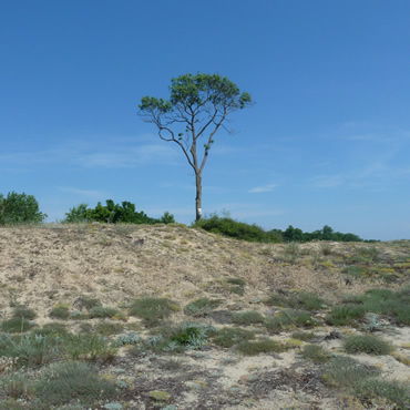
This metadata corresponds to the EUNIS Coastal habitat types, predicted distribution of habitat suitability dataset. Coastal habitats are those above spring high tide limit (or above mean water level in non-tidal waters) occupying coastal features and characterised by their proximity to the sea, including coastal dunes and wooded coastal dunes, beaches and cliffs. Includes free-draining supralittoral habitats adjacent to marine habitats which are normally only very rarely subject to any type of salt water, in as much as they may be inhabited predominantly by terrestrial species, strandlines characterised by terrestrial invertebrates and moist and wet coastal dune slacks and dune-slack pools. Supralittoral sands and wracks may be found also in marine habitats (M). Excludes supralittoral rock pools and habitats, the splash zone immediately above the the mean water line, as well the spray zone and zone subject to sporadic inundation with salt water in as much as it may be inhabited predominantly by marine species, which are included in marine (M). The modelled suitability for EUNIS coastal habitat types is an indication of where conditions are favourable for the habitat type based on sample plot data (Braun-Blanquet database) and the Maxent software package. The modelled suitability map may be used as a proxy for the geographical distribution of the habitat type. Note however that it is not representing the actual distribution of the habitat type. As predictors for the suitability modelling not only climate and soil parameters have been taken into account, but also so-called RS-EVB's, Remote Sensing-enabled Essential Biodiversity Variables, like land use, vegetation height, phenology, and LAI (Leaf Area Index). Because the EBV's are restricted by the extent of the remote sensing data (EEA38 countries and the United Kingdom) the modelling result does also not go beyond this boundary. The dataset is provided both in Geodatabase and Geopackage formats.
-
SeaDataNet Temperature and Salinity historical data collection v2, including revised quality flags after quality control with ODV. For data access please register at http://www.marine-id.org
-
These products contain global near real time (NRT) Level 2P skin Sea Surface Temperature (SST) derived from SLSTR-A on Copernicus Sentinel-3 at full-resolution swath (1 km at nadir) in GHRSST compliant NetCDF format. All SSTs from the Sea and Land Surface Temperature Radiometer (SLSTR) series of instruments are SST skin measurements. For more details please see “What is SST?” on the GHRSST web pages. At night, the skin temperature is typically a few tenths of a degree cooler than the temperature measured by in situ systems; in the day, the skin can be considerably higher if strong diurnal warming is present. The SLSTRs are dual-view self-calibrating radiometers with SST retrieved from spectral bands at nominally 3.74, 10.85 and 12 µm (referred to as S7, S8 & S9). Corrections for water vapour atmospheric absorption are performed using a triple window at night, and a split window during the day as the 3.7 µm channel is not used due to solar contamination. All pixels in the dual-view part of the swath are viewed twice, via nadir and oblique views with different atmospheric path lengths, allowing for correction for aerosol effects. Consequently, there are four possible retrieved SSTs, referred to as N2 (nadir-only 11 µm and 12 µm), N3 (nadir-only 3.7 µm, 11 µm and 12 µm), D2 (dual-view 11 µm and 12 µm) and D3 (dual-view 3.7 µm, 11 µm and 12 µm). The L2P file contains the best SST available for each pixel and flags are included to identify which retrieval is used. If the observation is in the nadir-only / single-view part of swath then "sst_algorithm_types" is N2 or N3, and if the observation is in the dual-view part of swath then "sst_algorithm_types" is D2 or D3. For D2 or D3 pixels it is possible to generate their N2 or N3 equivalent by subtracting the value in the "dual_nadir_sst_difference" field. Users are advised to use only QL = 5 dual-view SSTs for reference sensor applications and to use single-view (all quality levels) and quality level 3 and 4 dual-view data only for other qualitative analysis. Users are reminded to apply the SSES bias adjustments as SLSTR-B is harmonised to SLSTR-A through SSES. Users can consider using the "theoretical_uncertainty" for weighting observations rather than the simple SSES standard deviation values. Primary access to data is via the EUMETSAT Data Store (linked below). Other access methods can be found in the EUMETSAT Product Navigator https://navigator.eumetsat.int/product/EO:EUM:DAT:SENTINEL-3:SL_2_WST___NRT?query=slstr&results=22&s=advanced. Please also read the EUMETSAT SLSTR Product Notices (linked below) as they provide a lot of useful information. All products currently contain SLSTRA-MAR-L2P-v1.0 as the GHRSST Collection ID in the file metadata, which will be revised in a future release.
-
This metadata corresponds to the EUNIS Littoral biogenic habitat (salt marshes) types, predicted distribution of habitat suitability dataset. Littoral habitats are those formed by animals such as worms and mussels or plants (salt marshes). The verified littoral biogenic habitat samples used are derived from the Braun-Blanquet database (http://www.sci.muni.cz/botany/vegsci/braun_blanquet.php?lang=en) which is a centralised database of vegetation plots and comprises copies of national and regional databases using a unified taxonomic reference database. The geographic extent of the distribution data are all European countries except Armenia and Azerbaijan. The modelled suitability for EUNIS saltmarsh habitat types is an indication of where conditions are favourable for the habitat type based on sample plot data (Braun-Blanquet database) and the Maxent software package. The modelled suitability map may be used as a proxy for the geographical distribution of the habitat type. However, note that it is not representing the actual distribution of the habitat type. As predictors for the suitabilty modelling not only Climate and Soil parameters have been taken into account, but also so-called RS-EVB's, Remote Sensing-enabled Essential Biodiversity Variables like Landuse, Vegetation height, Phenology, LAI(Leave Area Index) and Population density. Because the EBV's are restricted by the extent of the Remote Sensing data (EEA38 countries and the United Kingdom) the modelling result does also not go beyond this boundary. The dataset is provided both in Geodatabase and Geopackage formats. The Training map files show the modelled suitable distribution, omitting the 10% of occurrence records in the least suitable environment under the assumption that they are not representative of the overall suitable habitat distribution. The 10 percentile training presence is an arbitrary threshold which omits all regions with habitat suitability lower than the suitability values for the lowest 10% of occurrence records.