 Catalogue PIGMA
Atlantique
Type of resources
Available actions
Topics
Keywords
Contact for the resource
Provided by
Years
Formats
Representation types
Update frequencies
status
Scale
Resolution
-
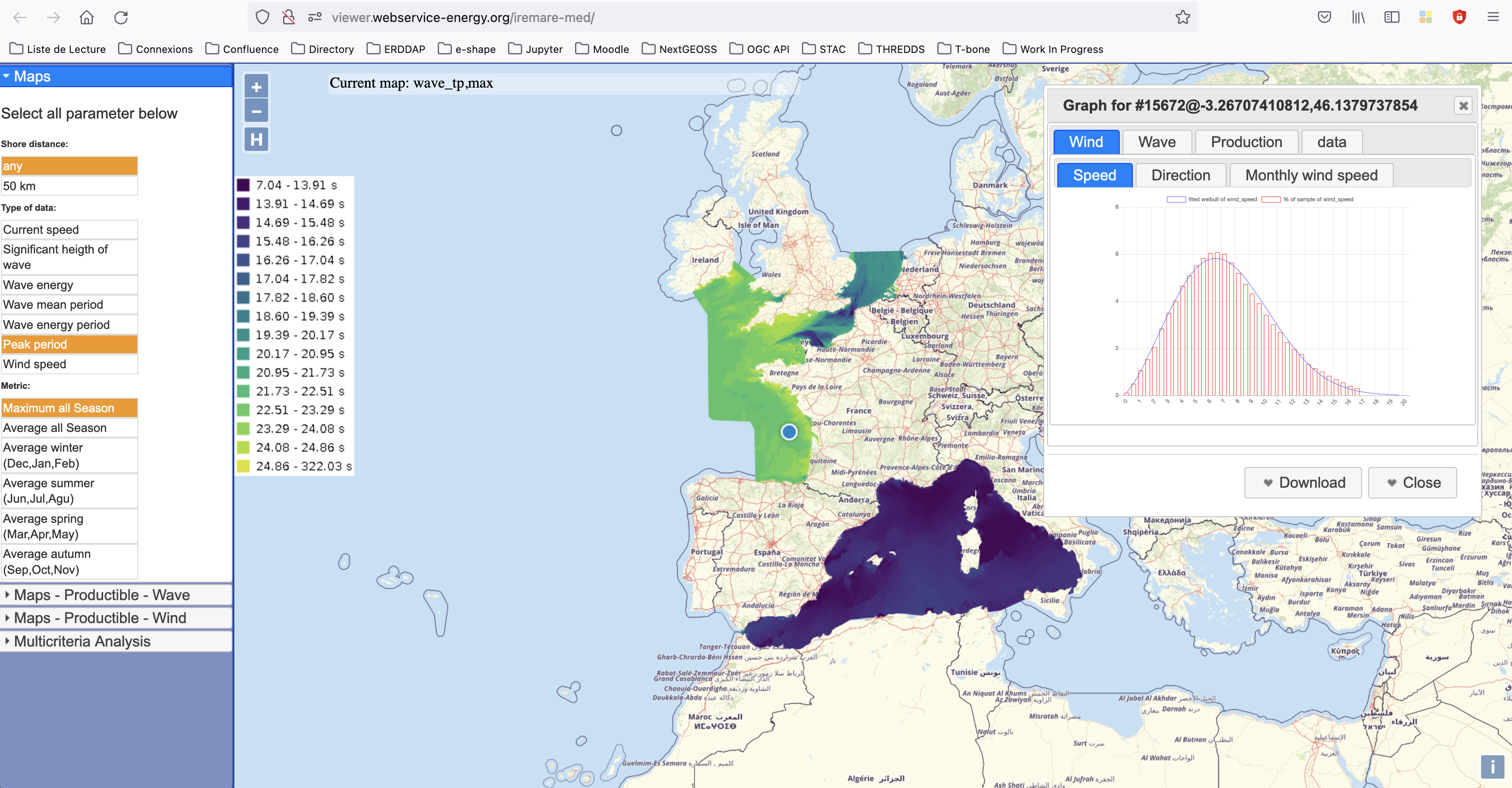
IREMARE (Marine Renewable Energie Resource Information) is a project funded by ADEME (Agency for the Environment and Energy Control, French Public Institution), convention n°1505C0027. It is dedicated to the production and dissemination of high level information about Marine Renewable Energy (MRE) resource. The information produced during IREMARE project covers the western coast of France (Atlantic, English Channel and North Sea) and can be used for national down to local scale studies. IREMARE-MED (Informations sur la Ressource pour les Energies MArines REnouvelables en MEDiterranée/Marine Renewable Energie Resource Information in the Mediterranean) is a project funded by ADEME (Agence de l'Environnement et de la Maitrise de l'Energie/Agency for the Environment and Energy Control, French Public Institution), convention n°1705C0016. It is dedicated to the production and dissemination of high level information about Marine Renewable Energy (MRE) resource. The data comes from the HOMERE database (Boudiere et al. 2013) for the zone Atlantic, Channel and North Sea and from the ANEMOC-2 dataset (Tiberi-Wadier et al. 2016) for the Mediterranean Sea.
-
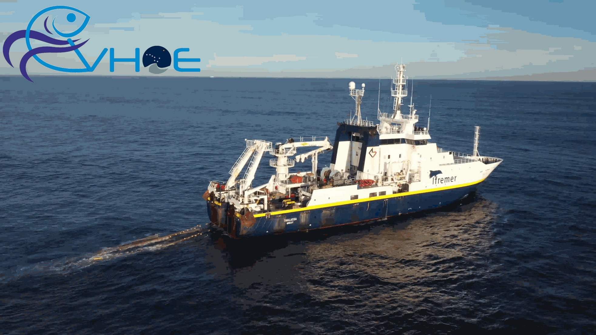
EVHOE (« Evaluation Halieutique de l’Ouest Européen ») surveys provide observational data on bentho-demersal communities on the continental shelves of the Bay of Biscay and the Celtic Sea for more than 30 years. The surveys operate a standardized bottom trawling gear and are conducted from 15 to 600 m depth, usually in the fourth quarter of the year, starting at the end of October. The main objectives are the monitoring of 22 commercial stocks of fish species and 10 cephalopods from the North-East Atlantic. The dataset also provide a description of regional diversity, including 250 taxa of fish, 45 taxa of cephalopods and others “commercial” invertebrates and, from 2008, more than 350 other taxa of benthic invertebrates. The acquisition of this dataset, organised by IFREMER, is steered by the IBTS working group organised within the framework of ICES. It is being funded by the European DCMAP programme, in coordination with the French Directorate-General for Maritime Affairs, Fisheries and Aquaculture (DGAMPA). This dataset is of great interest for the long-term monitoring of the continental shelves of the Bay of Biscay and the Celtic Sea. Moreover, on a larger scale, by being integrated into a European network of bottom trawl surveys, these data play an essential role in studying the evolution of ecosystems from continental shelves to the scale of the eastern North Atlantic. From April 2025, the proposed data have been updated in the latest standard format recognised by IFREMER (‘ELFIC’ format). The 5 data tables are compiled in a .zip file which also contains a document detailing the content of each table and their respective data fields.
-
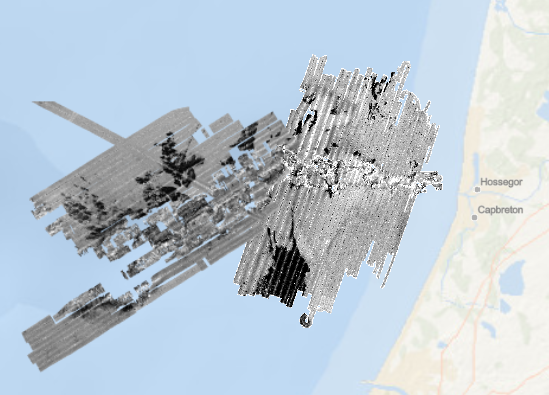
Rétrodiffusion du fond marin du canyon de Capbreton, au pas de 5 mètres (Capbreton 1), et 3 mètres (Capbreton 2). Ces jeux de données sont issus de l'acquisition acoustique du sondeur multifaisceaux EM1000 du N/O Le Suroît. L’intensité de la rétrodiffusion n’est pas directement enregistrée dans ces jeux de données, mais codée par des classes de valeurs (niveaux de gris de 0 à 255). Description de la campagne : CIRAC Pierre (1998) ITSAS cruise, RV Le Suroît, https://doi.org/10.17600/98020070
-
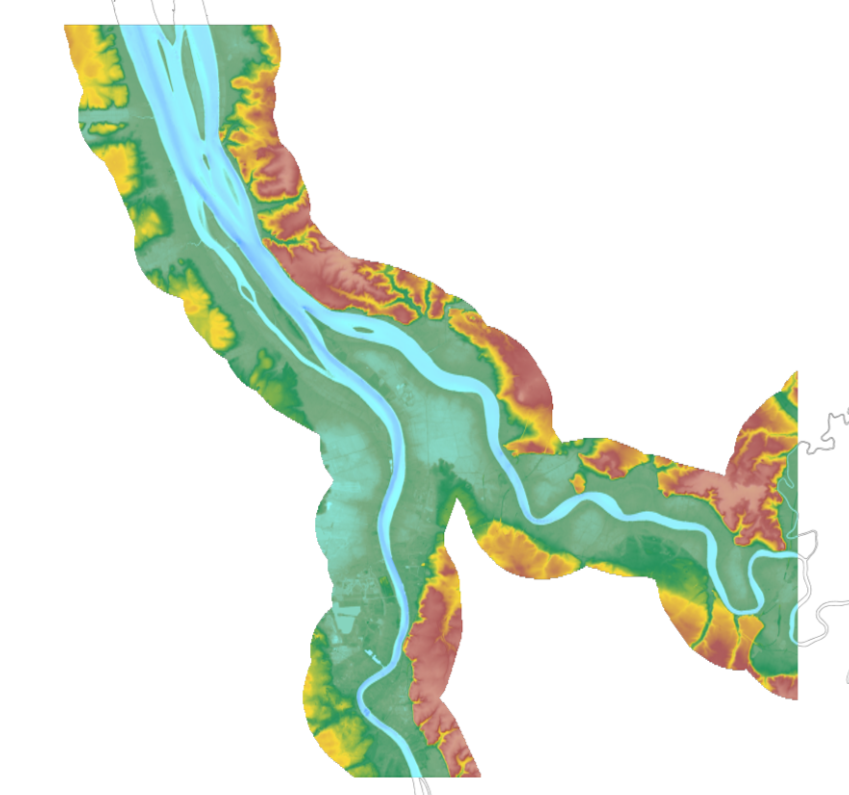
The update of the coastal topo-bathymetric DEM of the Gironde estuary - upstream with a resolution of 0.0002° (~ 20 m) was carried out in the third phase of the HOMONIM project. This DEM covers the upstream part of the Gironde estuary, from Pauillac to Bordeaux on the Garonne and to Libourne on the Dordogne. It is complementary to the DEM covering the downstream estuary (between Pauillac and the mouth of the Gironde). The DEM is intended to be implemented in hydrodynamic models in order to produce forecasts as accurate as possible of water heights and sea states at the coast to improve the relevance of the Wave-Submergence Vigilance. This product is available with either the Lowest Astronomic Tide (LAT) or the Mean Sea Level (MSL) as a vertical reference.
-
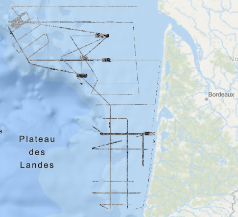
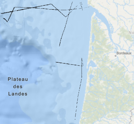
Rétrodiffusion du fond marin du plateau aquitain, dans le golfe de Gascogne, au pas de 5 mètres. Ce jeu de données est issu de l'acquisition acoustique du sondeur multifaisceaux EM1000 du N/O Le Suroît. Il rassemble 12 cartes créées à l'échelle 1/50 000. L’intensité de la rétrodiffusion n’est pas directement enregistrée dans ce jeu de données, mais codée par des classes de valeurs (niveaux de gris de 0 à 255). Description de la campagne : CIRAC Pierre (1998) ITSAS cruise, RV Le Suroît, https://doi.org/10.17600/98020070
-
Rétrodiffusion du fond marin du plateau aquitain, dans le golfe de Gascogne, au pas de 3 mètres. Ce jeu de données est issu de l'acquisition acoustique du sondeur multifaisceaux EM300 du N/O Le Suroît. Il rassemble 12 cartes créées à l'échelle 1/50 000. L’intensité de la rétrodiffusion n’est pas directement enregistrée dans ce jeu de données, mais codée par des classes de valeurs (niveaux de gris de 0 à 255). Description de la campagne : CIRAC Pierre (2001) ITSAS II cruise, RV Le Suroît, https://doi.org/10.17600/1020050
-
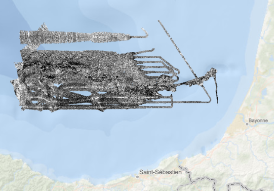
Rétrodiffusion du fond marin du canyon de Capbreton, dans le golfe de Gascogne, au pas de 8 mètres. Ce jeu de données est issu de l'acquisition acoustique du sondeur multifaisceaux EM300 du N/O Le Suroît. Description de la campagne : CIRAC Pierre (2001) ITSAS II cruise, RV Le Suroît, https://doi.org/10.17600/1020050
-
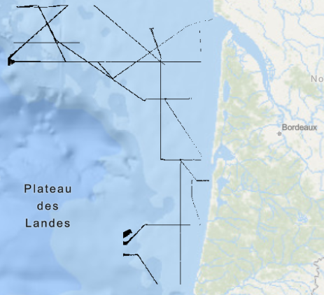
Rétrodiffusion du fond marin du plateau aquitain, dans le golfe de Gascogne, au pas de 2 à 3 mètres selon les cartes. Ce jeu de données est issu de l'acquisition acoustique du sondeur multifaisceaux EM1000 du N/O Thalia. Il rassemble 12 cartes créées à l'échelle 1/50 000. L’intensité de la rétrodiffusion n’est pas directement enregistrée dans ce jeu de données, mais codée par des classes de valeurs (niveaux de gris de 0 à 255). Description de la campagne : LERICOLAIS Gilles, AUGRIS Claude (1995) PLACETA / PLABAS 3 cruise, RV Thalia, https://doi.org/10.17600/95070070
-

The update of the coastal topo-bathymetric DEM of the Gironde estuary - downstream with a resolution of 0.0002° (~ 20 m) was carried out in the third phase of the HOMONIM project. This DEM covers the downstream part of the Gironde estuary, from Pauillac to its mouth. It is complementary to the DEM covering the upstream estuary. The DEM is intended to be implemented in hydrodynamic models in order to produce forecasts as accurate as possible of water heights and sea states at the coast to improve the relevance of the Wave-Submergence Vigilance. This product is available with either the Lowest Astronomic Tide (LAT) or the Mean Sea Level (MSL) as a vertical reference.
-
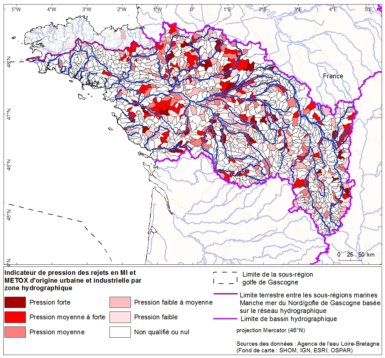
Répartition des sources de pollutions toxiques d'origine urbaine et industrielle dans le bassin Loire-Bretagne