 Catalogue PIGMA
25000
Type of resources
Available actions
Topics
Keywords
Contact for the resource
Provided by
Years
Formats
Representation types
Update frequencies
status
Scale
Resolution
-

Gestion de la taxe de séjour des Etablissements Touristiques aux forfaits (Montant/suivi déclaration/suivi facturation) à l'échelle des communautés de communes.
-
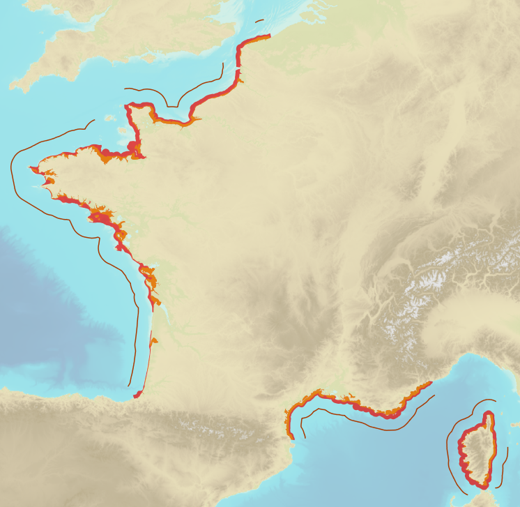
Limits defining ship classes based on their assigned operating maritime zones. These limits were produced by CEREMA in application of section II.14 of article 1 of decree no. 200945 amended on 30 August 1984. Navigation categories are defined in article 223.2 of the rules appended to the order of 23 November 1987 on shipping safety.
-
Ce jeu de données donne les intercommunalités sur le département de la Gironde.
-
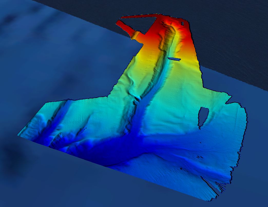
Grid processed for the purpose of the HR DTMs layer of EMODnet Bathymetry HRSM, October 2018
-
Ce jeu de données recense les communes du département de la Gironde suivies pour le Moustique Tigre.
-
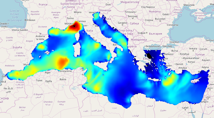
IOWAGA sea-states hindcast database generated by the wave model WAVEWATCH-III and forced by ECMWF winds on the Mediterranean grid over 2005-2017 period.
-

Gestion de la taxe de séjour des Établissements Touristiques aux réels (montant/suivi déclaration/suivi facturation) à l'échelle des communautés de communes.
-
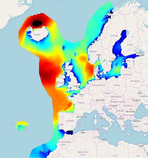
IOWAGA sea-states forecast best estimate generated by the wave model WAVEWATCH-III and forced by ECMWF winds on the North East Atlantic grid from 2017 to now
-
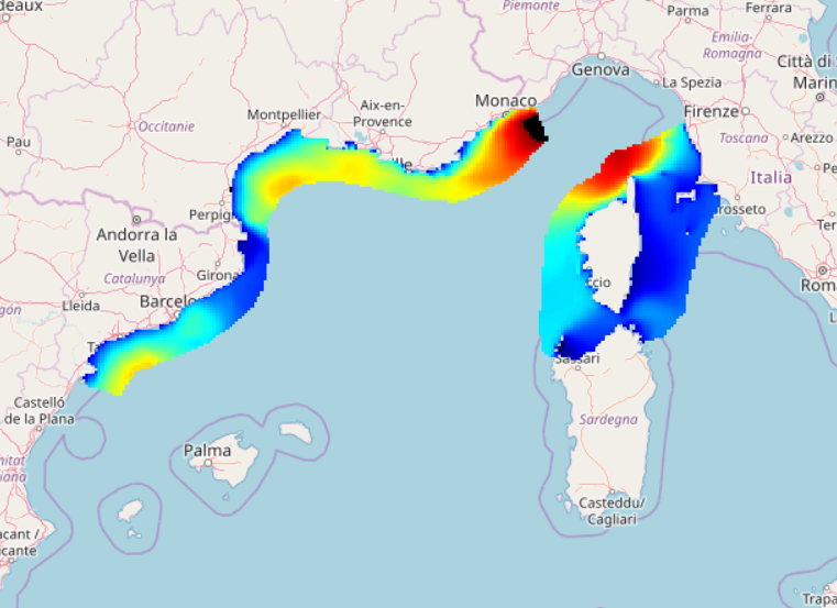
IOWAGA sea-states forecast best estimate generated by the wave model WAVEWATCH-III and forced by ECMWF winds on the North mediterranean grid from 2017 to now
-
IOWAGA sea-states forecast best estimate generated by the wave model WAVEWATCH-III and forced by ECMWF winds on the Mediterranean grid from 2017 to now