 Catalogue PIGMA
100000
Type of resources
Available actions
Topics
Keywords
Contact for the resource
Provided by
Years
Formats
Representation types
Update frequencies
status
Scale
Resolution
-
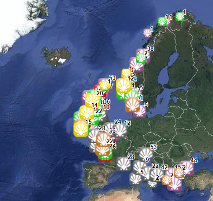
This dataset stems from the Joint Research Centre (JRC) Biomass Mandate (https://knowledge4policy.ec.europa.eu/projects-activities/jrc-biomass-mandate_en) and it is available for viewing and download on EMODnet - Human Activities web portal (www.emodnet-humanactivities.eu) and on the platform from the European Commission’s Knowledge Centre for Bioeconomy (https://knowledge4policy.ec.europa.eu/visualisation/bioeconomy-different-countries_en#algae_prod_plants). Its aim is to build a reliable database to characterize the algae sector and to support informed European policies on Blue Growth and Bioeconomy. More detailed information on the Status of the Algae Production Industry in Europe can be found in a JRC-led study published in Frontiers in Marine Science (https://publications.jrc.ec.europa.eu/repository/handle/JRC122250). Information on the location (geographic coordinates) of the production facilities, group of produced organism (macroalgae, microalgae and spirulina), production method (Fermenters, Harvesting , Photobioreactors, Open ponds, Semi Open ponds, land-based or at sea Aquaculture, Integrated multi-trophic or not) and species (see dataset) have been collected in the following countries: Austria, Belgium, Bulgaria, Croatia, Czech Republic, Denmark, Estonia, Faroe Islands, France, Germany, Greece, Greenland, Hungary, Iceland, Ireland, Italy, Latvia, the Netherlands, Norway, Portugal, Spain, Sweden, Switzerland and the UK. In November 2021, the JRC has updated the database with the latest information on the production units operational at the time.
-
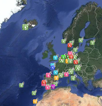
The database on shellfish aquaculture in the EU was created in 2014 by AND-International for the European Marine Observation and Data Network (EMODnet). It is the result of the aggregation and harmonization of datasets provided by national sources across the EU (plus Norway) and by the project Euroshell. Data are available for viewing and download on EMODnet - Human Activities web portal (www.emodnet-humanactivities.eu). The database contains points representing shellfish farms or shellfish production areas (depending on available data) in the following countries: Bulgaria, Denmark, France, Greece, Ireland, Italy, Netherlands, Norway and United Kingdom. Spanish data is provided separately through WMS services. Data is missing for Germany, Portugal, Sweden, Croatia and Slovenia. Except for Germany, the shellfish production remains limited in those MS. There is no production in other MS. Each point has the following attributes (where available): status (active, inactive), country, owner name, farm type (Mussels, Oysters, Mussels-Oysters, Clams, Specialised (other), Mixed (other)), production method (Long lines, Trestles or trays, Tanks, Rafts, Beds, Raceways), production stage (Grow out for human consumption, Hatchery, Nursery, Broodstock, Reproduction, Harvest, Other), purpose (Commercial, Research, Education, Display, Other), species detailed (English translation of the information provided on species grown or authorised in the source), point information (Polygon centroid, Original) depending on how the information is provided in the source (polygons or points), site_id, distance to coast (metres), position from coastline (At sea, within the coastline). The farm type relies on a typology established by AND-International, based on available information on species grown or authorised. A relational table provides harmonised information about species grown or authorised using Eurostat nomenclature for the Species Group (Mussels; Oysters; Clams, cockles, arkshells; Scallops, pectens; Abalones, winkles, conchs; Sea-urchins and other echinoderms) and when available the species name (e.g. Blue mussels - Mytilus edulis). The distance to coast (EEA coastline shapefile) has been calculated using the original data map projections, where available. In the other cases it was used the UTM WGS84 Zone projected coordinate system where data fall in. Compared with the previous version this new version has been not only updated but was also reviewed (dataset schema and attributes values), in order to add information on production methods, production stages and purposes and to provide a more useful typology based on species grown. Data from Norway and Bulgaria have been added. Data from France relies on cadastral data rather than large production areas in the previous database.
-

This dataset represents the regions for levels 1, 2 and 3 of the Nomenclature of Territorial Units for Statistics (NUTS) for 2016. The NUTS nomenclature is a hierarchical classification of statistical regions and subdivides the EU economic territory into regions of four different levels (NUTS , 1, 2 and 3, moving respectively from larger to smaller territorial units). NUTS 1 is the most aggregated level. An additional Country level (NUTS 0) is also available for countries where the the nation at statistical level does not coincide with the administrative boundaries. For example Mt Athos in Greece and Mellum and Minsener Ogg in Germany. The NUTS classification has been officially established through Regulation (EC) No 2016/2066 of the European Parliament and of the Council and its amendments. A non-official NUTS-like classification has been defined for the EFTA countries and candidate countries. An introduction to the NUTS classification is available here: http://ec.europa.eu/eurostat/web/nuts/overview. This dataset has been created mainly from the EuroBoundary Map v 12 (Eurogeographics) and geographic information from TurkStat for Turkey. The public dataset is available under the Download link indicated below. Available scales are 1M, 3M, 10M, 20M, 60M). The full dataset is available via the EC restricted download link under GISCO.NUTS_2016. Here six scale ranges (100K, 1M, 3M, 10M and 20M, 60M) are available. Coverage is the economic territory of the EU, EFTA countries and candidate countries as in 2013.
-
Complete Coastline Features for all the countries that produced Corine Land Cover 2000 and have a coastline, with detailed descriptions on the environment and type of coastal areas. Each coast segment has inherited CLC 2000 class, and also the attributes from Eurosion Coastline version 2.1 2004, regarding geomorphology, type of coast and erosion trends.
-
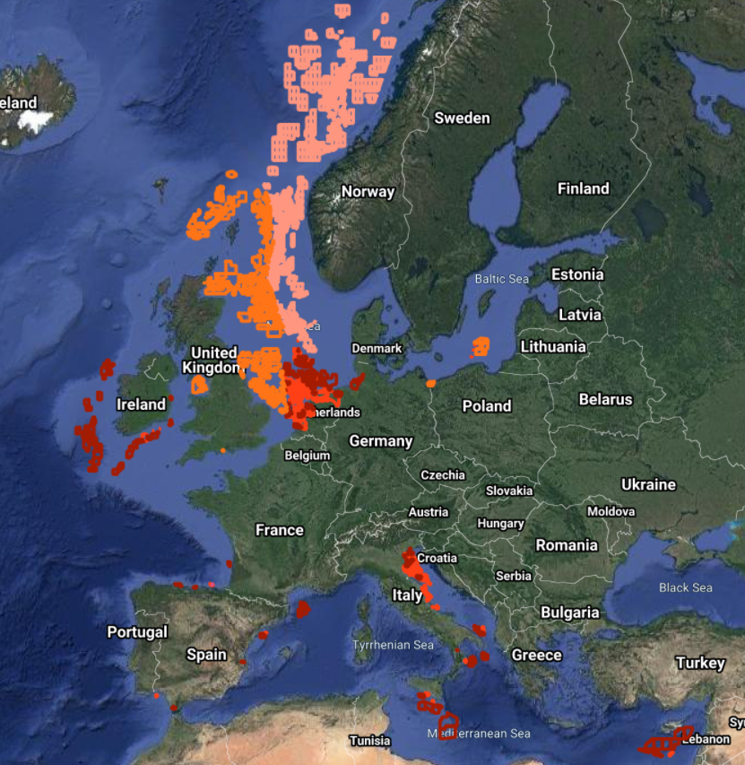
The Marine Reporting Units (MRUs) are used within the reporting obligations of the Marine Strategy Framework Directive (MSFD) in order to link the implementation of the different articles to specific marine areas. The MRUs can be of varying sizes, according to the appropriate scale for the different reports (e.g. region, sub-region, regional or sub-regional subdivision, Member State marine waters, WFD coastal waters, etc.), as indicated in the Good Environmental Status 2017 Decision. The present data set is the second public version released of the MRUs used during the MSFD 2018 reporting exercise on the update of Articles 8, 9 and 10. Only the MRUs of those countries that have gone through the reporting exercise by June 2020 have been included in this data set. Apart from the countries included already in version 1 of the dataset (SE, FI, EE, LV, PL, DE, DK, NL, BE, FR, ES, HR and RO), this version also includes seven more countries, namely MT, LT, IT, SI, CY, PT and IE. The data set is distributed in SHP and in INSPIRE-compliant GML format, made available also through an INSPIRE compliant ATOM service.
-
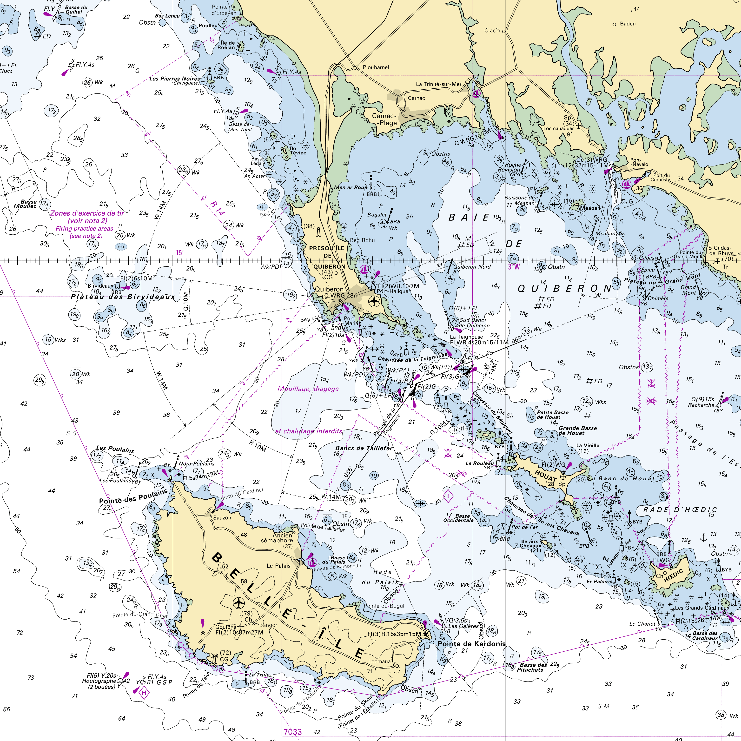
RasterMarine is a series of digital images taken from nautical charts, with no additions, legends or georeferencing information. The RasterMarine range is available at six sets of scales: - RasterMarine10 1:10,000 - RasterMarine25 1:25,000 - RasterMarine50 1:50,000 - RasterMarine100 1:100,000 - RasterMarine350 1:350,000 - RasterMarine1M 1:1,000,000. Unless exceptional circumstances apply, the RasterMarine range is updated on a weekly basis and the modified grid squares are re-published, replacing the previous versions. All corrections, publications, editions and suppressions with an effect on the reference nautical charts are taken into consideration. <br /> 09/07/2026 version <br />
-
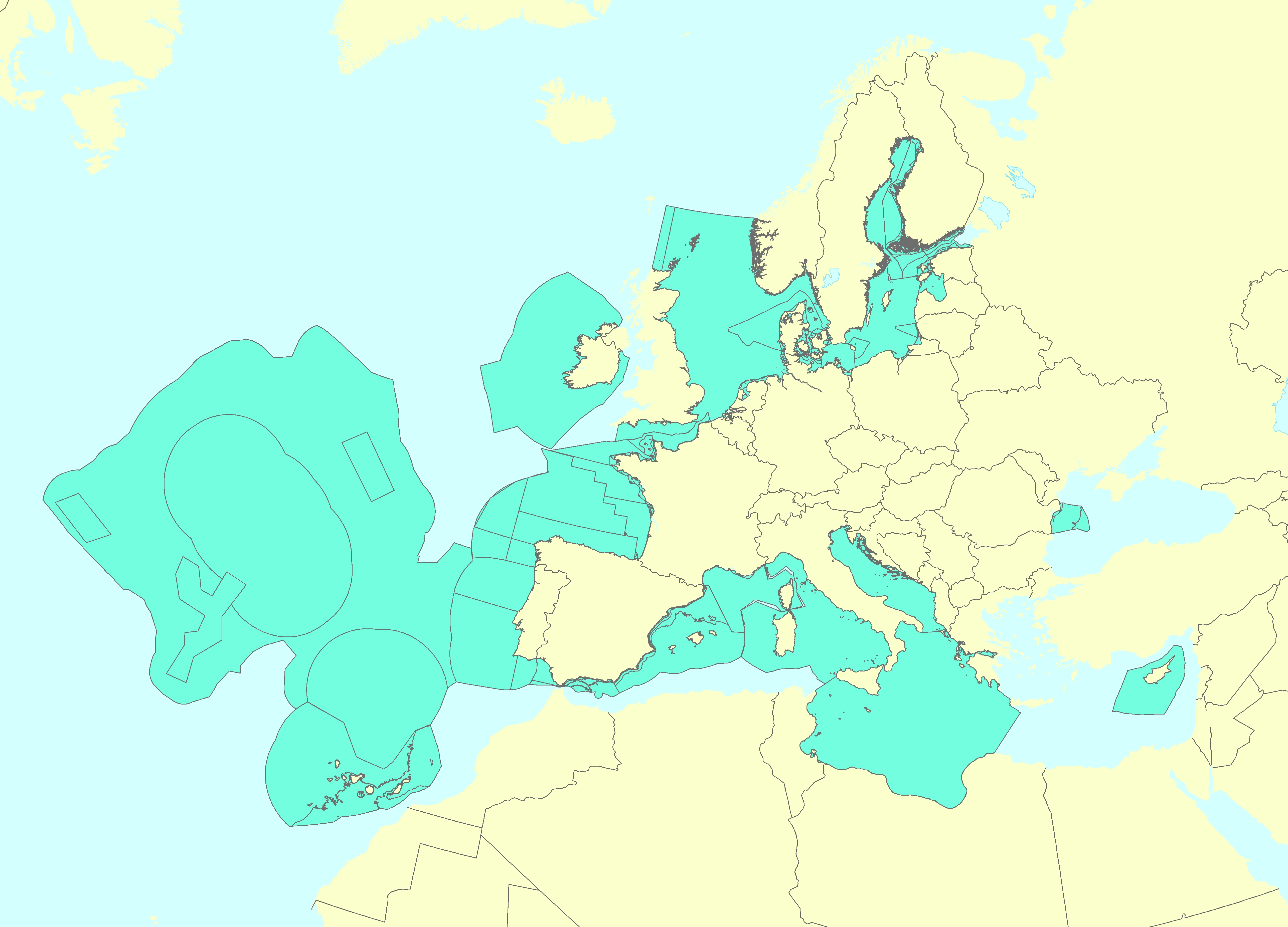
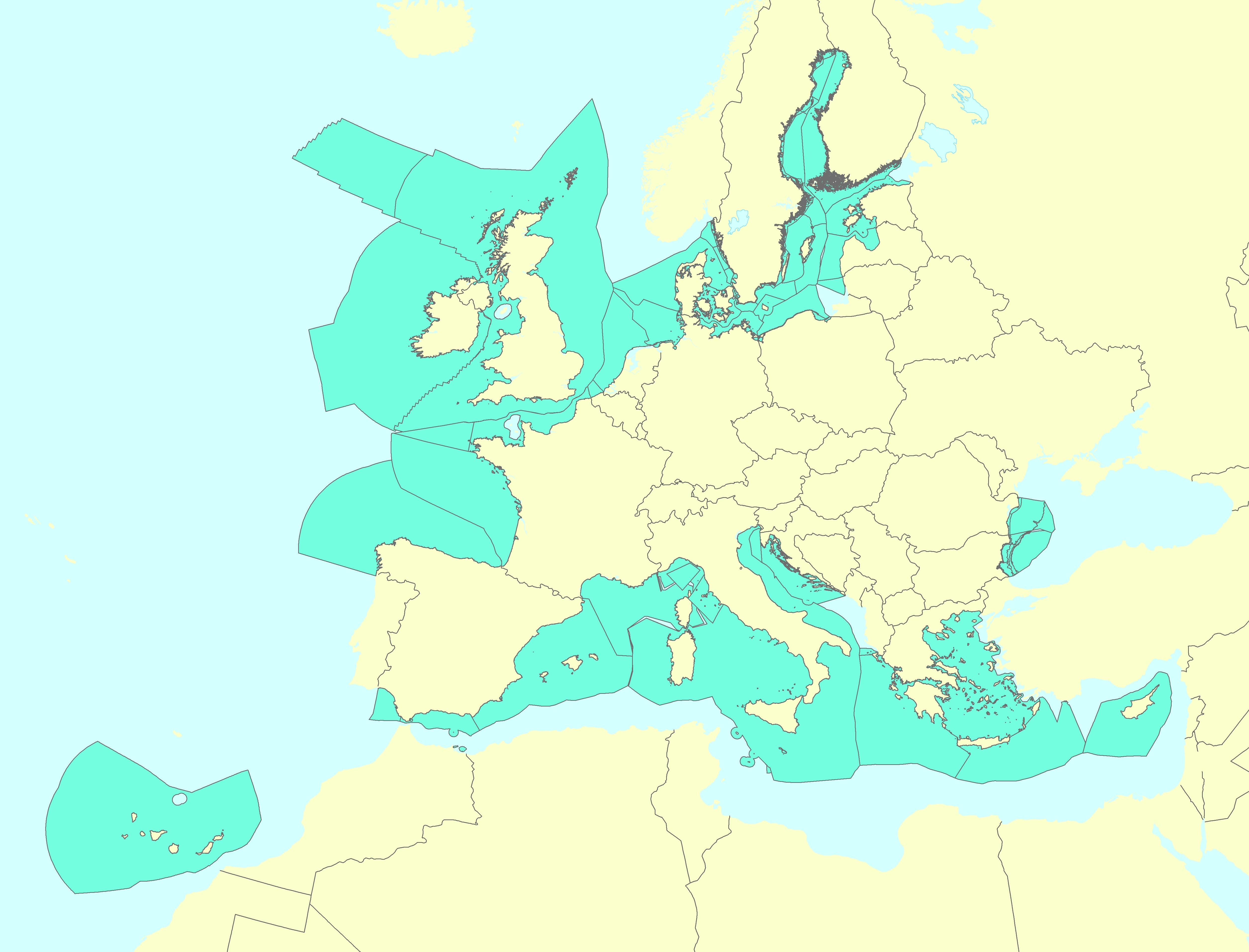
The dataset on offshore active licences for Oil and Gas exploitation and exploration in the EU was created in 2014 by Cogea for the European Marine Observation and Data Network (EMODnet). It is the result of the aggregation and harmonization of datasets provided by several EU and non-EU sources. It is updated every year, and is available for viewing and download on EMODnet - Human Activities web portal (www.emodnet-humanactivities.eu). It contains polygons representing active offshore licenced areas in the following countries: Croatia, Cyprus, Denmark, France, Germany, Ireland, Italy, Malta, Netherlands, Norway, Poland, Spain and United Kingdom. Where available each polygon has the following attributes: country, code, name, type (exploitation, exploration, exploitation and exploration, other, N/A), licensing round (it includes also pending applications in France and Spain), area (square km), area info (it indicates if the area value is original from the source or has been calculated), starting year, ending year, operator or administrator. Compared with the previous release, 'Exploitation, exploration' new type of licence has been added. Italy's exploration licences are all temporarily suspended.
-
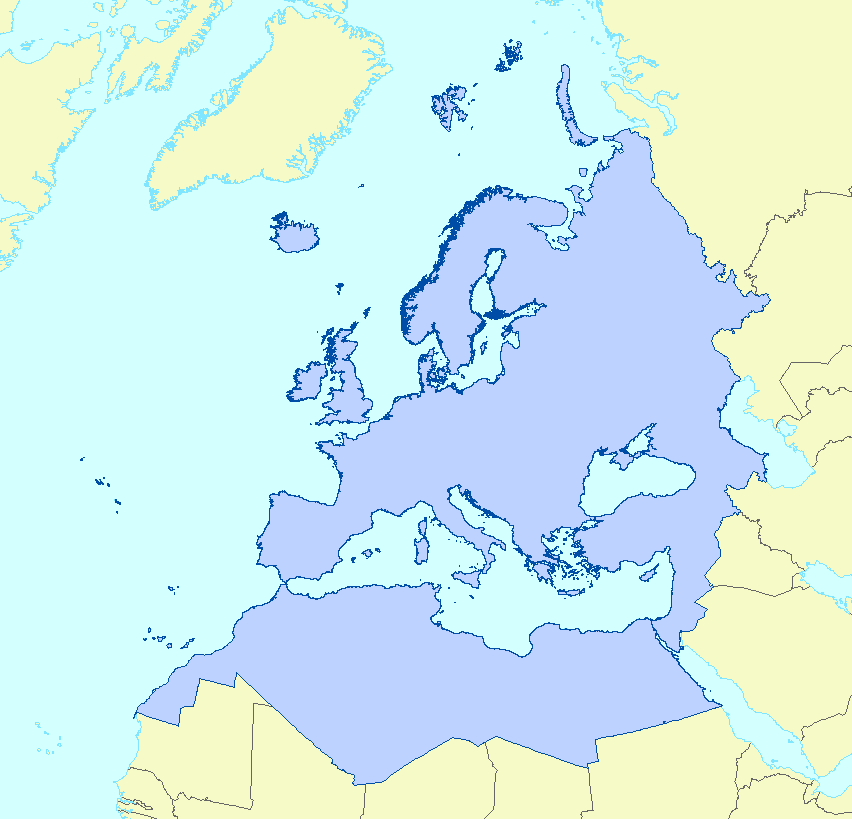
The EEA coastline dataset is created for detailed analysis with a Minimum Mapping Unit of e.g. 1:100000, for geographical Europe. The coastline is a hybrid product obtained from satellite imagery from two projects: 1) EUHYDRO (Pan-European hydrographic and drainage database) [https://land.copernicus.eu/pan-european/satellite-derived-products/eu-hydro/view] and 2) GSHHG (A Global Self-consistent, Hierarchical, High-resolution Geography Database) [http://www.soest.hawaii.edu/pwessel/gshhg/]. The defining criteria was altitude level = 0 from EUDEM [https://land.copernicus.eu/pan-european/satellite-derived-products/eu-dem/view]. Outside the coverage of the EUDEM, the coastline from GSHHG was used without modifications. A few manual amendments to the dataset were necessary to meet requirements from EU Nature Directives, Water Framework Directive and Marine Strategy Framework Directive. In 2015, several corrections were made in the Kalogeroi Islands (coordinates 38.169, 25.287) and two other Greek little islets (coordinates 36.766264, 23.604318), as well as in the peninsula of Porkkala (around coordinates 59.99, 24.42). In this revision (v3, 2017), 2 big lagoons have been removed from Baltic region, because, according to HELCOM, are freshwater lagoons. This dataset is a polygon usable as a water-land mask.
-

Frise chronologique des millésimes de modes d'occupation des sols produits par les régions françaises et par le programme Corine Land Cover.
-
The Marine Reporting Units (MRUs) are used within the reporting obligations of the Marine Strategy Framework Directive (MSFD) in order to link the implementation of the different articles to specific marine areas. The MRUs can be of varying sizes, according to the appropriate scale for the different reports (e.g. region, sub-region, regional or sub-regional subdivision, Member State marine waters, WFD coastal waters, etc.), as indicated in the Good Environmental Status 2017 Decision. The present data set is the first public version released of the MRUs used during the first cycle of implementation of the MSFD (2012-2018) in all the reporting exercises (2012 reporting of Articles 8, 9 and 10; 2014 reporting of Article 11; and 2016 reporting of Articles 13 & 14). The data set is distributed in SHP and in INSPIRE-compliant GML format.