 Catalogue PIGMA
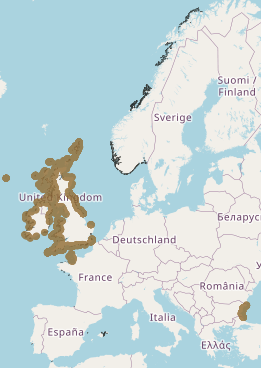
Celtic Seas
Type of resources
Available actions
Topics
Keywords
Contact for the resource
Provided by
Years
Formats
Representation types
Update frequencies
status
Scale
Resolution
-

Ireland’s Marine Atlas is developed and maintained by the Marine Institute with funding by the Government of Ireland. This work is part supported by the Irish Government and the European Maritime & Fisheries Fund as part of the EMFF Operational Programme for 2014-2020. The atlas provides a one-stop-shop to view and download marine environmental data relevant to reporting under Ireland’s Marine Strategy Framework Directive (MSFD). The aim of the European Union’s MSFD directive is to protect more effectively the marine environment across Europe through the establishment of “good marine waters”. Data in Ireland’s Marine Atlas has been guided by the European Directive on harmonising environmental data across Europe within a spatial data infrastructure known as INSPIRE. INSPIRE Data Specifications (Data Models) have been used to manage data to the categories visible under THEMES in the atlas. Many of the layers displayed in the Atlas are also used in the National Marine Planning Framework (NMPF). This framework aims to bring together all marine-based human activities, outlining the government’s vision, objectives and marine planning policies for each marine activity. The NMPF report details how these marine activities will interact with each other in an ocean space that is under increasing spatial pressure, ensuring the sustainable use of our marine resources to 2040. Please read the following information carefully as it sets out the terms and conditions that govern the use of products and services on this website. Once you have read these terms and conditions click the "Agree" button at the bottom of the page to proceed. By clicking the "Agree" button you will be deemed to have accepted the terms and conditions, our legal notices and privacy statement.
-

This is a compilation of OSPAR habitat point data for the northeast Atlantic submitted by OSPAR contracting parties. The compilation is coordinated by the UK's Joint Nature Conservation Committee, working with a representative from each of the OSPAR coastal contracting parties. This public dataset does not contain records relating to sensitive species (e.g. Ostrea edulis) in specific areas, or where data are restricted from public release by the owner's use limitations. This version (v2020) was published in July 2021.
-
Excel file containing CPR data from Standard Areas B4,C3,C4,D3,D4,D5,E4,F4 for the plankton Calanus finmarchicus and helgolandicus, total traverse (small) copepods, total large copepods, Phytoplankton Colour Index and Cnidaria (presence denoted by a 1, absence by a zero). All taxa are from 1980, except Cnidaria which are from 2011. Dataset is in the format of sample level data, with each row being a discrete sample, with a sample being 3m3 filtered seawater, and 10nm of tow. For each row, a sample has the following information, starting at column a: Standard area of sample, sample id, latitude (decimal degrees) of sample mid point, longitude (decimal degrees) of sample midpoint, sample midpoint date and local time, year of sample, month of sample, then plankton abundance values (or PCI index or cnidaria presence/absence). All taxa have been looked for during the period this dataset spans, so zero values represent true absence.
-
This layer shows the current known extent and distribution of macroalgal canopy in European waters, collated by EMODnet Seabed Habitats. The polygons portion was last updated in 2019. The points were added in Sept 2021. The purpose was to produce a data product that would provide the best compilation of evidence for the essential ocean variable (EOV) known as Macroalgal canopy cover and composition (sub-variable: Areal extent), as defined by the Global Ocean Observing System (GOOS). Kelp and fucoid brown algae are the dominant species that comprise macroalgal forests. This data product should be considered a work in progress and is not an official product.
-
Intermediate Assessment 2017 - Seabed Litter - Litter is widespread on the seafloor across the area assessed, with plastic being the predominant material encountered. In the areas assessed, higher amounts of litter are found in the Eastern Bay of Biscay, Southern Celtic Seas and English Channel relative to the north of the Greater North Sea and Celtic Seas.
-
The Continuous Plankton Recorder (CPR) Survey is the most geographically extensive marine monitoring programme in the world. Today the Survey is operated by the Marine Biological Association, based in Plymouth, UK. Operating since 1931, the Continuous Plankton Recorder (CPR) survey is recognised as the longest sustained and geographically most extensive marine biological survey in the world. The dataset comprises a uniquely large record of marine biodiversity covering ~800 taxa over multi-decadal periods. In terms of our scientific understanding of natural variability and human-induced change on our oceans, the CPR survey is of global importance and it is used by scientists, policy makers and environmental managers across the world. The data is used to examine strategically important science pillars such as climate change, human health, fisheries, biodiversity, pathogens, invasive species, ocean acidification and natural capital. The results have included the globally first documented studies of large-scale ecological regime shifts, and of biogeographic, phenological and trans-arctic migrations in the marine environment in response to climate change. The data in this sampling event resource has been published as a Darwin Core Archive (DwC-A), which is a standardized format for sharing biodiversity data as a set of one or more data tables. The core data table contains 252,385 records. 2 extension data tables also exist. An extension record supplies extra information about a core record. The number of records in each extension data table is illustrated below.
-
Output of the 2019 EUSeaMap broad-scale predictive model, produced by EMODnet Seabed Habitats and aggregated into the Benthic Broad Habitat Types of the Marine Strategy Framework Directive (as defined in the Commission Decision 17 May 2017). The extent of the mapped area includes the Mediterranean Sea, Black Sea, Baltic Sea, and areas of the North Eastern Atlantic extending from the Canary Islands in the south to the Barents Sea in the north. The map was produced using a "top-down" modelling approach using classified habitat descriptors to determine a final output habitat. Habitat descriptors differ per region but include: - Biological zone - Energy class - Oxygen regime - Salinity regime - Seabed substrate - Riverine input Habitat descriptors (excepting Substrate) are calculated using underlying physical data and thresholds derived from statistical analyses or expert judgement on known conditions.
-

The abundance of ichthyoplankton in samples from dedicated plankton surveys by Cefas with positional and sample data. Surveys took place off the Western Coast of the UK and Ireland between 1986 and 2004. Series of cruises undertaken to contribute to the estimation of the spawning stock biomass of the western mackerel and horse mackerel stocks by plankton survey. The triennial mackerel egg surveys were begun in 1977 to estimate the SSB of the western mackerel stock. Since 1986 the surveys have also been used to estimate the SSB of horse mackerel. Plankton sampling is undertaken to estimate the egg production and trawling is carried out to estimate the mean fecundity of the mature female fish. Various designs of Gulf VII type samplers have been used with various apertures of nosecones and 270 micron nets. Samplers are now standardised to the 53cm version, fitted with 20cm aperture nosecones. Analysis at Cefas involved separating all fish eggs and larvae from samples. Where possible all eggs were identified. Eggs lacking identifiable features were measured. Where >100 eggs were found, sub-sampling was undertaken. Eggs that were unmeasured were apportioned across the size distribution of measured eggs. All mackerel and horse mackerel eggs were staged.
-

This layer shows the current known extent and distribution of live hard coral cover in European waters, collated by EMODnet Seabed Habitats. The polygons portion was last updated in 2019. The points were added in Sept 2021. Lophelia pertusa and Coral gardens are both on the OSPAR List of threatened and/or declining species and habitats. The purpose was to produce a data product that would provide the best compilation of evidence for the essential ocean variable (EOV) known as Hard coral cover and composition (sub-variable: Live hard coral cover and extent), as defined by the Global Ocean Observing System (GOOS). This data product should be considered a work in progress and is not an official product.
-

The Plankton Lifeform Extraction Tool brings together disparate European plankton datasets into a central database from which it extracts abundance time series of plankton functional groups, called “lifeforms”, according to shared biological traits. This tool has been designed to make complex plankton datasets accessible and meaningful for policy, public interest, and scientific discovery. The Plankton Lifeform Extraction Tool currently integrates 155 000 samples, containing over 44 million plankton records, from nine different plankton datasets within UK and European seas, collected between 1924 and 2017. Additional datasets can be added, and time series can be updated.