 Catalogue PIGMA
/Etat du Milieu/Hydrodynamique
Type of resources
Available actions
Topics
Keywords
Contact for the resource
Provided by
Years
Formats
Representation types
Update frequencies
status
Scale
Resolution
-
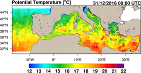
Ce jeu de données contient les résultats journaliers (archives et prévisions) du modèle hydrodynamique MFS configuration "EAS 5" du Centro Euro-Mediterraneo sui Cambiamenti Climatici (CMCC). Les résultats sont collectés quotidiennement via le portail Copernicus Marine (produit MEDSEA_ANALYSIS_FORECAST_PHY_006_013 - daily). Ces données sont utilisées comme données de forçage pour les modèles côtiers en Méditerranée. Variables : température, courants, salinité sur 72 profondeurs, journaliers
-

Cette archive contient les résultats du modèle hydrodynamique MFS - EAS6 du CMCC servant de forçage aux modèles côtiers en Méditerranée.
-
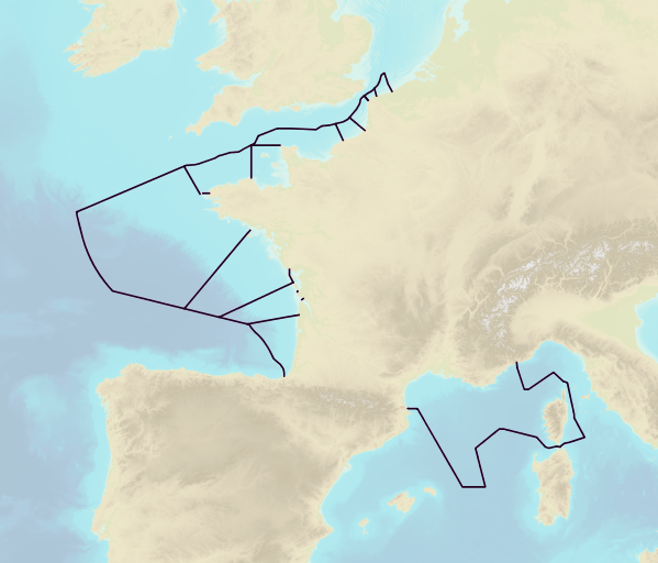
This product includes the boundaries of tidal zones for French Channel, Atlantic and Mediterranean coasts in shapefile format. Information on the characteristics of tidal zones is available as part of the "Maritime Altimetric Reference Values" product.
-
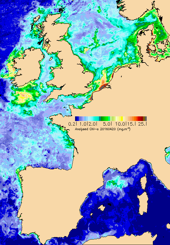
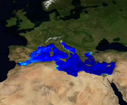
Ce jeu de données regroupe des données satellite de température de surface, de chlorophylle-a, de Matières en suspension non-algales, d'irradiance solaire et de vent sur l'ouest européen. Données produites sur une grille de 1.2km en Netcdf ou GeoTif.
-
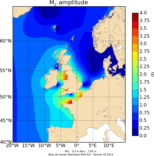
Les composantes harmoniques de hauteurs et courants ont été calculées à partir des modèles MARS2D de PREVIMER. Une analyse harmonique du rejeu 2008-2009 à l’aide de l'outil Tidal ToolBox (développé par le LEGOS) a permis de calculer les constantes harmoniques (amplitude et phase), à partir desquelles les hauteurs et courants de marée peuvent être prédits pour n’importe quelle période.
-
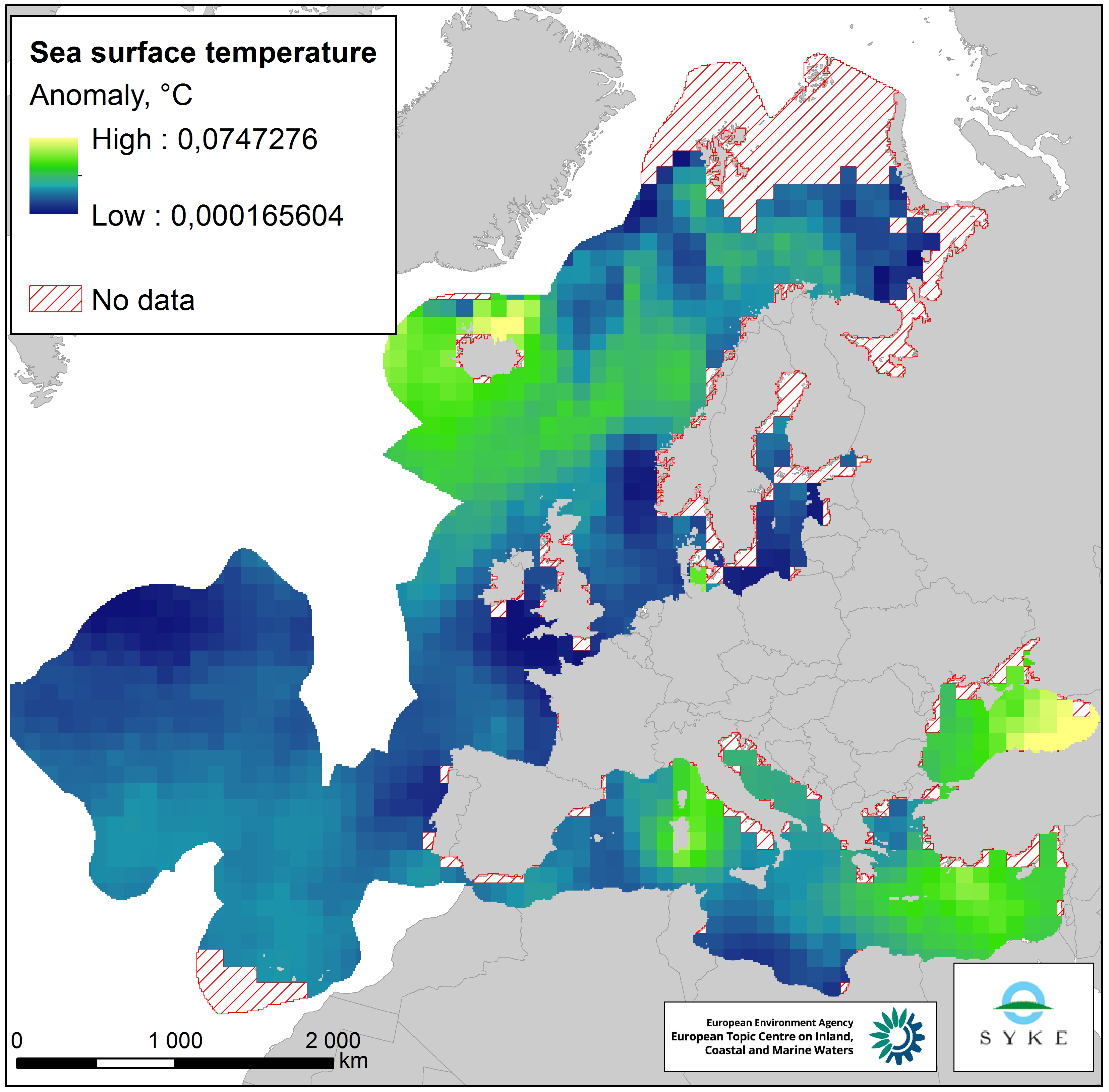
This raster dataset represents the Sea Surface Temperature (SST) anomalies, i.e. changes of sea temperatures, in the European Seas. The dataset is based on the map "Mean annual sea surface temperature trend in European seas" by Istituto Nazionale di Geofisica e Vulcanologia (INGV), which depicts the linear trend in sea surface temperature (in °C/yr) for the European seas over the past 25 years (1989-2013). Since all changes of sea temperatures can be considered to have an impact on the marine environment, the pressure layer includes absolute values of SST anomalies, i.e. negative/decreasing temperature trends were changed to positive values so that they represent a pressure. The original data was in a 1° grid format but was converted to a 100 km resolution, adapted to the EEA 10 km grid and clipped with the area of interest. This dataset has been prepared for the calculation of the combined effect index, produced for the ETC/ICM Report 4/2019 "Multiple pressures and their combined effects in Europe's seas" available on: https://www.eionet.europa.eu/etcs/etc-icm/etc-icm-report-4-2019-multiple-pressures-and-their-combined-effects-in-europes-seas-1.
-
Résultats du modèle hydrodynamqiue MFS de l'INGV (différentes versions selon la date) servant de forçage aux modèles côtiers en Méditerranée. Variables température, courants, salinité sur 72 profondeurs, journaliers
-
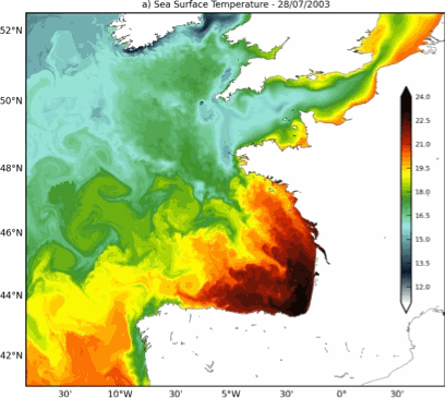
Données de la simulation numérique produite par la configuration BACH100_100lev-51 basée sur le modèle MARS3D (Theetten et al., 2017, http://doi.org/10.17882/43017) Les variables sont : température, salinité, courant et élévation de la surface libre à 1 km de résolution horizontale
-
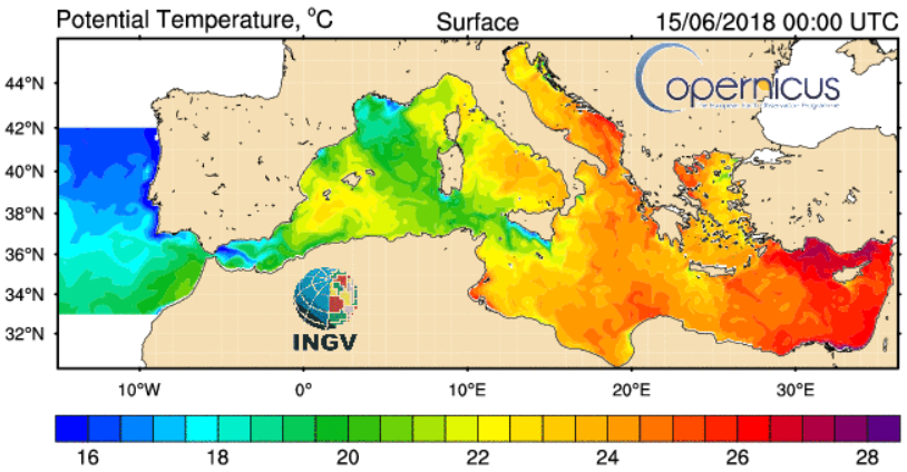
Cette archive contient les résultats du modèle hydrodynamique MFS - EAS4 du CMCC servant de forçage aux modèles côtiers en Méditerranée. Variables : température, courants, salinité sur 72 profondeurs, journaliers
-
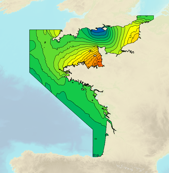
Tidal ranges on the French coasts of the Channel and the Atlantic for a coefficient of 95 : tidal range for mean spring tides for average atmospheric conditions..